ITALY AND SLOVENIA – THE GULF OF TRIESTE AND THE ISTRIAN PENINSULA SECTOR 2
Plan. – This sector describes the N coast of Italy on the Adriatic Sea, including that bordering the N side of the Gulf of Trieste. It also describes the coast of Slovenia (formerly Yugoslavia), which forms the E side of the Gulf of Trieste. The descriptive sequence is E and SE from Punta del Tagliamento to the NW approaches of Porto di Trieste, and then N and NE from Rt Marlera to and including Porto di Trieste.
General Remarks
20.1 Regulations. – Tanker vessels of 1,600 grt and over entering or leaving Italian ports and carrying, or with uncleaned tanks which last carried, petroleum, gas, or chemical products should report to a shore station before entering Italian territorial waters off Italian ports. For further details, see Pub. 140, Sailing Directions (Planning Guide) North Atlantic Ocean, Baltic Sea, North Sea, and the Mediterranean Sea.
Caution. – Vessels have been advised to avoid some of the ports and territorial waters of the former Yugoslavia. There have been reports of port blockades, vessels being fired upon, and indiscriminate minelaying.
Punta del Tagliamento to Porto di Monfalcone
20.2 Punta del Tagliamento (45°38'N, 13°06'E) is a low point of land forming the S side of the mouth of Fiume Tagliamento which is obstructed by shoals. A light is shown from a prominent structure, 21m high, standing on the point.
A large tank and several buildings are situated 2 miles N of the light and are conspicuous from seaward. A small pier, with a depth of 2.5m at its head, is situated 2 miles NNE of the light and fronts a resort area.
 |
|
Punta del Tagliamento bearing N |
Porto Lignano (45°42'N, 13°09'E), a small harbor, consists of a channel, 1 mile long, which extends N into Laguna di Marano. This harbor is fronted by a sand bar and is mostly used by light-draft vessels, small craft, and yachts. An obstruction light marks a tall building, 60m high, which stands 1.5 miles SW of the harbor. Vessels can anchor, in a depth of 10m, mud, about 2 miles SE of the entrance.
Caution. – An outfall pipeline extends 4 miles SE from a point on the shore, 1.8 miles SW of the entrance. Anchoring and fishing are prohibited in its vicinity.
An outfall extends 3.6 miles SSE from a point on the S shore of Isola di Sant’Andrea. The seaward end is marked by a lighted buoy. Anchoring and fishing are prohibited in the vicinity of the piping.
20.3 Porto Buso (45°43'N, 13°15'E) lies at the confluence of two rivers, which form two inland waterways. The entrance is marked by lighted and unlighted beacons; the narrow channel leads between shallow shoals. The buildings of the village stand on both sides of the mouth which is protected by two small breakwaters. Small coasters, with local knowledge, use this entrance and proceed to Porto Nogaro, a small harbor basin, lying 4 miles inland. A local pilot is available; pilotage is required for vessels over 500 gross tons. The pilot may be contacted on VHF channel 12. Vessels up to 80m in length and with a maximum draft of 5m can be handled.
20.4 The Gulf of Trieste (Trscanski Zaliv) (45°40'N, 13°35'E) is entered between Grado and Rt Gornja Savudrija, 11.5 miles SSE. The N side is low and is backed by lagoons. The NE side is high, precipitous, and is backed by mountains. The SE side is deeply indented and is backed by moderately high hills.
Grado (45°40'N, 13°23'E), a small town and resort, stands on a low and flat islet which faces the sea. The town is connected to the mainland N of the lagoon by a causeway which carries a roadway and forms the E side of Canale di Belvedere. A bridge, with a moveable span, connects the town and the causeway. There are numerous beach villas and hotels situated in the vicinity of the town.
A dredged entrance channel leads W of the town and affords access to a small harbor at Grado and to the channels of the lagoon. This channel is marked by dolphins and masts and an outer approach lighted buoy is moored about 2 miles SW of the town. It is reported (1988) to have a least depth of 3m, but it is subject to silting. It has been reported (1994) that these dolphins no longer mark the channel, and those that remain are poorly maintained. The port monitors VHF channels 4 and 16.
Winds from the S quadrant, which are predominant in fall and spring, cause a very rough sea in the entrance.
Vessels are advised to use the channel only in calm weather and to proceed with caution at a speed not exceeding 7 knots, because when exceeding this speed they may have difficulty maneuvering in the shallow and confined waters. The banks are affected by freshets from the lagoons and by strong winds from seaward and the depths are liable to change. Local pilots are available. The port monitors VHF channel 16. The channel is used by small craft, pleasure craft, and small coasters. Large vessels can anchor offshore to the SSE of Grado. The holding ground of sand and mud is good.
The campaniles standing at Grado and at Aquileia, 5.5 miles N of Grado, are prominent from seaward.
Between Grado and Punta Sdobba, 7 miles ENE, the coast is fronted by shoals, with depths of less than 5m, which extend up to 1.8 miles offshore. Banco Mula di Muggia, most of which dries, forms the W part of these shoals and is marked by a lighted beacon situated about 2.3 miles SE of Grado. This drying shoal is reported to be extending to the E.
Caution. – An outfall extends 3 miles SE from a point on the coast about 3 miles NE of Grado. Anchoring and fishing are prohibited in the vicinity of the outfall.
A circular prohibited area is located adjacent to and SW of the outfall. This area is dangerous due to the probable presence of bottom mines.
An outfall pipeline extends 2.5 miles SE from a point on the shore at the E end of Banco Mula di Muggia.
20.5 Punta Sdobba (45°43'N, 13°33'E), a low and sandy point, is formed at the confluence of several rivers. Drying sandbanks extend up to about 0.7 mile E from this point. A coastal bank, with depths of less than 5m, extends up to about 0.9 mile from the point and is marked by a lighted beacon situated on its SE side. It is reported that less water than charted may exist in this vicinity and vessels should give this area a wide berth. A small craft channel, marked by piles, leads through the shoals and drying flats to the river entrance.
Golfo di Panzano, the shores of which are low, lies between Punta Sdobba and Duino, 3.4 miles NE. Duino consists of a close group of yellowish -colored houses and a very conspicuous castle. This small town is fronted by a small harbor which is protected by two moles and is used by fishing boats and pleasure craft.
Porto di Monfalcone (45°47'N, 13°33'E)
World Port Index No. 40790
20.6 The port of Monfalcone lies in the NW corner of Golfo di Panzano and is approached through a dredged channel. The harbor has commercial facilities for mostly bulk cargo and a shipyard.
Poro di Monfalcone Home Page http://www.porto.monfalcone.gorizia.it
Tides – Currents. – Tides rise about 0.9m at springs and 0.6m at neaps.
Depths – Limitations. – The entrance channel, which is 4,500m long and 170m wide, was dredged to a depth of 10.5m (1993). The main commercial quays include Portorosega Quay, with 1,000m of total berthing space and depths of 7.5 to 9.5m alongside; Cereal Quay, 120m long, a depth of 10m alongside; and an ENEL power station quay, 330m long, with a depth of 9.5m alongside. There are facilities for tanker and bulk vessels. Vessels up to 180m in length and 10.2m draft have been handled at HW.
Aspect. – The town of Monfalcone, situated 1.5 miles inland, is mostly obscured by the shipyard and port installations. Prominent landmarks include the castle at Duino; several resort buildings standing on the shore of the bay to the NW of the harbor; a group of silos situated at the head of the harbor; and a tall chimney standing at the power station in Monfalcone.
The entrance channel is marked by lighted buoys and beacons. An outer approach lighted beacon is situated about 1.5 miles SSW of the castle at Duino.
Pilotage. – Pilotage is compulsory for vessels over 500 grt and is available during daylight hours only. Pilots can be contacted on VHF channel 14 and board 1 mile off the port entrance.
Regulations. – Vessels carrying polluting or dangerous cargo must report to the harbormaster 24 hours in advance.
A speed of 5 knots is not to be exceeded in the entrance channel or harbor.
Anchorage. – Large vessels may anchor, in depths of 10 to 12m, about 1.6 miles SSE of the castle at Duino.
Caution. – A submarine water pipeline, which stands 2m above the sea bottom and constitutes a permanent obstruction, extends SE between Duino and Porto di Trieste and may best be seen on the chart. Anchoring and fishing are prohibited in its vicinity.
A fishing prohibited area extends W from the pipeline and its associated restrictions and may best be seen on the chart.
A submarine pipeline extends SSE from Golfo di Panzano and is best seen on the chart.
Porti di Monfalcone to the Northwest Approaches of the Gulf of Trieste
20.7 Sistiana (45°46'N, 13°38'E) (World Port Index No. 40800), a small town, is situated at the head of an inlet which is surrounded by a chain of hills with luxurious vegetation. It is easily identified by the open limestone quarries situated on the surrounding hills. The town is fronted by a small harbor which is protected by two breakwaters. There are 200m of berthing space with depths of 4 to 4.9m alongside. The harbor is mostly used by small craft, pleasure craft, and local ferries.
Between Sistiana and Miramare, a rocky projection located 5.5 miles SE, the coast is high and steep. A conspicuous castle stands on Miramare and a conspicuous water tank, with bricked up window-like openings, is situated on the cliff edge, 1 mile SE of Sistiana. The prominent aqueduct of Aurisina is situated 1 mile SE of the water tank and a tower stands close inland of it. A small boat harbor, formed by a short breakwater and a mole, lies close SE of the aqueduct. The small and prominent town of Santa Croce di Trieste stands on a hill, close inland of this boat harbor.
Valle Grignano, a small craft harbor, lies in a small bay on the NW side of Miramare. It is formed by a short breakwater and a mole. There are depths of 2 to 6m in the harbor which is mostly used by pleasure craft.
Barcola, a small harbor, lies in the NW approaches to Trieste, 2.2 miles SE of Miramare. It is protected by an angled breakwater and a mole. There are depths of 2.5 to 3.5m in the two basins of the harbor and they are mostly used by pleasure craft.
Rt Marlera to the Southeast Approaches of theGulf of Trieste
20.8 Rt Marlera (44°48'N, 14°00'E) is the E point of the S extremity of Istria, a mountainous peninsula, which separates the Gulf of Venice from the Gulf of Kvarner. This cape is 21m high, bare, steep-to, and projects 1.7 miles SE from the peninsula. A light is shown from a structure, 9m high, standing on this cape.
The W side of Istria, extending N and NE to Trieste, has an irregular shoreline which is mostly bare except for a sprinkling of low, green bushes. The land rises gradually from the shore in undulating hills on which there are situated numerous scattered villages, vineyards, and olive and cedar groves. These hills terminate in a dominating mountainous ridge.
The W side of Istria is fronted by numerous islands, and rocks and shoals extend up to 2 miles offshore in places.
20.9 Rt Kamenjak (44°46'N, 13°55'E), the S extremity of Istria, is a narrow and hilly point of land, 46m high. This point is not defined, except in very clear weather, and vessels approaching from the E will first sight the bell towers of several hilltop villages and the light structure at Hrid Porer. The prominent village of Premantura is situated 2.5 miles N of the extremity of the point. A signal station and a radiobeacon are situated on the point.
Hrid Porer, a rock 7m high, lies near the outer end of a reef which extends up to 1.3 miles SW from the W face of Rt Kamenjak. A light is shown from a structure, 31m high, standing on this rock. A racon is situated at the light structure.
Plicina Albanez, a rock, lies 1.5 miles SSE of Hrid Porer. It has a depth of 2.7m and is surrounded by dangers. A light is shown from a structure, 15m high, standing on this rock. When this light is extinguished, a light is shown from a structure, 2m high, standing on the S end of the dangers around Hrid Porer.
Medulinski Zaljev, entered between Rt Marlera and Rt Kamenjak, is divided into inner and outer bays by Rt Kasteja, the extremity of a low peninsula which projects S from the NE side. The outer bay contains several islets and rocks. Otocic Finera, the outermost islet, is marked by a beacon. Small vessels, with local knowledge, can anchor, in a depth of 16m, mud, about 0.2 mile NNW of this islet.
The coast between Rt Kamenjak and Rt Kumpar, 8 miles NW, consists of an irregular and hilly shoreline which is indented by many small coves. Rt Verudica, located 5.5 miles NW of Rt Kamenjak, is surmounted by a hotel and a ruined convent. A light is shown from the point.
A conspicuous signal station is situated at a fort surmounting a hill, 0.7 mile SSE of Rt Kumpar.
World Port Index No. 40960
20.10 Luka Pula, which is essentially a naval base, is an almost landlocked basin surrounded by hills. It is entered between Rt Kumpar and Rt Kristo, 0.9 mile N.
Depths – Limitations. – The entrance is narrowed to a width of about 450m by a breakwater which extends NNW from Rt Kumpar. The harbor is divided into outer and inner part by two islets, Otocic Sveta Katarina and Otocic Sveti Andrija, and by Poluoticic Sveti Petar, a low projection surmounted by a cement factory. The inner harbor is divided into two parts by Otocic Uljanic and has a marina, a naval base, and several commercial facilities.
Depths in the outer harbor vary from 37m at the entrance to 22m close S of Otocic Sveti Andrija. The passage for large vessels leads S and E of the above island and has depths of over 18m. Depths in the middle of the inner harbor decrease from 27 to 9m.
An oil pier is situated on the E side of the outer harbor, 1 mile SE of Rt Kristo. It is 100m long and has a depth of 8.5m at the head. Several oil storage tanks are situated near the root of the pier.
Poluoticic Sveti Petar, Rijeka, and Ugljan Quays have 900m of total berthing space, with depths of 4 to 9m alongside.
The quayed berths fronting the town have depths of 3 to 6.1m alongside and are used by ferries, fishing vessels, and coasters.
Vessels up to 18,000 dwt and 7m draft have been accommodated.
Aspect. – The land in the vicinity of Luka Pula is not high and the only prominent points near the entrance are Rt Kumpar and a steep point, 81m high, located 1 mile SSE. Conspicuous forts stand on the summits of the hills which surround the harbor. The Roman amphitheater, having high and preserved walls, is conspicuous on the close approach to the harbor.
Pilotage. – Pilotage is compulsory for vessels over 500 grt. Pilots can be contacted on VHF channel 9 or 12 and board vessels near the breakwater entrance. Vessels should send an ETA 48 hours and 24 hours in advance. Pilot services should be requested 24 hours in advance.
Anchorage. – The harbor is of sufficient size to afford several anchorage berths, in depths of 11 to 35m, mud. A large number of small ships can also be accommodated. There are several mooring buoys situated in the outer and inner harbors. Permission for anchorage should be obtained from the naval authorities.
Caution. – Anchorage is prohibited in an area, which may best be seen on the chart, lying between Otok Veli Brijun and the mainland and in the outer part of Luka Pula.
Several submarine cables are laid in the vicinity of the harbor and may best be seen on the chart.
A restricted area, which may best be seen on the chart, lies centered 3 miles SW of Rt Kumpar. Anchoring and fishing are prohibited within the restricted area due to the presence of explosives scattered on the bottom.
20.11 Brionski Otoci (44°55'N, 13°45'E) is separated from the coast by Fazanski Kanal and consists of a group of islands which are composed of marble and covered with thick bush and low trees. Numerous islets, rocks, and reefs extend up to 1.5 miles W and NW of the two principal islands, Otok Veliki Brijun and Otok Mali Brioni.
Otok Veliki Brjun, the S island, is 58m high and has a conspicuous fort situated on its summit. A light is shown from a structure, 15m high, standing on Rt Peneda, the S extremity of the island.

View, in two parts, of the coast in the vicinity of Luka Rovinj
Otok Mali Brioi, the N island, has a prominent stone quarry situated on it. Reefs extend up to 1.3 miles NW of the NW extremity of this island and are marked by a lighted beacon.
Caution. – A prohibited area, which may best be seen on the chart, extends up to 1.6 miles seaward of the W side of Brionski Otoci.
20.12 Fazanski Kanal (44°53'N, 13°48'E), a channel, lies between the mainland and Brionski Otoci and extends between Rt Kristo and Rt Barbariga, 6.4 miles NE. Otok Sveti Jerolim, Otocic Kozada, and Plicina Kozada lie in mid-channel at the S part of the passage. The best route leads to the W of these three islands.
A least depth of 10.4m exists in the fairway of the narrowest part of the channel, which is about 300m wide, but with extreme care a least depth of 11.9m can be maintained.
The E side of the channel is bordered by a narrow, shallow reef and indented by a number of small and shallow coves. Otok Sveti Jerolim consists mainly of two hills, the higher and NW one being 17m high. A conspicuous quarry, with steep sides, is situated on the island. A short pier, with a depth of 40m at its head, projects from the NW side of the island.
Otocic Kozada, 9m high, is surrounded by a narrow reef. A short pier, with a depth of 3m, projects from the NE side of this islet.
Luka Fazana, a small and shallow harbor, fronts the village of Fazana, 2.3 miles N of Rt Kristo. The prominent town of Vodnjan stands on a hill, 135m high, 3 miles NE of the harbor and serves as a good landmark. A reef borders the shore to the S of the harbor entrance and is marked by a buoy.
Rt Mrtulin is located 1.7 miles NNW of Fazana. A reef, with a depth of 3.2m, extends 0.5 mile W from this point and is marked by a buoy. Two conspicuous lime kilns stand about midway between Rt Mrtulin and Rt Barbariga, 3 miles NNW.
Caution. – Passage through Fazanski Kanal is prohibited to all vessels without prior permission.
Submarines exercise frequently in the N entrance to the channel.
Several submarine cables and pipelines cross the S and central parts of the channel.
20.13 Rt Korente (45°04'N, 13°38'E) is located 6.5 miles NW of Rt Barbariga. The coast between is bordered by islets, rocks, and sunken dangers. The outer danger, Plicina Porer, lies about 2 miles offshore and has a least depth of 8.1m.
A chain of islets and rocks extends 1.5 miles SSW from Rt Korente. Hrid Sv Ivan na Pucini is a rocky islet, 9m high, which lies at the SW end of the chain. A light is shown from a structure, 15m high, standing on this rock.
A dangerous wreck is reported to lie about 2 miles NW of the light. Rt Montauro, located 0.4 mile NNE of Rt Korente, is 34m high and the N extremity of a rounded promontory.
Luka Rovinj (45°05'N, 13°38'E)
World Port Index No. 40940
20.14 Luka Rovinj, an industrial town, stands in a bight entered between Rt Montauro and Rt Mucja, 0.8 mile N. This bight is divided into two bays by a small peninsula which projects W and terminates in Rt Sveta Eufemija. The bay to the S of the peninsula contains two coves. The town stands partly on this peninsula and partly on the slopes of the surrounding hills.
Otocic Sveta Katarina, an island, lies 0.4 mile S of Rt Sveta Eufemija and has a conspicuous red-colored building standing near its center. Two small islets lie 0.5 mile W of Rt Mucja. Otocic Banjole, the outer island in the entrance, lies 1 mile SW of Rt Sveta Eufemija and is 15m high and steep-to.
Depths – Limitations. – Depths of 11 to 26m lie in the outer part of the bay, S of Otocic Sveta Katarina. A harbor, protected by breakwaters, provides quays with depths of 2 to 7m along-side. Vessels with drafts up to 6m can be accommodated. There are facilities for general cargo and passenger ferry vessels.
Aspect. – Turnina Vrh, 107m high and surmounted by ruins, stands 2 miles ENE of the town. Sveti Martin Vrh, 230m high, stands 5 miles NE of the town and is also prominent. Other prominent landmarks include a pointed campanile standing near Rt Sveta Eufemija; the ancient quarries on Rt Montauro; and a tower standing 0.7 mile N of Rt Mucja.
Pilotage. – Pilotage is compulsory. Pilots can be contacted by VHF and board close W of Otocic Sveta Katarina. Pilots are provided from Pula and must be requested 24 hours in advance. The port monitors VHF channels 10 and 16.
Anchorage. – Vessels can anchor, in depths of 20 to 24m, about 300m NNW of the pointed campanile near Rt Sveta Eufemija. Anchorage can also be taken, in a depth of 31m, about 600m SW of Otocic Banjole.
20.15 Limski Kanal (45°07'N, 13°36'E) is entered between Rt Kriz, located 2.4 miles NW of Rovinj, and Rt Sjole, 1 mile NNW. The canal is 5 miles long and has steep sides which vary from 61 to 152m in height. Trees and thick bush cover the banks and the canal is exposed to W winds and seas. The depths decrease gradually towards the head of the canal from 33m at the mouth. It has been declared a nature reserve and is only used for fish and shellfish farming. Use of the area for other maritime activities must pose no threat to the natural balance. Navigation and anchorage are prohibited without permission.
Rocky shoals extend up to 1.3 miles SW, W, and NW of Rt Sjole and are marked by buoys and beacons. Plicina Mramori, the outermost rocky shoal, lies about 1.8 miles NW of Rt Sjole and is marked by a lighted beacon.
Luka Porec lies 6 miles N of the entrance to Limski Kanal. The coast between is lower than that to the S and is fronted by islets, rocks, and shoals which extend up to 1.5 miles offshore.
Vessels, except those with local knowledge bound for the small harbors along this stretch of coast, should give this part of the coast a wide berth.
20.16 Luka Porec (45°14'N, 13°35'E) (World Port Index No. 40920) lies between a small peninsula, on which stands the town of Porec, and a reef, on which lies the island Otocic Sveti Nikola. Hrid Barbaran, a low lying flat rock, lies on a reef directly N of the entrance. A conspicuous castle is situated on Otocic Sveti Nikola and the church tower and the cathedral, standing in the town, are conspicuous. The town of Porec is an important tourist attraction.
Depths of 5 to 8m lie in the middle of the harbor and a wharf and a pier, which front the town, have depths of 2 to 5.2m alongside. Pilots are provided from Pula and must be requested 24 hours in advance. Large vessels can anchor, as convenient, in a depth of 22m, good holding ground, WNW of Hrid Barbaran. The port monitors VHF channels 10 and 16.
A dangerous wreck is reported to lie about 4 miles WSW of Luka Porec.
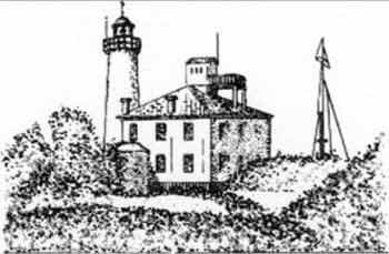
Rt Zub (Dente) (45°18'N, 13°34'E), marked by a light, is located 4.3 miles NNE of Luka Porec. The coast between is irregular and is fronted by reefs which extend up to 1.7 miles offshore in places.
 |
|
Rt Zub Light |
20.17 Luka Mirna (Porto Quieto) (45°18'N, 13°34'E) (World Port Index No. 40900), a bay, is entered between Rt Zub and Rt Lameja, 1.2 miles NNW. Rt Lameja is the extremity of a short peninsula on which stands the town of Novigrad (Cittanova). Fiume Mirna discharges through a prominent valley into the NE part of the head of this bay. The S shore of the bay consists of hills and cliffs, whereas the N shore slopes gently, except at its E end where there are steep and reddish -colored cliffs.
Depths decrease gradually towards the head of the bay from 20m at the entrance. Plicina Val, lying 0.5 mile WSW of Rt Lameja, is the outer danger on the N side of the entrance and is marked by a buoy.
The town of Novigrad, with the dark valley of the Fiume Mirna in the background, is very prominent. A conspicuous chimney stands at the brickworks situated on the N shore of the bay.
Good anchorage can be obtained by vessels of any size in Luka Mirna, sheltered from all but W and SW winds. Vessels of 7,000 dwt and 7.9m draft anchor here and load bauxite from lighters. The best berth for large vessels, in depths of 16 to 18m, lies about 0.5 mile offshore; local knowledge is required.
20.18 Novigrad (Cittanova) (45°19'N, 13°34'E) (World Port Index No. 40890), a small bay, lies close N of the N entrance point of Luka Mirna and is encumbered by shoals. The partially-walled town of Novigrad is built on the peninsula which forms the S side of this bay. A conspicuous campanile stands in the town. A small harbor, protected by a breakwater, fronts the town and is accessible to small vessels with drafts up to 3m.
Caution. – Several wrecks lie up to 8 miles W of Novigrad and may best be seen on the chart. The approach to the harbor is encumbered by several shoals.
20.19 Rt Dajla (45°21'N, 13°32'E) is located 2 miles NNW of Novigrad. The coast between is low and clear of dangers. Luka Dajla, entered between Rt Dajla and Rt Komun, is small in extent and suitable for small vessels. A conspicuous convent stands close E of the S entrance point. A reef extends about 0.3 mile NW from Rt Dajla and its outer extremity is marked by a buoy. A small pier, with a depth of 3.9m at its head, is situated on the NE shore of the bay. Small vessels, with local knowledge, can anchor, in depths of 6 to 8m, close N of the convent.
Luka Umag (45°26'N, 13°31'E) (World Port Index No. 40880), a small bay, lies 5 miles NNW of Luka Dajla. The town of Umag, which is a resort, stands on the S entrance point of the bay, which is suitable for small light-draft vessels. A curved breakwater extends NW from the town and forms a small harbor with a depth of 4m. Pilots are available from Pula with 24 hours notice. The pilot boards about 1 mile SW of the breakwater. Anchorage can be taken, in a depth of 18m, mud, W of the campanile in the town. Small vessels may anchor in the center of the harbor.
Caution. – Mariners should exercise caution approaching from the N to avoid Paklena Shoal.
A submarine cable originates at the coast 0.4 mile S of the curving breakwater.
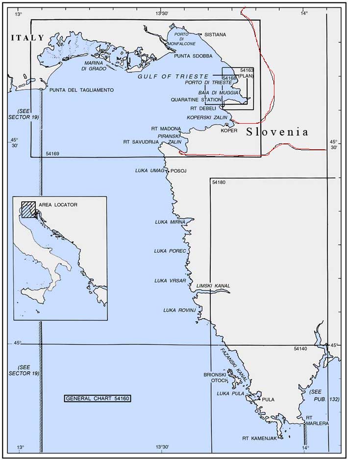
20.20 Rt Gornja Savudrija (Capo Salvore) (45°30'N, 13°30'E), low and dark, is located 3.8 miles N of Luka Umag. The coast between is low and fronted by dangers which extend up to 1.3 miles offshore. This cape is the NW extremity of the Istrian peninsula and has a face, 1.5 miles long. Rt Savudrija Light is shown from a prominent stone tower, 29m high, standing on Rt Far, which is the SW headland of the face.
A dangerous wreck is reported to lie about 5 miles NW of the light. A wreck, with a depth of 5.5m, lies about 5.2 miles NNW of the light.
Caution. – Large vessels, with drafts greater than 15m and speeds greater than 12 knots, should remain at least 2 miles from the coast between Rt Savudrija and Luka Koper.
20.21 Piranski Zaliv (Baia di Pirano) (45°30'N, 13°34'E) is entered between Rt Savudrija and Rt Madona, 3 miles NE. Rt Madona is marked by a light and a tower. Rt Savudrija is marked by a stone tower and light. The NE shore of this inlet is backed by hills, which are cultivated with olive and cypress trees, whereas the SW shore is low and has sparse growth. The maritime border between Slovenia and Croatia passes through the bay.
Piran (Pirano) (45°32'N, 13°34'E) (World Port Index No. 40870), a small town, is situated on Rt Madona and is fronted by a small craft harbor which is protected by two moles and has depths of 1.5 to 5.5m. Conspicuous from seaward are the ruins of an old castle, situated on the heights to the E of the town, and the high steeple of a church which stands near the edge of a high wall. Portoroz, a village, is situated on the NE side of the inlet and is fronted by a quay and a pier with a depth of 4.9m alongside.
Large vessels can anchor, in a depth of 14m, mud and clay, in the outer part of the inlet about 1.3 miles SW of Rt Madona.
Caution. – A prohibited anchorage area lies in the inner part of Piranski Zaliv and may best be seen on the chart.
An outfall pipeline extends 2 miles NW from Piran and its seaward end is marked by a lighted buoy. Anchoring and fishing are prohibited in the vicinity of this pipeline.
A wreck, with a depth of 11m, lies about 5 miles NNW of Rt Madona.
20.22 Koperski Zaliv (Baia di Capodistria) (45°33'N, 13°40'E) is entered between Rt Ronco and Rt Debeli, 5 miles NE. The NE and SW shores of the bay are hilly, but the shore at the head of the bay, through which the Fiume Risano flows, is low. Monte Sermino, surrounded by salt beds, rises isolated in the river valley.
A prominent convent stands on the NE shore of the bay. Antignano, a town, is situated 5.7 miles ESE of Rt Debeli and is also prominent. Rt Debeli is fronted by a shoal which is marked by a lighted beacon.
Izola (45°32'N, 13°39'E) (World Port Index No. 40865), a small town, stands in the SW part of the bay and completely occupies a small peninsula. A small craft harbor, protected by two moles, lies on the W side of the town.
Note. – All vessels calling at harbors in Slovenia should send their ETA and draft 24 hours before arrival. Vessels carrying dangerous goods should send their ETA and draft 48 hours before arrival through any coast radio station to the Slovenian Maritime Directorate. Pilotage is compulsory for vessels over 500 gross tons entering or leaving Slovenian ports.
World Port Index No. 40860
.20.23 Koper (Capodistria), a small town, stands in the NE part of Koperski Zaliv. It is built on gently sloping rocky terrain which appears as an island. A small craft harbor, formed by two moles, lies on the W side of the town and is used by fishing vessels and small craft. A new commercial harbor extends along the E shore of the bay to the N of the town.
Port of Koper Home Page http://www.luka-kp-si
Depths – Limitations. – The new harbor has 1,900m of total berthing space with depths of 6 to 13.5m alongside. There are facilities for bulk, container, ro-ro, and tank vessels. Vessels up to 317,800 dwt and 303m in length have been handled. Generally, vessels are limited to a draft of 13m, with no restrictions on length.
Pilotage. – Pilotage is compulsory for vessels over 500 gross tons. Pilotage is normally available 24 hours, but is only available during daylight hours for vessels entering the coal terminal in Basin III and for oil and chemical tankers when visibility is less than 400m or the wind is greater than force 4 on the Beaufort scale. The pilot may be contacted on VHF channel 8 or 16. The pilot boards 0.4 mile W of the Fairway Lighted Buoy.
Anchorage. – The recommended anchorage, in a depth of 18m, mud, lies about 1.2 miles SSE of Rt Debeli.
Caution. – Vessels may encounter fishing nets which extend up to 3 miles from the shore of the Gulf of Trieste. Care should be taken to avoid the pilings supporting these nets as they are not always visible above the sea surface.
Numerous fishing vessels may be encountered in the approaches to the port.
Baia di Muggia (45°36'N, 13°46'E)
World Port Index No. 40830
20.24 Baia di Muggia, entered on the S side of the port of Trieste, is backed by hills which are mostly cultivated and have numerous villages, farms, and villas situated on them. The land is low and level at the head of the bay. The small town of Muggia, with a castle, stands on the S side of the bay. The facilities on the N shore of the bay are included with the port of Trieste.
The main SIOT oil terminal, which is connected to the Trans-Alpine pipeline, is situated in Baia di Muggia and consists of two jetties.
Depths – Limitations. – Canale Sud, for use by tankers bound for berths in Vallone di Muggia and by those vessels whose draft does not allow them to use the Canale Nord approach to Trieste, leads to Baia di Muggia.
A dredged channel, with a depth of 16.5m, leads to the berths. The terminal has six berths, with depths of 11 to 17m alongside. Tankers up to 160,000 dwt and 16.4m draft, and partially-laden tankers of 250,000 dwt, can be handled.
Aspect. – The dredged entrance channel is marked by lighted buoys. An outer approach lighted buoy is moored about 1 mile W of the S end of the S detached breakwater. For further information, see Porto di Trieste in paragraph 20.25.
Pilotage. – Pilotage is compulsory for vessels over 500 grt. Pilots can be contacted by VHF and board tankers about 1.5 miles W of the S end of Diga Luigi Rizzo, the S detached breakwater.
Vessels should send an ETA 48 hours in advance and report any changes if more than 1 hour. Regulations. – Canale Sud can only be used by one vessel at a time. Priority is given to outbound vessels.
Anchorage. – A designated anchorage area for tankers, which may best be seen on the chart, lies in the W approaches and extends up to 3.0 miles W of Diga Luigi Rizzo, the S detached breakwater. Vessels should contact the pilot station before anchoring.
Caution. – Numerous fishing vessels may be encountered in the approaches to the port.
Porto di Trieste (45°39'N, 13°46'E)
World Port Index No. 40820
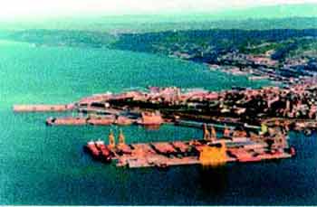
20.25 Porto di Trieste is one of the largest and most important ports in the Adriatic Sea and includes a Free Zone.Porto di Trieste Home Page http://www.porto.trieste.it
Tides – Currents. – Tides rise about 0.6m at springs and 0.5m at neaps. During a bora, the water level can be reduced by as much as 1.2 to 1.5m.
Depths – Limitations. – There is a depth of 18m in the approach to the port.
Canale Nord has been established for vessels entering Porto Franco Vecchio, the Arsenale Triestino, the Scalo Legnami, and Banchini Terma. In adverse weather, the pilot may allow vessels to use Canale Sud, the approach to Baia di Muggia.
Porto Franco Vecchio is the N part of the port and a free zone. It has several basins and moles and is protected by a detached breakwater. This section of the port extends 0.7 mile S to Mole IV.
Porto Doganale, the original harbor of Trieste, lies along the NW side of the city. It extends 0.6 mile SW between Mole IV and Mole Fratelli Bandiera and is used by passenger liners, fishing vessels, and pleasure craft.
Porto Franco Nuovo, a free zone, extends SSW from Mole Fratelli Bandiera to Mole V, and then ESE to the N part of Baia di Muggia. This section of the port contains the main commercial facilities and is protected by three detached breakwaters. There are also extensive repair facilities with several drydocks, the largest being 295m long and 56m wide.
There are facilities for general cargo, bulk, timber, livestock, passenger, reefer, container, and ro-ro vessels. The port has 12,128m of total berthing space, with depths of 6 to 18m alongside. Vessels up to 15.8m draft can be accommodated.
Aspect. – Haze frequently obscures the landmarks in the approach to the port until vessels are fairly close-to, but in clear weather, the mountains backing the shoreline are prominent. Monte Nanos, 1,300m high and the highest peak, stands 14 miles NE of the city.
Faro della Vittoria is a conspicuous stone tower, 68m high, which is surmounted by a bronze statue and stands 0.5 mile N of the N end of the port. A light is shown from this tower.
Radio masts, in two prominent groups of four, stand 0.4 mile ESE of the light. A prominent television mast, 110m high, stands 1.6 miles E of the light on the summit of Monte Concanello.
Tempio Mariano, a prominent temple, stands 1 miles NNW of the light on the summit of Monte Grisa. This temple is shaped like a pyramid and illuminated at night in summer.
 |
|
Porto Franco Nuovo |
Winds – Weather. – During the winter and late autumn, the bora, a strong NE wind, blows in the Gulf of Trieste with its Porto Franco Nuovo greatest strength near the port.
The current at the entrance of the port is generally negligible, Castelle di Miramare, a conspicuous castle, is situated 2.5 seldom exceeding a velocity of 1 knot. miles NW of the light.
A racon is situated at the light structure standing on the N end of the central detached breakwater. A racon is also located at the S end of the N detached breakwater.
Pilotage. – Pilotage is compulsory for vessels over 500 grt. Pilots can be contacted on VHF channel 14 or 16 and generally board vessels, except tankers, about 1.5 miles W of the N end of Diga Luigi Rizzo. Vessels should sent an ETA 48 hours before arrival and report any changes to it of more than 1 hour. The assistance of tugs is required for tankers of greater than 3,000 gross tons.
Regulations. – Canale Nord can only be crossed from the N or S when a pilot is on board or after consulting with the pilotage authority. Vessels with a draft greater than 14m must not cross the channel.
Regulations for inbound vessels are, as follows:
- Vessels directed to an anchorage must contact the pilot on VHF channel 14 to report their ETA in the roads and request a berth.
- When settled at a berth vessels must contact the Operations Center on VHF channel 16 and report their berth number.
- Vessels at anchor must maintain a continuous listening watch on VHF channels 14 and 16.
Regulations for outbound vessels are, as follows:
- Vessels not subject to compulsory pilotage must agree with the pilot station as to procedures and times of movement within the harbor and in both N and S canals.
- Vessels subject to compulsory pilotage must embark the pilot in the N or S canal.
- Vessels must contact the Operations Center on VHF channel 16 once the departure maneuvers are complete and the pilot disembarked and report the following information:
- Type of vessel.
- Route.
- Speed.
- Destination.
- Date and time of arrival at destination.
- Number of passengers.
- Quantity of cargo.
- Quality of cargo.
Anchorage. – Designated anchorage areas, for vessels carrying dangerous or non-dangerous cargo, are best seen on the chart, and are reserved, as follows:
- Anchor Berths A1-A4 – tankers.
- Anchor Berth S1 – for unloading residuals.
- Anchor Berths B1-B4 – tankers when the A series of berths are full and for vessels carrying dangerous cargo.
- Anchor Berths C1-C4 – tankers carrying non-dangerous cargo.
All vessels should contact the pilot station before anchoring. There is also sufficient room for large vessels to anchor within the harbor and there are several mooring buoys.
Caution. – A submarine water pipeline, which stands 2m above the sea bottom and constitutes a permanent obstruction, extends NW between Porto di Trieste and Duino and may best be seen on the chart. Anchoring and fishing are prohibited in its vicinity.
An outfall pipeline, which may best be seen on the chart, lies in the harbor and extends 2.5 miles WNW from the vicinity of the N end of the S detached breakwater. Anchoring and fishing are prohibited in its vicinity.
Numerous fishing vessels are often encountered in the approaches to the port.
A disused explosives dumping ground area, which may best be seen on the chart, lies centered 1.2 miles SW of Faro della Vittoria.
A wreck, with a depth of 16m, lies about 0.5 mile NW of the N end of the N detached breakwater.
Work is in progress (2006) to extend the Luigi Rizzo Mole near Molo V. The work area is marked by lighted buoys and is expected to complete in March, 2009.