ITALY – EAST COAST – CAPO SANTA MARIA DI LEUCA TO TESTA DEL GARGANO SECTOR 17
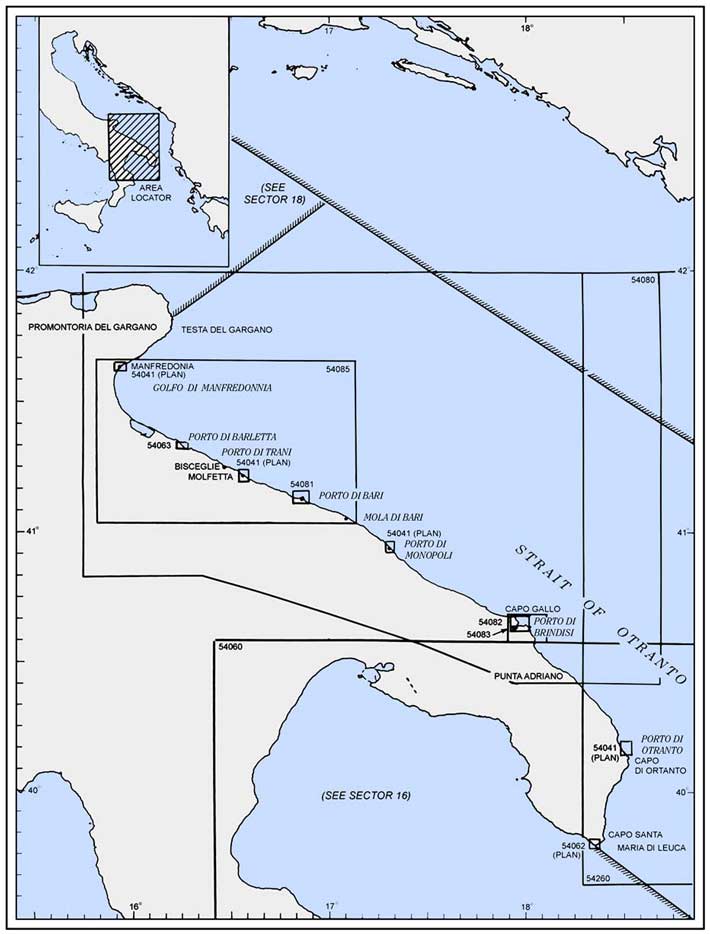
Plan. – This sector describes the S part of the Italian Adriatic coast from Capo Santa Maria di Leuca (39°48'N, 18°22'E) N to Testa del Gargano (41°50'N, 16°12'E) on the E side of Promontorio del Gargano.
General Remarks
17.1 Regulations. – Tanker vessels of 1,600 grt and over entering or leaving Italian ports and carrying, or with uncleaned tanks which last carried, petroleum, gas, or chemical products should report to a shore station before entering Italian territorial waters off Italian ports. For further details, see Pub. 140, Sailing Directions (Planning Guide) North Atlantic Ocean, Baltic Sea, North Sea, and the Mediterranean Sea.
Caution. – Tunny nets are laid out annually between March and November close off many places along the E coast of Italy.
Landslides may occur along the section of coast described in this sector.
Numerous offshore oil and gas installations and associated pipelines and service craft may be encountered off the coast described in this sector.
Capo Santa Maria di Leuca to Porto di Brindisi
17.2 Capo Santa Maria di Leuca (39°48'N, 18°22'E) forms the heel of the Italian boot. This cape is 140m high and appears rocky and precipitous from the S, but from other directions, it presents a more gradually sloping appearance. A light, with an auxiliary light, are shown from a prominent structure, 48m high, standing 0.2 mile NNE of Punta Meliso, the SW extremity of the cape.
A conspicuous signal station, consisting of a tower with arched windows, stands 1.5 miles NW of the light. The old signal station, which stands 1.5 miles NE of the light, is visible only from a short distance. A high -rise building and the bell tower of the cathedral at the town of Leuca, standing W of the cape, are very conspicuous.
Between Capo Santa Maria di Leuca and Capo d’ Otranto, the coast consists of a cultivated and rocky plateau. From Capo d’ Otranto to Capo Gallo, the coast is low and is indented by numerous coves.
Porto di Tricase (39°56'N, 18°24'E) is a small inlet protected by a breakwater which forms a small craft harbor. Several buildings and villas and an arched stone viaduct stand in the vicinity of the harbor. The port monitors VHF channels 14 and 16. Gagliano del Capo, a village, is 3 miles N of Capo Santa Maria di Leuca and can be seen conspicuously above the headland of the cape from a few miles offshore. The campanile in this village is prominent.
17.3 Porto di Castro (40 °00'N, 18°26'E), a small bay, lies 4 miles NNE of Porto di Tricase and is dominated by the village of Castro which stands on a hill, 99m high. A conspicuous castle is situated in this village. A small harbor lies at the NE head of the bay and is suitable for small boats only. Anchorage is available, in a depth of 13m, mud, about 700m SW of Punta Mocarone, the NE entrance point of the bay.
From Porto di Castro to Porto Miggiano, 2 miles NNE, the coast is high and indented by fissures and coves. Porto Miggiano is a small boat harbor. Terme di Santa Cesarea, a spa, contains several prominent ornamental buildings. It stands on a high and rocky part of the coast, 1 mile NE of Porto Miggiano. The coast to the S of this spa is marked by several stone quarries.
Caution. – Entry is prohibited into an area with a radius of 1,000m centered 9.5 miles ESE of Terme di Santa Cesarea, where works are in progress (2008) to construct a floating wind turbine.
Porto Badisco, located 3 miles N of Porto Miggiano, is a narrow and deep inlet with high and rocky sides. A gray building and a red house stand close W of the entrance and are prominent. This inlet is only frequented by local small craft.
Capo d’ Otranto (40 °06'N, 18°31'E) is the E extremity of a high, precipitous, and steep-to tableland. A light is shown from a structure, 8m high, standing on the cape. A disused light tower stands near the base of the cape and a disused signal station surmounts the cape.
Punta Posta delle Fasci is located 1.7 miles N of Capo d’ Otranto. It is low, rocky, and flat but is easily recognized. Punta dell’Orto is located 0.3 mile NNW of the point and is overlooked by a conspicuous tower which is surrounded by houses. Torre del Serpe, standing 0.3 mile NW of Punta dell’Orto, is situated on a hill, 34m high. It is formed by a slender pile of masonry ruins, but is still prominent from seaward.
17.4 Porto di Otranto (40 °09'N, 18°30'E) (World Port Index No. 40490), a small port, lies in a bay which is entered between Punta San Nicola, located 2.5 miles NW of Capo d’ Otranto, and Punta Craul (La Punta), 0.5 mile NW. A breakwater extends NW from Punta San Nicola and encloses the SE part of the bay. The town of Otranto stands on the SW side of the bay.
Porto di Otranto Home Page http://www.guardiacostiera.it/otranto
Winds – Weather. – The harbor is protected from all winds except those from the N. The bora, a strong and dry NE to N wind, can be violent here, especially in winter, and usually lasts for a few days.
Tides – Currents. – The current generally follows the coast and sets S, even with SE winds. In summer, this current sometimes attains a rate of 1.5 knots.
Depths – Limitations. – The main commercial facility is Molo San Nicola, which is 260 long and has depths of 6 to 7m alongside. Vessels up to 5,300 dwt, 102m in length, and 5.3m draft have been accommodated alongside.
Aspect. – The town of Otranto is built on relatively high and yellowish rock stratum. A conspicuous castle stands in its SE part and the bell tower of the cathedral is prominent. A conspicuous war memorial, 24m high, stands 0.3 mile W of the town.
Range beacons indicate the entrance channel and may best be seen on the chart. A lighted buoy, moored about 140m SW of the breakwater head, marks the N extremity of the shallow water in the SE part of the harbor.
Secca delle Casse fronts the breakwater and extends ESE to Punta San Nicola. A lighted buoy is moored at the SW edge of this shoal.
Secca La Scala, with a least depth of 9.4m, lies about 0.5 mile NE of Punta Craul; the sea breaks on this shoal during strong winds.
Pilotage. – Pilotage is compulsory for vessels of more than 500 gross tons. The pilot boards 0.6 mile from the port entrance.
Regulations. – Vessels should send an ETA 48 hours prior to arrival and confirm the ETA by 1200 on the day prior to arrival. The port can be contacted on VHF channel 11 or 16.
A Traffic Separation Scheme (TSS) has been established in the approaches to Otranto.
Anchorage. – Anchorages N1 to N6 are located in an area centered 2.5 miles N of Molo San Nicolo Head. Anchorage S1 is centered 1.75 miles SE of Molo San Nicola Head.
Caution. – Due to the existence of submarine cables, an anchoring and fishing prohibited area, which may best be seen on the chart, extends NE from Punta Craul.
Vessels intending to enter the inner harbor should close the NW shore as closely as possible to allow sufficient room to line up on the range.
17.5 Baia di Alimini (40 °12'N, 18°28'E) lies 3 miles N of Otranto and has an inlet at its head which leads to a large lagoon. A conspicuous masonry bridge, with seven arches, crosses this inlet and is prominent from seaward. Small vessels can anchor, in depths of 14 to 18m within the bay.
The coast to the N of this inlet consists of a sandy beach backed by groups of irregular sand dunes which are sparsely covered with bushes.
Secca Missipezza, a rocky and steep-to reef, extends about 0.5 mile offshore, close N of Baia di Alimini. It is advisable to always pass to the E of this reef.
Torre San Andrea (40 °15'N, 18°27'E) stands on a coastal elevation and is surmounted by a disused signal station. A light is shown from this checkered tower. A large white building and a prominent farm house are situated near the tower.
Punta San Cataldo (40 °23'N, 18°18'E) is low and sandy; a conspicuous white bathing pavilion stands on the beach, close W of it. A light is shown from a structure, 23m high, standing on the point.
A pumping station, with a tall chimney, stands on the coast, 3.2 miles NW of the light.
A rocky ledge, with depths of 0.9 to 4m, extends up to 0.3 mile E of the point. Anchorage may be taken, in a depth of 10m, sand, about 1 mile ESE of the point.
Caution. – A prohibited area, which can best be seen on the chart, extends up to 5 miles offshore from a section of the coast lying close N of Punta San Cataldo. This area is a firing area.
17.6 Torre Specchiolla (40 °30'N, 18°07'E) stands 11.5 mile NW of Punta San Cataldo and a prominent coast guard station is reported to be situated near it.
The coast to the N of this tower is low and generally rocky. It contains few dwellings, but there are numerous towers.
Caution. – All vessels not entering or leaving Brindisi are prohibited from navigating within the coastal zone extending 6 miles from the coast between Torre San Gennaro (40 °32.4'N, 18°04.0'E) and Torre Guaceto, standing 6.5 miles WNW of Punta Penne.
17.7 Squinzano, a town, is situated 5 miles inland, 5.5 miles SW of Torre Specchiolla. The houses are situated on the summit of a flat-topped hill and are mostly inconspicuous. The pointed bell tower of the town rises above these houses and is very conspicuous from seaward.
Torre Mattarella stands 5.5 miles NW of Torre Specchiolla and is red and rectangular. A white masonry building is situated close E of this tower.
Capo Cavallo (Capo di Torre Cavallo) (40 °38'N, 18°01'E), a low promontory, is located in the E approach to Brindisi. This cape can easily be identified by a conspicuous tower with a burn-off flare, which can be seen from a considerable distance on a clear night.
It is reported (1990) that a power station is situated 4.5 miles S of the cape and a chimney, 200m high, stands in its vicinity. An industrial complex of tanks, towers, and chimneys is situated W of the cape.
Anchorage can be obtained 4.5 miles E of the cape, in depths of 30 to 60m Secche di Capo Cavallo, a rocky foul area, extends 0.8 mile E and about 1 mile N of the cape. It has numerous rocks with depths of 1.8 to 9.8m and is marked by a lighted buoy which is moored about 1.5 miles NE of the cape. This lighted buoy marks the edge of the deep water NE of the cape and is used as an approach buoy by vessels inbound from the E or S.
Caution. – A danger area, the limits of which are shown, lies within 3 miles of the coast and extends up to about 2 miles E and 4.5 miles SE of Capo Cavallo. Vessels are prohibited from entering this area.
Porto di Brindisi (40 °39'N, 17°59'E)
World Port Index No. 40500
17.8 The large port of Brindisi lies between Capo Bianco, located 1.2 miles WNW of Capo Cavallo, and Punta Riso, 1.5 miles NW.
It is divided into three parts. Porto Esterno is the outer harbor; Porto Medio is the middle harbor; and Porto Interno is the inner harbor, which is entered from Porto Medio through Canale Pigonati and consists of two basins. The port has com-mercial facilities, serves as a ferry terminal, and has ex-tensive naval installations.
Porto di Brindisi Home Page http://www.porto.br.it
Winds – Weather. – Winds from the SE and NE predominate, but NW winds are not infrequent. The harbor is sheltered from all winds except those from the NE and E, which sometimes cause disturbances. The bora, a strong and dry NE to N wind, can also be violent here, especially in winter.
Depths – Limitations. – Canale Pigonati has a depth of 10.9m and vessels up to 9.4m draft can enter Porto Interno, the inner harbor. Costa Morena, at the S side of Porto Medio, has 500m of berthing space with depths up to 13.7m alongside. Vessels with a draft of up to 12.5m can be accommodated.
Tankers with a draft of 11.5m can be accommodated at the sea berth. For the discharging or loading of other refined products of Montedison Installations, the depth of the berths vary from 4 to 9m.
Vessels berthing at the N section of Porto Medio are restricted to maximum allowable heights, as follows:
- Costa Morena Wharf – 53m.
- Riva Wharf – 40m.
- New Spur Wharves – 36m.
These restrictions have been established due to the proximity of the port area to Brindisi Airport.
An offshore oil terminal is situated 500m SW of Isolotto Traversa and the berth consists of several mooring buoys. A submarine pipeline extends SE from the berth to the SE shore of Porto Esterno. Tankers up to 11.5m draft can be handled.
Aspect. – Isole Pedagne Grandi (Le Pedagne), a chain of low islets, lies on a shoal bank at the E side of the port, N of Capo Bianco. Isola Pedagne Grande, the largest and E islet, lies 0.3 mile NNE of the cape and is connected to it by a breakwater. Isolotto Traversa, the W islet, lies 0.6 mile NW of Capo Bianco and forms the S entrance point of the outer harbor. Le Pedagne Light is shown from a structure, 18m high, standing on this islet.
Isola Sant Andrea, an island, lies on a shoal bank at the NW side of the port. It is located 1 mile W of Isolotto Traversa and 0.3 mile E of the mainland coast. A breakwater extends between the NW end of the island and the mainland. A radio tower stands on the SE part of this island.
Forte a Mare, an island dominated by a massive stone building with a signal station, lies close S of the S end of Isola Sant Andrea and is connected to it by a bridge.
Diga di Punta Riso, a breakwater, extends 1.3 mile E from Punta Riso, the NE extremity of Isola Sant Andrea. It forms the N side of the outer harbor and a light is shown from the head.
Torre Penna, a large and prominent tower, stands on the extremity of Capo Gallo, a low tongue of land, which is located 2 miles NW of Punta Riso. The coast to the N of this cape is low, flat, and contains several towers and villages. The most conspicuous of these villages are Carovigno and Ostuni, which are situated 4 miles inland, 13 and 16 miles WNW, respectively, of Capo Gallo.
A conspicuous monument to sailors, which represents a rudder, stands close W of Canale Pigonati. Brindisi Light is shown from the top of the this monument.
An aeronautical light is shown from a structure situated 0.5 mile WNW of the monument.
Other prominent landmarks include the cathedral, standing SW of Canale Pigonati; and an ancient castle, flanked by towers, standing WSW of Canale Pigonati.
Pilotage. – Pilotage is compulsory for vessels over 500 grt and all tankers. Pilots may be contacted on VHF channel 12 and board 1 mile outside the entrance.
Regulations. – The port is a naval base and special regulations are in effect relating to the movement of vessels, berthing, and anchoring.
A speed limit of 6 knots is in force within the port.
Vessels must send a request for berthing to the harbormaster at least 24 hours prior to ETA. Prior to anchoring, vessels must contact the harbormaster, as follows:
| Local time | VHF channel |
|---|---|
| 08:00 - 20:00 | 12 |
| All other times | 16 |
Vessels carrying polluting or dangerous cargo must report to the harbormaster 36 hours in advance; if the vessel intends to load or unload, the notice must be given 48 hours in advance.
Vessels entering Porto Medio, contrary to normal custom, have priority over vessels leaving, except that Italian naval vessels have priority over all other vessels.
Vessels transiting Canale Pigonati must, if possible, do so with engines stopped. Movements in the passage are regulated by the harbormaster. Vessels leaving, whether commercial or military, have priority.
Vessels must not approach military installations without permission.
A traffic separation scheme (TSS) is located off the port.
Anchorage. –. The recommended anchorage for small and medium-sized vessels is in Anchorage NW, centered 2.5 miles WNW of Punta Penne, in depths of 20 to 50m. Anchorage SE is centered 5 miles ESE of Capo di Torre Cavallo.
Waiting Area BR1 is centered 2.75 miles ESE of Capo di Torre Cavallo. It was established to accommodate vessels complying with UN inspection requirements.
Directions. – Vessels approaching from the E or S should pass E and N of the lighted buoy moored NE of Capo Cavallo.
Caution. – Numerous anchoring prohibited areas lie in the entrance and within the port and may best be seen on the chart.
Moorings for the use of aircraft are situated along the shores of Porto Medio, which is occasionally used for flying operations.
Silting has always occurred within this port and depths may be less than shown on the chart.
Several unlighted mooring buoys are situated within the port.
The land in the vicinity of the port is low and difficult to identify, especially during S winds, when a haze is prevalent. On nearing the port, the character of the bottom can be helpful in determining position. It has weeds off Capo Cavallo to the S of the port; hard mud off Capo Gallo to the N of the port; and rock, sand, or gravel between the two.
Porto di Brindisi to Porto di Bari
17.9 Porto di Monopoli (40 °57'N, 17°18'E) (World Port Index No. 40510), a small harbor, lies 35 miles NW of Brindisi and is protected by two moles.
Tides – Currents. – Generally, the current in this vicinity follows the direction of the coast and sets SE. With N and NE winds, it may attain a rate up to 2 or 3 knots.
Depths – Limitations. – The harbor has 275m of total berthing space with depths of 4.5 to 8.5m alongside. There are facilities for general cargo, tanker, bulk, and fishing vessels. Vessels up to 110m in length and 6.7m draft can be accommodated.
Aspect. – The town of Monopoli is situated on the SW side of the harbor. The most prominent landmarks in its vicinity include a pointed bell tower; the church of San Francesco with a clock; three chimneys standing at the cement works; and a single chimney standing at the oil refinery which is situated close E of the cement works. A castle stands at the root of the S mole.
When seen from the SE, in clear weather, at a distance of 15 to 20 miles, the town appears as a narrow, low, and white strip. Numerous resort camps are situated along the coast in the vicinity of the town. The town of Conversano, situated 8 miles W of the port, is conspicuous from seaward because of its height.
Torre Canne, 32m high and conspicuous, stands on the coast, 10 miles SE of the harbor. A light, which can be seen from the approaches, is shown from this structure. A prominent high -rise building is reported to stand 0.5 mile S of the light. A small boat harbor, dominated by a prominent castle, lies at Villanova, 5.5 mile SE of the light.
Pilotage. – Pilotage is compulsory for merchant vessels over 400 grt. Pilots can be contacted on VHF channel 12 and board 1 mile from the entrance to the port.
Anchorage. – Anchorage depends on the prevailing winds. If the wind is the normal prevailing wind from the N, vessels usually anchor about 2 to 3 miles SE of the harbor entrance. If the wind is from the S, vessels anchor to the N of the entrance.
Vessels must contact the harbormaster on VHF channel 16 prior to anchoring.
Caution. – Vessels should give the mole heads a wide berth. A submarine cable extends across the entry between the breakwaters, as best seen on the chart.
17.10 Polignano a Mare (41°00'N, 17°13'E), a town, is situated 4.5 miles NW of Monopoli and is conspicuous. It stands on a craggy coastal bluff and has numerous chimneys and sprawling whitish -colored houses. Isolotto San Paolo, a rocky islet, lies close offshore near the town and is surmounted by a ruined monastery.
Between Monopoli and Mola di Bari, 11 miles NW, the coast is low, rocky, and indented. A number of towers, coves, and scattered buildings exist along this stretch of coast. From Mola di Bari to Porto di Bari, 11 miles WNW, numerous towers and houses stand along the coast. Motel dell Agip, a seven-story building, stands isolated 3 miles WNW of Mola di Bari and is very conspicuous.
17.11 Mola di Bari (41°03'N, 17°06'E) (World Port Index No. 40520), a small harbor, lies 11 miles ESE of Porto di Bari and is protected by moles. Prominent landmarks in the town, from E to W, include a factory chimney, standing near the beach ; three bell towers; and the dome of the cathedral. The harbor is accessible to small vessels up to 50m in length and 3.5m draft. The port monitors VHF channel 16. Anchorage, in good weather, can be obtained, in a depth of 10m, hard mud, about 1 mile off the harbor.
Caution. – A fish farming plant is located 1.3 miles E of Mola di Bari. It is marked by lighted and unlighted buoys. Anchoring, fishing, and stopping are prohibited within 0.3 mile of the plant.
Porto di Bari (41°08'N, 16°52'E)
World Port Index No. 40530
17.12 The port of Bari lies 11 mile WNW of Molo di Bari and is protected by breakwaters. It is divided into two harbors. Bacino Grande, the large commercial harbor, lies on the NW side of the old city and Porto Vecchio, a small craft and fishing harbor, lies on the SE side. The city of Bari is disposed in a wide arc to the S of the port.
Porto di Bari Home Page http://www.porto.bari.it
Winds – Weather. – The prevailing winds are from the NE through N to SE and are often harbingers of storms. The sirocco carries mist and humidity. The mistral creates strong currents. East winds commomly bring clouds and storms.
Tides – Currents. – The current in the vicinity of the harbor follows the coast and sets SE, changing direction with fresh SE winds. Winds from the N may increase the rate of this current from 1 to 3 knots. A counterclockwise current, which is quite strong, may sometimes be experienced within the harbor during strong N winds.
Depths – Limitations. – The main commercial facilities include Molo St. Vito, with 550m of total berthing space and depths of 3 to 6m alongside, which is used by ferries; Banchina Capitan, with 370m of total berthing space and depths of 5 to 5.5m alongside, which is used for general cargo and passengers; Molo Ridosso, with 560m of total berthing space and depths of 7.6 to 10.3m alongside, which is used by naval vessels and ferries; and Banchina Deposito Franco, Mezzog, and Levante, with 945m of total berthing space and depths of 8.5 to 9.8m alongside, which is used by bulk and large passenger vessels.
In addition, there is 2,300m of total quayage situated along the inner sides of the breakwaters. These berths have depths of 7.3 to 14m alongside and are used by tankers. Vessels up to 300m in length and 12.2m draft can be accommodated.
Aspect. – At night, the illumination of the city has been reported to be visible from as far as 30 miles. Three greenish lights, arranged horizontally and shown at a factory, have been reported to be the first harbor lights sighted.
The old city stands between the two harbors near the root of the main outer breakwater. A castle, with a signal tower; a cathedral, with a steepled bell tower; and a basilica are situated in the old city and are prominent. Several conspicuous silos stand N of the old city and near the root of the breakwater.
A light is shown from a prominent tower, 62m high, standing on Punta San Cataldo at the W side of the main harbor. A racon is situated at the light structure on the head of the main outer breakwater.
Pilotage. – Pilotage is compulsory for vessels over 500 grt including those anchoring off the port. Requests for pilots must be submitted 24 hours prior to arrival. Pilots may be contacted on VHF channel 12 or 16 and generally board about 1 mile outside the main harbor entrance.
Regulations. – Vessels carrying polluting or dangerous cargo must report to the harbormaster 36 hours in advance; if the vessel intends to load or unload, the notice must be given 48 hours in advance.
A traffic separation scheme, best seen on the chart, has been established in the approaches to the port.
Anchorage. – Three designated anchorage areas are located outside the harbor, as follows:
- Anchorage Area A lies, in depths of 22 to 26m, about 0.6 mile NE of the main harbor entrance. The area is bounded by the outbound lane of the TSS and Nuovo Molo Foraneo.
- Anchorage Area B is adjacent to and ESE of Anchorage Area A and is best seen on the chart.
- Anchorage Area C is located about 0.5 mile NW of the entrance. Generally, the bottom is rocky and covered with a thin layer of mud and sand. Consequently, anchors often become fouled on the bottom.
Caution. – Prohibited anchorage area lie in the entrances to both harbors and may best be seen on the chart.
A rocky and shallow shoal patch, Secca del Monte, over which the sea breaks, lies close N of Porto Vecchio.
A sewage outfall extends about 750m NE from the shore about 1.6 miles W of Nuovo Molo Foraneo head, terminating about 0.5 mile SW of Anchorage Area C.
Porto di Bari to Porto di Barletta
17.13 Santo Spirito (41°10'N, 16°45'E) (World Port Index No. 40540), a small town, is situated 4.8 miles WNW of Bari and stands on the shores of a cove which is open to the N. The town is fronted by a small harbor which is used by fishing vessels and small craft, and is protected by two breakwaters.
The town of Giovinazzo, partially surrounded by a wall on the seaward side, stands prominently on the coast, 4 miles WNW of Santo Spirito. It is fronted by a small craft harbor. A creek, used by small coastal vessels, lies close NW of the town. A shallow shoal lies close off the E entrance point of this creek. It is reported that the bell tower of the cathedral in the town is conspicuous from seaward.
17.14 Molfetta (41°12'N, 16°36'E) (World Port Index No. 40550), a small port, lies 4 miles WNW of Giovinazzo. The harbor is formed by two moles and a detached breakwater, which lies NW of the entrance, shelters it from winds from the N and NW.
Depths – Limitations. – The main commercial facilities include 475m of total berthing space, with depths of 3.4 to 7m alongside. The harbor is used mainly by bulkers and can accommodate vessels up to 10,500 dwt, 160m in length, and 7m draft.
Aspect. – From a distance, the town presents an imposing appearance. A conspicuous church, with a bell tower, stands isolated on the shore, 0.6 mile W of the town. The prominent twin towers of the seminary are situated near the root of the E mole.
A light is shown from a prominent structure, 18m high, standing near the root of the E mole.
Pilotage. – Pilotage is compulsory for vessels over 500 grt. Pilots are provided through the station at Bari and board about 1 mile ENE of the head of Molo Foraneo.
Regulations. – All vessels are prohibited to move within, enter, or depart through the harbor entrance at a speed greater than 3 knots.
The harbor can be contacted on VHF channel 12.
Vessels are required to contact the port office on VHF channel 16 to obtain permission to anchor.
Caution. – Vessels should remain clear of the heads of the moles and the breakwater.
A fishing prohibited area lies centered 3.5 miles NE of the harbor entrance and may best be seen on the chart.
Unexploded ordnance lies on the sea bottom 7.1 miles NE of Molfetta.
A marine farm, marked by buoys, lies centered 1.8 miles NNE of Giovinazzo.
A historic wreck, with its circular restricted area, lies 4.3 miles N of Molfetta.
17.15 Torre Calderino (41°14'N, 16°33'E) stands 2 miles WNW of Molfetta and is conspicuous. A prominent silo and a factory are situated 1 mile SW of this tower.
Bisceglie (41°15'N, 16°31'E), a town, stands around a small inlet. The large whitish -colored dome of the cathedral, situated in the town center, is conspicuous. The inlet forms a small harbor which is protected by breakwaters and is mostly used by fishing vessels. In summer, this inlet is used by numerous yachts. Small vessels with local knowledge can anchor off the inlet.
Between Bisceglie and Trani, 4.5 miles WNW, the coast consists of rocky and broken terrain which slopes abruptly to a narrow and sandy beach. Two masonry bridges, with numerous arches, cross a stream, 2 miles NW of Bisceglie. A prominent tower stands close N of them.
Capo Punta Colonna is located 1 mile ESE of Trani and is surmounted by a large and whitish -colored convent. The point is rocky and relatively high. The village of Andria, with three large and conspicuous campaniles, is situated 6.5 miles WSW of Trani.
17.16 Porto di Trani (41°17'N, 16°25'E) consists of a natural bay, about 300m in diameter, which forms a small harbor and is protected by three breakwaters. The harbor is mostly used by coasters, yachts, and fishing vessels. Vessels up to 60m in length and 4.3m draft can enter. The harbor is subject to silting and can be contacted on VHF channel 14 or 16. Anchorage may be taken outside the harbor with good holding ground. However, this roadstead is not recommended with winds and seas from the NE quadrant.
The town surrounds the harbor and is composed of low and bright-colored houses crowded together. A conspicuous cathedral, with a spired campanile, and a castle, with towers and arches, stand in the town.
From Trani to Porto di Barletta, the coast is low and sandy.
Castel del Monte (41°05'N, 16°16'E), 540m high, stands 13.5 miles SSW of Trani. This peak is the highest in the vicinity and is very conspicuous from seaward.
Porto di Barletta (41°19'N, 16°17'E)
World Port Index No. 40580
17.17 Porto di Barletta, a small port, lies 6.5 miles WNW of Trani and is formed by two breakwaters. The harbor is sheltered against heavy seas and is considered more secure than any other port along this stretch of coast.
Depths – Limitations. – There are quays on the inside of the breakwaters, with depths of 8 to 8.5m alongside. There are facilities for general cargo and bulk vessels. Vessels up to 17,000 grt, with a maximum length of 180m and a maximum draft of 6.2m, can be accommodated.
Aspect. – During reduced visibility, the first landmark to be sighted in the vicinity of the port is the straight and white-colored road which leads S from the port to the town of Andria, 5.5 miles inland. A prominent cemetery is situated on the coast, 1 mile W of Barletta.
Conspicuous landmarks in the city include the whitish -colored campanile of a church standing in the E part; a large bastioned castle situated E of the campanile; the large cupola of a church standing 0.5 mile WSW of the campanile; and several chimneys standing E of the castle. Several prominent silos, 44m high, stand in the vicinity of the harbor.
The city of Barletta differs from other cities and towns in the vicinity because its houses are not whitewashed. A light is shown from a tower, 29m high, standing on an inner spur of the W breakwater.
Pilotage. – Pilotage is compulsory for vessels over 500 grt. Pilots may be contacted on VHF channel 14 and board 1 mile N of the entrance.
Vessels with a draft greater than 7m must use a pilot to proceed to the anchorage. Vessels should send an ETA 72 hours, 48 hours, and 24 hours in advance of arrival.
Anchorage. – Anchorage may be taken offshore, either to the W or E of the harbor. To the E of the harbor, the bottom contains patches of rock; to the W, mud and sand, with good holding properties, can be found. A good berth is found in a depth of 8m, about 1 mile NW of the W breakwater.
Two designated anchorage areas, best seen on the chart, lie NE of Barletta; each is 1 mile in radius. Anchorage Area A is for all cargo vessels, except for tankers carrying dangerous cargo. Anchorage Area B is for tankers carrying dangerous cargo.
Caution. – An anchoring, stopping, and fishing prohibited area, which may best be seen on the chart, extends up to 1.5 miles N of the entrance.
An outfall pipeline extends up to 1.5 miles NNE from a point on the shore, 1.5 miles W of the harbor.
A dangerous wreck lies about 2.2 miles N of the harbor entrance.
A submarine power cable, best seen on the chart, extends across the entrance between breakwaters.
17.18 Golfo di Manfredonia (41°30'N, 16°10'E) is entered between Barletta and Testa del Gargano, a headland, 30 miles N. The SW coast of the gulf, to within 3 miles of Manfredonia, is low and marshy. Several lakes and salt marshes lie inland and are backed by an undulating and cultivated plain. From Manfredonia, the NE coast becomes high, steep, and is backed by the mountainous terrain of Promontorio del Gargano. This gulf is frequently used by numerous fishing vessels.
Fiume Ofanto discharges through a mouth located 4.3 miles WNW of Barletta. Sediment from this river is carried SE and contributes to the silting of many harbors in that direction. Torre d’Ofanto, prominent and white, rises above the trees, 0.7 mile S of the river mouth.
17.19 Margherita di Savoia (41°23'N, 16°08'E), a small town, appears as a line of light-colored buildings rising from the sea. Two short moles extend N from the shore fronting the town and protect the entrance to a canal which is used by small craft. Three steel bridges span the canal and are prominent. The harbor authority monitors VHF channel 16. Anchorage can be obtained, in good weather, in depths of 11 to 13m, mud, about 1 mile off the canal entrance.
Caution. – A fish farm, marked by lighted and unlighted buoys, is located 2.5 miles NE of the town. A dangerous wreck is reported to lie about 3 miles NE of the canal entrance.
17.20 The conspicuous village of Trinitapoli, with a prominent cupola, is situated 3 miles W of Margherita di Savoia and the more elevated village of San Ferdinando stands 6 miles SW of the town.
The village of Zapponeta stands 9 miles NW of Margherita di Savoia; its houses, with some red-roofed sheds, appear prominently near the beach.
This entire stretch of coast is recognizable by the conspicuous aerial cableway pylons which carry salt from Margherita di Savoia to Barletta.
Manfredonia (41°37'N, 15°55'E)
World Port Index No. 40590
17.21 Manfredonia, a small port, is divided into two harbors. The old harbor is formed by two converging breakwaters. The industrial harbor is situated at the head of a breakwater jetty which extends 1.2 miles SE from the shore at the NE side of the old harbor; piers at the head form a sheltered harbor basin.
Winds – Weather. – Winds from the SW sometimes blow briefly in heavy squalls and make entering and leaving dangerous. Although the roadstead offers little protection from sirocco winds, which blow from the SE and S, these seldom blow hard near the land and the sea is never very heavy in the road-stead. The bora, locally called monterese, which blows from the NE and N, sometimes arrives in violent squalls flowing down the gorges of Promontorio del Gargano.
Depths – Limitations. – The old harbor has 700m of total berthing space with depths of 2 to 7.5m alongside. It is used by small general cargo vessels, passenger ferries, fishing vessels, and naval craft with drafts up to 9.5m.
The industrial harbor, which has 5 berths, is mainly used for chemicals and bulk cargoes. It has 1,765m of total berthing space, with a depth of 10m alongside, and can accommodate vessels up to 9.9m draft with no restriction in length.
Aspect. – Monte Calvo, 1,055m high, stands 9 miles NW of Manfredonia and is the highest and most prominent peak in the area. Also prominent is Monte degli Angeli, 886m high, which stands 5 miles N of the town and has a village, with conspicuous tower, situated near its summit.
Prominent landmarks in the town include a castle, floodlighted at night, standing at the E side; the cupola of the church standing close SW of the castle; and a keep, formed by a truncated cone, situated near the root of the S breakwater of the old harbor.
An industrial complex extends NE of the town and is brightly lighted at night. It includes large buildings, tanks, and chimneys. A tourist resort complex extends SW of the town.
A light is shown from a structure, 18m high, standing near the root of the E breakwater of the old harbor.
Pilotage. – Pilotage is compulsory for vessels over 500 grt. Pilots can be contacted on VHF channel 12. Vessels should send a request for a pilot at least 1 hour before arrival. The pilot boards 1 mile outside the breakwater.
Anchorage. – Designated anchorage areas, which may best be seen on the chart, lie in the approaches to the port. Anchorage Area A1, Anchorage Area A2, Anchorage Area A3, Anchorage Area A4, and Anchorage Area A5 are for vessels carrying general cargo. Anchorage Area A6 and Anchorage Area A7 are for vessels carrying dangerous cargo.
Vessels must contact the maritime authority on VHF channel 16 for permission to anchor.
Manfredonia to Testa del Gargano
17.22 Punta Grugno (41°42'N, 16°04'E) is located 7.5 miles NE of Manfredonia and slopes steeply to the sea. A small fishing and pleasure boat harbor fronts the coast 1 mile NNE of the point. A unused light tower and an isolated building stand on Punta Agnuli, close NE of the harbor.
Torre Proposti (41°47'N, 16°12'E), consisting of a white structure with a squat tower at one corner, stands on a steep headland, 7.8 miles NE of Punta Grugno. It is 22m high and is situated on a massive reddish -colored base. A light is shown from the top of this tower. A prominent hotel complex is reported to be situated 3 miles SW of this tower.
Between this tower and Testa del Gargano, 2.5 miles N, the coast is indented by numerous coves which contain underwater rocks and close off-lying islets.
Testa del Gargano (41°50'N, 16°12'E), the NE extremity of Golfo di Manfredonia, is steep, rocky, and fronted by several rocks. The remains of an old tower stand on this headland. Several prominent towers stand on the coast, which is fronted by rocks, N of this headland.