Plan. – This sector describes the SE coast of Italy from Capo Spartivento NE to Porto di Taranto, and then SE to Capo Santa Maria di Leuca (39°48'N, 18°22'E).
General Remarks 16.1 Regulations. – Tanker vessels of 1,600 grt and over entering or leaving Italian ports and carrying, or with uncleaned tanks which last carried, petroleum, gas, or chemical products should report to a shore station before entering Italian territorial waters off Italian ports. For further details, see Pub. 140, Sailing Directions (Planning Guide) North Atlantic Ocean, Baltic Sea, North Sea, and the Mediterranean Sea.
Caution. – Tunny nets are laid out annually between March and November close off many places along the shores of Italy. Submarines frequently exercise within the waters described in this sector and a good lookout should be kept for them.
Capo Spartivento to Porto di Crotone
16.2 Capo Spartivento (37°55'N, 16°04'E), marked by a light, is fully described in paragraph 13.82.
Capo Bruzzano (38°02'N, 16°09'E), a whitish and steep rocky point, is located 8 miles NNE of Capo Spartivento. Monte Scapparone, 1,056m high, stands 6 miles W of the cape and has a conspicuous, sparsely wooded, and rounded summit.
Scoglio Monistili, an inconspicuous above-water rock, lies close inshore, 3 miles SSW of Capo Bruzzano.
Brancaleone Marina is situated midway between Capo Spartivento and Capo Bruzzano and consists of a several houses and a prominent church with a bell tower. A three-arch bridge crosses a stream close NE of this village and is prominent. A dangerous wreck lies close NE of the village.
The village of Brancaleone, dominated by a large church, stands on a hill, 1.2 miles NW of Brancaleone Marina.
The large village of Bianco, standing 3 miles N of Capo Bruzzano, is surrounded to the N and S by light-colored hills and is conspicuous.
A sand bank lies close off the coast, 1.5 miles NE of Bianco. This bank is probably caused by silt from nearby streams and presents a danger to navigation. A bridge crosses the mouth of each of two rivers which lie 2.3 and 2.8 miles N of Bianco. The N bridge is the larger and more conspicuous of the two.
Anchorage may be taken, in a depth of 20m, sand, about 0.7 mile offshore, in front of the village of Bianco. However, this anchorage is dangerous in SE winds, which if strong, cause heavy seas and are often accompanied by mist.
Bovalino Marina, a town, is situated 3.5 miles NNE of Bianco. A conspicuous railroad station and a steeple, topped by four small spires, stand in the center of the town. A large castle stands 1.5 miles NW of the town and is conspicuous from the NE. Ardore Marina, a town, stands 2 miles NE of Bovalino Marina and has a conspicuous church, with a white steeple, in its center.
16.3 Siderno Marina (38°16'N, 16°18'E) (World Port Index No. 40400), a small town, is dominated by the quadrangular steeple of the church. A pier situated 0.7 mile NE of the town is used to handle cement. Vessels up to 110m in length and 7m draft can be accommodated. Anchorage is available, in depths of 20m to 26m, about 0.3 mile off Siderno Marina. This anchorage is sheltered from winds between W and NW, but is completely exposed to those between E and SE.
Marina di Gioiosa Ionica, a small town, stands near the mouth of Fiumara Turbido, 2.5 miles NE of Siderno Marina. The river mouth is spanned by a bridge supported on five piers. The waters in front of this town are very deep and not suitable for anchorage.
Roccella Ionica (38°19'N, 16°24'E), a small town, is built partly on a plain and partly on a hill which is surmounted by a large citadel. A prominent tower stands close N of the citadel. From the NE or SW, this citadel and tower appear like two great castles. A dangerous wreck lies close offshore, SW of the town. Anchorage is available with good holding ground off the town. The bottom is mud, but the beach is continuously extending seaward and local knowledge is necessary. In winter, any anchorage in this area may be dangerous because of bad weather.
16.4 Punta Stilo (38°27'N, 16°35'E), low and sandy, is overlooked by a hill. A light is shown from a prominent structure, 15m high, standing on the hill.
Monasterace is situated 1.5 miles W of Punta Stilo. This village is built on a semiconical hill which is surrounded by a wall and gives the appearance of a large castle from a distance. Monte Stella, 1,046m high, stands 7.5 miles W of Punta Stilo and has a sharp peak which may be readily identified from the NE. A conspicuous water tank stands 1.5 miles WNW of the light on Punta Stilo.
A dangerous wreck lies about 0.5 mile SSW of the light. Another dangerous wreck lies about 0.7 mile offshore, 4.7 miles N of the light.
 |
|
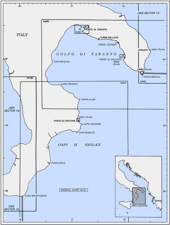
Punta Stilo bearing 284° |
Golfo di Squillace lies between Punta Stilo and Capo Rizzuto (38°53'N, 17°06'E), 36 miles NE. This gulf has low and sandy shores which are backed by the high green slopes of Appennino Calabrese. Numerous streams, most of which are short and torrential, flow into the gulf. Winds are almost always present in the gulf even when it is calm outside.
Marina di Badolato (Badolato Stazione), situated 7.5 miles N of Punta Stilo, is not easily seen from seaward. Two dark isolated houses surmount two hills which stand S of this village and are the best landmarks in this vicinity. Badolato, situated 2 miles W of Marina di Badolato, can be seen only in the early morning hours. The most conspicuous object in this village being the church on top of a hill.
Marina di Badolato offers the best anchorage off this part of the coast. Small vessels can anchor, in a depth of 9m, about 0.4 mile off the beach which fronts the village. This anchorage is dangerous in W winds as it has a whirling characteristic. Large vessels can anchor, in a depth of 80m, about 2.5 miles offshore.
16.5 Soverato Marina (38°42'N, 16°33'E), a small town, is situated 7 miles N of Marina di Badolato and is conspicuous from seaward. A church, with a red roof, stands on a hill which dominates the town. A large brick-colored building stands next to the church.
A wreck lies about 1.5 miles offshore, 3.2 miles SE of the town. The depths in this area are reported to be shallower because of silt from the nearby river.
Soverato Marina provides one of the safest anchorages along this coast. Vessels can anchor, in a depth of 29m, sand, about 0.1 mile offshore and ENE of the church. Local knowledge is advisable. This roadstead is partially protected by a sandspit which extends about 300m from the coast. It is dangerous with winds from between the N and SE. Large vessels can anchor, in depth of 160m, about 1.5 miles N of Soverato Marina.
Punta di Staletti (38°45'N, 16°34'E) is the extremity of a rocky and steep-sided promontory which is partially covered with vegetation. A red-roofed castle, with a crenellated turret, stands on the summit of the promontory. A conspicuous viaduct, with twelve arches, is situated near this point.
The village of Squillace, situated 3 miles NW of Punta di Staletti, stands on a conspicuous isolated hill, 345m high, which is covered with dark vegetation. A prominent castle overlooks this village.
Caution. – A submarine cable, which may best be seen on the chart, extends SE from the shore, 1 mile NE of Punta di Staletti.
16.6 Marina di Catanzaro (38°49'N, 16°37'E) (World Port Index No. 40430), a sprawling town, is situated 4.5 miles NE of Punta di Staletti. Numerous conspicuous chimneys and various tall factories stand in the town. A long steel railway bridge, standing close S of the town, and a ruined tower, surmounting a hill close NW of the town, are prominent. A small craft harbor, protected by moles, lies close E of the town and vessels work their cargo in the roadstead. In winter, with fresh offshore winds, vessels usually anchor close inshore where the depths are great and the holding ground is good. Local pilots are available.
Catanzaro, a large town, is situated 5 miles N of Marina di Catanzaro. This town is easily identified, as it appears as a large white patch against the mountains. At night, the lights of the town are very conspicuous.
Torre del Crocchio (38°55'N, 16°50'E) is conspicuous, although it is in ruins and of a dark aspect. This tower stands on the W bank of a river and several conspicuous buildings are situated 0.7 mile NW of it; the most conspicuous is the railway station of Cropani. The houses of Botricello are also conspicuous and are situated on a slight rise of ground 2 miles NNE of the tower. Marina di Botricello, a village, stands on the wooded shore and consists of low dwellings and a prominent church.
16.7 Barco Vercillo (38°55'N, 16°59'E), a cove, is entered 7 miles E of Torre del Crocchio and provides anchorage, in a depth of 12m, sand, about 0.3 mile offshore. A sandy shoal lies in the E part of this cove.
Le Castella, a conspicuous group of ruined bastions, is surmounted by a prominent tower. This group stands on a low peninsula 3 miles W of Capo Rizzuto and is almost surrounded by the sea.
Secca Le Castella, lying about 0.5 mile SSW of Le Castella, consists of a reef with two rocky heads. A least depth of 6.1m lies in the channel leading between this reef and the shore.
16.8 Capo Rizzuto (38°53'N, 17°06'E), located 3.5 miles ESE of Le Castella, is the extremity of a low, rocky, and steep-sided promontory. A light and an auxiliary light are shown from a structure, 17m high, standing on the cape.
Two conspicuous towers, in addition to the light structure, stand on the cape. One, a cylindrical tower, stands on the E side and the other, a square one, stands on the W side.
From off this cape, the large town of Catanzaro is visible and appears as a large white patch against the mountains.
Vessels can anchor, in depths of 14 to 20m, over a rocky and irregular bottom in the bay lying between Le Castella and Capo Rizzuto. Local knowledge is advisable.
Caution. – A nature reserve has been established in the vicinity of Capo Rizzuto.
 |
|
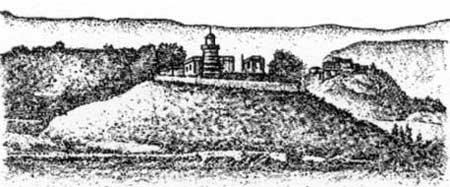
Capo Rizzuto Light |
Between Capo Rizzuto and Capo Colonne, 10 miles NE, the coast is generally flat and rocky with many cliffy points up to 20m high. Le Arene Rosse, formed by two reddish bluffs, is located 3.2 miles NE of Capo Rizzuto.
Two shoals, known as Secche di Capo Rizzuto, have least depths of 4m and 8m and lie 1.5 miles and 2.3 miles ENE, respectively, of Capo Rizzuto.
Capo Cimiti, located 5.4 miles NE of Capo Rizzuto, is the extremity of a low and rocky promontory. Several prominent white silos stand close SW of this cape.
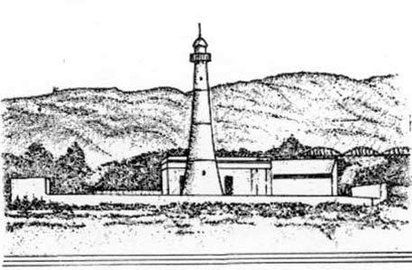
16.9 Capo Colonne (39°02'N, 17°12'E), 20m high, is the N extremity of a flat promontory. A light is shown from a prominent structure, 22m high, standing 0.2 mile S of the extremity of the cape.
Several houses, a large quadrangular tower, and a chapel, all prominent, are situated on the cape. The ruins of an ancient temple and a large column stand close seaward of the light. A prominent viaduct, with numerous arches, is situated 1.5 miles WSW of the light and is conspicuous. A disused signal station, consisting of a building surmounted by a tower, stands at a height of 144m, 2 miles W of the light.
A shoal, with a depth of less than 1.8m, extends up to 0.2 mile E from the cape. Vessels can anchor, in a depth of 20m, about 1 mile SW of the light, but local knowledge is required.
Numerous shoals and submerged reefs, dangerous to navigation, lie up to about 0.4 mile offshore between Capo Colonne and Porto di Crotone, 4.5 miles NW.
Porto di Crotone (39°05'N, 17°08'E)
World Port Index No. 40440
16.10 Porto di Crotone, a small port, consists of two harbors which are protected by breakwaters. Porto Vecchio, the smaller harbor, is entered from the S and Porto Nuovo, the larger harbor, is entered from the NW.
Winds – Weather. – Winds from the NE through SE prevail during the winter. In spring, mostly NE winds prevail.
Depths – Limitations. – Porto Vecchio, in the S part of the port, affords good shelter and can accommodate vessels up to 61m in length and 4.2m draft. It is used mostly by fishing boats.
Porto Nuovo, in the N part of the port, contains the main commercial facilities. Molo Guinti, 299m long, has a depth of 8.5m alongside and can accommodate a vessel with a maximum draft of 7m. Molo Foraneo, 427m long, has depths of 5.5 to 7.2m alongside. Banchina di Riva, 428m long, has depths up to 8.6m alongside and can accommodate a vessel with a maximum draft of 8m. There are facilities for chemical, ro-ro, bulk, and tanker vessels. Vessels up to 35,000 dwt, 198m in length, and 8.7m draft can be accommodated.
Aspect. – A conspicuous fort, with high bastions, stands on a point, 43m high, between the two harbors. The town extends W and S from this fort. Two large factories and a cemetery, surrounded by a low wall, are situated in an isolated position, 1 mile S of the town. A chimney, 90m high, stands 1 mile W of the entrance to Porto Nuovo.
Pilotage. – Pilotage is compulsory for vessels over 500 grt and for tankers of any size. Pilots may be contacted on VHF channel 14 or 16 and board 1 mile from Molo Foraneo Light.
Regulations. – Power-driven vessels entering and leaving the port have the right-of-way over sailing vessels and small craft within 1 mile of the entrances.
Vessels departing either harbor have the right-of-way over vessels entering.
Anchorage. – Vessels can anchor, in a depth of 14m, good holding ground, about midway between Capo Colonne and the port. Vessels can also anchor SE of Crotone, in a depth of 13m, ENE of the cemetery.
Caution. – The heads of the breakwaters should be given a wide berth.
Recognition of the navigation lights shown from the heads of the breakwaters is, at times, very difficult because of the illumination of the port and several bluish lights situated to the NW of the port.
Several oil production platforms, wells, and associated submarine pipelines, are situated in the approaches to Crotone and may best be seen on the chart A stranded wreck, marked by a buoy, lies 0.5 mile N of the head of Molo Foraneo. A second wreck lies approximately 0.5 mile NW of the mole head.
Porto di Crotone to Porto di Taranto
16.11 Golfo di Taranto (40 °00'N, 17°00'E) is entered between Capo Colonne and Capo Santa Maria di Leuca, 72 miles NE. The W side of the gulf is backed by the mountains of the Appennino Calabrese, which have some remarkable summits and can be seen from a great distance. The NE side of the gulf is low and flat. All the shores of the gulf are bordered by sandy beaches, which in general, are fringed by marshy ground.
Caution. – Italian submarines frequently exercise in an area indicated on the chart within Golfo di Taranto. A good lookout should be kept for them by vessels passing through the area.
16.12 Punta Alice (39°24'N, 17°09'E) is low and steep-to. A light is shown from a prominent structure, 27m high, standing 0.3 mile SW of the extremity of the point.
 |
|
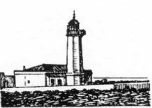
Punta Alice Light |
The coast between Crotone and Punta Alice consists of a beach alternating between sand and gravel. Fiume Neto, located 7 miles N of Crotone, enters the sea through a densely-wooded mouth that extends several miles E of the general coast line. A steel railway bridge and two red silos are situated 1.5 miles W of the mouth of this river and are conspicuous from the SE. The conspicuous railway station of Strongoli, surrounded by lower buildings, stands 0.5 mile N of the wooded area.
The most prominent landmark to be seen from any direction is the church of San Nicola dell Alto, which stands on a saddle in the mountains between a pointed and a rounded summit, 10 miles NW of the mouth of Fiume Neto.
The town of Ciro is situated on a green hill, 4 miles WSW of Punta Alice. It is distinctly visible at a great distance from all directions. A white signal station stands on the summit of Serra Sanguigna, a bare cupola-shaped hill, standing 0.5 mile WNW of Ciro. Madonna di Mare, a small and conspicuous church, is situated 1.5 miles WNW of Punta Alice.
A prominent building, with an industrial plant nearby, stands 0.5 mile W of Punta Alice. A T-head pier, with off-lying dolphins, lies on the N side of Punta Alice and is connected with the industrial plant. The head, 140m long, has a depth of 10m alongside and is used for loading mineral salt. Local pilots are available and may be ordered in advance through Porto di Crotone.
16.13 Torre Policaretto (39°29'N, 17°01'E), standing on Punta Fiumenica, is conspicuous from a great distance and consists of two entirely separated and ruined fragments. In fair weather or with offshore winds, anchorage is available about 1 mile SE of this tower.
Capo Trionto (39°37'N, 16°46'E) is low, steep-to, and covered with vegetation. A light is shown from a prominent structure, 18m high, standing close W of the mouth of Fiume Trionto, which enters the sea through the cape. A marine farm, marked by lighted buoys, is located 1.7 miles W of the cape.
 |
|
Capo Trionto bearing 156° |
16.14 San Angelo di Rossano (39°37'N, 16°38'E) is situated 5.5 miles W of Capo Trionto. The houses of this town are obscured by trees, but several factory chimneys are prominent from a short distance offshore. Sometimes the smoke from these factory chimneys may be used as a guide when approaching. Anchorage can be taken, in good weather, in front of the town. A good berth, in a depth of 37m, lies about 140m offshore, with the stern secured to mooring posts on the beach. Local knowledge is advisable and vessels should leave on the first indication of onshore winds.
16.15 Shiavonia (39°39'N, 16°32'E), a village, stands 5 miles WNW of San Angelo di Rossano and serves as the port for Corigliano Calabro. A large tower is situated amongst the houses of this village and is prominent. In summer, this village is a popular resort.
Corigliano Calabro, a town, is situated on a hill, 3.5 miles SSW of the village. It is dominated by a castle. Pilotage is not compulsory but is recommended. Vessels should send an ETA 24 hours in advance of arrival. The pilot boards 1.5 miles from the harbor entrance. Vessels waiting to carry out operations must anchor in one of the four charted anchorage berths designated A1 through A4. Vessels can anchor, in depths of 15 to 20m, off the village, in a good holding ground of mud and sand. Vessels must contact the harbormaster on VHF channel 14 or 16 prior to anchoring.
Punta Coscio (39°43'N, 16°31'E) is a flat, heavily-wooded point through which Fiume Crati discharges into the sea by two mouths. After heavy rain, the sea is discolored for up to about 1 mile offshore in this vicinity.
Porto di Sibari Marina (39°44'N, 16°31'E), an extensive yacht harbor, lies close N of the mouth of Fiume Crati, 5 miles NNW of Shiavonia. It is entered through a canal, with a depth of 4m, which is protected by two moles. A light is shown at Sibari, situated in the vicinity of the harbor entrance; a lighted range indicates the approach channel.
The beach between Capo Trionto and the mouth of Fiume Saraceno, lying 7.5 miles N of Punta Coscio, is undulating and composed of alluvial deposit from the numerous torrents. The character of the shore alters to the NE of Fiume Saraceno and hills stand closer to the beach. When dry, the river bed of Fiume Saraceno is visible from a great distance offshore.
The village of Trebisacce, situated 1 mile NE of the mouth of Fiume Saraceno, stands on a spur, 73m high, that slopes steeply towards the sea.
16.16 Trebisacce Marina (39°52'N, 16°32'E) (World Port Index No. 40460), fronted by a short pier, is built on the beach, close SE of Trebisacce. A high chimney, a long wall with arches, and a steel bridge, are situated in the vicinity of this prominent village. Anchorage can be obtained off Trebisacce Marina. The bottom is sandy and the holding ground is good. Large vessels can anchor, in a depth of 20m, about 1 mile offshore. The depths decrease rapidly towards the beach.
Secca Amendolara, an off-lying bank, lies 7 miles SE of Capo Spulico and has a least depth of 26m.
Capo Spulico (39°58'N, 16°38'E) is very low and partially covered with bushes. Fiume Ferro flows out to the sea through this cape. A steel railway bridge crosses the river, 0.2 mile from its mouth, and is prominent. Anchorage, sheltered from winds between W and NNE, can be obtained by small vessels close S of this cape, but local knowledge is required. The bottom is sand.
The coast between Capo Spulico and the mouth of Torrente Canna, 8.5 miles N, is high, but from the latter river to Punta Rondinella, 34 miles NE, it is low, marshy, wooded in places, and intersected by many torrents and rivers. The river mouths, which are hidden by low scrub, are mostly difficult to distinguish.
Montegiordana Marina, a village, is situated 4.7 miles NNW of Capo Spulico. Two pairs of low chimneys and a shed, situ-ated near a factory cableway, stand in the vicinity of this village and are prominent.
16.17 Scoglio Cervaro (40 °04'N, 16°36'E) is a low, black rock which lies close to the coast. It is visible against the light-colored beach for a distance of up to 6 miles offshore.
Marina di Rocca Imperiale, a village, stands near the S mouth of Torrente Canna and consists of several red and white buildings. A tank, the railway station, and Torre Lizzana, surmounted by two sentry boxes and a tall column, are situated in the village and are prominent from seaward. Anchorage is available off this village, in a depth of 14m, sand and mud, good holding ground, near Torre Lizzana.
Fiume Sinni (40 °09'N, 16°41'E) enters the sea through a sandy point and prominent muddy river water sometimes extends as far as 2 miles offshore in this area. Between this river and Fiume Agri, lying 4 miles NNE, there are several lagoons and marshes which are backed by extensive woods.
16.18 Torre Scanzano (40 °15'N, 16°45'E) stands in an isolated position near the beach. It is a dark-colored pyramid-shaped structure surmounted by a small building. Anchorage can be obtained, in a depth of 13m, about 1.5 miles offshore E of this tower. Local knowledge is required and in winter it is advisable to anchor farther offshore. It is dangerous to remain at this anchorage with ESE or S winds.
Torre Mattoni, half in ruins, stands near the edge of the beach, 10.5 miles NNE of Torre Scanzano. A conspicuous two-story building stands 0.7 mile WSW of the tower. The conspicuous railway station of Metaponto, with a large water tank in its vicinity, stands 3 miles SW of Torre Mattoni.
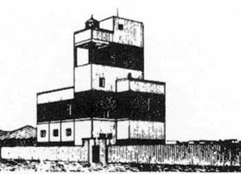
The railway station of Ginosa, surrounded by red and yellow houses, is situated 2 miles NE of Torre Mattoni and is prominent. A conspicuous disused light structure, consisting of a square tower standing on a two-story building, is situated close SE of this railway station. Anchorage can be obtained off the coast and ESE of the disused light structure, but local knowledge is required.
Three prominent cylindrical pillars stand along the coast between the railway station of Ginosa and Taranto.
 |
|
Ginosa Disused Light |
16.19 Torre Lato (40 °30'N, 16°59'E) is situated on the beach, on the SW side of the mouth of Fiume Lato. It is low, preserved, and stands out prominently against the trees. A bridge spans the river close inside its mouth.
Secca Armeleia, with a least depth of 8m, lies between 2 and 4 miles E of Torre Lato. This reef consists of rock and weed, and seas break over it during strong S winds. Several isolated shoal depths lie close E and SE of this reef.
Caution. – A torpedo range lies along a line joining Torre Lato and Torre Montello, 9.5 miles E, and is marked by buoys moored either singly or in pairs.
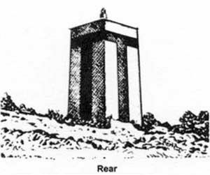
16.20 Punta Rondinella (40 °29'N, 17°11'E) is low, narrow, and forms the NW point of Mar Grande at Taranto. Torre Montello, thin with three rows of windows, stands 1 mile NE of the point and is conspicuous from seaward. A conspicuous chimney, with a continuously burning flare, stands 320m NE of Torre Montello.
Porto Industriale Esterno lies 1.5 miles NNW of Punta Rondinella. The port consists of a basin, dredged to 12.5m, extending 0.5 mile SW from the coast, with a turning basin situated at the seaward end. Four berths are located on the NW and SE sides of the basin.
Porto di Taranto (40 °27'N, 17°12'E)
World Port Index No. 40470
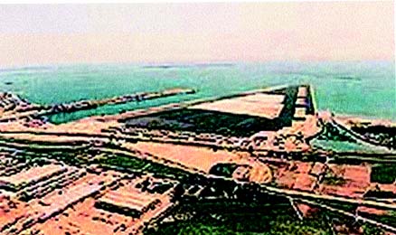
16.21 The extensive port of Taranto consists of Mare Grande, an outer harbor, which is protected by breakwaters; Mare Piccolo, an inner harbor, which consists of two bays; Porto Mercantile, a quayed basin, which lies in the NE part of Mare Grande and is protected by two moles; and Porto Industriale, which extends along the N shore of Mare Grande. The port is primarily a naval base.
Port of Taranto Home Page http://www.port.taranto.it
Winds – Weather. – From September to March, winds alternate usually between the NW and NE. The NE winds blow sometimes with such force as to cause a sea in Mare Piccolo. Winds from the SW raise a lively sea and cause high water in Mare Grande. Winds from the SE, especially in winter, are strong and may disturb cargo handling by vessels berthed in Porto Mercantile. These winds usually also bring mist and rain, especially during May and June. In spring, strong W gusts of wind blow over the roadstead. They are generally of a brief duration and slacken towards sunset. Winds from the E and S usually bring fog.
Tides – Currents. – The current off the port sets W, but is usually weak and is felt only during strong E winds.
Depths – Limitations. – Porto Mercantile has 1,180m of total berthing space with depths of 7.7 to 12m alongside. A channel dredged to a depth of 25m leads to Porto Industriale.
The main facilities include a petroleum pier, 900m long, which has four berths, with depths of 6 to 9.6m alongside, and can handle vessels up to 34,000 dwt and 9.5m draft; two cement piers, which have 340m of total berthing space, with a depth of 12m alongside; and a bulk-steel pier, which has 925m of total berthing space, with depths of 15.6 to 24m alongside, and can handle vessels up to 300,000 dwt and 23m draft.
An offshore sea terminal lies in the center of Mare Grande and consists of several mooring buoys. The berth can accommodate tankers up to 230,000 dwt, 350m in length, and 22m draft.
In Mare Piccolo, the shipyard pier at the head of the W bay has a berth with a dredged depth of 10.4m alongside. The aviation gas jetty has a depth of 7.5m alongside and can handle vessels up to 160m in length and 6.5m draft.
Passagio Piccolo, providing navigable passage between Mare Piccolo and Mare Grande, is 375m long and 73m wide, with a depth of 12m. It is 57m wide between the abutments of a two-leaf swing bridge which has a clearance of 12m above mean sea level.
This canal is regulated exclusively by the Italian naval authorities and traffic is limited to merchant vessels carrying government cargo and naval vessels. The speed of transit for moderate-sized vessels is limited to 6 knots, which is considered also to be the most desirable maneuvering speed. Large vessels exceeding 150m in length are permitted to pass through at a speed of 10 knots provided their propeller revolutions are reduced when actually in the canal. Vessels up to 235m length, 32.6m beam, and 8.8m draft can pass through the canal, but passage of such large vessels is difficult. The maximum recommended beam is 38m, but vessels with a beam exceeding 32m must:
1. Transit the canal during daylight hours.
2. Give precedence to other vessels and take two pilots and two tugs having at least 2,000 hp. Detailed regulations of the canal should be obtained from the port authorities.
 |
|
Port of Taranto |
Aspect. – The city is built on a rocky tongue of land which separates Mare Piccolo, on its NE side, from Mar Grande, on its SW side. Mare Grande and Mare Piccolo are connected by a narrow canal known as Passagio Piccolo. A bridge connects the E part of Taranto with the peninsula which extends S and separates the W and E bays of Mare Piccolo.
The heights containing several prominent villages extend NW from the city and are conspicuous from a considerable distance offshore.
Isola San Pietro, the larger of the two islets fronting Mare Grande, lies 2 miles SW of Punta Rondinella. It is low, rocky, and irregular in shape. Numerous structures and buildings stand on this islet. Torre Vedetta, the most conspicuous, is situated 0.8 mile E of Punta La Forca, the W extremity of the islet. A framework television mast stands near the W extremity and several red sheds are situated near the E extremity. Breakwaters, which protect Mare Grande from the W, extend between Punta Rondinella and Isola San Piero and ESE from the SE side of the islet.
Lighted buoys are moored about 1 mile SSW and 1.5 miles E of Punta La Forca and mark the coastal shoal bank.
Capo San Vito, marked by a light, is located 2 miles SE of Isola San Pietro and is the S entrance point of Mare Grande. A radiobeacon is located at the light. A breakwater extends NW from a point on the shore, 0.7 mile NNE of the cape. A racon is situated at the light structure standing on the head of this breakwater. A lighted beacon is situated 1 mile SW of the head of this breakwater and marks the shoals on the E side of the entrance channel. Casa Gigante Beacon, marked by a light, stands 0.4 mile E of the root of this breakwater and consists of a conspicuous square tower, 20m high, surmounted by a mast.
Secca della Sirena lies in the N part of Mare Grande, 1.6 miles SE of Punta Rondinella. It has a least depth of 7.2m and is marked by lighted beacons. A detached breakwater lies close NNW of this shoal. Secca della Tarantola lies in the SE part of Mar Grande, 2.5 miles NE of Capo San Vito. It has a least depth of 2.9m and a breakwater extends SE from its N part to the shore.
A lighted range and a reverse lighted range are necessary for the transit of Passagio Piccolo and may best be seen on the chart. Lights at the rear range structures are shown only when vessels are passing through the canal at night.
The most conspicuous objects visible in Mare Grande are the campanile of San Cataldo, rising above all the buildings of Taranto; Castel San Angelo, standing on the W point of the entrance to Mare Piccolo; and Palazzo del Governo, standing to the E of the entrance.
Pilotage. – Pilotage is compulsory for merchant vessels over 500 grt entering or leaving Mare Grande and for all vessels authorized to enter or leave Mare Piccolo. Pilots board vessels with drafts greater than 16m about 4 miles WSW of Cabo San Vito Light. Vessels with drafts of 16m or less are boarded 1 mile from the beginning of the channel.
Cargo vessels should send an ETA at least 6 hours in advance and tankers should send an ETA at least 36 hours in advance giving their SOLAS and CLC (Civil Liability Convention) requirements. All vessels at anchor must maintain a listening watch on VHF channel 12 from h +15 until h +20 every hour so instructions and information can be relayed. Vessels entering and departing port must maintain a listening watch on VHF channel 67 in order to maintain contact with the Castello Signal Station.
Regulations. –. A Traffic Separation Scheme, best seen on the chart, is located in the approaches to Taranto.
Outbound vessels with drafts greater than 16m have precedence over inbound vessels.
Vessels anchoring should follow the directions of the pilot.
Anchorage is prohibited in the entrances to Porto Mercantile and Porto Industriale, and on or near the range lines of Passagio Piccolo. Anchorage is prohibited in the E part of the W basin of Mare Piccolo.
 |
|
Passagio Piccolo Front Range Light Structure |
 |
|
Passagio Piccolo Rear Range Light Structure |
Anchoring and stopping are prohibited within 0.1 mile of Isola San Paolo, Isolotto San Pietro and any military installation, and within 90m of any of the breakwaters surrounding Mare Grande.
Vessels must not stop in the entrance fairway or obstruct other vessels entering or leaving.
Vessels which are carrying, or which have carried, dangerous or polluting cargo in a liquid or gaseous state, are prohibited from navigating within the coastal zone extending 6 miles from the coast between the mouth of Fiume Sunni and Punta Prosciutto (40 °17'N, 17°46'E), unless entering or leaving the port of Taranto.
Anchorage. – Mare Grande provides a spacious roadstead anchorage. The anchorage for merchant vessels lies in the area to the NE of Isola San Paolo. There are also numerous mooring buoys within Mare Grande, some of which have telephone connections.
Anchorage can also be taken in the W part of the W basin of Mare Piccolo.
Caution. – A prohibited area lies in the SE part of Mare Grande and may best be seen on the chart.
A dangerous for navigation and fishing area, the limits of which are shown on the chart, lies centered 2.3 miles WNW of Punta La Forca and is marked by a lighted buoy. Underwater obstructions are placed within this area from time to time. Such obstructions are usually marked by buoys of different shapes and constitute navigational hazards.
Several torpedo rafts and a searchlight float are moored in the E part of Mare Piccolo
Porto di Taranto to Porto di Gallipoli
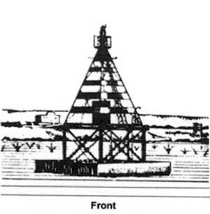
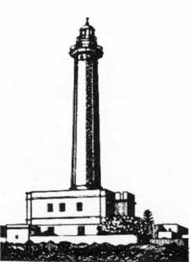
16.22 Capo San Vito (40 °24'N, 17°12'E), the S entrance point of Mare Grande, is low. A light is shown from a prominent tower, 43m high, standing 0.2 mile N of the SW extremity of the cape.
 |
|
Capo San Vito Light |
Torre San Vito, large and light-colored, and a disused signal station are situated near the light. Several airplane hangers stand 0.6 mile ENE of the light and are particularly conspicuous.
Between the cape and Torre dell Ovo, 15 miles ESE, the coast is mostly low, rocky, and irregular. The village of Roccaforzata, situated 8.7 miles ENE of Capo San Vito and 5 miles inland, appears prominent from seaward. This village stands on a hill, 144m high, and is dominated by a conspicuous castle.
Torre dell Ovo (40 °18'N, 17°30'E), 17m high, is surmounted by a hut and stands on a small and rocky point which is flanked closely on either side by similar points. Torre Colimena stands on a point, 11 miles E of Torre dell Ovo. It is the tallest of several conspicuous towers situated along this stretch of coast.
16.23 Porto Cesario (40 °15'N, 17°54'E), a small craft harbor, lies on the SE side of a point which is surmounted by Torre Cesareo, a large quadrangular building.
Torre Squillace stands 1.5 miles SE of Torre Cesareo and a narrow tongue of land extends 1.2 miles NW from its vicinity and protects the above harbor. The coast between this tower and Gallipoli is wooded in places, sandy, and rocky at intervals. Torre dell Inserraglio, situated 3.2 miles S of Torre Squillace, is white and appears to rise from the sea.
Caution. – Numerous wrecks, some dangerous, lie offshore between Porto Cesario and Gallipoli and may best be seen on the chart.
Porto di Gallipoli (40 °03'N, 17°59'E)
World Port Index No. 40480
16.24 The port of Gallipoli consists of a harbor which lies on the N side of a low promontory and is protected by moles.
Depths – Limitations. – The main facilities of the harbor include Molo Foraneo, 356m long, with a depth of 7 to 11m alongside; Tramontana Quay, 169m long, with a depth of 12m alongside; Sottoflutto Quay, 110m long, with a depth of 6.5m alongside; Banchina Quay, 145m long, with a depth of 4.5m; Ferrovia Quay, 175m long, with 7.5m alongside; and Lido Quay, 200m long, with a depth of 6.5m alongside. Vessels up to 26,000 dwt, 150m in length, 18.2m beam, and 10.5m draft can be accommodated.
Sena del Canneto, a small craft harbor, lies S of the bridge which connects the island to the promontory and is protected by breakwaters.
Aspect. – The town of Gallipoli stands partly on the promontory and partly on a rocky island which lies close W of it. A masonry bridge, 137m long, connects the island to the E extremity of the promontory.
The town has an oriental aspect and is surmounted by several ancient bastions. The village of Grosso di Racale stands 3 miles inland, 8 miles SE of the town. It is situated on an olive tree-covered ridge and is conspicuous from seaward.
The main outer mole extends 0.4 mile ENE from the N side of the rocky island. Secca del Rafo, a detached shoal, lies about 0.3 mile WNW of the head of the mole. It has a least depth of 2.6m and is marked by a lighted buoy.
Pilotage. – Pilotage is compulsory for vessels over 500 grt. Local pilots can be contacted on VHF channel 16 and board near the entrance to the harbor.
Regulations. – The harbormaster has established anchorage berths for the use of vessels waiting to carry out commercial operations in the port. Vessels must contact the harbormaster on VHF channel 16 for authorization to use these anchorage berths.
Anchorage. – Anchorage can be obtained, in a depth of 15m, about 300m NW of the head of the mole or on the S side of the promontory in a depth of 16m, about 0.3 mile SSE of the rocky island.
Caution. – Tunny nets are laid out in the vicinity of Gallipoli. These nets are set in February and are removed in November. Fish traps may be set throughout the whole year along the coast to the NE of the harbor.
Vessels approaching from the S and W may pass between the mole and Secca del Rafo, but it is not recommended. Passage to the N of Secca del Rafo is preferred.
Strong NW and NE winds may make entering the harbor difficult. Less depths than charted (1995) may be found in the harbor.
Porto di Gallipoli to Capo Santa Maria di Leuca
16.25 Isola Sant Andrea (40 °03'N, 17°57'E) lies 0.8 mile WSW of the W end of the rocky island on which part of the town of Gallipoli stands. It is low and is almost completely inundated by the sea during strong SE winds. A light is shown from a conspicuous tower, 43m high, standing on the SW extremity of the island.
Punta del Pizzo (40 °00'N, 18°00'E), located 3 miles S of Gallipoli, lies at the S end of a sandy bay and is surmounted by a small turret with windows. Torre Suda, standing 3.5 miles SE of Punta del Pizzo, is a cylindrical tower with a rectangular superstructure. A basin for small boats lies close S of this tower.
From Punta del Pizzo to Torre San Giovanni, 9.5 miles SE, the coast is low and rocky. The hillsides are dotted with buildings which become more numerous as the tower is approached.
Caution. – A circular prohibited area, best seen on the chart, lies midway between Punta del Pizzo and Torre San Giovanni. A dangerous wreck with a depth of 8m lies 1.5 miles N of the N extremity of the prohibited area.
16.26 Torre San Giovanni (39°53'N, 18°07'E), surrounded by fishermen’s huts, stands on a rocky point. A light is shown from this tower which is 24m high.
About 250m SE of Torre San Giovanni, a ridge of rocks, about 0.7 mile long, lies parallel with the coast and about 0.1 mile offshore. From seaward, this ridge appears to have seven distinct rocks. The largest of these rocks, known as Scoglio Tondo, has a rounded top.
The coast between Torre San Giovanni and Torre I Pali, 5 miles SE, is fronted by Secche d’Ugenta, a reef with depths of less than 5.5m. This reef extends up to 2 miles offshore in places and is marked by a lighted buoy.
Torre I Pali stands on the SE extremity of a low tongue of land and is almost completely in ruins. Torre Vado, standing 3.2 miles E of Torre I Pali, is cylindrical and well preserved.
16.27 Punta Ristola (39°47'N, 18°21'E) is the W entrance point of a small bay which lies between this point and Punta Meliso, 1 mile ENE. Banco la Scala, with depths of 11 to 18m, fronts this bay and extends up to 1.7 miles SSE of Punta Ristola. Leuca, a town, stands at the head of the small bay. It is a resort and has numerous prominent villas. Anchorage can be obtained, in a depth of 12m, off the town. This roadstead affords shelter from NE winds, but it is dangerous with S winds.
Punta Meliso, the SW extremity of Capo Santa Maria di Leuca (39°48'N, 18°22'E), is marked by a light and is described in paragraph 17.2.
Caution. – During reduced visibility in the vicinity of Secche d’Ugenta and Banco la Scala, vessels are advised to keep offshore and in depths of over 30m.
Tunny nets are set within a radius of 3.2 miles of Torre San Giovanni. The area is not restricted as the nets are set at the risk of the owner. These nets are set in February and are removed in November. Nets are also set 10 miles SE of Torre San Giovanni and extend up to about 1 mile SW from the shore.