
ITALY – SICILIA (SICILY) AND STRETTO DI MESSINA SECTOR 15
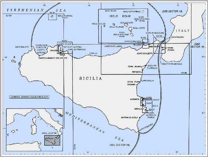
Plan. – This sector describes the N coast of Sicilia (Sicily) and its off-lying islands, from W to E; the NE coast of Sicilia and Stretto di Messina; and then the SE coast of Sicilia, from N to S.
General Remarks
15.1 Winds – Weather. – The Marrobbio, a phenomenon experienced most frequently along the SW coast of Sicilia, is common throughout this whole area. It usually occurs during undisturbed weather and produces waves or surges, sometimes isolated or sometimes in a series. These waves or surges cause sudden fluctuations of the water level, up to 1m, and set up dangerous currents in confined bays or harbors.
During the winter, between October and March, SW winds predominate off the N coast of Sicilia. These winds often blow with moderate gale force or they may be of a squally nature. During September and April, the winds usually blow from the NE or SE with approximately the same frequency. Winds from the NE prevail more frequently during the summer months. These winds are less constant than the S winter winds.
Land and sea breezes are well developed in summer. The sea breeze, known as Imbattu, springs up in the morning after 1000. It freshens during the day, reaches a maximum at 1400, and calms at sunset. The sea breeze freshens somewhat when it swings to the NW. If the sea breeze continues until about 2200, calms or light winds will generally prevail on the following day.
Squalls can be expected off the mouth of Fiumara d’Agro, on the E coast of Sicilia, during W or SW winds. Violent N or NW winds sometimes blow down from the valley located off the N side of Monte Etna. Storms from the NE, of a long duration, occur in the vicinity of Capo Schiso, especially during spring. Winds from the E and SE, often violent, predominate in the vicinity of Capo Molini. Winds from SE or NW, lasting for 2 or 3 days, usually occur in the vicinity of Golfo di Catania during winter. Winds from the NE and NW are more frequent during spring and summer. In September, violent SW winds, of a short duration, occur quite frequently. Strong SE winds, accompanied by heavy swells, frequently occur in October and November. Winds from the ENE and ESE prevail in winter in the vicinity of Siracusa and W or SW winds sometimes blow with violence.
Tides – Currents. – The currents in the vicinity of Sicilia are irregular and are generally influenced by the prevailing wind. Along the N coast, the current almost always sets W at a rate of 0.5 knot. Further offshore, the current flows E and then NW along the W coast of Italy. The inshore current appears to be stronger than the offshore one.
Strong currents are sometimes found among the islands of Isole Eolie. These currents are greatly influenced by the winds. During summer, with variable breezes, a general S set has been observed. This set is particularly noticeable in the vicinity of the W islands of the group. Currents of variable rates, up to a maximum of 3 knots, have been observed setting E or W in the channel lying between the S island of the group and the N coast of Sicilia.
The currents off the E side of Sicilia usually follow the coast and set SW in the vicinity of Capo Schiso. Along the coast to the S of Monte Etna, a current sets S in summer and autumn at a rate of about 0.3 knot. This current is quite noticeable near the coast and extends from 1 to 1.8 miles offshore. Weak currents, mostly influenced by the winds, are found in Golfo di Catania and similar currents are found off Augusta and Siracusa.
Regulations. – Tanker vessels of 1,600 grt and over entering or leaving Italian ports and carrying, or with uncleaned tanks which last carried, petroleum, gas, or chemical products should report to a shore station before entering Italian territorial waters off Italian ports. For further details, see Pub. 140, Sailing Directions (Planning Guide) North Atlantic Ocean, Baltic Sea, North Sea, and the Mediterranean Sea.
Caution. – Tunny nets are laid out annually between March and November close off many places along the N coast of Sicilia.
15.2 Sicilia (Sicily) (37°50'N, 13°30'E) is the largest and one of the most important islands in the Mediterranean. It is separated from the W side of the toe of the boot of Italy by the deep Stretto di Messina.
Capo San Vito (38°11'N, 12°44'E), marked by a light, is the NW extremity of the island. It is fully described in paragraph 14.18.
A small bay, with a sandy beach, indents the N side of the peninsula which stands between Capo San Vito and Punta di Solanto, 1.7 miles ESE. San Vito Lo Capo, a village, is situated at the head of this bay and is a fishing boat harbor, protected by breakwaters, lies close NW of it. The square structure of a fortress-like shrine, with a bell tower, is situated in front of the village and is prominent. An ancient and massive red-colored tower, partly in ruins, stands on the beach, close N of the village. However, it can only be seen from the W side of the peninsula.
Monte Monaco (38°10'N, 12°35'E), 532m high with steep and rocky sides, stands 1.7 miles SE of Capo San Vito. It is located at the N end of a ridge that descends from Monte Sparagio, 1,110m high, which stands 7 miles further S.
15.3 Isola d’Ustica (38°42'N, 13°10'E), lying 30 miles N of Punta Raisi, is of volcanic formation, fertile, and cultivated. A hilly ridge crosses the N central part of the island and rises to Monte Guardia dei Turchi, summit, which is 248m high. A radar station, consisting of a brown building topped by a large white sphere, stands on the summit and is visible from all directions.
The N slope of Monte Guardia dei Turchi descends steeply towards a wide level plain, 20m high, which trends towards the N coast. The S slope is less steep and several hills stand between the mountain and the S coast of the island. From a distance E or W, Isola d’Ustica appears as two islets lying close together.
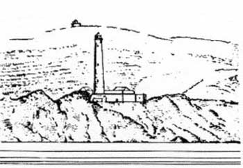
Punta Cavazzi (38°41'N, 13°10'E), a rocky point, is the SW extremity of Isola d’Ustica. A light is shown from a tower, 28m high, standing on the point.
 |
|
Punta Cavazzi Light |
The W coast of the island between Punta Cavazzi and Punta Gorgo Salato, 2 miles NE, is fringed by shoals. Punta dello Spalmatore, a long and sharp rocky tongue, extends about 0.3 mile N of Punta Cavazzi and its outer part is bordered by above-water rocks. A large and prominent tower stands at the inner end of this rocky tongue. During E or NE winds, small vessels, with local knowledge, can anchor, in a depth of 38m, rocky bottom, between Punta dello Spalmatore and Punta Cavazzi, and about 300m offshore.
Punta di Megna, a rounded projection, is located 0.7 mile NNE of Punta dello Spalmatore and is fringed by above-water rocks. A rocky patch, with a depth of 4.6m, lies about 0.2 mile W of this point. Scoglio del Medico, a large above-water rock, lies about 0.3 mile NNW of the Punta di Megna. The channel leading between this rock and the rocks fringing the point is deep and about 250m wide. During SE winds, small vessels, with local knowledge, can anchor, in a depth of 20m, off the NW side of the island in 20m, E of Scoglio del Medico, but the bottom is rocky.
15.4 Punta Gorgo Salato (38°43'N, 13°11'E) is the N extremity of the island. Secca Colombara, a rock, lies about 0.4 mile N of this point and has a depth of 1.5m. Scoglio Colombara, a high rock resembling a tower, lies close inshore, 1 mile SE of Punta Gorgo Salato.
The NE coast of the island between Punta Gorgo Salato and Capo Falconara, 1.2 miles SE, is rugged and steep-to.
Punta Omo Morto is located 1 mile SE of Punta Gorgo Salato. A light and an auxiliary light are shown from a structure, 10m high, standing on this point. The coast in the vicinity of this point rises in a vertical, rocky wall to a height of 101m.
Capo Falconara (38°43'N, 13°12'E), the E extremity of the island, is located 0.2 mile SE of Punta Omo Morto. Above this cape, at an elevation of 156m, stand the ruins of an old fort.
The SE coast of the island between Capo Falconara and Punta Licciardolo, 1.7 miles SW, is indented by several very small coves and is rather steep-to. Cala Santa Maria, a small cove, lies close SW of Capo Falconara. Ustica, a village with a number of prominent white houses, stands on a slope, at the head of this cove. A harbor for small craft, protected by a mole, fronts the village. A prominent tower is situated on a hill, 81m high, which stands close above the S entrance point of the cove. The tall and circular tower of a disused windmill is situated on a hill, 0.2 mile SSW of the tower. Anchorage can be obtained by small vessels, in a depth of 7m, sand and weed, within Cala Santa Maria, about 90m offshore. Larger vessels can obtain anchorage, in a depth of 37m, at the entrance to the cove. Local knowledge is required.
Punta Licciardolo (38°41'N, 13°10'E), the S extremity of the island, is formed by a gently sloping point. The S coast of the island between this point and Punta Gavazzi, 1 mile WNW, is steep and clear of known off-lying dangers.
Caution. – The waters around Isola d’Ustica have been declared a marine nature reserve and special regulations apply. The local authorities should be contacted for further information.
An anchoring and fishing prohibited area, best seen on the chart, is located in the Cala Santa Maria.
A historic wreck lies close SE of the breakwater light in Ustica.
15.5 Golfo di Castellammare (35°05'N, 12°55'E) lies between Punta di Solanto and Punta di Raisi, 16 miles E. Several villages are situated on the slopes of the mountains overlooking this gulf. In summer, the gulf is usually crowded with fishing boats and there are no offshore dangers. A prominent railroad runs along the S and E shores of the gulf.
Punta di Solanto (38°11'N, 12°46'E) is low and flat. A light is shown from a structure, 5m high, standing 0.2 mile SSE of the point. A prominent tower, partly in ruins, stands close SE of the point. A tunny factory, consisting of a group of prominent white buildings dominated by a tall chimney, is situated 0.5 mile S of the tower. Tunny nets are laid annually from March to November in the vicinity of this factory.
The coast to the S of these buildings is very rocky, steep, and high. A square tower, partly in ruins, stands about halfway up the slope of a small promontory, 2.5 miles SSE of Punta Solanto. A tourist resort village is situated close N of the tower. The craggy coastline is interrupted, 1 mile S of the tower, by the short tip of a rocky spur which forms a sandy beach.
Torre Scopello (38°04'N, 12°49'E), a white structure, stands on top of a rocky knoll. Two high rocks lie close off this knoll. A white tower is situated 0.5 mile inland and stands on a hill which shows prominently against the mountains in the background. A group of white buildings at a tunny factory stand close S of Torre Scopello. Tunny nets are laid out annually in the vicinity of Torre Scopello and off a small cove lying 3 miles N.
Puntazzo, a yellow and salient point, is located 1 mile SE of Torre Scopello. It is covered with olive trees and vineyards. A gray square tower, with a small gallery, stands among some houses on the shores of an inlet, close SE of Puntazzo. A prominent white bridge stands at the head of this inlet.
Punta La Porta, a rocky point with a hole in it, is located 1.5 miles ESE of Puntazzo. An above-water rock lies close off this point. Tunney nets are laid out annually close SE of Punta La Porta.
Castellammare del Golfo (38°02'N, 12°52'E) stands at the foot of Monte Inice. An ancient castle, shaped like a massive tower, stands on a rocky point in front of the town. A large cathedral is situated close inland and close S of the castle. Farther inland and at a higher elevation, a prominent church, which is flanked by two bell towers, faces the sea. A small craft harbor, protected by a breakwater, fronts the town.
Secca Cernia, with a depth of 6.9m, lies about 0.3 mile N of the head of the breakwater. Anchorage can be taken, in a depth of 11m, good holding ground, W of Secca Cernia or, in a depth of 16m, E of Secca Cernia. Local knowledge is required.
Caution. – A marine farm, marked by a lighted buoy, is located 2 miles NE of the town.
15.6 Between Castellammare del Golfo and Balestrate, a town 6 miles E, the coast is low, sandy, and backed by low hills. Alcamo Marina, a prominent beach resort, is situated 3 miles E of Castellammare del Golfo. Tunny nets are laid out annually between March and November off Alcamo Marina.
Balestrate (38°03'N, 13°00'E) stands on a short rocky projection of the coast. A prominent bell tower, with a pyramid-shaped roof, is situated in the center of the town.
A chain of above and below-water rocks fronts the town. However, anchorage can be taken, in a depth of 11m, sand, about 1 mile seaward of these rocks.
Trappeto, a village, stands 2 miles ENE of Balestrate. The coast between is steep, rugged, and fringed by rocks, awash. A rocky area, with a least depth of 5.5m, lies about 0.3 mile offshore, abreast Trappeto.
15.7 Capo di Rama (38°08'N, 13°03'E), 30m high and level, is surmounted by a tower, partly in ruins. A small cove lies between this cape and a small point, 2.3 miles NE, and is used by fishing boats.
Terrasini is situated 1.5 miles NE of Capo di Rama. It stands on a rocky shore which is broken in several places by short, steep beaches. A tall tower stands on a small promontory, close W of this town. A prominent and large church, facing seaward and flanked by two bell towers, stands in the center of the town. The town is fronted by a small craft harbor which is protected by a mole. Anchorage can be obtained outside the harbor where the depths are deep and regular, sand and weed, good holding ground. Small vessels can remain at anchor sheltered from all but NW winds.
Cinisi, a village, is situated close E of Terrasini. It stands on a lower slope of Monte Pizzo di Mezzo, which is 850m high. A large yellow church stands near the center of the village and is conspicuous from seaward.
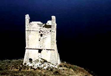
Punta Molinazzo (38°10'N, 13°05'E), located 1 mile N of Terrasini, is low, rocky, and fringed by rocks. A large, isolated, and rectangular tower stands on the SW end of this point.
Between Punta Molinazzo and Punta di Raisi, 1.7 miles NE, the coast is low and rocky. Several rocky shoal areas, with
 |
|
Punta Molinazzo |
Punta Molinazzo depths of 3 to 5.5m, lie up to 0.5 mile offshore along this stretch of shore.
Punta di Raisi (38°11'N, 13°07'E), the E entrance point of Golfo di Castellammare, is low and rocky. An airport, with a control tower, is situated in the vicinity of the point and is conspicuous. It is reported (1994) that an aeronautical light is shown from the control tower. A tall tower, in ruins, stands close E of the point. Several ancient walls and a few houses are situated near this tower, and a shallow inlet indents the coast close E of it. A tower, similar to the above tower, stands near the head of this inlet. Torre Muzza, partly in ruins and reddish, stands on the end of a small and rocky promontory, 2.5 miles E of Punta di Raisi.
Punta del Passagio (38°12'N, 13°14'E) is located 6.4 miles ENE of Punta Raisi. A tower, dark reddish, stands on a hill, 191m high, near the point.
Between Punta di Raisi and Capo Gallo, 10 miles ENE, the coast is mostly steep-to, slightly indented, and backed by high, rugged mountains.
Isola delle Femmine, 35m high, lies on a shoal spit which extends about 1 mile NNW from Punta del Passagio. This small island is surmounted by a prominent square tower.
15.8 Baia di Carini (38°11'N, 13°11'E) is entered between Torre Muzza and Isola delle Femmine, 4 miles ENE. This bay is clear of dangers and is quite deep in its outer part. The shores are level and covered with citrus groves. Several tall and brick-colored chimneys stand among the groves.
Carini is situated 2 miles inland, 3 miles SSE of Torre Muzza. The town stands at the back of a small hill which is joined to the mountains of the interior by a saddle. Capaci, a small town, is situated 0.7 mile inland, 2 miles S of Punta del Passagio. A tower, surrounded by a high wall, stands 0.2 mile inland, 3 miles E of Torre Muzza.
Anchorage can be taken, according to the direction of the wind, either SE of Torre Muzza or in the E part of Baia di Carini. The holding ground of sand is good in both anchorages. The bottom in the middle of the bay is rocky.
A light-colored smokestack, topped by a pole with a weather vane, identifies the village of Isola delle Femmine, which is situated close S of Punta del Passagio. A small shipyard stands on the W side of Punta del Passagio. A small harbor, used only by fishing boats, lies on the E side of the point and is protected by a jetty which is partly in ruins.
Sferracavallo (38°12'N, 13°16'E), a resort town, is situated 2 miles SE of the village of Isola delle Femmine. It is built along the rocky shores of a small cove and is conspicuous. A sandy beach lies at the head of the cove.
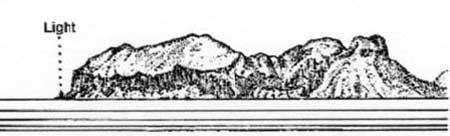
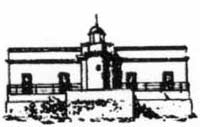
15.9 Capo Gallo (38°13'N, 13°19'E) is the N extremity of a mountainous promontory. From a distance it appears as an island. A light is shown from a tower, 7m high, standing in front of a low building on the cape. A disused signal station stands 0.5 mile SW of the light.
A dangerous wreck lies about 1.8 miles E of Capo Gallo.
 |
|
Capo Gallo bearing SE |
 |
|
Capo Gallo Light |
Between Capo Gallo and Punta di Mondello, 1 mile SSE, the coast is formed by the steep side of a mountain. A small breakwater, partly in ruins, extends 100m ESE from a point located about midway between the cape and Punta di Mondello. An old and cylindrical tower stands on Punta di Mondello.
La Barra (38°17'N, 13°23'E), a sand and coral bank, lies 4.5 miles NNE of Capo Gallo and has a least depth of 65m.
Baia di Mondello is entered between Punta di Mondello and Punta Celesi, 1 mile SSE. A wide beach, backed by a plain, forms the shores of this bay. A tower, partly in ruins, stands in the village of Mondello, which is situated on the NW shore of the bay. A small pier fronts the village. A prominent building, with a roof of many gables, stands at the head of the bay. There is a mole, 100m long, extending N from Punta Celesi and a prominent crane stands on it.
Punta Priola is located 1 mile ESE of Punta Celesi. An old and disused shipyard, with several large symmetrical buildings and four slipways, lies 0.3 mile W of Punta Priola and is now used as a marina. A long jetty, partly in ruins, projects from the coast in the vicinity of this marina.
Caution. – Due to the existence of submarine cables, an anchoring and fishing prohibited area, which may best be seen on the chart, extends seaward from the shore between Punta Priola and Capo Gallo.
15.10 Golfo di Palermo (38°08'N, 13°25'E) lies between Punta Priola and Capo Mongerbino, 8.3 miles SE. The shores of the gulf are backed by rugged mountains with fertile and cultivated valleys.
Monte Pellegrino (38°10'N, 13°21'E), 600m high, rises S of Punta Priola and dominates the coast in this vicinity. The mountain is steep, barren, dark reddish, and surmounted by a disused signal station. A small tower, in ruins, stands on the shore, 1 mile SSE of Punta Priola.
Punta Arenella (38°09'N, 13°23'E) is a rocky point surmounted by a round and orange-colored tower, 18m high. A prominent group of buildings stands behind the tower and a prominent establishment, with a black-colored chimney, is situated close N of it. A pier, with a depth of 5m alongside its head, extends from this establishment and a prominent crane stands on it.
Castello Utveggio, a conspicuous red building, stands 1 mile W of Punta Aranella. A pleasure craft basin, protected by a mole, lies close SSW of Punta Aranella and an extensive yacht harbor lies 0.6 mile S of the point.
Monte Cuccio, 1,050m high, stands 4 miles W of Palermo and is surmounted by a small church. A large fortress is situated, at an elevation of 762m, on a flat mountain ridge, 2 miles S of Monte Cuccio.
Porto di Palermo (38°08'N, 13°22'E)
World Port Index No. 40130
15.11 Porto di Palermo lies in the SW corner of Golfo di Palermo, 1 mile S of Punta Aranella. The main commercial harbor is protected by breakwaters and Porto Industriale, with repair facilities, a shipyard, and drydocks, lies immediately to the N.
Port of Palermo Home Page http://www.autoport.pa.it
Winds – Weather. – During the winter between October and March, winds from the SW and NW are dominant in the gulf. However, storms from the NE sometimes occur in these months. Squalls from the SE occur occasionally during the spring months. Fog is not prevalent but does occur sometimes during the spring.
Tides – Currents. – The tides are negligible, being only 0.3m at springs. The mean sea level in this gulf may fall as much as 0.5m below normal during February, March, and April.
The currents in the gulf are weak and are influenced mostly by the winds. There is very little current within the harbor.
Depths – Limitations. – The outer harbor has depths of 14 to 30m. The main commercial facilities include Puntone Quay, 400m long, with a depth of 14m alongside; Quattroventi Quay, 235m long, with a depth of 8m alongside; St. Lucia Pier, with 230m of total berthing space and depths of 8 to 10m alongside; Marinai Quay 1, 115m long, with a depth of 11m alongside; Marinai Quay 2, 110m long, with a depth of 12m alongside; Piave Pier, with 737m of total berthing space with a depth of 12m alongside; Veneto Pier, with 717m of total berthing space with depths of 8 to 12m alongside; and Sammuzzo Quay, 350m long, with a depth of 8m alongside.
There are facilities for ro-ro, bulk, and container vessels. Generally, vessels up to 250m in length and 13.4m draft can be accommodated.
In addition, there are extensive repair facilities and several drydocks which can handle vessels up to 400,000 dwt.
The port is being developed (1994) in order to be able to handle vessels up to 16.4m draft. There are reports (2002) of container terminal expansion plans.
Aspect. – Palermo can be identified by the prominent mountains surrounding it. Prominent landmarks include the dark dome of the theater standing in the center of the city; the cathedral, with a black dome, situated close S of the theater; the astronomical observatory, standing near the cathedral which consists of a massive, light-colored building topped by a small white dome; and a red tower which stands close W of the theater and rises above the firehouse.
A long, vertical row of conspicuous lights mark an aqueduct which is situated in the hills, in the SE part of the city. It is reported that the loom of the city lights can be seen from a distance of about 8 miles, but at midnight many of these lights are turned off.
It is reported (1990) that the cranes at the shipyard in the N part of the port are conspicuous from seaward.
A light is shown from a structure standing on the elbow of the outer breakwater. A racon is situated at the light.
Pilotage. – Pilotage is compulsory for vessels of 500 grt or over when entering or leaving port and for vessels of more than 1,000 gross tons when operating within 1 mile of the Esso and AGIP terminals. Warships, fishing vessels, tugs, and local traffic are exempt from the pilotage rules.
Pilots can be contacted on VHF channels 11, 12, or 16 and generally board about 1 mile from the harbor entrance. In bad weather the pilot boat leads vessels into the harbor.
Regulations. – No vessel is permitted to enter, leave, or move within the port during the 30 minutes preceding the arrival or departure of the mail steamers. The normal times of this prohibition are 0645, 0830, and 2030 daily, but these times are approximate and others may occur.
A vessel traffic service (VTS) is established in Palermo. Participation in the VTS is mandatory for cargo vessels of more than 300 gross tons, fishing vessels of 24m loa and over, all passenger vessels, and leisure craft of 45m loa and over Participation is optional for other vessels.
The Palermo VTS is bounded by a line joining:
- The Palermo breakwater racon at position 38° 07.7'N, 13° 22.6'E
- 38° 24.7'N, 13° 22.6'E
- 38° 16.3'N, 13° 41.5'E
- 38° 07.6'N, 13° 41.5'E
- Capo Mongerbino (38° 07.5'N, 13° 30.7'E).
A precautionary area extends 5 miles seaward from the VTS area borders.
The VTS (call sign: Palermo VTS) uses VHF channels 11, 14, and 16. Vessels should establish initial contact with the VTS when within the precautionary area.
Vessels transiting the VTS make the following reports:
- Entry report.
Designator Information Required AVessel name, call sign, flag, and IMO number BGross tons CPort of registry and Registration No. DLength overall EYear built FOwner GMaster’s name and surname HNumber of passengers and crew IDate and time of entering VTS JEntry position (Latitude/Longitude) KTrue course LSpeed MLast port of call/date and time of departure NDestination and ETA OMaximum draft PCargo onboard and nature of cargo QDangerous goods onboard - Departure report.
Designator Information Required ADate and time of exit BExit position CTrue course DSpeed
Vessels inbound for Palermo provide the following entry report prior to entering the VTS area:
| Designator | Information Required |
|---|---|
A |
Vessel name, call sign, flag, and IMO number |
B |
Gross tons |
C |
Port of registry and Registration No. |
D |
Length overall |
E |
Year built |
F |
Owner |
G |
Master’s name and surname |
H |
Number of passengers and crew |
I |
Date and time of entering VTS |
J |
Entry position (Latitude/Longitude) |
K |
True course |
L |
Speed |
M |
Last port of call/date and time of departure |
N |
Destination and ETA |
O |
Cargo onboard and nature of cargo |
P |
Dangerous goods onboard |
Q |
Type vessel |
R |
Net tons |
While inbound, additional reports are due, as follows:
- One hour before entering the inbound lane.
- When entering the inbound lane.
- At the pilot boarding location.
- On arrival at the berth stating time and berth position.
- Before anchoring (if necessary), stating reason, ETA at anchorage, position at anchorage, and date and time of anchoring.
Outward bound vessels report, as follows:
- One hour before departure stating ETD, destination and ETA, cargo onboard, dangerous goods onboard, and number of passengers.
- No later than 5 minutes before ETD to receive permission to proceed.
- At the entrance to the outbound lane.
- At the exit of the outbound lane.
- Upon exiting the VTS area stating date and time of departure and position.
Anchorage. – Vessels can anchor, in depths of 46 to 64m, between 0.5 and 1 mile off the harbor entrance. The holding ground is good, but this roadstead is open to N and E winds.
Vessels at anchor vessels must maintain a continuous listening watch on VHF channels 11 and 14, provide their position upon request, and in bad weather conduct a radio check with Palermo VTS every 2 hours.
Caution. –. Two prohibited areas, best seen on the chart, are located along the S side of the Golfo di Palermo. Both enclose outfalls marked by lighted buoys.
15.12 Punta del Corsaro (38°06'N, 13°26'E), a rocky projection, is located 3.2 miles SE of Palermo and is surmounted by a prominent tower with a white vertical stripe on its N side.
AGIP-Esso Oil Terminal (38°06'N, 13°25'E) lies in the vicinity of Punta del Corsaro and is formed by two offshore berths. These berths consist of several mooring buoys, are marked by lighted buoys, and are connected to the shore by submarine pipelines. Vessels moor with their sterns to the buoys. The AGIP Berth, situated 1 mile W of the point, can accommodate vessels up to 25,000 dwt, 185m in length, and 9.7m draft. The Esso Berth, situated close E of the point, can accommodated vessels up to 15m draft with no limitation of length.
Bagheria (38°05'N, 13°30'E) is situated 4 miles ESE of Punta del Corsaro. This town can be easily identified by several conspicuous buildings and tall chimneys. A short tower stands close SE of Bagheria. Aspra, a small village, is situated on the coast close N of Bagheria. It is dominated by a tall and pointed bell tower. Anchorage can be obtained, in depths of 16 to 18m, good holding ground, anywhere between the oil terminal at Punta del Corsaro and the village of Aspra remaining clear of the charted sewer.
Capo Mongerbino (38°07'N, 13°31'E), the E entrance point of the gulf, is the NW extremity of the promontory formed by Monte Montalfano, 376m high, which stands 1.2 miles SE of the cape. It is fronted by two above-water rocks.
 |
|
Capo Zefferano Light |
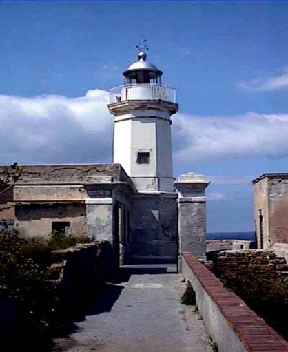
15.13 Capo Zafferano (38°07'N, 13°32'E), located 1.5 miles ESE of Capo Mongerbino, rises to a rocky and conical hill, 223m high. This cape appears as an island when seen from the NW or SE, as the land between it and Monte Catalfano is low. A light is shown from a structure, 11m high, standing on the cape. A small tower, in ruins, is situated near the summit of the cape. An islet, 6m high, lies close N of the N extremity of the cape.
Between Capo Zafferano and Capo Grosso, 5.8 miles SSE, the coast is rocky and indented by two small coves.
Porticello, a prominent village, stands 1.5 miles S of Capo Zafferano and is fronted by a small craft harbor which is protected by two moles.
Secca di Chianca, a rocky area, lies about 1 mile SE of Capo Zafferano and has a depth of 11m. Scoglio Formica, a rock awash, lies on a small shoal about 1 mile E of Porticello.
Caution. – An area prohibited to anchoring and fishing lies centered in position 38°05.3'N, 13°33.6'E and has a radius of 150m. A historic wreck and its related restricted area, with a radius of 250m, is centered in position 38°05.0'N, 13°32.7'E
15.14 Torre Solanto, formed by a prominent castle, stands on an unnamed cape, 1 mile S of Porticello. Porto di Spagna, a small bay, is entered close S of this cape. Anchorage, sheltered from W winds, can be taken, in depths of 12 to 14m, mud and sand, in the middle of the entrance of this bay. Anchorage berths, designated A1, A2, A3, B1, and B2, are located E and SE of the tower and are positioned as follows:
| Berth | Position |
|---|---|
A1 |
38°04'20 "N, 13°33'21"E |
A2 |
38°03'56"N, 13°33'39"E |
A3 |
38°03'38"N, 13°34'03"E |
B1 |
38°02'56"N, 13°34'33"E |
B2 |
38°02'38"N, 13°34'51"E |
Casteldaccia (38°03'N, 13°32'E), a small town, stands 1.5 tower, stands in front of this village, and a conspicuous cememiles SSW of Torre Solanto and is prominent from seaward. A tery is situated 0.6 mile ESE of the tower. The village is fronted large, gray church is situated in this town. Altavilla Milicia, a by a small craft harbor which is protected by moles. village with a prominent church, stands on the brow of a flat-topped hill, 1 mile SE of the town. The hill is covered with
15.15 Termini Imerese (37°59'N, 13°42'E) (World Port olive trees. Torre Colonna, low and square, stands near the Index No. 40120), a small harbor, is protected by a breakwater coast, 2 miles ESE of Altavilla Milicia. and a rubble jetty.
Capo Grosso is surmounted by a square tower and a prominent tourist resort is situated in this vicinity.
Winds – Weather. – The harbor is sheltered from N and W
San Nicolo l’Arena (38°01'N, 13°37'E), a small village, is winds. At times, strong SW squalls descend from the mount-situated 1 mile SE of Capo Grosso. A prominent castle, with a ains, but these do not raise heavy seas in the harbor. The harbor is open to the E and is sometimes unsafe during strong SE and E winds.
Capo Zefferano Harbor
Tides – Currents. – Currents in this vicinity usually set W at varying rates. Strong W winds may cause an E set and strong currents have been reported to set SE along the outer side of the breakwater and then enter the harbor.
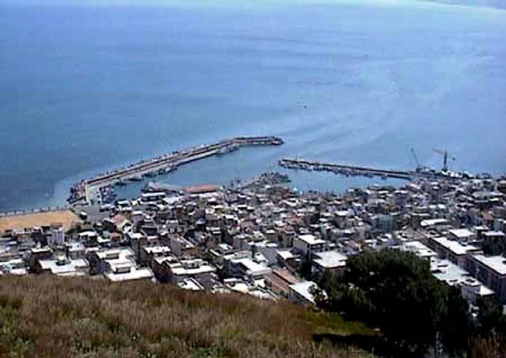
Depths – Limitations. – The harbor is protected on its N side by a breakwater which extends 0.7 mile E from the coast at the N end of the town. It is protected on the S side by Molo Sottoflutto, which extends 0.3 mile ENE from the shore. A depths of 7m lies in the entrance channel, but the harbor is liable to silt up. There is over 800m of total quayage within the harbor and small vessels up to 80m in length and 6m draft can enter.
Aspect. – Termini Imerese is prominent and is built on terraces on the side of a rather steep slope. Monte Santo Calogero stands 3 miles SSE of the town and its slopes are covered with olive groves. Its summit, 1,325m high, appears as two peaks when seen from some directions. A cathedral, with a conspicuous bell tower, is situated near the N end of the town. Another bell tower stands in the NW part of the town near some steep cliffs.
Other prominent landmarks include the large building of the hot baths standing below and E of the cathedral; the red-roofed yellow buildings of the prison standing in the mountains to the S of the town; a low hospital building, with a small bell tower, situated in front of the prison; the two tall chimneys of a sulfur refinery situated at the root of the breakwater; and the low railroad station, with a big shed in front of it, standing on the beach near the SE end of the town.
A circular-shaped conspicuous church, with a red dome-like roof, stands SE of the town. Another conspicuous church, hex-agonal-shaped with a pointed roof, stands farther to the E at a point where the coastal road leads to the mountains. The white supporting wall of this road is also conspicuous from seaward.
Pilotage. – Pilotage is compulsory for vessels berthing at the ENEL pier. There is a local pilot at Termini Imerese and vessels without local knowledge are advised to make use of his services. Vessels of more than 500 grt must employ the berthing assistance offered. The port can be contacted on VHF channel 16. The pilot can be contacted on VHF channel 8.
Vessels must contact the port on VHF channel 16 prior to anchoring. The bottom is formed of soft mud, but the roadstead is fully exposed to E winds.
Anchorage. – Anchorage berths have been designated from NE to NNW of the port, as follows:
| Berth | Position |
|---|---|
A1 |
38°01'06"N, 13°46'12"E |
A2 |
38°00'00"N, 13°44'49"E |
A3 |
38°01'24"N, 13°44'06"E |
A4 |
38°00'54"N, 13°41'24"E |
B2 |
38°01'48"N, 13°40'00"E |
Caution. – Anchoring prohibited areas, which may best be seen on the chart, extend up to about 2 miles N from the coast in the vicinity of Termini Imerese.
15.16 Fiume Torto (37°58'N, 13°46'E) enters the sea 3.1 miles E of Termini Imerese. The shore between is fronted by a sandy beach. The mouth of the river can be easily recognized by a bridge and two large buildings.
Pontile ENEL oil pier extends 1 mile N from a point on the shore, 0.8 mile W of the river mouth. Three conspicuous chimneys, 70m high, stand near the root of this pier. Three high buildings and two large tanks are situated in this vicinity and are also conspicuous.
Between Torre Battilamano and Capo Plaia, 7.5 miles ENE, the coast is low and sandy. Torre Roccella, a high structure with ruins in front of it, is situated 3.5 miles SW of Capo Plaia. The village of Campofelice stands on a flat and green spur of the mountains, close S of the tower.
Torre Battilamano (37°59'N, 13°49'E), a low tower which is attached to the W side of a building, stands on the beach, 2 miles E of Fiume Torto. The mouth of Fiume Grande, which is spanned by a prominent masonry bridge, lies close E of this tower.
Capo Plaia is low, flat, and covered with olive trees. A small village, standing in a valley just SW of the cape, is very prominent. A prominent hotel and another white building are situated near the village.
A tower, in ruins, stands on a rocky knoll that juts out from the coast, 2.5 miles E of Capo Plaia. A small church, with a red roof, stands isolated on the shore, close E of the cape.
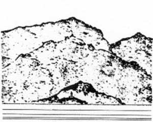
15.17 Capo Cefalu (38°02'N, 14°02'E) is the low and rocky extremity of a slight projection which rises to a prominent hill, 269m high. This hill is conical in shape and is surmounted by the ruins of a castle. A wide and low saddle separates this hill from the mountains close inland. A light is shown from a structure, 26m high, standing on the cape.
Cefalu, a small town, stands on the W side of the prominent and conical hill. A cathedral, flanked by two bell towers ending in pyramidal tops, dominates the town. A small craft harbor lies on the E side of the cape and has a pier which is used as a hydrofoil terminal.
A submarine pipeline, 0.8 mile in length, extends NE from the end of Capo Cefalu. It is marked at its extremity by a lighted buoy.
Between Capo Cefalu and Punta Finale, 5.5 miles E, the coast is indented by an exposed bay. Heavy squalls blow down from the mountains which back this bay. A tower, partly in ruins, stands on a rocky point, 0.5 mile SE of the cape. A small inlet, which affords shelter to small craft during SW winds, lies between the cape and the tower.
 |
|
Capo Cefalu from N |
Between Punta Finale and Punta Caronia, 13 miles E, the coast is rocky and steep-to. Punta Finale is a small and rocky promontory with reddish sides. Three towers, partly in ruins, stand on this point. Pollina, a prominent mountain village, stands 2.5 miles S of the point. A prominent tower is situated in the W part of this village. The village of Finale, with a partly-ruined tower in front of it, is situated close SE of the point and is conspicuous from seaward.
The opening of a wide valley, in which Fiume di Pollina flows, lies close E of Finale. The mouth of this river is crossed by a bridge with five arches. Three rocks, one of which is high and prominent, lie close to the coast, 3 miles ESE of Punta Finale. A conspicuous tower stands on the shore, close W of these rocks.
Castel di Tusa (38°00'N, 14°15'E), a village fronted by the ruins of a castle, stands on a rocky projection, 5 miles E of Punta Finale. Tusa, a small town, is situated 1.8 miles S of the village. A bell tower, with a pointed top, stands in the middle of the town.
Fiume di Tusa, the mouth of which is spanned by a many-arched bridge, flows into the sea, 1 mile E of Castel di Tusa. A tower, with a group of houses close to it, stands 2.5 miles E of the river mouth. A factory, with a very tall chimney, is situated close E of the tower and a tract of sandy beach lies near it.
Fiume di Santo Stefano (38°01'N, 14°19'E) flows into the sea, 4.5 miles WSW of Punta Caronia. Its mouth is spanned by two prominent bridges. Santo Stefano di Camastra is situated close E of the river mouth and stands on a small hill which is covered with olive trees and vineyards. A conspicuous refinery, with a square chimney, is situated 1 mile E of the town.
15.18 Punta Caronia (38°02'N, 14°25'E) is low, rounded, and backed by a deep valley. The point is covered with white gravel and is intersected by the mouth of Torrente di Caronia. Caronia stands on the slopes of a hill, 302m high, 1 mile SE of the point. A prominent castle stands in this town.
Between Punta Caronia and the mouth of Torrente Furiano, 6.5 miles E, the coast is formed by a stony beach. Rocks, some of which are large, front this stretch of shore. A small tower, attached to the N side of a building, is situated 1.8 miles SW of the river mouth.
A stony beach extends between the mouth of Torrente Furiano and the town of Torrenova, 6 miles ENE, and is backed by a series of narrow valleys through which mountain streams flow. Monte San Fratello, 718m high, rises behind the coastal hills. It appears as a large and cylindrical tower. The town of San Fratello stands at a height of 675m behind the summit of this mountain. A cathedral, with a prominent bell tower, is situated in the middle of the town which is visible from the W, but from some directions is hidden by the mountains.
Aquedolci, a village, stands on the coast, 1.5 miles E of the mouth of Torrente Furiano. A large church, with a bell tower, dominates this village. A conspicuous tower, with a square tower at its E side, stands at the E end of the village.
15.19 Santa Agata di Militella (38°04'N, 14°39'E) is dominated by a conspicuous church with a pointed and reddish bell tower. A long building, with a slender chimney, stands close W of this town and is conspicuous. A cone-shaped rocky peak rises close ESE of Santa Agata di Militella. San Marco d’Alunzio, a village with several bell towers, surmounts a round-topped mountain, 548m high, 3 miles E of the town.
A dangerous wreck lies about 1 mile offshore in the vicinity of Santa Agata di Militella.
Torrenova, a small village, stands at the foot of the mountain on which the village of San Marco d’Alunzio is situated. The railroad station and the bell tower of this village are prominent. Between Torrenova and Capo d’Orlando, 5.5 miles NE, the coast is formed by a sandy beach which is backed by high mountains.
Caution. – Submarine cables extend seaward from the vicinity of Santa Agata di Militella and may best be seen on the chart.
Isole Eolie (Isole Lipari) 15.20 Isole Eolie (Isole Lipari) (38°30'N, 14°55'E) is a group of seven main islands and a number of smaller islets and rocks which lie within 35 miles of the E part of the N coast of Sicilia. All of these islands are of volcanic origin, with Isola Vulcano and Isola Stromboli still active. The islands are high, steep-sided, and rocky. They are also fertile, but a large part of the soil is too rocky to be cultivated.
The islands are steep-to and the dangers in the vicinity are described with each particular island.
Caution. – Extensive fishing operations are carried out in the vicinity of Isole Eolie. Each boat carries a light at night, but often these lights are not shown until the near approach of a vessel. During April, May, and June long-net fishing takes place E of Isola Lipari, Isola Salina, and Isola Vulcano, between 38°22'N and 38°32'N, and within 5 miles of the coasts of these islands. Vessels should avoid this area during the fishing season. From the middle of April to the middle of July, fishing takes place on a large scale in the area to the NE of Isola Stromboli. During this period, vessels should pass not less than 5 miles to the E of the island.
15.21 Isola Alicudi (38°33'N, 14°21'E), the W island of the group, is a rounded cone, and at the summit of Montagnola, attains a height of 625m. The volcano is no longer active and its crater is almost inaccessible. The W side of the island is steep, rugged, and uninhabited. The E side slopes and consists of cultivated plateaus and rounded hills on which stand some houses and a church. A light marks the SE side of the island.
15.22 Isola Filicudi (38°35'N, 14°33'E) has a summit that appears conical in shape from offshore. The W and N sides of the island are steep, rocky, and barren. The S and E sides are less steep and have cultivated areas with scattered farm houses. Monte Fossa Felci, the summit of the island, is 774m high.
The depths around this island are deep, except off the NE side and off a point located on the W coast where rocks and shoals lie very close inshore. Scoglio Galera, a low and black rock, lies close off the middle of the W side of the island. There are no suitable anchorages for large vessels off the island.
Capo Graziano, the SE extremity of the island, is formed by a small peninsula. Its outer end consists of a rounded summit, 174m high, and its inner part is low and cultivated. From seaward, the extremity of this cape appears as a large rock which is separated from the island. A concrete pier, 50m long, is situated near the cape and has a depth of 5m at its head.
Punta Stimpagnato, the SW extremity of the island, is located 2 miles W of Capo Graziano. The coast between is cultivated. This point is formed of steep rocks which are cut in vertical prisms and topped by sharp pinnacles. A village stands close E of the point, on the sides of a deep-walled valley which descends from the summit of the island. A church, with a pointed bell tower, stands in the village and is prominent.
Punta di Perciato, located 0.7 mile W of the summit of the island, has several natural arches on it. The NW and N sides of the island are high and are fronted by above-water rocks, some of which are prominent. Punta del Zucco Grande, the NE point of the island, is high and rocky. Vineyards are situated on the slope above this point.
A group of rocks lies about 0.7 mile off the NW coast of the island. La Canna, the most prominent rock, is 70m high and is shaped like an obelisk. The channel leading between this group of rocks and the island is 0.5 mile wide and clear of dangers. There are no suitable anchorages for large vessels in the vicinity of the island. A light is shown from a 20m tower on the NW coast of the island.
15.23 Isola Santo (Salina) (38°34'N, 14°51'E) is formed by two extinct volcanoes. There is a flat saddle between the peaks of these volcanoes from which two valleys descend towards the coasts. One valley descends towards the N coast and the other descends towards the S coast. The village of Pollara stands in an amphitheater-like crater, NW of the W volcano. A large church dominates this village.
The volcanic activity has ceased, but on the N coast, E of Malfa, the land is heated and emits vapors. Gaseous bubbles rise from the sea close off the S side of the island and 200m off the village of Rinella. These bubbles emit hydrogen sulfide gas, which can be smelled from quite a distance.
Punta Valle la Spina, the W extremity of the island, is steep and rocky. The coast to the N of this point consists of high, vertical, and rocky cliffs.
Punta del Perciato, the NW extremity of the island, is formed by a promontory which has vertical sides. It is pierced by a large arch under which the seas break amidst the rocks. This opening is prominent from the NE or SW. A building, topped by a turret and a signal mast, stands high up on the point. This structure is reported to be painted an orange yellow color.
Between Punta del Perciato and Capo Faro, 3 miles E, the N coast of the island is cultivated.
Malfa (38°35'N, 14°50'E), a village, is situated about midway between the point and the cape. In front of this village, the land descends to the sea in the form of terraces with supporting walls which are prominent. A conspicuous church, with a small bell tower, is situated in this village. A jetty, 80m long, fronts the village and projects seaward from the front of a five-stepped retaining wall. This jetty has a depth 5m at its head and gives shelter to small craft and fishing boats.
Capo Faro (38°35'N, 14°52'E), the NE extremity of the island, is rocky and steep. A light is shown from a tower, 12m high, standing on the cape. A low building, painted yellow, is situated behind the light.
Between Malfa and Capo Faro, the coast is steep, rocky, and fronted by above-water rocks. A large church, with a bell tower and a two-story building attached to its E side, dominates this part of the coast. A smaller church, with a pointed bell tower, is situated nearer to the cape.
Secca del Capo, an isolated shoal, lies about 3.2 miles NE of Capo Faro. This shoal has a depth of 8m and fishing boats are often found in its vicinity.
15.24 Santa Mariana Salina (38°33'N, 14°22'E), the principal village, is situated 1.2 miles S of Capo Faro. This village stands on gently sloping ground along the seashore. A large church, with a huge dome, stands in the village. A smaller church, with two spired bell towers, stands near the shore, close S of the larger church. A small mole, with a depth of 4m alongside, fronts the village and is protected by a breakwater.
Punta Lingua (38°32'N, 14°52'E), the SE extremity of the island, is formed by the end of a low promontory and has a gravel beach. The village of Lingua, with a prominent church, is situated near the point. A light is shown from a structure, 11m high, standing on the point.
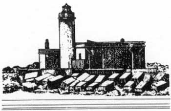 |
|
Punta Lingua Light |
Punta Grottazzo, the S extremity of the island, ends in a vertical wall of rock. Between Punta Grottazzo and Punta Valle La Spina, 3.5 miles NW, there is a wide, cultivated valley which lies between the steep slopes of the two main summits. Rinella, a village, stands near the middle of this stretch of coast and is situated at the seaward end of the valley. This village is fronted by a main quay which is backed by high walls. A mole, quayed on its E side, projects 120m SSE from the W end of the main quay and has depths of 13m at its head and 4.5m at its root.
The village of Leni lies close inland of Rinella. A prominent church, with a bell tower, is situated in this village. A large church, with a bell tower topped by a small dome, is located close W of Rinella.
Isola Santo offers no safe anchorage to large vessels, nor any shelter that can be recommended in bad weather. Vessels, with local knowledge, can anchor, in a depth of 29m, sand and rock, abreast the S church in Santa Mariana Salina and about 180m from the shore.
Caution. – Due to the existence of submarine cables, an anchoring and fishing prohibited area lies off the W side of Isola Santo and may best be seen on the chart.
15.25 Isola Lipari (38°29'N, 14°56'E) is the largest island of the Isole Eolie. Its W side is cliffy, broken by ravines, and is barren. Punta della Crapazza, the S extremity of the island, is formed by a prominent and rocky cliff that is joined to the main part of the island by a low, rocky isthmus. From the E or W, this point appears as a detached rock. The coast on either side of this point is high, cliffy, and steep.
Punta del Perciato, located 0.7 mile WNW of Punta Crapazza, consists of a rocky mass with a hole in it which is conspicuous from the NE and SW. Between Punta del Perciato and Punta di Iacopo (Punta di Jacopo), 0.7 mile NNW, the coast is steep and rugged. Pietra Lunga and Pietra Menalda are two high rocks which lie 0.2 SSE and 0.1 mile WSW, respectively, of Punta del Perciato. Le Formiche, a group of rocks, lies on a detached shoal, close NW of Punta del Perciato. These rocks are mostly low or awash, but one is high and prominent.
Punta delle Grotticelle (38°28'N, 14°55'E) can be identified by several small caves at sea level and by the pink and yellow color of the rocks in its vicinity. Between this point and Punta del Legno Nero, the NW extremity of Isola Lipari, the coast is high, rugged, and steep.
All dangers, except Banco del Bagno, lie within 0.5 mile of the coast. Banco del Bagno, which is small in extent and steep-to, has a least depth of 12.5m and lies about 1.7 miles W of Punta delle Grotticelle.
Pietra del Bagno, which is high on its E and low on its W side, is a prominent rock lying about 0.2 mile offshore, 1.2 miles NW of Punta delle Grotticelle. The narrow channel leading between this rock and the shore is foul.
Scoglio Imerata, a prominent tall rock, lies close to the shore, 0.8 mile SW of Punta del Legno Nero.
Between Punta del Legno Nero and Punta della Castagna, 2 miles E, the coast is slightly indented and steep-to. The village of Acquacalda stands close E of Punta del Legno Nero. A T-head pier, with a conveyor belt and loading chute, is situated close E of this village and local pilots are available.
15.26 Punta della Castagna (38°31'N, 14°58'E) is a rocky projection of a brownish -red color. A reef, with rocks awash, extends up to about 100m from the point. Campo Bianco, a prominent hill, stands close SW of the point and is covered with white pumice stone.
Capo Rosso, located 1 mile S of Punta della Castagna, is a short, steep, and rocky prominence. Because of its reddish color, this cape stands out against the white background of the slopes of Campo Bianco. A building, with a chimney, stands close S of the cape.
Porticello (38°31'N, 14°58'E), a village, is situated close S of Punta della Castagna. It can be easily be identified by the wooden chutes used in the excavation of pumice stone. Three small piers, used by coasters and lighters, and one large pier, with a conveyor belt for loading pumice, front the village. The large pier is 265m long and has a depth of 11m alongside. Vessels up to 20,000 dwt can be handled. Pilotage is compulsory for vessels over 500 tons and local pilots can be embarked at Rada di Lipari.
Monte Rosa (38°29'N, 14°59'E) is surmounted by a prominent iron cross, 15m high. It is the summit of Sciarra di Monte Rosa, a promontory, which extends 1 mile E from the coast. Canneto di Lipari, a small village, stands near a beach, close N of Monte Rosa. A red chimney stands near the village which is fronted by a small pier, in ruins. Anchorage can be obtained by small vessels with local knowledge off Canneto di Lipari. A good berth, in depths of 20 to 29m, sand and weed, lies about 180m offshore. This roadstead, known as Rada di Lipari, is partially protected and is bounded on the N side by the S side of Sciarra di Monte Rosa, and on the S side by Punta San Giuseppe, 2 miles SSE.
Caution. – Due to the existence of submarine cables, an anchorage and fishing prohibited area, which may best be seen on the chart, lies off the E coast of Isola Lipari, N of Sciarra di Monte Rosa.
15.27 Lipari (38°29'N, 14°58'E) (World Port Index No. 40300), a village, stands along the W shore of the roadstead. The walls of an ancient castle stand in the middle of the front part of the village on a high and steep volcanic projection. These walls, which are partly in ruins, encompass the cathedral, several churches, and a number of houses. City Hall, a large, rectangular building is situated close N of the castle. The coast to the S of the castle consists of a beach and then rises steeply to form the promontory which terminates in Punta San Giuseppe.
A prominent church, flanked on its S side by a bell tower with a flat roof, is situated in the N part of the village. A small islet is connected to the shore by a short and quayed breakwater. A church, with a pointed bell tower, stands on this islet. A prominent building stands on Punta Scaliddi, at the N end of the village.
A quay, 46m long, is situated close W of Punta Scaliddi and is used by ferries. It has depths of 0.6 to 7m alongside. A short mole, with a depth of 5m at its head, is situated close N of the quay.
A disused light structure, consisting of a turret surmounting a red house, stands about 300m WNW of the head of a mole extending from the N side of the roadstead. It is reported that a yacht harbor is under construction in this vicinity. Pilotage is compulsory for vessels of more than 500 grt. The pilots monitor VHF channels 11 and 16. Anchorage can be taken, in depths of 29 to 40m, sand, about 200m off the middle of the S slope of Sciarra di Monte Rosa. Vessels can also anchor, in depths of 20 to 26m, sand, off the prominent church standing 0.3 mile NNE of Punta Scaliddi and about 200m offshore.
15.28 Isola Vulcano (38°23'N, 14°58'E) is barren and rugged, especially on its W side. The slopes of the S part of the island are partly cultivated. Gran Cratere (Fossa di Vulcano) dominates the N part of the island and is still active. It is of characteristic volcanic shape, but is of unusual color, especially near its summit, which is 382m high. Monte Vulcanello, inactive, forms the N end of the island. A low, sandy isthmus separates this crater from the N slopes of Gran Cratere. The crater is cone-shaped and appears as an island when seen from the W or E. Isola Vulcano is mostly steep-to.
Punta dei Porci (38°22'N, 15°00'E), the S extremity of the island, is high, steep, and fringed by rocks. A light is shown from a prominent structure, 31m high, standing on the point. This light is obscured from some directions.
Capo Secco is located 2 miles NW of the light and can be identified by a large, reddish, and perpendicular rock which fronts it.
Testa Grossa is a long and rocky promontory, with vertical reddish sides, which forms the W extremity of the island. It is located 1 mile NW of Capo Secco. This entire part of the coast is steep, rugged, barren, and fringed with rocks.
Punta del Monaco and Capo Grosso are located 0.5 mile N and 1 mile N, respectively, of Testa Grossa. To the N of Testa Grossa, the coast is high, rocky, perpendicular, and very jagged. Cala di Mastro Minico, a small cove, lies between Punta del Monaco and Capo Grosso. A low light-colored rock lies in the middle of this cove. Capo Grosso is a slender, rocky promontory with a jagged profile. Punta Cala Formaggio, a similar promontory, is located close NE of the cape.
Porto di Levante (38°25'N, 14°58'E), a small cove, has a mole, quayed on its S side, which extends 85m E from the shore. It has depths of 13m at the head and 4m at the root. This mole is suitable for small craft, but the head is reserved for use by the local ferry service. A short pier extends NE from close S of the root of the ferry mole and a quay fronts the foreshore between them. This short pier is used as a hydrofoil terminal and vessels with drafts up to 3.5m can berth alongside.
Faraglione della Fabrica, two prominent and various colored rocks, stand on the shore at the head of this cove. Several houses, one of which is battlemented and has a prominent red roof, stand near the head of the cove. The sea water close to the shore in the S part of the cove is warm and sulfurous because of volcanic action. This cove affords anchorage, in a depth of 29m, sand, about 100m from the shore. Local knowledge is required. Vessels should not anchor off the S shore of the cove, as the bottom is rocky.
15.29 Cala Rossa (38°25'N, 14°59'E), a small cove with rocky shores, is entered between Punta Nere and Punta Luccia, 0.5 mile ESE. Punta Nere is a small, black, and rocky prominence which forms the S entrance point of Porto di Levante. The coast to the S of Punta Luccia is steep, barren, and reddish. A short beach of dark sand lies between Punta Molo di Femmina, located 1.8 miles SSE of Punta Luccia, and Punta Bandiera, 0.5 mile SSE. Punta Bandiera, the SE extremity of the island, is formed by a spur projecting from Monte Aria. A small shrine stands on the point and a prom-inent white house is situated on a slope above it. The S slope of Monte Aria is verdant and partly cultivated.
Insenatura di Cannitello, a very small inlet, lies between Punta Bandiera and Punta Cannitello, 0.2 mile SW. It has a short beach of dark sand at the head and the hillsides above the beach are cultivated.
Caution. – Due to the existence of submarine cables, an anchoring and fishing prohibited area, which may best be seen on the chart, extends seaward from the N end of Isola Vulcano.
15.30 Isola Panaria (38°38'N, 15°04'E) is divided along its main axis by a high ridge. Picco del Corvo, 465m high, is the summit of this ridge and is surmounted by a small iron cross. The W slope of this ridge is rocky, barren, steep, and cliffy. The E slope is less steep, verdant, and partly cultivated. On the spur that descends S from the summit, Picco Tribunale stands halfway down and consists of a spire-shaped mass of rock. A smaller rocky spire rises a little farther down the spur.
Capo Milazzese (38°37'N, 15°04'E) is a low and narrow projection. Cala di Iunco, a small inlet, is entered close E of this cape and is encumbered with rocks. The cape terminates in a steep projection which is fringed by several small rocks.
The W and N sides of the island are rocky, barren, steep, and fronted by rocks. Scoglio la Nave, a high and prominent rock, lies close W of the N extremity of the island.
Punta Briglia, the NE extremity of the island, has a rocky overhanging cliff of reddish color and is fringed by rocks.
15.31 Punta Peppemaria (38°38'N, 15°05'E), the E extremity of the island, is located 0.5 mile SSE of Punta Brigia and is topped by a small tabernacle. A light is shown from a structure surrounded by a wall, 9m high, standing on the point.
A pebble beach lies on the N side of the point and a short mole, with a depth of 5m at the head, extends E from it and is used by fishing vessels and ferries. A mooring buoy situated close off this mole is used by hydrofoils. A local pilot is available to aid with berthing.
Santo Pietro, a small village, is situated close W of the point and has two prominent churches with bell towers.
Large vessels can anchor, in depths of 22 to 24m, sand, about 500m NE of Punta Peppemaria. Small vessels can anchor, in depths of 8 to 9m to the N of the point and about 150m offshore. Anchorage can also be taken, in depths of 15 to 26m, good holding ground, sand and weed, about 500m SE of the point.
Between Punta Peppemaria and Punta di Drauto, 0.5 mile SSW, the coast is steep and rocky. Le Formiche, a steep-to group of rocks almost awash, lies 0.5 mile SSE of Punta Peppemaria. An isolated shoal depth of 5.9m lies about 180m W of Le Formiche.
Caution. – Due to the existence of submarine cables, an anchoring and fishing prohibited area, which may best be seen on the chart, extends from the S and SE sides of Isola Panaria.
An obstruction, with a least depth of 17.9m, lies 1 mile NE of Punta Briglia.
15.32 Dattilo (38°38'N, 15°06'E), a small islet, is 103m high, reddish, and pyramidal. Panarelli, a group of low rocks, lies within 0.3 mile N of this islet. These rocks are formed of very hard, pungent, and vitreous lava.
Isola Lisca Nera, low and black; Bottaro; and Isola Lisca Bianca are three small volcanic islets which lie close E of Panarelli. The latter two are white in color with incrustations of aluminum sulfate. Occasionally, emissions of hydrogen sulfide gas occur and large bubbles rise to the surface of the sea in this vicinity.
Isola Basiluzzo (38°40'N, 15°07'E) has coasts that are high, cliffy, and jagged. The summit of this islet is 165m high, flat, and has a gentle slope to the S. Scoglio Spinazzola, a high and steep-sided rock, lies close off the W extremity of this islet.
15.33 Isola Stromboli (38°47'N, 15°13'E) consists of a single volcanic cone. The volcano is still active, the red reflection of the crater being almost always visible at night. The stream of lava, stones, and cinders, which descend steeply to the sea on its NW side, is in marked contrast to the green slopes on the NE side of the island. The coasts of the island are mostly rocky, rugged, and cliffy. There are short tracts of dark beach on the NE side of the island.
Punta del Monaco (38°46'N, 15°13'E), the S extremity of the island, is rounded and steep. Punta delle Chiappe, located 2 miles NW of Punta del Monaco, is a round point. Its rocky sides descend steeply to the sea and are fringed with rocks. Ginostra, a small village, is situated between these points and can be easily identified by its white houses and church. A prominent, winding stairway leads from the village to the rocky coast.
The NW side of the island between Punta delle Chiappe and Punta Labronzo, 1.5 miles NW, is occupied by Sciara del Fuoco, a blackish wall, which descends from the new crater to the sea. Dense white vapors are often seen along this wall. Punta Labronzo is fringed by rocks, some of which are above water. A solitary white cottage stands on this point.
Punta della Lena (38°48'N, 15°15'E), the NE extremity of the island, is located 1.5 miles ESE of Punta Labronzo. A building, with a tall and red chimney, stands near the point. A sandy beach, fronted by a small jetty, lies close W of the point. Insenatura di Ficogrande, a small and sandy bight, lies close W of the beach.
Scari, San Vincenzo, Piscita, and San Bartolomeo are small villages which extend, almost without a break, from close S of Punta della Lena to close W of Insenatura di Ficogrande. The church at San Vicenzo is white and has a large dome. The church at San Bartolomeo has a prominent bell tower.
The E side of the island between Punta della Lena and Punta del Monaco, 2.3 miles SW, is steep and barren with some reddish crags. Punta dell’Olmo, located 0.8 mile NE of Punta del Monaco, is formed by a spur that descends from the summit of the old crater. A large, truncated, and cone-shaped pillar stands on this spur. A low rock, which is joined to the shore by a short isthmus, lies close off Punta dell’Olmo and is surrounded by other rocks.
There are no safe anchorages in the vicinity of Isola Stromboli due to the great depths surrounding it.
Caution. – Due to the existence of submarine cables, an anchoring and fishing prohibited area, which may best be seen on the chart, extends NE and SE of Punta della Lena.
15.34 Strombolicchio (38°49'N, 15°15'E), 50m high, lies 1 mile NNE of Punta della Lena and is a large rock with steep sides and irregular spires. Its E side is light-colored and has some reddish crags. A prominent flight of steps has been cut in the rock on its NW side. A light is shown from a tower, 8m high, standing on the summit of the rock.
Extensive fishing operations are carried out in the vicinity of Isola Stromboli.
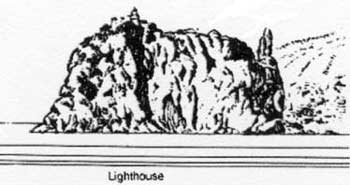 |
|
Strombolicchio from NNE |
Sicilia – North Coast (Continued)
15.35 Capo d’Orlando (38°10'N, 14°45'E) is a rocky promontory, 100m high. It appears conical in shape when viewed from the NW. A church, surrounded by an old wall, stands on the summit of the cape. A light is shown from a structure, 10m high, standing on the cape.
A signal station, consisting of a low building surrounded by a wall, stands on a hill almost the same height as the cape, which rises close S of the cape. This hill is separated from the cape by a saddle.
Reefs extend up to about 0.5 mile seaward of the cape and sudden squalls and heavy seas are encountered off it. Explosive devices are also present on the sea floor in the vicinity of the reefs.
Between Capo d’Orlando and Capo Calava, 8 miles ENE, the coast is steep, rugged, and slightly indented. Scoglio di Brolo, 14m high, is a prominent rock which lies 0.3 mile offshore, 3.7 miles E of Capo d’Orlando.
Brolo (38°09'N, 14°50'E), a village, stands on a rocky hill, 45m high. A tall, square, and battlemented tower, partly in ruins, stands in this village. Heavy squalls from the mountains are sometimes experienced off this village.
Capo Piraino, located 1.5 miles E of Scoglio di Brolo, is high, steep, and surrounded by a narrow beach. Several rocks, awash, lie close offshore in this vicinity. A large tower, partly covered by a red roof, stands on a rocky projection at the foot of this cape. The prominent village of Piraino stands on the steep side of a mountain, 0.5 mile S of Capo Piraino. A prominent tower is situated close W of the village and a prominent church, with a low bell tower, stands 0.2 mile SW of it.
Gioiosa Marea stands on a slight slope, 2 miles E of Capo Piraino. This prominent town is situated at the end of a narrow valley and has three conspicuous steeples.
15.36 Golfo di Patti (38°10'N, 15°05'E) is a large and open bay which is entered between Capo Calava and Capo di Milazzo, 15.5 miles ENE. Its shores are mostly steep-to.
Capo Calava (38°11'N, 14°55'E), high and rugged, is steep on its N and E sides. Several rocks lie close off the E side of the cape and a sandy beach fronts the W side.
San Giorgio, a village, is situated 1.7 miles SE of the cape and stands near the mouth of a small stream. A large red building and a church are situated in this village and are prominent.
The town of Patti stands in a green valley at the head of the gulf. A large church, with a prominent bell tower, stands in the town. The village of Marina di Patti stands on the shore of the gulf, close N of Patti. A red building, with a tall chimney, stands near the W end of this village. A large battlement building is situated close E of the red building.
Capo Tindari (38°09'N, 15°03'E) is 279m high and steep with vertical cliffs on its E side. A red church, with two pointed bell towers, stands on the summit of this cape. It is prominent from the E, but cannot be seen from W.
Secca di Tindari, a shifting sandbank, fringes the cape. Pietra di Patti, a brown rock, is 14m high and lies 2.7 miles W of the cape. A low rock lies close E of this brown rock.
Falcone, a village, stands near the beach, 1 mile ESE of Oliveri. A factory, with a tall chimney, and a red-roofed church, with a pointed bell tower, stand in the village and are prominent. Porto Rosa, a small harbor, lies 1.7 miles E of Falcone and is protected by inner and outer breakwaters.
Oliveri, a small village, is situated 2 miles SSE of Capo Tindari and is partially hidden by a railroad embankment. Its red-roofed houses are prominent and a castle, partly hidden by trees, stands on a mound at the SW end of the village. A fish factory, with two tall chimneys, is situated on the beach in front of the village.
Barcellona, a village, is situated 1 mile inland, 7 miles E of Falcone. It stands among some citrus groves and can be easily identified by the large church with has a prominent dome and a peaked bell tower. Small vessels can anchor about 0.2 mile off the coast near this village.
Caution. – Due to the existence of submarine cables, an anchoring and fishing prohibited area, which may best be seen on the chart, extends up to 3 miles ESE of Capo Calava.
15.37 Capo Milazzo (38°16'N, 15°14'E) is the rocky N extremity of a low and narrow peninsula. This peninsula is fronted by rocks and shoals and is covered with olive trees. It appears as an island when seen from the W or E. Monte Trinita, 135m high and surmounted by a church and a tower, stands on the W side of the peninsula, 1 mile S of its extremity. The N part of the E side of the peninsula is high and steep. A light is shown from a prominent structure, 10m high, standing on the cape.
A red building, surmounted by a turret, and a flagstaff are situated close E of the light. The coast between Capo Milazzo and Capo Peloro, 20 miles E, is low, sandy, and cultivated.
Caution. – Winds and stormy weather from the SE, which last from 3 to 6 days, often prevail in the vicinity of Capo Milazzo.
Due to the existence of submarine cables, an anchoring and fishing prohibited area, which may best be seen on the chart, extends seaward from E of the Capo Milazzo peninsula.
World Port Index No. 40110
15.38 The port of Milazzo lies at the base of the Capo Milazzo peninsula. It has a basin, protected by two moles, and facilities for tankers and LPG vessels.
Port of Milazzo Home Page http://www.porto.messina.i
Winds – Weather. – In summer, strong SE winds sometimes interfere with vessels moored at the port. Winds from the NE, usually of a short duration, sometimes endanger vessels in the anchorage.
Depths – Limitations. – The main cargo facilities include Molo Ludovico, 340m long, with a depth of 6.7m alongside, and Pontile Eolie, 65m long, with a depth of 7m alongside. Both of these quays handle general cargo.
There are three offshore tanker and LPG jetties situated close ESE of the harbor basin. These have a total of ten berths, with alongside depths of 6.1 to 25.3m, and can accommodate tankers up to 350,000 dwt.
Aspect. – Milazzo is divided into an old and a new city. The old city stands on the slope which descends from a prominent citadel. A disused church, with a conspicuous dome, stands within the walls of the citadel. A large two-story building, with a wide terrace, stands near the citadel and is prominent.
The new city is built on flat ground on the low isthmus that joins the peninsula of Capo Milazzo to the main part of Sicilia. A church, with a prominent silver dome, stands in the center of the new city. A bell tower, with a red pointed roof, stands alongside this church. A red chimney, 50m high and enclosed in an iron framework, stands 0.5 mile S of the head of the N mole. A large brick building stands near the root of the N mole.
Croce di Mare, a group of rocks up to 1.3m high, lie close to the coast, 1 mile N of the N mole. A small chapel stands on one of these rocks.
Pilotage. – Pilotage is compulsory for vessels over 500 grt. Pilots can be contacted on VHF channel 12 or 16 and generally board about 1.5 miles off the harbor. Vessels should send an ETA at least 24 hours in advance of arrival.
Regulations. – All vessels entering or leaving the port must proceed with caution and are prohibited from exceeding 5 knots, crossing the harbor entrance in any direction simultaneously with other vessels, or from using ships whistle or siren except in cases to prevent collisions.
Vessels must have visibility of the port basin or outer harbor so as not to impede vessels entering or departing the harbor. Departing ships have precedence over arriving vessels but are prohibited from getting underway when other vessels are inbound.
Within a 0.5 mile radius of the harbor entrance, rowboats, sailboats, mechanically-powered fishing boats or pleasure craft must keep clear of other vessels entering or departing the harbor.
Fishing of any kind, including recreational fishing, is prohibited within a 0.5 mile radius of the harbor entrance.
A Maritime Monitoring Service is established in Milazzo. The service provides information about port regulations and activities, local weather conditions, loading information from local agents, and changing regulations. The service (call sign: Milazzo Ships Information Service) can be contacted on VHF channel 10 or 16.
Anchorage. – Anchorage can be taken, in a depth of 29m, mud, about 300m E of the head of the N mole. However, this anchorage is exposed to NE and E winds. Small vessels can anchor within the harbor.
Vessels over1000 grt are required to contact the pilot station and anchor in one of the designated offshore berths.
Anchorage is prohibited within 0.75 mile ESE of the harbor entrance.
Caution. – A submarine cable, not charted, lies between the head of the N mole and Croce di Mare, described above.
The quayed sections of the moles and the berths on the W side of the harbor have underwater projections that extend up to 18m from them in places.
A navigation, stopping and fishing prohibited area lies in the vicinity of the offshore oil jetties and may best be seen on the chart.
15.39 Spadafora (38°13'N, 15°23'E), a town, is situated 6 miles E of Milazzo and can easily be identified by two tall chimneys. A high building, with a red roof and surrounded by a wall, stands on the beach, close W of the town.
Rometta, a village, is situated 1.8 miles ENE of Spadafora and can easily be identified by its factories and by the reddish crags of the hills in the background. A church, with a red roof and a small pointed bell tower, stands in the village. A large building, with two tall chimneys, also stands in this vicinity. A long and low reddish-colored building is situated in the W part of the village.
Fiumara Saponara flows into the sea, close E of Rometta. A prominent bridge, with many arches, spans this river, close within its mouth.
Gesso, a town, stands on a hill, 265m high. It is situated 1.5 miles inland, 2 miles E of the mouth of the river. A large church, with a bell tower, dominates this town.
Between Gesso and Capo Rasocolmo, 4.2 miles NE, the coast is steep and precipitous.
Capo Rasocolmo (38°18'N, 15°32'E) is the termination of a cultivated tableland which descends in a steep and rocky slope. A sandy beach stretches along the foot of the cape. A light is shown from a dwelling, 13m high, standing on the cape.
A church, with a spired belfry, stands close SE of the light. Between Capo Rasocolmo and Capo Peloro, 6.5 miles ESE, the coast is fronted by a sandy beach and backed by hills.
15.40 Capo Peloro (38°16'N, 15°39'E), the NE extremity of Sicilia, is low and sandy. A prominent fortress, topped by a turret and a signal mast, stands on the E side of the cape. Torre Faro, a village, stands on the S side of the cape and can be identified by its prominent church with a pointed bell tower. A light and an auxiliary light are shown from a conspicuous structure, 37m high, standing on the cape. A racon is situated at the light.
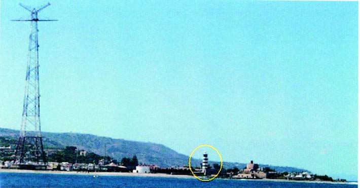
Capo Peloro Light
Secca Rasocolmo, an extensive shoal, fronts the shore between Capo Rasocolmo and Capo Peloro. It has depths of less than 11m and extends up to 1.3 miles offshore in places. When the sea is calm, numerous fishing boats, with drift nets, may be seen near this shoal.
A disused light tower, 39m high, stands on Punta Mazzone, which is located 0.5 mile WNW of the E end of the cape. The E end of Capo Peloro is low, but the hills that back the N coast of the island commence 1 mile W of it.
The cape is subject to erosion and shoal ground extends up to about 0.2 mile NE and 0.3 mile E of it. Vessels should pass at least 0.5 mile off when entering the Stretto di Messina.
Caution. – Several submarine gas pipelines, which extend across the N end of the Stretto di Messina, are landed on the coast, about 2 miles W of Capo Peloro. These pipelines may best be seen on the chart.
An anchoring and fishing prohibited area, the limits of which are shown on the chart, lies in the vicinity of these pipelines and extends across the strait.
Stretto di Messina – Sicilia – East Coast
15.41 Stretto di Messina (38°12'N, 15°36'E) connects the Tyrrhenian Sea to the N with the Ionian Sea to the S. Its W side is formed by the N part of the E coast of Sicilia. The Italian government has announced plans to construct a suspension bridge across the straits. This project could take three to five years to complete.
Caution. – In winter, N and NE winds prevail in the strait and are especially violent when the mountains in S part of Italy are snow-covered. Gales from the S and SE often occur and clash with the above winds, producing heavy and confused seas. In March, strong W or WSW winds prevail and these usually begin in the form of very violent squalls. During June, E and SW winds sometimes clash in the strait and violent squalls occur when either predominate.
Violent squalls, which come down from the valleys of the mountains on either side of the strait, occur frequently.
Strong currents, eddies, and whirlpools are found throughout the Stretto di Messena.
Fishing by nets is carried out to a considerable extent along the shores on either side of the strait.
Numerous ferries cross the strait and it is not unusual to see five such vessels crossing simultaneously at speeds up to 22 knots.
For information concerning pilotage and regulations in Stretto di Messina, see paragraph 13.74.
15.42 Capo Peloro (38°16'N, 15°39'E), the NW entrance point of Stretto di Messina, has been previously described in paragraph 15.40.
Torre Faro, a village, stands on the S side of the cape, close W of Punta Sottile. This village can easily be identified by its prominent church with a pointed bell tower. Between this village and Messina, the coast is formed by a steep-to sandy beach. Ganzirri is situated 1.5 miles WSW of Torre Faro. A church, with a red roof and a bell tower, stands on the W side of this prominent village.
Pace (38°14'N, 15°35'E), a village, is situated 4 miles SW of Capo Peloro. It is marked by a prominent cylindrical building which has a colonnade at the base and a green hemispherical dome. Fiumara dell Annunziata, a small stream, enters the sea 1.5 miles SSW of this village. A prominent convent stands on the S side of the mouth of the stream.
Small vessels can anchor, in a depth of 11m, sand, off the village of Ganzirri. This anchorage is exposed to strong SE and SSE winds which raise a heavy sea. Small vessels can also anchor, in depths of 20 to 29m, sand, NE of the building with the green dome in Pace. Care must be taken to avoid two groups of rocks, with depths of 4m, which lie close offshore in this vicinity. These anchorages are open roadsteads and cannot be considered as safe during periods of inclement weather.
15.43 Ancoraggio di Paradiso (38°13'N, 15°34'E), a roadstead, lies 1 mile S of Pace and 1.6 miles N of the entrance of the port of Messina. Vessels can anchor, in depths of 50 to 70m, good holding ground, as charted offshore. Anchor berths are designated in this area. The charted berth SW is designated Bravo. The two berths to the NE of the anchorage and fishing prohibited area offshore are designated Berth Delta and Berth Echo, from closest to the area to the NE. Berth Charlie is not available due to the presence of a wreck. The outer part of this anchorage is exposed to the full force of the tidal currents.
World Port Index No. 40100
Messina
15.44 The port of Messina lies between the E coast of Sicilia and an encircling peninsula which curves NE, N, and W. It connects Sicilia to the Italian mainland and is used by several ferries.
Port of Messina Home Page http://www.porto.messina.it
Winds – Weather. – The harbor is open to the N, and strong N and NE winds cause a swell to occur within it. The harbor is protected from winds from other directions.
Tides – Currents. – The tidal current setting N at springs raises a heavy sea off the E side of the encircling peninsula. At such times, vessels approaching the harbor from the S should give the E side of the peninsula a wide berth.
Depth – Limitations. – There is deep water in the harbor and 550m of total berthing space, with depths of 7.6 to 9.2m alongside. Large passenger vessels up to 300m in length and 10m draft can enter the harbor. Tankers up to 100m in length and 8.2m draft can be accommodated alongside. There are extensive repair facilities, with a drydock, 263m long and 38m wide.
A berth, consisting of eight dolphins and joined to the shore, is situated 0.2 mile SW of Punta San Raineri.
Aspect. – An octagonal column, topped by a large statue and illuminated at night by green floodlights, stands on Forte San Salvatore at the W end of the encircling peninsula. The Meteorological Observatory, consisting of a building with a turret and a high reddish iron trellis, is situated 0.5 mile WNW of the above column. The Mausoleum of the War Dead, which has a very prominent dome, stands 0.5 mile W of the same column; a conspicuous cross, 122m high, surmounts the dome.
Other prominent objects in the town include the tower and spire of the cathedral standing 0.5 mile SSW of the column and a chimney standing 0.5 mile S of the column.
Forte Castellaccio, situated 1 mile W of Forte San Salvatore, is prominent from seaward.
A light is shown from a prominent tower, 42m high, standing on Punta San Raineri, the E extremity of the encircling peninsula. Several oil tanks are situated near the light.
Pilotage. – Pilotage is compulsory for all vessels of more than 15,000 gross tons and for vessels of more than 6,000 gross tons carrying pollutants. Pilots generally board about 1.5miles N of Punta San Raineri and are available 24 hours.
Technical difficulties require vessels to contact the pilots at the following e-mail address until further notice: pilotime@tin.it
Pilots are also available for the passage through the Stretto di Messina. Vessels must request pilot services at least 24 hours prior to arrival.
Vessels exempt from compulsory pilotage include vessels less than 500 gross tons, naval or military craft, and ferry boat lines operating at usual terminals.
During special traffic situations or marine weather, if necessary, the marine authority can demand a pilot be on board.
Regulations. – The simultaneous passage or the crossing of two or more vessels across the entrance of the port is forbidden.
All vessels entering or leaving port must not exceed a speed of 7 knots.
Priority for entry is established by vessel arrival at a point 0.5 mile from the entrance. Vessels must keep one another advised of intentions on VHF channel 16.
Naval vessels have precedence over all merchant vessels both in entering and leaving the port.
Merchant vessels leaving the port have precedence over those entering. Ferries have precedence over all other merchant vessels.
National Railway ships transporting trains have the right-ofway over other ships should they arrive at the harbor at the same time.
A continuous listening watch on VHF channel 16 is required for all ships in harbor.
Caution. – An area within the harbor is used as a seaplane landing area.
An area in the NE part of the harbor is restricted to only naval vessels.
Anchoring, fishing, and underwater activities are prohibited in the approaches to and within the port.
An area N of the port near the village of Porticatello contains an anchoring and fishing prohibited area best seen on the chart.
15.45 Capo Scaletta (38°03'N, 15°29'E) is located 9 miles SSW of Punta San Raineri. The coast between consists of a narrow sandy beach backed by a mountain range. Monte Antennamare, 1,124m high, stands 5.5 miles WSW of Punta San Raineri and is prominent. It has a flat summit, but from certain directions it appears conical.
Fuimara di San Filippo, a stream with a wide white bed, enters the sea, 3 miles SW of Punta San Raineri. A church, with a bell tower, stands on the SW side of the mouth of this stream.
Galati Marina, a village, is situated 2.9 miles SSW of the mouth of Fuimara di San Filippo. It can be easily identified by a church with a red roof and a low bell tower. Fiumara di San Stefano flows in to the sea, 0.5 mile S of this village. Its mouth is crossed by a prominent bridge with three spans.
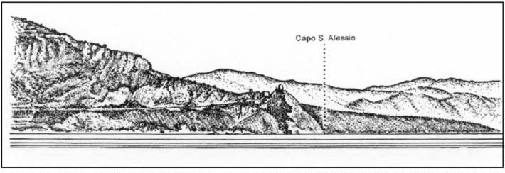
Capo Santo Alessio bearing NW
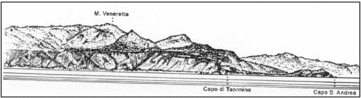
Capo di Taormina bearing NW
A large and conspicuous two-story building stands on a hill, 1.5 miles S of the mouth of the river.
San Paolo, a village, is situated 0.5 mile S of the large building and stands on the S side of the mouth of Fiumara di Pezzolo. A prominent building, with two turrets, stands on a hill in the back of this village. A small church, with a bell tower, is situated in the village.
Capo Scaletta can be identified by the village of Scaletta Superiore, which stands at a rather high elevation on its SW side. A large tower is situated in this village. Monte Scuderi, 1,253m high, stands 3.5 miles WNW of the cape and is prominent. The summit appears rounded from the N or S, but from the E it appears to have a trapezoidal shape.
Between Capo Scaletta, the SW entrance point of Stretto di Messina, and Capo di Ali, 3 miles SW, the coast is rocky, steep-to, and clear of dangers.
15.46 Capo di Ali (38°01'N, 15°26'E) is a conspicuous headland of light color and its sides are cut by crevices. The cape is fronted by rocks and backed by mountains. The coastal highway passes near the cape and is conspicuous from seaward. Monte Belvedere, 743m high, stands 3 miles WSW of the cape. The dark ruins of a castle surmount the summit of this mountain.
Between Capo d’Ali and Capo Santo Alessio, 8 miles SW, the coast is fronted by a sandy beach along which is situated an almost continuous line of villages.
Capo Santo Alessio is rugged, steep, and surmounted by an old fort. From the N, the cape appears to slope regularly towards the sea, and some light-colored streaks are located near its extremity. From the E, the cape appears to be faced with rock cliffs on its S side.
Fiumara d’ Agro enters the sea, 1 mile NW of the cape. Squalls from the W and SW frequently blow down from the valley of this river.
Capo San Andre is located 4.5 miles SW of Capo Santo Alessio. This cape is the E extremity of a promontory and a long and low building stands on it.
Between Capo di San Andrea and Capo di Taormina, 0.8 mile SW, is a small bay which is divided into two parts by Isola Bella, an islet. This islet is prominent and is connected to the shore by a shoal flat.
Rada di Taormina is entered between Capo di Taormina and Capo Schiso, 1.7 miles SW. This bay is fully exposed to SE winds. Capo di Taormina is surmounted by a five-story building and Scoglio Agonia, a rocky islet, lies close SE of it. This islet is 18m high and a white cross stands on its highest point. The cape is fronted by cliffs and fringed with rocks.
The shores of the bay consist of a steep beach of coarse gravel. Castello Schiso, a conspicuous castle surmounted by a tower, stands on the N part of a promontory of which Capo Schiso is the E extremity. A conspicuous two-story hotel is situated near the castle. A mole extends about 300m from the cape and is used by yachts. Naxos, a small craft harbor, lies at the SE corner of the bay near the castle and is formed by moles. Vessels can anchor, in depths of 15 to 20m, sand, good holding ground, about 0.5 mile WSW of Scoglio Agonia.
Another anchorage, with similar depths, lies in the S part of the bay and about 0.4 mile N of Capo Schiso. These anchorages are fully exposed to E and SE winds. Local knowledge is required.
15.47 Giardini (37°50'N, 15°16'E) is situated on the W shore of the bay, 1 mile WSW of the Capo di Taormina. This town can be identified by a prominent church, with a green roof and a green spire, which stands near the shore, 0.8 mile NNW of Capo Schiso.
Capo Schiso (37°49'N, 15°17'E), the S entrance point of the bay, is low, black, and is the extremity of one of the oldest and longest streams of lava erupted by Monte Etna. A light is shown from the end of rocks on the N side of the cape.
Between Capo Schiso and Riposto, 6 miles SW, the coast is formed by a shingle beach, backed by woods.
Caution. – In the summer, nocturnal fishing is carried out with nets in the sea area between Capo Schiso and Capo Murro di Porco, 50 miles S. These nets may be placed up to 30 miles from the coast, with a length of white lights marking the surface. Particular attention should be paid to the presence of small vessels, which are difficult to see against the illuminated background of the net markings.
An outfall is located 1.2 miles SW of Capo Schiso.
15.48 Monte Etna (37°45'N, 15°00'E) is a conspicuous and truncated, volcanic mountain, 3,274m high. Like all volcanoes, its elevation varies from time to time. The volcano rises directly from the sea on its E side, down which flow several streams of lava. The regular slope of the volcano is broken by many secondary cones which are formed along the fissures of the lateral eruptions. The hot vapors discharged and the heat of the rocks prevent the summit from being perpetually covered with snow.
Monte Etna dominates the coast and is visible from a great distance. An observatory, with a dome, stands at a height of 2,932m on a level plain, 0.5 mile from the S rim of the crater.
Riposto (37°44'N, 15°13'E) (World Port Index No. 40280), a small harbor, is formed by two breakwaters. The town can be identified by its cathedral with a prominent dome, and by its customs house which is surmounted by a tower on the SE corner. A light is shown from a structure, 10m high, standing on Punta del Chiancore, at the S end of the town.
 |
|
Riposto Light |
The harbor can be contacted on VHF channel 14, 16, or 68.
There are no pilots, tugs, or berthing assistance available. Services may be obtained from Catania in an emergency.
A quay situated on the inner face of the outer breakwater has 280m of berthing space with depths of 3.8 to 8m alongside. Vessels up to 75m in length and 7m draft can be handled.
Small vessels can anchor, in depths of 3 to 10m, in the center of the harbor. Larger vessels can anchor off the harbor in convenient depths. Local knowledge is required. The harbor and the outer anchorage are exposed to E winds and heavy seas roll in at such times. It has been reported (2001) that extensive construction is in progress in the harbor and that the entrance is closed.
15.49 Pozzillo (37°39'N, 15°12'E), a town, stands on the N side of a low, dark, and prominent projection which is fronted by rocks. A church, with a prominent bell tower, is situated in the center of this town. Several villages stand along the coast to the N and S of the town.
Santa Tecla (38°38'N, 15°11'E), a village, stands on a rather high projection, 1.5 miles SSW of Pozzillo. A dark-colored tower stands close N of the village and is conspicuous. A small boat harbor, protected by a breakwater, fronts the shore near the village. To the S of the village, the coast becomes high and consists of mainly cliffs of black lava.
Santa Marie La Scala, a small fishing harbor, lies 1 mile S of Santa Tecla. A prominent bell tower is situated near the harbor.
Two small shoals, with depths of 2.7m and 5m, lie close together about 0.2 mile offshore, 0.7 mile S of Santa Marie La Scala.
Capo Molini (37°35'N, 15°11'E) is formed of lava. From seaward, it appears as a black wall dominated by hills which are covered with fruit groves and orchards. A light is shown from a prominent structure, 20m high, standing on the NE side of the cape.
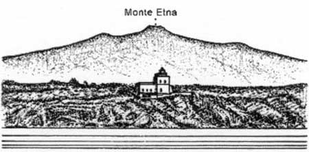 |
|
Capo Molini Light bearing NW |
Aci Trezza, a small fishing village, is situated 1 mile SSW of Capo Molini. This village can be identified by its red houses and by a prominent small church. A small fishing harbor, protected by breakwaters, fronts the village.
15.50 Iso Ciclopi (37°34'N, 15°10'E), a group of four basaltic rocks, lies close SE of Aci Trezza. These rocks are of a prismatic columnar formation and are very prominent, being a darker color than the land behind them. Isola di Aci, the largest and N rock, lies 0.2 mile offshore and is surmounted by a building with a tower. Isola Faraglione, 43m high, lies close S of the above rock.
Aci Castello, a village, stands close to the beach, 1 mile SW of Aci Trezza. A prominent cliff, surmounted by some ruins, juts out in front of this village. During offshore winds, temporary anchorage can be obtained, in depths of 20 to 29m, off Aci Castello, but local knowledge is required.
Between Aci Castello and Catania, 4 miles SW, the coast consists of lava cliffs fringed with rocks. Porto Ulisse (Ognina), a small fishing harbor protected by moles, lies on the S shore of a small creek, 2 miles SW of Aci Castello. A village is situated near the harbor and a prominent chimney stands 0.3 mile S of it.
Caution. – The waters in the vicinity of Iso Ciclopi have been declared a marine nature reserve; special regulations apply.
World Port Index No. 40270
15.51 The port of Catania lies in the NW corner of Golfo di Catania. The harbor is protected by breakwaters and divided into two basins. The city stands on the edge of a plain and has often been partially destroyed by the eruptions of Mount Etna, the last being in 1969 when lava reached the sea.
Port of Catania Home Page http://www.portocatania.it
Winds – Weather. – Winds from the SE cause a considerable swell in the harbor. Violent storms from seaward sometimes cause a considerable disturbance of the waters in the harbor.
Tides – Currents. – The currents are weak and usually follow the direction of the wind. However, strong currents have been reported in the harbor entrance.
Depths – Limitations. – Molo di Levante, the outer breakwater, extends 1 mile S and forms an entrance about 200m wide. There are depths of 10.3 to 12.1m in the entrance, but this depth can vary due to the effect of the swells.
Molo Mezzogiorno, the oil berth, has 361m of total berthing space, with depths of 7.9 to 9.3m alongside.
Porto Peschereccio has 861m of total berthing space, with depths of 5.5 to 9m alongside.
Molo Centrale has 1,325m of total berthing space, with depths of 5.5 to 9.1m alongside.
Molo di Levante has 290m of total berthing space, with depths of 4.9 to 6.3m alongside.
There are facilities for bulk, ro-ro, container, and tank vessels, as well as ferries. Vessels up to 9.1m draft can be acommodated and there are no restrictions with regard to length or breadth.
Aspect. – Monte Etna is the dominating feature in the approach to the port. Several domes are visible above the city, the most conspicuous of which include the dome of the Astronomical Observatory cupola; the dome of Piazza del Duoma, in the center of the E part of the city; and the dome of the cathedral in the middle of the city.
Casa del Sole is situated 1 mile SW of the head of Molo di Levante. This prominent building is a gray-green color with a turret and two pavilions standing N and S of it. A conspicuous factory, with a high chimney, stands in this vicinity and is enclosed by a red fence. Several prominent silos stand in the vicinity of the harbor.
A light is shown from a structure, 28m high, standing 0.7 mile W of the head of Molo di Levante.
Pilotage. – Pilotage is compulsory for all vessels over 500 grt. Pilots can be contacted on VHF channel 12, 14, or 16 and board about 1 mile from the harbor entrance. Vessels should send their ETA 72 hours in advance.
Anchorage. – Small vessels can anchor close S, but clear of the harbor entrance.
Caution. – An anchoring and trawling prohibited area, which may best be seen on the chart, lies close S of the harbor entrance and extends up to 12 miles seaward.
Less depths than charted are reported to lie close off the S side of Molo Mezzogiorno. It is reported that entering the harbor during SE gales can be dangerous. A wreck, with least depth 9m, lies close SW of the light at the head of the E breakwater.
15.52 Bruccoli (37°17'N, 15°11'E), a village, stands on the SW side of a small and steep-sided cove, 13 miles SSE of Catania. An ancient castle, with four towers, is situated close N of the village and a prominent lime kiln stands 0.2 mile W of it. Fishing boats and small craft use the cove. A light is shown from a structure, 12m high, standing close N of the castle.
Between Catania and Bruccoli, the coast consists of a stretch of sandy beach.
Capo Campolato, low and flat, is located 0.9 mile NE of Bruccoli and is the S entrance point of Golfo di Catania. This cape has projections of whitish rock and uneven sides. It rises vertically above the sea and is fringed with rocks.
Vessels can anchor, in depths of 11m to 14m, close off the SW corner of Golfo di Catania. However, this roadstead is fully exposed to N and E winds. Anchorage, sheltered from all but N winds, can also be taken, in a depth of 18m, rock and weed, about 500m NE of the castle at Bruccoli.
Between Capo Campolato and Capo Santa Croce, 4.5 miles SE, the coast is rocky and jagged.
Capo Santa Croce (37°15'N, 15°15'E) is low, rocky, and surmounted by several buildings. Rocks front this cape and extend up to about 300m offshore. A light is shown from a prominent structure, 27m high, standing on the cape.
Between Capo Santa Croce and Capo Santa Panagia, 8.5 miles SSE, there is a large bight which is divided into two parts by Penisola Magnisi. The N part of the bight is known as Baia di Augusta and the S part as Baia di Santa Panagia. Several large and conspicuous oil refineries stand on the W side of Baia di Augusta.
World Port Index No. 40250
15.53 The extensive port of Augusta lies in the NW part of Baia di Augusta and is divided into three parts, namely Porto Xifonio, Porto Megarese, and Seno del Priolo.
Port of Augusta Home Page http://www.augol.it/porto
Winds – Weather. – Winds from the NE and SE, of lasting duration, prevail. These winds are weak in summer and strong in winter. Winds from the W also prevail during the winter months. Fresh WSW winds produce a heavy sea and may be dangerous to vessels in the roadstead.
Depths – Limitations. – The N breakwater extends 1.1 miles SSE from the S end of Isolotto di Augusta. The S breakwater extends 0.6 mile ENE from the SW side of the bay. A detached breakwater, 1.4 miles long, extends between the heads of the N and S breakwaters and forms two entrances. Passo di Levante, the main entrance, leads N of the N end of the detached breakwater into Porto Megarese and has a depth of 37m.
Porto Megarese is the central part of the port and lies W of the breakwaters and Isolotto di Augusta. An extensive area, close inside the main entrance, is dredged to a depth of 21.8m, although caution is necessary as depths of from 11.5 to 20.7m, which are best seen on the chart, are located within the limits of the dredged area.
Porto Xifonio, an inlet, lies outside the main harbor and NE of Isolotto di Augusta.
Seno del Priolo, a bight, lies in the S part of the bay and is fringed by a shoal bank with depths of less than 10m extending up to 0.6 mile offshore.
A new ro-ro terminal is situated in the NW part of the main harbor, 1 mile W of the N end of Isolotto di Augusta. It has 761m of total berthing space, with a depth of 12m alongside, and a jetty, 738m long, with depths up to 12.2m alongside the outer end. Vessels up to 10.8m draft can be accommodated.
Macet Jetty is situated in the NE part of the main harbor, NNW of the N end of Isolotto di Augusta. It has depths up to 8.5m alongside and can accommodate vessels up to 25,000 dwt, stern-to.
Enichem Augusta, situated S of the ro-ro terminal, is used for loading and discharging chemical products. The N jetty has a depth of 5.4m alongside and can accommodate vessels up to 3,000 dwt. The S jetty has a depth of 9.1m alongside and can accommodate vessels up to 30,000 dwt. A platform, situated close SE of the S jetty, has a depth of 6.4m alongside and can handle vessels up to 5,000 dwt, moored stern-to.
Pontile Consortile extends 0.4 mile SE from the reclaimed land, 0.4 mile S of Enichem Augusta. It has dredged depths of 5.8m alongside the inner half and 13.3m alongside the outer half.
Pontile Esso No. 1 extends 1,050m from the shore, 0.5 mile SSW of Pontile Consortile. The berths at the head have depths of 11.3m alongside, and vessels up to 38,000 dwt and 250m in length can be accommodated.
Pontile Esso No. 2, situated close S of Pontile Esso No. 1, extends 1,150m from the shore and has four berths with depths of 7.9 to 16.4m alongside. Vessels up to 140,000 dwt and 297m in length can be accommodated.
A pier, supporting a sea water intake, extends from the shore close S of Pontile Esso No. 2.
Unicem Pier, which is used to handle bulk cement, extends 640m from shore, 0.9 mile S of Pontile Esso No. 2. It has a depth of 7m alongside the berth.
Pontile Marina Militare, a naval pier, extends 0.2 mile NE from the shore, 0.4 mile SE of the cement pier. It has depths up to 11m alongside.
Pontile Superpetroliere, for deep-draft tankers, extends 0.6 mile ENE from the shore, close SSE of the naval pier. It has depths of 12.2 to 20.4m alongside and can accommodate tankers up to 450,000 dwt and 20.1m draft.
Liquids Pier is situated close SE of the root of Pontile Superpetroliere and has depths of 12.9m alongside the N side and 11.4m alongside the S side.
The oil platform, situated close S of Liquids Pier, has a depth of 10.1m alongside and can accommodate vessels up to 20,000 dwt, stern-to.
Other piers in this area have depths of 4 to 9.5m alongside and can accommodate vessels up to 20,000 dwt.
Montecatini Pier, used for chemical products, is situated outside the main harbor and close S of the S breakwater. It has depths of 5.5 to 8.2m alongside and can accommodate vessels up to 20,000 dwt.
VLCC tankers with drafts up to 21m have entered the harbor and anchored within Porto Megarese.
Aspect. – The prominent city of Augusta is situated on Isolotto di Augusta, which extends 1.2 miles S from the N shore of the bay to which it is connected by bridges. A conspicuous cathedral, with a bell tower, stands in the N part of the city. However, due to the high buildings which have been constructed around it, this cathedral is no longer a good landmark.
Torre Avolos, a tower, is 18m high and stands on a prominent ancient fort situated on a small islet, 0.2 mile S of the S extremity of Isolotto di Augusta. An iron framework mast, 37m high, stands close S of the tower.
A prominent chimney, 70m high, stands 2.5 miles W of Torre Avolos and another chimney, with a flare, stands close ENE of it.
Forte Garzia and Forte Vittoria are situated on a shoal which lies 0.7 mile W of the N end of Isolotto di Augusta. A prominent framework mast, 27m high, stands on the latter fort. Punta Pila is located 0.3 mile NNW of these forts and can be identified by a prominent hangar, 74m high, standing 0.3 mile NW of it.
Priolo, a prominent village, is situated 3.7 miles SSW of Torre Avolos. The refinery standing close N of this village is marked by numerous chimneys and flares.
A signal station is situated on the summit of a rocky hill, 187m high, standing 4.5 miles W of Capo Santa Panagia. It serves as a prominent landmark for vessels approaching either Augusta or Siracusa.
A racon is situated at the beacon which lies close W of the head of the N breakwater.
A lighted range, which may best be seen on the chart, indicates the entrance fairway through Passo di Levante. Disused light structures stand close N of the existing entrance range and should not be mistaken for it.
Pilotage. – Pilotage is compulsory for all vessels over 500 grt. Pilots can be contacted on VHF channel 10 and generally board between 1 and 2 miles E of the harbor entrance. Large vessels may be boarded about 3 miles E of the entrance.
Vessels should send an ETA 24 hours in advance to the harbormaster at Augusta via telex. The message should include the following information:
- Request for a pilot.
- Name of agent.
- Reason for call.
- Last port of call and sailing date.
- Cargo details.
Vessels must also send the following information 12 hours before entering Italian territorial waters:
- Name and nationality.
- Call sign.
- GRT and dwt.
- Length and draft.
- ETA at pilot station.
- Information relating to certificates (IMO, etc.).
- Any mechanical defects, if applicable. Vessels should then confirm their ETA 1 hour in advance of arrival.
Regulations. – All vessels and boats, except naval craft, are prohibited from approaching the military piers, military installations, or any wrecks in the harbor.
Vessels are prohibited from stopping within a radius of 1 mile seaward of the entrance to Porto Megarese, or within 0.5 mile of the entrances when inside the harbor.
A vessel leaving the harbor has precedence over a vessel entering the harbor. Vessels are prohibited from entering or leaving the harbor at the same time.
Anchorage. – Vessels can anchor, in depths of 16 to 27m, mud, sand, and weed, anywhere in the middle part of Porto Megarese. Porto Xifonio and Seno del Priolo offer protected anchorage to small vessels. Vessels intending to remain at anchor in Porto Megarese should moor clear of the entrance range.
Caution. – Several red aircraft buoys are moored in the NW part of Porto Megarese. Vessels entering and leaving the harbor should stay close to the entrance range. Caution is necessary when entering the harbor in bad weather, as seas sometimes break heavily over the breakwater. Several anchoring and fishing prohibited areas lie within the harbor and may best be seen on the chart. Several prohibited areas lie in the NE part of the harbor and may best be seen on the chart. It is reported (1990) that the lights of the city and refineries make identification of the navigational entry lights difficult.
15.54 Penisola Magnisi (37°09'N, 15°14'E), less than 30m high, is joined to the mainland by a narrow, sandy isthmus. A large tower stands on the W side of this peninsula above the isthmus. A light is shown from a tower, 6m high, standing on the NE extremity of the peninsula.
Punta Magnisi (37°09'N, 15°15'E), the SE extremity of Penisola Magnisi, is steep-to on its S side. A T-head oil pier, which can accommodate tankers up to 22,000 dwt, is situated
0.3 mile W of the point and has a depth of 11m alongside. Caution. – A seawater intake is situated 0.7 mile SW of the T-head pier and is marked by a light.
A submarine pipeline extends 0.9 mile ENE from the N end of Penisola Magnisi. Anchoring and fishing are prohibited in its vicinity.
An anchoring and fishing prohibited area, the limits of which are shown on the chart, lies centered 2 miles E of Punta Mag-nisi.
15.55 Baia di Santa Panagia (37°08'N, 15°16'E), open to the E and NE, indents the coast between Punta Magnisi and Capo Santa Panagia, 3.2 miles SE. Cala Canaletto, the NW part of this bay, has sandy shores. The shores of the bay to the S of Cala Canaletto are fringed by rocks. Vessels can anchor, in depths of 10 to 11m, sand and rock, moderately good holding ground, in the middle of the outer part of Cala Canaletto.
15.56 Melilli Oil Terminal (37°07'N, 15°16'E) (World Port Index No. 40245) lies 2.3 miles SSE of Punta Magnisi in the S part of Baia di Santa Panagia. It consists of a main pier which extends 0.7 mile NE from shore and has five berths.
Depths – Limitations. – The five berths have depths of 18 to 74m alongside. One berth can accommodate LNG vessels up to 3,000 dwt and 100m in length ; three berths can accommodate tankers of 30,000 to 250,000 dwt; and one berth can accommodate Vessels up to 400,000 dwt, 366m in length, and 23.7m draft.
Aspect. – Lighted ranges indicate the approaches to the berths and may best be seen on the chart.
Pilotage. – Pilotage is compulsory for all vessels bound for the oil terminal pier. Pilots can be contacted on VHF channel 14 and generally board vessels approaching from the S off Porto di Siracusa. Vessels approaching from the N are boarded about 1 mile E of Punta Magnisi.
Vessels should send an ETA at least 24 hours in advance to the harbormaster in Siracusa. Vessels berth during daytime only and must arrange for a floating boom to be rigged all around in order to prevent oil pollution.
Anchorage. – VLCCs can anchor, in depths of 54 to 56m, sand, good holding ground, within an area centered about 1 mile NNE of the head of the pier.
15.57 Capo Santa Panagia (37°06'N, 15°18'E), terminating in steep sides, is the NE extremity of a hilly promontory, the sides of which slope gently to the sea. The coast of this promontory is rocky. Between Capo Santa Panagia and Punta Spuntone, 1.5 miles S, the coast is rocky and rather steep-to.
Punta Spuntone (37°05'N, 15°18'E) can be identified by its yellowish cliffs and by its numerous grottoes. Two latticework masts, 59m high, stand on the cape.
Between Punta Spuntone and Porto Marmorea (Porto Piccolo), 0.7 mile SSW, the coast is rocky and very irregular. Porto Marmorea is a small harbor, with a depth of 3m, which is enclosed by two breakwaters and protected by two outer breakwaters. A prominent war memorial stands 0.4 mile W of the harbor entrance. Two prominent towers stand on the S side of the harbor, close SW of the root of the S breakwater.
World Port Index No. 40240
15.58 The port of Siracusa, also known as Porto Grande, consists of a large bay which is entered between the S end of Isola Ortigia and Punta Castelluccio, 0.6 mile S. The commercial facilities are situated in the NE part of the bay which forms a natural harbor.
Winds – Weather. – Winds from the ENE and ESE prevail during the winter. Winds from the SW and WSW sometimes blow with violence and may endanger vessels alongside the quays. Winds from the NE and E sometimes produce a swell within the harbor.
Tides – Currents. – The tidal rise is negligible. Outside the harbor, the currents along the coast are mostly weak and are influenced by the winds.
The joining of the current from Fiume Anapo, which flows out of the W shore of the harbor, with the current flowing out from La Darsena, in the NE part, sometimes causes a considerable current. This current follows the W side of Isola Ortigia and discharges through the entrance. Its rate varies between 1 and 3 knots, depending upon whether the wind is favorable or contrary.
Depths – Limitations. – The main commercial facilities include Molo San Antonio, which extends from the N side of the harbor and is used by general cargo, passenger, and ferry vessels. It has 555m of total berthing space with depths of 6.1 to 8m alongside. The harbor also has 900m of berthing space, with depths of 3.6 to 4.6m alongside, which is used by fishing vessels, yachts, and small craft. Vessels up to 30,000 dwt and 8.3m have been handled.
Aspect. – The city of Siracusa is built on Isola Ortigia, which extends 0.8 mile from the S part of Port Marmorea. La Darsena is a narrow channel, spanned by bridges, which separates Isola Ortigia from the mainland.
The E side of Isola Ortigia is fronted by rocks and Secca dei Cani, awash, lies about 0.2 mile E of the middle of this side.
A light is shown from a prominent structure, 8m high, standing on Punta Castelluccio which is fronted by rocks. A spit, with a depth of 7m near its outer end, extends up to about 0.3 mile NW of the light. Secca Galera, with a least depth of 6m, lies close W of the N end of this spit.
Castello Maniace, marked by a light, stands on a high rampart at the S end of Isola Ortigia. This castle consists of a square-based structure with a circular tower at each corner. A monastery, topped by a dome, and a cathedral, decorated by numerous statues, stand out prominently above the other buildings of the city. Palazzo del Poste, a high structure with two towers, stands near the N end of the city, and a high brick-colored tower stands close N of it.
A prominent war memorial, consisting of a tall structure with columns, stands 0.2 mile N of the root of Molo San Antonio. The airport, with several hangars, is situated close W of Molo San Antonio and is also prominent.
A lighted range, situated on the W shore of the harbor, indicates the entrance fairway and may best be seen on the chart.
Pilotage. – Pilotage is compulsory for vessels over 500 grt. Pilots can be contacted on VHF channel 14 and board about 1 mile NNE or 1 mile ESE of Castello Maniace Light.
Regulations. – A prohibited area, reserved for aircraft, lies in the NW part of the harbor and may best be seen on the chart. A red flag is hoisted at the seaplane base when aircraft are about to maneuver.
Anchorage. – The harbor can accommodate a large number of vessels. Anchorage can be taken, in depths of 7 to 14m, mud, but the holding ground is not good. The S part of the harbor is deeper and the holding ground is better than in the N part.
Caution. – Vessels approaching Siracusa from the N should give Isola Ortigia a wide berth in order to clear Scoglio del Cani.
It has been reported that the lights on motor vehicles, which are proceeding along the main road to the W of the lighted range, are intermittently obscured by foliage and can, at times, be mistaken for the navigation lights.
Obstructions have been reported (1987) to lie in the vicinity of Secca Galera. An area of foul ground lies about 0.9 mile SSW of Castello Maniace.
15.59 Capo Murro di Porco (37°00'N, 15°20'E) is located 3 miles SE of Punta Castelluccio. The coast between is rocky and steep. The cape consists of rocky and vertical cliffs, up to 15m high. A light is shown from a prominent structure, 20m high, standing on the cape.
Baia di Ognina (37°00'N, 15°18'E) is entered between Capo Murro di Porco and Capo Ognina, 4 miles WSW. Capo Ognina is faced with cliffs and surmounted by the inconspicuous ruins of a tower. A tower, which is visible from the S, stands 1 mile WNW of these ruins.
The shores of the bay are rocky and there is a sandy cove in its innermost part. The bay offers shelter from N and W winds, but tunny nets are laid out annually within it. Anchorage can be obtained, in a depth of 24m, good holding ground, mud and sand, in the N part of the bay.
Caution. – Due to the existence of submarine cables, an anchoring prohibited area, which can best be seen on the chart, extends seaward from the S part of Baia di Ognina.
15.60 Punta del Cane (36°57'N, 15°13'E) is located 2.7 miles WSW of Capo Ognina. The coast between is rocky and somewhat irregular. A sandy beach lies near the point and a small cove is entered close N of it. Several rocks, awash, lie close inshore within 1 mile SW of the point.
Capo Negro, located 2.5 miles SW of Punta del Cane, is low, narrow, and surmounted by a small house. A shoal bank, with a least depth of 49m, extends up to 0.5 mile SE of the cape and the seas break over it in bad weather.
Avola, a town, is situated on a wooded hill, 40m high, 2 miles WSW of Capo Negro. A tall chimney stands in the S part of the town. A prominent dark-colored cathedral, which has a square bell tower, stands in the center of the town.
Marina di Avola, a small harbor, fronts the coast, close SE of Avola. A fish processing plant, topped by a square chimney, is situated near the harbor. The harbor is formed by a mole and is only used by fishing boats and small craft with local knowledge. Anchorage can be taken, in depths of 8 to 10m, about 0.4 mile off Marina di Avola. This is an open roadstead and can only be used during offshore winds.
15.61 Punta Calabernado (36°52'N, 15°08'E), a small projection, is located 1.8 miles S of Marina di Avola. A small inlet lies near the point and serves as a harbor for the town of Noto, which is situated 3 miles W. A jetty extends 30m NE from the shore and affords shelter to small craft. A tower stands near the E end of the inlet and is prominent from the N.
Between Punta Calabernado and Capo Passero, 10.8 miles S, numerous dangers lie close off the coast. Torre Vendicari, a large roofless tower, stands on the coast, 4.5 miles SSW of Punta Calabernado. This tower is prominent and salt pans lie on either side of it. A fish factory, with a tall chimney, is also situated near the tower.
Isola Vendicari, small and low, lies 0.6 mile SSE of the tower. This islet is surmounted by two wooden buildings and a narrow tongue of sand connects it to the mainland. Anchorage can be obtained by small vessels between Torre Vendicari and Isolotto Vendicari, but local knowledge is required.
Marzamemi, a town, is situated on a small rocky point, 3 miles S of Isola Vendicari. The coast between is fronted by shoals which extend up to 1 mile offshore. Several detached shoals, with depths of 11m, lie about 1 mile ESE of Isola Vendicari and about 1 mile NE of the town.
Isola Piccola and Isola Grande, two small islets, lie in a shallow bay which is entered close S of Marzamemi. Fossa dell Isola Grande, a small craft harbor, lies in the S part of this bay and is protected by a mole.
The coast between Isola Grande and Capo Passero is arid and barren. Pachino, a prominent town, stands on a hill, 2 miles SW of Marzamemi.
15.62 Capo Passero (36°41'N, 15°10'E) is the E extremity of Isola di Capo Passero, a small island, which lies close offshore. This island forms the SE extremity of Sicilia. It is steep-sided, except on its W side, where it is connected to the mainland by shoal ground. A castle is situated on the cape. Capo Passero Light is shown from a structure, 19m high, standing on the NE corner of the castle. Anchorage, sheltered from W winds, can be obtained, in depths of 16 to 18m, about 1.5 miles NNW of Isola di Capo Passero.
Cozzo Spandaro Light is shown from a conspicuous structure, 36m high, standing on a hill, close W of Isola di Capo Passero. A signal station is situated close S of the light and the prominent village of Porto Palo stands 0.2 mile SSE of it.
A stranded wreck lies 0.4 mile SSE of Capo Passero Light.