
ITALY – THE STRAIT OF SICILIA AND MALTA CHANNEL SECTOR 14 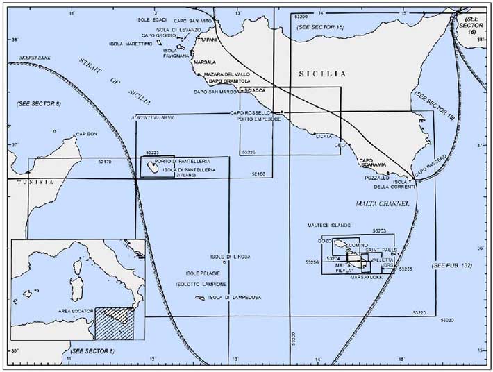
Plan. – This sector describes the W and S coasts of Sicilia (Sicily), the Strait of Sicilia, and Malta Channel including the islands and banks S of Sicilia. The descriptive sequence is SE from Skerki Bank to the Maltese Islands, S from Capo San Vito to Capo Granitola, and then SE to Capo Passero. The other islands and banks are described with their adjacent coasts.
14.1 Skerki Bank (37°50'N, 10°55'E) is centered about 35 miles NNW of Ras at Tib (Cap Bon), which is described in paragraph 8.14, and extends for about 35 miles in a general NE-SW direction. The bottom of this extensive bank consists of coral, rock, sand, and shells.
Sylvia Knoll, lying at the NE end of Skerki Bank, has a least depth of 12m. Biddlecombe Reef, with a depth of 6.7m, lies about 7 miles SW of Sylvia Bank.
Locust Patch, with a depth of 12m, lies 5 miles W of Keith Reef. Hecate Patch, with a depth of 7m, lies about 2 miles S of Locust Patch.
Keith Reef is the shallowest patch on the bank. It lies nearly 2 miles SSE of Biddlecombe Reef and is composed of compact limestone. A small rock, covered with weed, lies at the center of this reef and has a depth of 0.3m. It is usually marked by breakers. It is reported that the remains of a stranded wreck lie in the vicinity of this rock. In addition, two dangerous wrecks lie at the NE end of the rock.
Caution. – The currents in the vicinity of Skerki Bank are irregular in both rate and direction. The shoal patches are not always marked by breakers. Vessels should exercise caution and give the dangers on this bank a wide berth.
14.2 Isola di Pantellaria (36°48'N, 12°00'E), a mountainous and volcanic island, lies 46 miles ESE of Ras at Tib (Cap Bon). Montagna Grande, 834m high, dominates this island. The coastal currents in the vicinity of the island vary in direction and velocity with the wind force and direction.
Pantellaria (36°50'N, 11°56'E), a small craft harbor, lies at the NW end of Isola di Pantellaria and is protected by breakwaters. Vessels may only anchor in one of the six designated anchorage areas after obtaining permission from the Harbor-master at Trapani.
Punta San Leonardo (36°50'N, 11°55'E), a low point, is located at the NW end of the island, close E of Pantellaria. A light is shown from a structure, 3m high, standing on this point. A cemetery, situated 0.5 mile SE of this point, is conspicuous.
Punta Bue Marino, low and dark, is located 0.5 mile ENE of Punta San Leonardo. Two coves lie close E of this point.
Punta Caruscia is located 1 mile ESE of Punta Bue Marino. Ancoraggio di Campobello lies between Punta Caruscia and Punta Pozzolana, 0.8 mile ESE, and affords anchorage, sheltered from W winds. Small vessels can obtain anchorage between these two points, in a depth of 29m, rock and weed. Local knowledge is required.
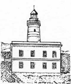
14.3 Punta Spadillo (36°48'N, 12°00'E), located 1.2 miles E of Punta Pozzolana, is the rocky NE extremity of a promontory on the W side of which is a cove. A light is shown from a structure, 21m high, standing on this point.
 |
|
Punta Spadillo Light |
Punta Tracino, marked by a light, is located 2.5 miles SE of Punta Spadillo. It is high and rocky. A small islet, almost as high as the point itself, lies close off the point and is surmounted by a small pillar. Anchorage can be obtained, in depths of 20 to 22m, sand with patches of rock, about 300m S of this small islet, but local knowledge is required.
Punta Limarsi, located 4 miles SSW of Punta Tracino, is rugged and rocky. A light is shown from a structure, 6m high, standing on this point. Anchorage can be obtained by small vessels in Porto Dietro Isola, a slight indentation, close NE of Punta Limarsi. A good berth, in depths of 22 to 27m, coarse sand with some rock, lies about 320m NE of Punta Limarsi, but local knowledge is required.
Punta Polacca is located 2.3 miles W of Punta Limarsi. The coast between is high and rocky.
Punta Tre Pietre, located 2.5 miles NW of Punta Polacca, is the SW extremity of a promontory which is fronted by three small above-water rocks. A light is shown from the W entrance point of Porto di Scauri, which lies 0.3 mile E of Punta Tre Pietre. Anchorage can be obtained, in a depth of 16m, coarse sand and rock, about 200m S of the light.
Caution. – A fishing and anchoring prohibited area extends up to 6 miles seaward from the vicinity of Punta Bue Mario Point and may best be seen on the chart.
A prohibited area, best seen on the chart, is located close off Punta del Gadir about 1 mile SE of Punta Spadillo.
A storage tanker (Tazerka) is moored in the vicinity of (36°36'N, 11°41'E), which is situated about 17 miles SW of Punta Tre Pietre.
Isole Pelagie
14.4 Isole Pelagie (35°52'N, 12°52'E), a group of three volcanic islands, consists of Isola di Linosa, Isola di Lampedusa, and Isola Lampione. The group is Italian and lies on the African continental shelf, SSE of Isola di Pantellaria.
Isola di Linosa (35°52'N, 12°52'E), the NE island of the group, lies 66 miles SE of Isola di Pantellaria. Monte Vulcano, 195m high, stands on the S side of the island; Monte Rosso, 186m high, stands 0.5 mile N of Monte Vulcano; and Monte di Ponente, 107m high, stands on the W side of the island.
A rocky patch, with a least depth of 3.9m, lies about 0.2 mile E of Punta Calcarella, the SE extremity of the island, and is the only off-lying danger. A depth of 14m lies about 0.2 mile offshore, on the N side of the island.
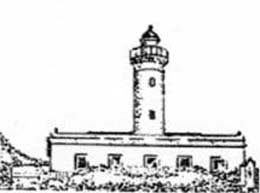
A light is shown from a prominent structure, 17m high, standing on Punta Beppe Tuccio, the NE extremity of the island. Another light is shown from a structure, 6m high, standing close NE of Punta Arena Bianca, the SW extremity of the island.
 |
|
Punta Beppe Tuccio Light |
14.5 Isolotto Lampione (Scoglio Lampione) (35°33'N, 12°19'E), a small island, lies 32 miles SW of Isola di Linosa. It is uninhabited, 40m high, and has a flat top with cliffy sides. When seen from the NW, this island appears like a wall rising from the sea. A light is shown from a structure, 6m high, standing on the W side of the island.
Isola Lampedusa (35°30'N, 12°36'E), the largest and S island of the group, lies 10 miles ESE of Isola di Lampione. This island is flat-topped and barren. Monte Albero Sole, 133m high, stands on its NW side and is prominent. There are no close off-lying dangers.
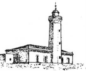
A light is shown from a structure, 19m high, standing on Capo Grecale, the NE extremity of the island. Two large masts are situated close W of the light. A marine farm, marked by a lighted buoy, has been established off the entrance to Cala Creta about 1 mile S of Capo Grecale.
A light is also shown from a structure, 6m high, standing on Capo Ponente, the SW extremity of the island. A prominent radio mast stands on a hill, 0.4 mile E of the light.
 |
|
Capo Grecale Light |
14.6 Lampedusa (35°30'N, 12°36'E), the capital of the island, is situated on its SE side. This small town is fronted by a harbor which consists of three coves. It is open to the S and is entered between Punta Guitgia and Punta Maccaferri, 0.2 mile
E. Both of these entrance points are marked by lights. A mole protects the inner harbor which is only suitable for small craft with lengths less than 30m and drafts up to 3m. Small coasters and fishing vessels, up to 80m in length, can anchor and moor, stern-to-shore, off Punta Maccaferri. The harbor can be contacted on VHF channel 14 or 16. Vessels can anchor, in a depth of 14m, sand and weed, off the harbor entrance.
14.7 The Maltese Islands, an extensive group, consist of three main islands, Ghawdex (Gozo), Kemmuna (Comino), and Malta, and several islets which lie centered 90 miles ENE of Lampedusa.
Regulations. – A Vessel Traffic Service (VTS) has been established for Malta and can be contacted on VHF channels 69 or 16 (call sign: Coastal Station). Participation is mandatory for the following vessels:
- Vessels of 300 gross tons and over.
- Vessels carrying dangerous cargo.
- Vessels not certified gas-free.
- Vessels engaged in cargo-handling operations.
- Vessels undergoing inerting, tank cleaning, gas freeing, or purging operations.
- Vessels over 15m loa.
- Mobile offshore rigs.
- Vessels using a pilot.
The VTS includes the area within Maltese territorial waters and is responsible for monitoring shipping and receiving information within the area. This VTS also monitors vessels bound for a port in Malta or leaving the port VTS area.
Caution. – Oil drilling rigs may frequently be encountered between this group of islands and the S coast of Sicilia.
14.8 Ghawdex (Gozo) (36°03'N, 14°15'E), the NW island in the group, rises in high cliffs to a plateau. Several villages stand around the island and Victoria (Rabat), the largest town, is situated near its center.
Ras San Dimitri (36°04'N, 14°11'E), a high and steep-to promontory, forms the NW extremity of the island. A light is shown from a structure, 21m high, standing 1.7 miles E of Ras San Dimitri. This light structure surmounts Gordan, 161m high, a prominent hill.
From Ras San Dimitri, the coast trends generally SE for 8 miles to Ras il Qala, the SE extremity of the island. The N coast is generally free of off-lying dangers.
From Ras il Qala, the coast trends SW for 4 miles to Ras il Newhela, the S extremity of the island. Gebel tal Halfa, an islet, lies 0.3 mile WSW of Ras il Qala and is 22m high. Numerous above-water rocks encumber this stretch of the coast and depths of 18m or less extend S across North Comino Channel to Comino (Kemmuna).
Temporary anchorage can be taken, in a depth of 18m, sand, off the small harbor of Mgarr, which lies 1.5 miles WSW of Ras il Qala. This anchorage is exposed to E winds which blow through North Comino Channel and is also open to the S and SW.
From Ras il Newhela, the coast trends NW for 4 miles to Ras il Wardija, and then 2 miles N to Ras San Dimitri. This part of the coast rises in high cliffs from the sea, is steep-to, and is mostly free of dangers.
Caution. – A former explosive dumping area, 2 miles in diameter, lies about 3 miles N of Gozo.
A submarine cable area extends S from Gozo to Comino.
14.9 Comino (Kemmuna) (36°01'N, 14°20'E) a small island, lies nearly midway between Gozo and Malta and divides the channel into the North Comino Channel (Il Fliegu ta Ghawdex) and the South Comino Channel (Il Fliegu ta Malta). Passage through these two channels is restricted to noncommercial vessels and other vessels of 50m or less in length.
Kemmunett, a small rocky islet, is located close W of Comino (Kemmuna), and several above-water rocks lie between them. The NW extension of shoal water surrounding the islet is marked by a lighted beacon.
The currents in the passages on both sides of Comino are irregular in direction, sometimes setting against a strong wind, but their rates are usually less than 1 knot.
Sultan Rock, with a depth of 6m, is the E rock of Skoll tal-Abjad tal-Prosha, a group of dangers with a least depth of 5.5m, which lie about 0.2 mile E of the SE end of Comino.
Anchorage, with local knowledge, can be taken, in depths of 16 to 21m, in Il Mats, a small bay, lying on the W side of the island.
Caution. – A submarine cable area extends S from Comino to Malta.
14.10 Malta (35°55'N, 14°25'E), the S and largest island of the group, lies close S of Comino and 2.5 miles SE of Gozo. Valletta, the largest port and capital, is situated on the E side of the island and is also a tourist resort.
Ponta tal Cirkewwa (Ponta tal Marfa) (35°59'N, 14°20'E), the NW extremity of Malta, is a low point backed by high and sloping land. Shoals and above-water rocks extend up to about
0.2 mile N of this point.
A breakwater extends about 300m from Ponta tal Marfa. A ro-ro ferry terminal berth, with a depth of 5m alongside, is situated at the head of this breakwater. A conspicuous hotel, visible from all sides of the promontory, stands 0.2 mile E of Ponta tal Marfa.
The coast from Ponta tal Marfa slopes NE for 2 miles to Ponta ta l’Ahrax, the N extremity of the island, and is indented by several small bays.
From Ponta ta l’Ahrax, the coast then trends SE for 13 miles to Ponta taz Zonqor, the NE extremity of island. From N to S, this stretch of coast is broken by Mellieha Bay, St. Pauls Bay, Salina Bay, St. Georges Bay, St. Julians Bay, and Valletta Harbor.
14.11 Sikka il-Bajda (Balls Bank) (36°00'N, 14°24'E), with depths of 10.4 to 20m, lies 2 miles E of Ponta ta l’Ahrax. This shoal should be avoided.
From Ponta ta l’Ahrax to Dahlet ix-Xilep, 0.7 mile SE, the coast consists of high broken cliffs with rocks below them, especially near the latter point. Dahlet ix-Xilep is a high bluff surmounted by a conspicuous church. A prominent statue stands close to the edge of the cliff.
Mellieha Bay is entered between Dahlet ix-Xilep and Ras il-Griebeg, 1 mile SSE. There are submerged rocks and shoals in the bay, but it affords good anchorage during offshore winds to vessels with local knowledge.
Gzejjer Selmunet (St. Pauls island), an islet, lies close inshore, about 0.9 mile ESE of Ras il-Griebeg. This islet is divided into two parts which are joined by a low and narrow isthmus. A remarkable statue of Saint Paul stands on the summit, 40m high, of the higher and W part.
Saint Pauls Bay (Il Bajja ta’ San-Pawl il-Bahar) is entered between Gzejjer Selmunet and Ras il-Qawra, 1 mile SE. Selmun Palace, 23m high, stands on a hill, 1 mile WSW of the statue of Saint Paul. Several prominent oil tanks, painted silver, stand 0.4 mile SE of the palace. A concrete quay, 53m long, with depths of 2.1 to 3.4m alongside, is situated 0.6 mile SE of the palace.
A designated approach channel has been established in St. Paul’s Bay and may best be seen on the chart. Anchoring and fishing are prohibited in this channel. Marine farms, best seen on the chart, lie on the N side of the channel.
Anchorage, sheltered from offshore winds, can be obtained within the bay, in depths of over 18m. The holding ground is good, except on a rocky patch lying near the entrance. However, in depths of less than 20m, care should be taken to select a sandy spot.
A spit, with a least depth of 9.4m, extends about 0.5 mile ENE from Ras il-Qawra. A lighted buoy lies 0.2 mile NE of the extremity of the spit. Diving takes place in the vicinity of the buoy and it should be given a wide berth.
Salina Bay is entered between Ras il-Qawra and Ras-il Ghallis, 0.4 mile SSE. A salt works and a hotel stand at the head of this bay. A prominent tower stands close SE of Ras-il Ghallis.
The coast from Ras il-Qawra to Valletta, 5 miles SE, is indented by numerous bays which are suitable only for small craft with local knowledge. Above-water rocks and shallow shoal patches extend up to 0.3 mile seaward of the coast.
14.12 Saint George’s Point (36°56'N, 14°29'E), surmounted by a prominent tower, is the N entrance point of Saint George’s Bay. A radio mast stands 0.4 mile SW of the tower.
Outer St. George Rock, with a depth of 9.1m, is the N of several rocks lying on a spit which extends 0.7 mile NNE from the vicinity of St. George’s Point. Spinola Rock, with a depth of less than 1.8m, lies near the extremity of the spit.
St. Julian’s Point, located 0.7 mile SSE of Saint George’s Point, is the SE entrance point of St. Julians Bay.
Caution. – Anchoring and fishing prohibited areas lie in the approaches to Saint George’s Bay and Saint Julian’s Bay and may best be seen on the chart.
Vessels should exercise caution when off the coast between St. Paul’s Bay and Valletta Harbors due to the Pembroke Rifle Range areas. A red flag will be displayed from the tower on Saint George’s Point when firing is taking place on the range.
Valleta Harbors (35°54'N, 14°31'E)
World Port Index No. 40330
14.13 Valletta Harbors consists of two natural bays, each of which is comprised of several smaller bays or creeks.
Port of Valletta Home Page http://www.mma.gov.mt
Winds – Weather. – The Grecale, a strong NE wind, frequently sets up a rough sea and swell in the harbor entrance and approaches, and may make entry hazardous.
Tides – Currents. – The tidal range is almost negligible, being only 0.3m at springs.
Marrobbio surges or waves occur along this coast and may cause the water level in Valletta to fall rapidly as much as 0.3m with no warning. These surges may also cause destructive currents in the harbor.
Depths – Limitations. – The outer entrance has depths of 21 to 23m. The harbor fairway has depths of 9 to 23m.
Grand Harbor is the principal port of entry and handles practically all traffic, except tankers carrying petroleum with a flashpoint below 22.5°C. All other petroleum products, including LPG and explosives, are handled at Marsaxlokk Bay.
Parlatorio Wharf (Navy) can accommodate tankers up to 198m in length and 10.7m draft.
Deep Water Wharf is 490m long, with a depth of 10m alongside.
Flagstone Wharf is 217m long, with a depth of 12m alongside.
Crucifix Wharf, an extension of Deep Water Wharf, is 240m long with a depth of 10m alongside. It is used by passenger and cruise vessels.
Gun Wharf is 92m long with a depth of 7.4m alongside. It is used by ferries.
Laboratory Wharf and Magazine Wharf have a combined length of 440m with depths of 12.2 to 15m alongside. Bulk vessels up to 80,000 dwt and 13m draft can be accommodated.
There are also facilities for container and ro-ro vessels. A quay, with 240m of berthing space, is situated in Marsaxlokk and is used by oil exploration service vessels.
In addition, there are extensive repair facilities and drydocks which can accommodate vessels up to 300,000 dwt.
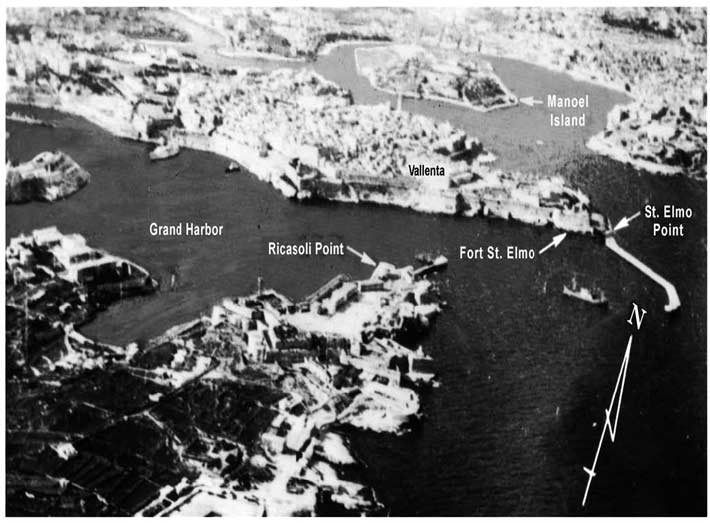
Aspect. – Marsamxett, the N harbor, is entered between Tigne Point and St. Elmo Point (Il-Ponta Sant’ Jiermu) and consists of Sliema Creek (Id-Dahla Ta’ Tas-Sliema), Lazaretto Creek, Msida Creek, and Pieta Creek.It serves as a quarantine anchorage and a mooring area for naval vessels. The naval installations consist mainly of small craft repair facilities. Alongside berthing space is limited and there is little or no commercial activity in Marsamxett, except for an extensive yacht harbor and an oil service base.
Grand Harbor, the S bay and main harbor, is entered between breakwaters which extend from St. Elmo Point and Ricasoli Point. It consists of Bighi Bay, Kalkara Creek, Dockyard Creek (Id-Dahla Tad Dockyard), French Creek, and Newport. This harbor contains the major naval facilities and the commercial port. Most of the commercial facilities are concentrated in Newport. Within this harbor, vessels work cargo into lighters from Mediterranean moorings. Dockyard Creek and French Creek are mostly reserved for naval vessels. The approaches to Grand Harbor present no navigational difficulties.
A light is shown from a structure standing on St. Elmo Point (Il-Ponta Sant’ Jiermu). An outer approach lighted buoy is moored about 1.2 miles NE of the light.
Lights mark the seaward ends of the breakwaters which protect the entrance to Grand Harbor.
Pilotage. – Pilotage is compulsory for vessels over 500 grt. Pilots can be contacted on VHF channel 12, 14, or 16 and generally board in the vicinity of the outer approach lighted buoy in good weather and near the harbor entrance in bad weather.
Vessels should send an ETA at least 2 hours in advance and when 5 miles from the outer approach lighted buoy. Vessels should also send their ETA to the Port Operations Manager 48 hours in advance through Malta (9HD).
Regulations. – A Vessel Traffic Service has been established for Valettaand can be contacted on VHF channel 12 or 16 (call sign: Valetta Port Control). Participation is mandatory for the following vessels:
- Vessels of 300 gross tons and over.
- Vessels carrying dangerous cargo.
- Vessels not certified gas-free.
- Vessels engaged in cargo-handling operations.
- Vessels undergoing inerting, tank cleaning, gas freeing, or purging operations.
- Vessels over 15m loa.
- Mobile offshore rigs.
- Vessels using a pilot.
The VTS includes the approaches to Valetta and Gozo, the harbor areas, the N and S channel between Malta and Gozo, bunkering areas and the waiting areas.
Vessels approaching the Valetta VTS from any direction should contact the VTS 2 hours prior to their ETA at the pilot station. Additional contact should be made 30 minutes prior to arrival at the pilot station. Reports should also be made when departing the harbor.
Signals. – The following traffic signals, shown from the Palace Tower and Fort Saint Angelo, do not apply to small craft or to vessels of less than 500 grt plying exclusively in the waters of Malta, providing such vessels or craft do not obstruct other vessels maneuvering in accordance with these signals:
 |
|
Valleta from ESE |
- A red square flag by day or four red lights, shown vertically, at night indicate that no vessels can enter, leave, or obstruct the entrance channel to Grand Harbor.
- A red diamond shape by day or a red light over a white light at night indicate that vessels may enter but not leave Grand Harbor.
- Two red diamond shapes, shown vertically, by day or two red lights, shown vertically, at night indicate that vessels may leave but not enter Grand Harbor.
- A blue triangular flag indicates that it is unsafe for boats and low powered craft to leave Grand Harbor or Marsamxett Harbor.
Vessels underway, with a pilot aboard, shall display International Code Flag H, by day, or a white light above a red light at night.
Vessels maneuvering, with a pilot aboard, will also display the following additional signals:
- International Code Pennant 2 by day, or two white lights, shown vertically, at night indicate that the vessel is maneuvering to anchor or berth and must not be obstructed or passed closely.
- International Code Flag G at the dip by day or three lights (red, white, red), shown vertically, at night indicate that the vessel is getting underway to proceed to sea and must not be overtaken or passed closely.
- International Code Pennant 2 over the Answering Pennant by day or three lights (white, red, white), shown vertically, at night indicate that the vessel has stopped maneuvering and may be passed or overtaken.
Vessels carrying explosives and awaiting berthing instructions in or near the approaches to a harbor shall display a black ball above International Code Flag B by day, or three lights (white, red, red), shown vertically, at night.
A storm signal, consisting of a single black ball by day or a red light by night, may be shown from the palace and Fort Saint Angelo. This storm warning indicates a wind of force 5 or greater is expected between 010°and 120°in Valletta Harbor.
A scend warning is issued subsequent to a gale warning and is promulgated until the sea has fallen to a less than 1.5m in crease.
Anchorage. – There are numerous mooring berths for naval vessels in both harbors. Merchant vessels usually moor in Marsa Creek, Grand Harbor.
Caution. – Several anchorage prohibited areas lie within Valletta Harbors and may best be seen on the chart.
Several submarine cables, which may best be seen on the chart, extend seaward from the vicinity of St. Elmo Point (Il-Ponta Sant’ Jiermu) and extend N along the coast of the island.
Several submarine pipelines lie within the harbors and may best be seen on the chart.
14.14 Ponta taz Zonqor (35°52'N, 14°35'E), the low-lying NE point of Malta, is located 3 miles SE of Ricasoli Point, the SE entrance point of Valletta Harbors. It is marked by a stone beacon that has been reported to be difficult to identify. Several prominent radio masts are reported to stand close SE of Ricasoli Point.
Della Larga Forca, a detached bank with a depth of 9.1m, lies about 0.4 mile offshore, 1 mile NNW of Ponta taz Zonqor.
The coast extends S for 3 miles from Ponta taz Zonqor to Ponta ta Delimara and is indented by several shallow bays.
Sikka Zonqor, a detached 8.5m patch, lies about 0.4 mile ESE of Ponta taz Zonqor. Outer Munxar Rock, with a depth of 9.7m, is the E danger in this vicinity and lies about 1 mile off-shore, 1.5 miles ESE of Ponta taz Zonqor.
Ponta ta Delimara (35°49'N, 14°34'E), the NE entrance point of Marsaxlokk, is located at the S end of a peninsula which terminates in a yellow cliff, 15m high. A light is shown from a tower, 24m high, standing close N of the S extremity of the peninsula. Two prominent radio masts stand close SSE of the light. An islet, 4m high, lies close S of the point. Several rocks lie on the shore bank which extends S of this islet and is marked by a lighted buoy moored about 0.2 mile SSE of Ponta ta Delimara.
Hurd Bank (35°53'N, 14°45'E), formed of coral and sand, lies 10 miles ENE of Ponta taz Zonqor and has depths of 35 and 44m.
Caution. – A dumping ground, 0.4 mile in diameter, lies close N of Della Larga Forca and may best be seen on the chart.
A submarine pipeline extends 0.5 mile NE from a point on the shore, 1 mile SE of Ricasoli Point. Anchoring is prohibited in the vicinity of this pipeline.
Commercial vessels may not enter the restricted area, which may best be seen on the chart, lying adjacent to the coast, 2 miles N of Ponta ta Delimara. This area extends up to 1.5 miles from the shore.
A current setting S has often been observed off the E end of Malta. During N winds, its rate increases and on occasion, it has been experienced as far off as Hurd Bank.
Marsaxlokk (Marsa Scirocco) (35°49'N, 14°33'E)
World Port Index No. 40340
14.15 Marsaxlokk is formed by an extensive bay which is entered between Ponta ta Delimara and Ponta ta Benghajsa, 1 mile WSW. The small towns of Marsaxlokk and Birzebbuga are situated, respectively, on the N and W sides of the bay.
Port of Marsaxlokk Home Page http://www.mma.gov.mt
Tides – Currents. – The tidal rise is negligible, being only 0.3m at springs. A very strong current sometimes sets NE about 1 mile off the entrance to the bay. It is caused apparently when the SE winds last several days, but usually ceases after two days of W winds.
Depths – Limitations. – Saint Lucien Oil Terminal, lying close SE of Fort Saint Lucien, consists of a fueling dolphin and several mooring buoys. Tankers are generally limited to 177m in length and 9.6m draft.
A new container facility includes Terminal 1 South Quay, 200m long, with a depth of 8m alongside; Terminal 1 West Quay, 168m long, with a depth of 9.8m alongside; Terminal 1 North Quay, 640m long, with a depth of 13.8m alongside; Terminal 2 West Quay, 460m long, with a depth of 16.5m alongside; Terminal 2 North Quay, 500m long, with a depth of 17m alongside; and Terminal 2 East Quay, 435m long, with a depth of 12.8m alongside.
The inner side of the breakwater, with depths of 14 to 18m alongside, can accommodate bulk vessels and tankers up to 80,000 dwt.
A bulk terminal is being constructed (1994) within the port which will accommodate vessels up to 200,000 dwt.
Aspect. – A breakwater extends 0.4 mile NE from Ponta ta Benghajsa and is marked by a light at its head. A lighted buoy is moored about 0.3 mile NE of the head of this breakwater.
Benghjsa Reef, with a least depth of 5.5m, lies near the SE end of a spit which extends 1 mile SE from Ponta ta Benghajsa. The extremity of this spit is marked by a lighted buoy moored about 1.2 miles S of Ponta ta Delimara. Benghisa Patch, with a least depth of 5.2m, lies on the spit, about 0.3 mile offshore.
Fort St. Lucien, a prominent building, stands 1.2 miles NW of Ponta ta Delimara. A conspicuous church is situated 0.9 mile NNE of this fort. Hajaro Rock lies close SE of the fort and is marked by a beacon.
A conspicuous water tower stands close to Fort Benghajsa, which stands on the S side of Ponta ta Benghajsa, the W entrance point. Another conspicuous water tower stands 0.5 mile N of Fort Benghajsa and a prominent church is situated 0.7 mile NNW of it. Several radio masts stand NNW of Fort Benghajsa.
A signal station is situated at Fort Tas-Silg, which stands 1.3 miles N of Ponta ta Delimara.
Capuchin Convent, a large building with a conspicuous white house standing 0.2 mile WSW of it, is situated on a ridge, 0.8 mile NNW of Fort Saint Lucien. However, this convent cannot be seen from the approaches to the bay.
Zetjun Church, with a conspicuous red dome, stands 0.7 mile N of the convent.
Pilotage. – Pilotage is compulsory for vessels over 500 grt The pilot boards 0.7 mile S of Ponta ta Delimara Light.
Vessels should contact Valletta Port Control on VHF channel 12 or 16 at least 2 hours before arrival at the pilot boarding position, stating:
- ETA at pilot boarding position.
- Last port of call
- LOA.
- Breadth.
- Gross tonnage.
- Net tonnage.
- Draft.
- Freeboard.
- Agent.
- Cargo.
- Vessel flag.
Vessels should call Valletta Port Control again when within 5 miles of the pilot boarding position.
Regulations. – A Vessel Traffic Service has been established for Marsaxlokk and can be contacted on VHF channel 14 or 16 (call sign: Marsaxlokk Port Control). Participation is mandatory for the following vessels:
- Vessels of 300 gross tons and over.
- Vessels carrying dangerous cargo.
- Vessels not certified gas-free.
- Vessels engaged in cargo-handling operations.
- Vessels undergoing inerting, tank cleaning, gas freeing, or purging operations.
- Vessels over 15m loa.
- Mobile offshore rigs.
- Vessels using a pilot.
The VTS includes the approaches to Marsaxlokk, the harbor, and the waiting area.
Vessels approaching the Marsaxlokk VTS from any direction should contact the VTS 2 hours prior to their ETA at the pilot station. Additional contact should be made 30 minutes prior to arrival at the pilot station. Reports should also be made when departing the harbor.
Anchorage. – The bay, protected from all but S winds, affords good holding ground. The bottom consists of fine sand and mud lying between hard patches which are covered with weeds. Vessels unable to enter Valletta Harbors during periods of strong NE winds, shelter here to await favorable weather.
Small vessels usually anchor off the E shore, ESE of Fort Saint Lucien.
Large vessels sometimes anchor outside the port at Hurd Bank, about 11 miles E of Marsaxlokk. There are depths of 35 to 40m, but this anchorage is not sheltered, although contact with the harbor may be maintained.
Caution. – A wave recorder buoy is moored close S of Ponta ta Delimara. Vessels should move with great caution when in the vicinity of this buoy and should avoid contact with it at all times.
Several unlighted mooring buoys are situated within the bay.
14.16 Ponta ta Benghajsa (35°49'N, 14°33'E), the SW entrance point of Marsaxlokk bay, is the SE point of Malta. From here, the coast curves generally NW for 12 miles to Ras ir Raheb, then N for 5 miles to Ponta tal Marfa. Deep water extends close inshore along most of this rugged section of coast, which is mostly formed of abrupt rock and sheer, steep cliffs.
Il-Minkba is located 3.2 miles W of Ponta ta Benghajsa. The coast between is cliffy, but these cliffs are more precipitous and lighter in color than those farther to the W. Several prominent radio masts stand 0.5 mile N and 0.7 mile E of Il-Minkba. Torri tal Wied Zurrieg, a square tower 12m high, stands on the coast, 1 mile W of Il-Minkba.
Hamrija Bank, with depths of 5.5 to 18.6m, extends up to 0.5 mile from the shore, 2 miles W of Il-Minkba.
Ix-Xaqqa, a small cove, is entered 3 miles WNW of Il-Minkba. A continuous wall of steep cliffs, above which stands the highest part of the island, extends 6 miles NW from this cove to Ras ir-Raheb. A disused signal station, with several conspicuous radio masts standing 0.5 mile SE, is situated on the coast, 2.3 miles NW of Ix-Xaqqa.
Fomm-ir-Rih, a bay, is entered close N of Ras ir-Raheb. Its S side is faced with a prominent perpendicular cliff, 37 to 52m high.
Ghajn Tuffieha, a bay, is entered 1.5 miles N of Ras ir-Raheb. Il Qarraba, a prominent rocky promontory, forms the S entrance point. A watch tower stands at the head of this bay, and several conspicuous hotel buildings stand close E and 0.2 mile N of it.
14.17 Filfla (35°47'N, 14°25'E), a rocky islet, lies 2.5 miles offshore, 7 miles WSW of Ponta ta Benghajsa. This islet is surrounded by above and below-water rocks and its sides are formed by cliffs up to 59m high.
Stork Rock, with a least depth of 6.7m, lies about 0.5 mile S of Filfla.
Small craft, seeking shelter from E winds, can find indifferent anchorage within the bays along the W coast of the island, but these bays are too small to afford any protection for oceangoing vessels.
Caution. – A prohibited area, with a radius of 1 mile, is centered on Filfla.
A countercurrent, which sets W at 0.5 to 1 knot, exists up to about 0.5 mile offshore along the S coast of Malta with fresh W or NW winds.
West Coast of Sicilia and Isole Egadi
14.18 Capo San Vito (38°11'N, 12°44'E), low and flat, is the NW extremity of Sicilia and is frequently used as a landfall by vessels approaching from the W. The cape is the E extremity of a flat projection, of which the W side is almost vertical and the N side is formed by a steep slope. A light is shown from a structure, 40m high, standing on the cape. Torre Roccazzo, a prominent single story building, is situated 0.5 mile SSW of the light. During bad weather, heavy breakers are experienced to the N of the cape and large vessels should not approach within 1.5 miles.
Anchorage can be obtained, in a depth of 12m, sand, SE of the light and NE of Torre Roccazzo. The holding ground is good and the anchorage is safe, except during NE winds.
The W part of Sicilia is generally mountainous with short stretches of flat land and coastal plains. Extensive dunes frequently flank the coastal plains and rise gradually to regions of wide plateaus.
From Capo San Vito, the coast trends SW for 15 miles to Trapani, then 14 miles S to Marsala, and then 17 miles SE to Capo Granitola.
Between Sicilia and Isole Egadi, the currents are strong at times and set NE or SW with the NE current predominating during the summer.
Punta del Saraceno, the NW extremity of a rounded promontory, is located 6 miles SW of Capo San Vito.
Punta Pizzolungo is located 5.5 miles SW of Punta del Saraceno. Secca Bonangia, a shoal with a depth of 1.8m, extends up to about 1.3 miles NE from a point, 0.4 mile N of Punta Pizzolungo.
Isolotto Asinelli (38°04'N, 12°32'E), a low and black rock, lies 1.5 miles W of Punta Pizzolungo. A light is shown from a structure, 6m high, standing on this rock.
14.19 Trapani (38°01'N, 12°30'E) (World Port Index No. 40150), a harbor protected by breakwaters, is the principal port on the W coast of Sicilia.
Port of Trapani Home Page http://www.portotrapani.it
Winds – Weather. – The harbor is exposed to all winds and is open to the W. In the spring, strong seasonal SE winds can make entry hazardous.
Tides – Currents. – The tidal rise is very slight. Currents are very weak, but the Marrobbio surges can cause sudden fluctuations up to 0.6 to 0.9m in the water level, but they are not considered dangerous.
Depths – Limitations. – The approach to Trapani is deep, with depths gradually shoaling to 14m off the W breakwater. A fairway, 90m wide, leads into the inner harbor. The harbor is subject to silting and a depth of 8.8m is maintained by frequent dredging. The main quay has 800m of total berthing space with a depth of 7.9m alongside. There are facilities for bulk vessels and pleasure craft. Vessels up to 202m in length and 7.8m draft can be accommodated.
Aspect. – The harbor is protected by a breakwater on its S side. A monument, illuminated at night, stands close E of this breakwater. A hospital is situated 0.5 mile S of the monument and consists of several low buildings, with red roofs and a tall chimney.
Scolio Palumbo, marked by a light, is the E of two small islets which lie in the approaches to the harbor and may best be seen on the chart. The N side of the fairway channel is marked by buoys.
Isola Egadi is described below in paragraph 14.24.
Pilotage. – Pilotage is compulsory for vessels over 500 grt. Pilots can be contacted on VHF channel 12 or 16 and generally board about 1 mile W of the W breakwater. Vessels should provide an ETA 24 hours in advance.
Regulations. – Departing vessels have the right of way over vessels entering the port.
Vessels must not stop within 0.3 mile of the harbor entrance.
A Traffic Separation Scheme (TSS) has been established in the approaches to the port. The scheme is not IMO adopted.
Anchorage. – The roadstead is only free of strong winds during the summer.
Vessels may anchor only in the charted anchorage areas. Circular Anchorage Areas A1 through A4 are located in the area between Torre Nubla and Punta Tramontana on Lunga Island. Anchorage Area A3 is for use by ships carrying dangerous cargo. Anchorage Area A5 is for the use of cruise ships.
Vessels must contact the pilot station on VHF channel 16 prior to anchoring to request assignment of an anchorage berth. Vessels at anchor must maintain a listening watch on VHF channels 12 and 16.
Caution. – It is dangerous to attempt to enter the harbor, during S and W winds, without local knowledge.
Vessels not bound for Trapani must remain at least 6 miles off the coast.
An area on the sea floor NE of Trapani should be avoided due to the presence of unexploded ordnance.
An uncharted wreck lies about 0.3 mile ESE of the center of Anchorage Area A5.
14.20 Punta Tramontana (37°54'N, 12°27'E), located 7 miles SW of Trapani, is the N extremity of Isola Grande. This island has many salt pans on it and a marsh lies between it and the mainland. Punta Scario, the NW extremity of Isola Grande, is located 1.2 miles WSW of Punta Tramontana. A bank, with depths of less than 9m, extends from Punta Scario, and a lighted buoy marks its NW extremity.
Between Trapani and Marsala, the coast is low and level with numerous and extensive salt pans.
Windmills, used for grinding salt and pumping water, are a common characteristic of this area.
Capo Boeo (Capo Lilibeo) (37°48'N, 12°25'E), located 5.5 miles S of Punta Scario, is low and surmounted by several prominent buildings.
14.21 Marsala (37°47'N, 12°26'E) (World Port Index No. 40170), a small harbor, is located on the SW coast of Sicily. It is protected by three breakwaters.
Depths – Limitations. – The entrance is 200m wide. There is 490m of total commercial berthing space with depths of 4.5 to 6.5m alongside. Vessels up to 140m in length and 5.6m draft can be accommodated. There are facilities for small craft and yachts.
Aspect. – Prominent landmarks in the town include the gray dome of the cathedral and a 14-story building standing close NW of it. Lights are shown from the heads of the breakwaters.
Pilotage. – Pilotage is compulsory for vessels over 500 grt. Pilots can be contacted on VHF channel 12, 14, or 16 and board about 1 mile from the harbor entrance.
Anchorage. – Anchorage can be obtained, in a depth of 11m, clay and weed, close outside the harbor, but local knowledge is required. Vessels are required to use one of the two authorized anchorage areas.
Caution. – The Marrobbio surges sometimes cause sudden and violent currents in this harbor.
It is dangerous to enter the harbor during a SE gale.
Vessels carrying noxious substances or dangerous or polluting cargo must maintain a minimum distance of 3 miles off the coast between Marsala and Capo Granitola.
14.22 Capo Feto (37°40'N, 12°31'E), located 9 miles SE of Marsala, is very low. The intervening coast and the cape are fringed with shoals, but they are mostly free of off-lying dangers. A light is shown from a prominent structure, 10m high, standing on the cape.
Caution. – Submarine gas pipelines, which extend SW to the coast of Tunisia, are landed at a point on the coast, 1 mile SE of Capo Feto. These pipelines may best be seen on the chart, and anchoring and fishing are prohibited in their vicinity. A historic wreck lies E of the cape within the charted prohibited area.
14.23 Mazara del Vallo (37°39'N, 12°35'E) (World Port Index No. 40180) lies 3 miles E of Capo Feto and is the only river port in Sicilia. Two moles and a detached breakwater protect the entrance of this small harbor.
Tides – Currents. – The tidal range is 0.3 to 0.5m.
Depths – Limitations. – The harbor is mainly used by fishing vessels. There is 580m of total commercial quayage with depths up to 5.6m. Vessels up to 90m in length and 5.5m draft can be accommodated. A yacht marina lies 0.7 mile E of the harbor and is protected by breakwaters.
Aspect. – The town is easily identified by the numerous and prominent cupolas and belfries of its churches. The most noticeable are the cupola of the cathedral which is 46m high and has a grayish-red belfry, 48m high, standing close to it; a church, with twin belfries, standing in the NW part of the town; and the belfry of a second church standing in the NW part of town which is isolated and surmounted by a pyramid.
A prominent white statue stands on the W side of the mouth of the river which flows through the town.
Pilotage. – Pilotage is compulsory for vessels of more than 500 grt. The port can be contacted on VHF channel 11 or 16.
Regulations. – A vessel traffic service (VTS) is established in the vicinity of Mazara del Vallo. Participation is mandatory for all vessels of more than 300 gross tons and fishing vessels of more than 45m loa. Participation is optional for warships, auxiliary warships, government vessels, fishing vessels and pleasure craft of less than 45m loa. Call Mazara del Vallo VTS on channel 13, 16, or 67.
The VTS area is bounded by a line joining:
a. The coast at Vallone Gurra di Mare at position 37°34.85'N, 12°51.92'E
b.37°20.28'N, 12°47.77'E
c. 37°21.42'N, 12°40.62'E
d. 37°23.22'N, 12°32.92'E
e. 37°32.40'N, 12°19.00'E
f. 37°39.98'N, 12°13.88'E
g. 37°41.60'N, 12°13.70'E
h. 37°41.53'N, 12°29.03'E at Punta Torrazza.
A precautionary area has been established extending two miles to seaward of the VTS boundaries.
Vessels must establish initial contact upon entering the precautionary area. The initial report contains the following information.
| Designator | Information Required |
|---|---|
A |
Vessel name, call sign, flag, and IMO No. |
B |
Gross tons |
C |
Port of registry and Registration No. |
D |
Length overall |
E |
Year built |
F |
Owner |
G |
Master’s name and surname |
H |
Number of passengers and crew |
I |
Time of entering VTS |
J |
Present Position (Latitude/Longitude) |
K |
True course |
L |
Speed |
M |
Last port of call/date and time of departure |
N |
Destination and ETA |
O |
Maximum draft |
P |
Cargo onboard and nature of cargo |
Q |
Dangerous goods onboard |
R |
Type of vessel |
S |
Net registered tons |
Vessels should also report anchorage, arrival, departure, and exit of the VTS area. The following information is needed for each report:
1. Anchoring report:
| Designator | Information Required |
|---|---|
A |
Reason for anchoring |
B |
ETA at anchorage |
C |
Position |
D |
Date and time of anchoring |
2. Arrival report:
| Designator | Information Required |
|---|---|
A |
Date and time of arrival at berth |
B |
Position of berth |
3. Departure report:
| Designator | Information Required |
|---|---|
A |
ETD |
B |
Destination and ETA |
C |
Cargo on board, quantity of cargo, nature of cargo, and number of passengers |
D |
Dangerous goods on board |
4. Exit report:
| Designator | Information Required |
|---|---|
A |
Time of exit |
B |
Position (Latitude/Longitude) |
Anchorage. – Anchorage, in a depth of 10m, rock and weed, is available, with local knowledge, SW of the harbor entrance.
Due to the existence of submarine cables, an anchoring and fishing prohibited area extends up to 6 miles SW from a point on the shore, 1 mile SE of the harbor.
Isole Egadi and Off-lying Banks and Shoals
14.24 Isole Egadi (37°58'N, 12°10'E) is a group of islands, islets, and rocks which lie off the W coast of Sicilia. This group consists of three principal islands, Isola Favignana, Isola di Levanzo, and Isola Marettimo; the islets of Maraone and Formica; and the rocks Porcelli and Asinelli. The islands lie on the insular shelf which extends W from the coast between Trapani and Marsala.
The currents in the vicinity of the islands are mostly caused by the wind. In the channel lying between the islands and the coast of Sicilia, the currents are strong and set NE and SW; the NE current predominates in the summer.
Strong W winds are sometimes preceded by a dense fog around Monte Falcone, which stands on Isola Marettimo, and sometimes raise a rough sea even close to the islet.
Caution. – A restricted area surrounds Isole Egadi. Due to the residual danger from obstructions and explosive ordnance, vessels are warned not to anchor, dredge, trawl, or carry out any bottom operations within this area.
The sea area surrounding the archipelago has been declared a marine nature reserve. Within the perimeter of the reserve several zones have been established each with varying restrictions. Contact local authorities for details.
14.25 Isola Marettimo (37°58'N, 12°03'E), the W and most mountainous island of the group, lies 18 miles W of Sicilia. Monte Falcone, 686m, stands 1.2 miles SE of its NW extremity. Marettimo, the only village, is situated on the E side of the island and is fronted by a small boat harbor protected by two moles.
The waters around Isola Marettimo have been declared a marine nature reserve and numerous restrictions apply. The local authorities should be contacted for more information.
A light is shown from a prominent structure, 24m high, standing near the SW extremity of the island. Secca Cretazzo, with a depth of 5.7m, lies about 0.3 mile S of the light and is usually marked by breakers.
Caution. – A prohibited area, with a radius of 1 mile, lies centered 5 miles SSW of Punta Bassano, the SE extremity of Isola Marettimo.
Another prohibited area is reported (1998) to lie centered in position 37°46.5'N, 11°58.5'E, with a radius of 1 mile, due to the presence of unexploded ordnance.
A submarine cable extends 2 miles seaward from a point 0.5 mile S of the Arena River.
14.26 Isola di Levanzo (38°01'N, 12°20'E), steep and rugged, lies 12 miles E of Isola Marettimo. Except at its NW and SE ends, the coasts of this island consist of steep cliffs. A light is shown from a prominent structure, 12m high, standing on Capo Grosso, the N extremity of the island.
Banco del Pesci, with a depth of 23m, lies about 5 miles NW of Capo Grosso. An isolated shoal, with a depth of 19.1m, lies about 1.5 miles E of Capo Grosso.
Caution. – It is reported that unexploded ordnance lies in the waters close to Isola di Levanzo.
14.27 Isola Favignana (37°57'N, 12°19'E), the largest island of the group, is located with Punta Faraglione, its N extremity, lying 2 miles SSW of Isola di Levanzo. A chain of hills extends S across the island from this point. The summit of this chain, 302m high, is surmounted by a fort with a signal station.
Favignana (37°56'N, 12°20'E) (World Port Index No. 40160), a small harbor, lies on the N side of the island at the head of a bay. This harbor is mostly used by fishing vessels. However, it was reported (1994) that hydrofoils and small automobile ferries use a quay which is situated on the inner side of the breakwater.
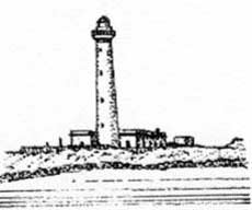
A light is shown from a prominent structure, 14m high, standing on Punta di Marsala, the SE extremity of the island. Another light is shown from a prominent tower, 38m high, standing on Punta Sottile, the W extremity of the island.
 |
|
Punta Sottile Light |
14.28 Secca del Toro (37°53'N, 12°19'E), an isolated rocky shoal, lies 2 miles S of Isola Favignana and has a least depth of 6.2m.
Isolotto Maraone, a low and barren islet, lies midway between Isola di Levanzo and the coast of Sicilia. A rocky bank, with depths of less than 5.5m, extends about 0.1 mile NW from the NW end of this islet and a dangerous wreck lies close SE of its SE end.
Isolotto Formica lies close E of Isolotto Maraone. A light is shown from a prominent tower, 20m high, standing on this islet. A large tower and a tunny factory are also situated on the islet. A small boat harbor lies at its S end.
A detached shoal, with a depth of 4.8m, lies about 0.3 mile E of the islet and several shoal patches, with depths of 16m and 17m, lie about 1 mile S and SE of the islet.
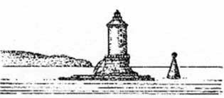
Scogli Porcelli is a group of rocks, awash, which lies about 3 miles N of Isolotto Formica. A light is shown from a tower, 25m high, standing on the rocks.
 |
|
Scoglio Porcelli Light |
Banco San Giovanni, a detached shoal patch, lies about 1 mile SE of Scogli Porcelli and has a depth of 11m.
South Coast of Sicilia and Off-lying Banks
14.29 Capo Granitola (37°34'N, 12°40'E) is wide, low, and fronted by rocks. A light is shown from a prominent tower, 35m high, standing on the cape.
From here, the coast trends ESE for 18 miles to Capo San Marco and then 24 miles SE to Capo Rossello. From Capo Granitola, the S coast of Sicilia extends 167 miles SE to Capo Passero, the SE extremity of the island. Generally, the low land fronting the sea is backed by low cliffs, hills, and low mountains. The coast is relatively free of off-lying dangers.
 |
|
Capo Granitola Light |
Caution. – Oil exploration is being carried out in the waters between the S coast of Sicilia and Malta; associated marks and structures may be encountered by vessels navigating in this area.
Unexploded ordnance is reported lie close to the S coast of Sicilia in many places.
14.30 Capo San Marco (37°30'N, 13°01'E) is an irregular reddish projection on the summit of which, at an elevation of 95m, stands a prominent round white tower with some cottages near it. A depth of 9m lies within 1 mile of the tower on Capo San Marco.
The town of Marinella stands 10 miles WNW of Capo San Marco and is fronted by a small craft harbor.
Sciacca (37°30'N, 13°05'E), a small harbor, lies 2.7 miles E of Capo San Marco and is protected by breakwaters. There are depths of 4.5 to 10m in the harbor basins, and they are mostly used by yachts and fishing vessels. The harbor can be contacted on VHF channel 16 and local pilots are available for vessels without local knowledge.
Caution. – A prohibited anchorage area, best seen on the chart, lies off Sciacca.
Capo Rossello (37°18'N, 13°27'E) is a cliffy and dark-reddish colored promontory. A light is shown from a structure, 7m high, standing on the cape.
Torre di Monte Rosso stands on a hill, 1 mile NW of the light. This tower is dark-colored with a rectangular superstructure.
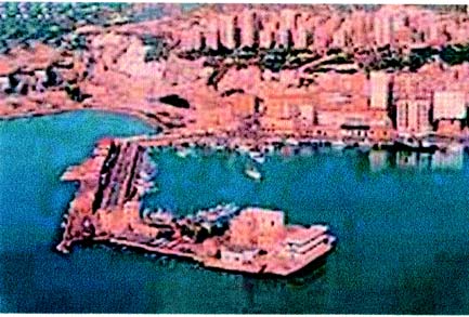
14.31 Porto Empedocle (37°17'N, 13°32'E) (World Port Index No. 40200), a small port, lies 4 miles E of Capo Rossello and is protected by breakwaters. It is the only harbor on the S coast of Sicilia which is sheltered from S winds.
Winds – Weather. – Strong SW and SE winds make entry into this harbor hazardous at times. Strong winds from the S to W sometimes cause a heavy scend to set into the harbor.
Depths – Limitations. – La Secca, a rocky shoal with a depth of 5.5m, lies 3 miles offshore, 5 miles SE of the harbor entrance.
The entrance channel has been dredged to a depth of 10.3m.
The N part of the outer harbor is shallow, but the S and SE part are dredged to a depth of 9.8m. The main commercial facilities include a quay, 500m long, with a depth of 7m alongside; and a quay, 600m long, with depths of 8.5 to 11.5m alongside. The harbor is mostly used by bulk vessels, ferries, and fishing boats. Vessels up to 132,285 dwt, 276m in length, and 8.5m draft can be accommodated.
Aspect. – Two conspicuous chimneys, 80m high, stand close W of the root of W breakwater.
Pilotage. – Pilotage is compulsory for vessels over 500 grt. The port can be contacted on VHF channel 12 or 16. The pilot boards close outside the entrance.
Anchorage. – Exposed anchorage can be obtained, in a depth of 12m, mud, good holding ground, about 0.4 mile SE of the harbor entrance.
Anchor Berth B1 (dangerous cargo and tankers) and Anchor Berth B2 (non-dangerous mixed cargo) lie, respectively, 1 mile WSW and 1 mile SE of the head of Molo di Ponente.
 |
|
Porto Empedocle |
Caution. – Due to the existence of cables, anchoring and fishing are prohibited in an area, which may best be seen on the chart, extending 6 miles seaward in the vicinity of La Secca.
Numerous fish havens, best seen on the chart, have been established along the coast between Sciacca and Porto Empedocle.
An outfall extends S from the shore 1.1 miles W of Porto Empedocle.
An anchoring and fishing prohibited area is established 12.2 miles WSW of Porto Empedocle due to the presence of unexploded ordnance on the sea floor. The area is a circle, with a radius 1 mile, centered on position 37°12.4'N, 13°17.1'E
14.32 Licata (37°06'N, 13°56'E) (World Port Index No. 40210), a small port, lies close W of the Fiume Salso, 23 miles SE of Porto Empedocle.
Winds – Weather. – In this vicinity, the most dangerous winds are from the SE. During spring, fall, and winter, such winds are often accompanied by mist and rain or sand and dust. During winter, the strongest prevailing W winds frequently bring snowstorms.
Tides – Currents. – The currents vary with wind force and direction. In the outer harbor, the prevailing NW wind can cause a current which may set E at a rate of up to 3 knots.
Depths – Limitations. – The harbor is protected by two moles and a breakwater. A training wall extends E of the harbor and prevents silting in the berthing area. There is a depth of 6.4m across the bar. A main commercial quay, 190m long, has a depth of 6.1m alongside. Bulk vessels up to 110m in length and 6m draft have been accommodated alongside. In addition, there is 230m of berthing space for fishing vessels.
Aspect. – Conspicuous landmarks include several chimneys standing close N of the W mole; Castel Sant Angelo and a disused signal station, standing at the W end of the town; and the cupola of the Church of Sant Angelo, standing in the E part of the town.
San Giacomo Light is shown from a tower, 37m high, standing 0.5 mile SE of Castel Sant Angelo, near the root of the E mole.
Pilotage. – Pilotage is compulsory for vessels over 500 grt. The pilot can be contacted on VHF channel 12. The pilot boards 0.7 mile S of the outer breakwater.
Anchorage. – Vessels can anchor, in a depth of 13m, mud and sand, good holding ground, SE of the E end of the breakwater. This anchorage is not recommended with SE and SW winds, due to the heavy seas raised.
Caution. – At night and during periods of strong W winds, the E entrance should be used. With SE winds and when leaving the harbor, the narrower W entrance should be used.
Silting is a problem in the vicinity of the harbor.
Fish havens, best seen on the chart, have been established SE and SW of the port.
14.33 Torre de Manfria (37°06'N, 14°08'E), standing 9 miles ESE of Licata, is gray, quadrangular, prominent, and has windows on its SE side. A plateau, 67m high, is located between this tower and Gela, 5 miles ESE, and its seaward side falls steeply to a beach. The plateau is backed by hills, up to 300m high, which stand 1 mile inland.
Capo Soprano, located 1 mile W of Gela, lies at the NW end of a plateau, 47m high. Monte Formaggio, 640m high, stands 12 miles N of the cape and is conspicuous. A prominent water tank stands 1.2 mile NW of the cape.
Gela (Porto Isola) (37°04'N, 14°15'E)
World Port Index No. 40220
14.34 Gela consists of a small craft harbor which is protected by breakwaters.
Port of Gela Home Page http://www.guardiacostiera.it/gela
Porto Isola, an oil terminal, lies 1 mile SE of this small harbor and consists of a jetty, with two dry cargo berths; a detached breakwater, with six tanker berths; a pier, with two chemical berths; and an offshore buoy berth for tankers.
Depth – Limitations. – A jetty, 2,800m long, extends SW from the shore and has two dry cargo berths at its head. The berths are 180m long and have depths of 8.5m and 9.6m alongside. Vessels up to 41,000 dwt, 180m in length, and 9.4m draft can be accommodated.
The jetty is protected by a detached breakwater, 1,200m long, with six tanker and LPG berths. These berths are 70 to 250m long and vessels up to 88,000 dwt and 9.6m draft can be accommodated alongside.
A pier, 350m long, has two berths at its head and can accommodate chemical vessels up to 100m in length and 6.1m draft.
The offshore buoy berth lies about 1 mile S of the detached breakwater, and a submarine pipeline extends NE from it to the shore. Tankers up to 70,000 dwt and 12.8m draft can be accommodated.
Aspect. – A conspicuous oil refinery, with several flares, is situated close E of Gela. A church, with a prominent dome, stands in the W part of the town.
Pilotage. – Pilotage is compulsory for tankers and all vessels of more than 500 grt. Pilots can be contacted on VHF channel 6, 12, or 16. Vessels must send a request for pilotage at least 24 hours and again 2 hours prior to arrival. Vessels generally berth during daylight hours only, but can unberth by day and at night.
The pilot boards 1 mile WSW of the W end of the breakwater or 1 mile SSE of its E end.
Anchorage. – Designated anchorages are, as follows:
- Area A – Vessels less than 2,000 gross tons.
- Area B – Vessels less than 2,000 gross tons.
- Area C – Vessels over 5,000 gross tons.
- Area D – Vessels over 5,000 gross tons.
- Area E – Vessels over 30,000 gross tons and bound for the ANIC Sea Berth.
- Area F – Vessels less than 5,000 gross tons.
Caution. – Two lighted oil production platforms, connected by a walkway, are situated 0.6 mile ENE of the detached breakwater.
The lighted oil production platform Perla is situated 7 miles S of Gela. A submarine pipeline extends NE from this platform to the shore. The lighted oil production platform Prezioso is situated 9 miles NW of platform Perla and is connected to it by a submarine pipeline.
Dangerous wrecks lie about 0.5 mile N of the W end of the detached breakwater and about 2.5 miles NE of platform Prezioso.
Anchoring and fishing are prohibited within areas extending up to 1.5 miles SW of the detached breakwater, extending up to 2 miles seaward of the oil refinery, and in the vicinity of any of the pipelines.
14.35 Scoglitti (36°53'N, 14°26'E), a small town, is situated 14 miles SSE of Gela and is fronted by a small craft harbor, protected by two moles. A light is shown from a prominent structure, 13m high, standing in the town.
Capo Scaramia (Scalambri) (36°47'N, 14°30'E), located 7 miles SSE of Scoglitti, is low, rocky, and fringed with rocks, some awash. A light is shown from a tower, 34m high, standing on the cape. A group of houses and a tower are situated close W of the light.
This cape should be given a wide berth. A stranded wreck is reported (1990) to lie about 1.5 miles W of the cape.
Punta Secca, a small craft harbor, lies close E of the cape.
Marina di Ragusa is situated 3 miles E of Capo Scaramia. This village is marked by a light and is fronted by a small pier.
Punta Religione, a rocky point with sandy shores, is located 5 miles ESE of Capo Scaramia and is surmounted by two prominent white buildings.
14.36 Pozzallo (36°43'N, 14°51'E) (World Port Index No. 40230), a small town, is situated 3.2 miles ENE of Punta Religione and can be identified by a large tower, 30m high, and a tall chimney which stands close NE of it. A small harbor lies close SW of the town. It is protected by breakwaters and mostly used by fishing vessels. The prevailing winds blow from W and NW.
A new harbor, consisting of an outer breakwater and an inner jetty, with 600m of berthing space, is situated close W of the town. The quay can accommodate vessels with a maximum draft of 9.3m. Pilotage is available and is compulsory for vessels of more than 500 grt. The pilot may be contacted on VHF channel 10. The pilot boards 0.5 to 1.0 mile E of Molo di Sopraflutto.
Caution. – Due to the existence of submarine cables, an anchoring and fishing prohibited area, which may best be seen on the chart, extends up to 6 miles seaward of Pozzallo.
14.37 Vega Oil Field (36°33'N, 14°38'E) lies centered 14.5 miles SW of Pozzallo. It consists of a lighted production platform, an SPM, a storage tanker, and interconnecting submarine pipelines. A racon is situated at the platform.
Isolotto Porri (36°41'N, 14°56'E), marked by a light, lies
1.2 miles offshore, 4.8 miles SE of Pozzallo. It is the largest of a group of above and below-water rocks. Reefs, with depths of 7 to 11m, lie up to 0.8 mile SW, 0.7 mile S, and 1.3 miles SSE of the rock. A detached shoal patch, with a depth of 13.7m, lies about 1.7 miles S of the rock.
Caution. – A lighted target buoy, moored about 3.5 miles SSE of Isolotto Porri, marks a firing exercise area.
14.38 Isola delle Correnti (36°39'N, 15°05'E) lies close offshore, 7.5 miles ESE of Isolotto Porri. A light is shown from a structure, 11m high, standing on this islet. It is connected to the mainland coast by a low and narrow isthmus which covers in bad weather. This islet shows up well from the E or W. Several detached shoal areas, with depths of less than 18m, lie 4.5 miles W and 3.5 miles S. A dangerous wreck, in 12m of water, lies 0.6 mile SSW of the light; a rock, awash, lies 1.6 miles WNW of the light.
Capo Passero (36°41'N, 15°10'E), located 4 miles NE of Isola delle Correnti, is the SE extremity of Sicilia. It is marked by a light and is fully described in paragraph 15.62.
Caution. – Drill rigs are frequently encountered in Malta Channel between Capo Passaro and the Maltese Islands and are generally established over the width of its expanse.
14.39 Adventure Bank (37°30'N, 12°00'E) extends from a position lying 9 miles SW of Marsala, on the W coast of Sicilia, to a position lying 14 miles N of Isola di Pantelleria. It has general depths of less than 90m.
Talbot Shoal (37°30'N, 11°41'E), a small shoal area, lies 48 miles W of Capo Granitola and has a least depth of 8.8m. A patch, with a depth of 44m, lies 5 miles S of Talbot Shoal. A small bank, with numerous pinnacles rising to depths of from 17.5 to 22m, lies about 4 miles E of Talbot Shoal. Uncharted shoals have been reported (1986) and may exist in the vicinity of Talbot Shoal.
Pantelleria Shoal (37°10'N, 12°07'E), with a least depth of 12m, lies on the S part of Adventure Bank, 25 miles SW of Capo Granitola. It consists of rock and gravel. An isolated patch, with a least depth of 13m, lies about 9 miles NE of this shoal.
14.40 Graham Shoal (37°10'N, 12°43'E), with a least depth of 6.9m, lies 24 miles S of Capo Granitola. It consists of coral and cinder and is the remains of a volcanic islet. The currents in the vicinity of this shoal are irregular both in direction and rate. They usually set SE, but a NE current, with a rate of 3 knots, has sometimes been experienced.
Terrible Bank (37°09'N, 12°53'E), with a least depth of about 14 miles N of the shallowest part of Terrible Bank. A 20m, lies 8 miles E of Graham Shoal and 27 miles SSE of depth of 16.5m was reported (1977) to lie about 7 miles NNE Capo Granitola. of Terrible Bank, but its existence is doubtful.
Depths of 29 to 33m lie within 2 miles S of the shallowest part of this bank. A depth of 28m was reported (1980) to lie about 14 miles N of the shallowest part of Terrible Bank. A depth of 16.5m was reported (1977) to lie about 7 miles NNE of Terrible Bank, but its existence is doubtful.