ITALY – WEST COAST – PROMONTORIO DI PIOMBINO TO CAPO SPARTIVENTO SECTOR 13
Plan. – This sector describes the NE and E shores of the Tyrrhenian Sea, the E side of Stretto di Messina, and the toe of the boot of Italy. The general descriptive sequence is from N to S.
General Remarks
13.1 Regulations. – Tanker vessels of 1,600 grt and over entering or leaving Italian ports and carrying, or with uncleaned tanks which last carried, petroleum, gas, or chemical products should report to a shore station before entering Italian territorial waters off Italian ports. For further details, see Pub. 140, Sailing Directions (Planning Guide) North Atlantic Ocean, Baltic Sea, North Sea, and the Mediterranean Sea.
13.2 Canale di Piombino (42°54'N, 10 °29'E) is generally about 5 miles wide and leads between the SW side of Promontorio di Piombino and the NE end of Isola d’Elba.
Punta Falcone (42°56'N, 10 °30'E), the SW extremity of Promontorio di Piombino, is a conspicuous headland which is fronted by a prominent rock. When seen from a distance, the promontory appears to be an island.
Isola Cerboli and Isola Palmaiola lie in the S approach to the channel and are fully described in paragraph 10.53.
At night, the red flashes of the blast furnaces situated in the industrial area of Piombino on the S end of Promontorio di Piombino are visible for some distance offshore. The thick smoke of the chimneys also helps to identify the area.
During the winter, the currents in Canale di Piombino are not very strong and are influenced by the prevailing winds. In summer, a current sets E and sometimes attains a rate of 2.5 knots, but it is weakened by SE winds. When winds are blowing from either of the two W quadrants, this current is strong in the vicinity of Isola Palmaiola and weak along the coast of Promontorio di Piombino.
Caution. – Due to the existence of submarine cables and pipelines, an anchoring and fishing prohibited area, the limits of which are shown on the chart, extends S and W from the SW side of Promontorio di Piombino.
Portovecchio di Piombino (42°56'N, 10 °33'E)
World Port Index No. 39740
13.3 The port of Piombino lies in the NW corner of Golfo di Follonica and is protected by breakwaters. The city of Piombino, an industrial center, is situated SW of the port and stands on the S end of Promontorio di Piombino.
Port of Piombino Home Page http://www.porto.piombino.li.it
Depths – Limitations. – Mollo Batteria extends NE and protects the harbor from the SE. Pontile Italsider extends SE and protects the harbor from the N and E. The approach has depths of 13 to 18m.
The main berths include the following:
- Ilva Pier N – 260m long, with a depth of 11.9m alongside.
- Ilva Pier S – 180m long, with a depth of 9.2m alongside.
- Magona Pier N – 50m long, with a depth of 6.7m alongside.
- Magona Pier S – 100m long, with a depth of 6.1m alongside.
- Trieste Pier – 130m long, with a depth of 5.8m alongside.
- Outer Mole – 140m long, with a depth of 7.9m alongside
There are facilities for general cargo, passenger, ro-ro, and bulk vessels. Lightering operations are also possible in an area designated by the port authorities.
The port can accommodate vessels up to 80,000 dwt, with a length of up to 260m, and a maximum draft of 11.9m.
Berthing of vessels greater than 50,000 dwt is inadvisable in darkness or bad weather. Severe S gales may force all ships in the harbor to leave berths on account of the swell and proceed to sea.
Aspect. – La Rocchetta, a rocky spur, is located 1.3 miles SE of Punta Falcone and extends 250m S from the middle of the city. A light is shown from a structure, 5m high, standing on this spur.
A prominent red belfry stands at the W end of the city and a hospital, with a slender tower, stands in the center. Il Castello, an old and massive fortress, stands on the coast, close E of the city.
A prominent disused signal station, with a flagstaff close to it, stands on the SE extremity of Promontorio di Piombino. Several blast furnaces and numerous chimneys are situated farther inland.
Pilotage. – Pilotage is compulsory for vessels over 500 grt. Pilots can be contacted on VHF channel 12 and generally board about 1 mile ESE of the Molo Batteria. Vessels should send an ETA and call on VHF 1 hour prior to arrival.
Regulations. – Vessels entering or leaving the harbor must keep to the starboard side of the approach channel and proceed at the slowest speed consistent with maneuverability. Vessels entering the harbor must give way to vessels leaving.
Vessels entering or leaving Piombino should maintain a listening watch on VHF channel 13, as follows:
- On entering – From 1 mile off the entrance until completion of berthing.
- On leaving – Immediately on leaving the berth until 1 mile off the entrance.
If requested, the Vessel Traffic Service (VTS) will provide information, radar assistance, and radar pilotage in the ap-proaches to Piombino. This service is available 24 hours. The VTS is located at the Semaphore Station and can be contacted on VHF channel 12.
Anchorage. – Anchorage A is for vessels with a draft of 7m or less. Anchorage C is for vessels with a draft of greater than 7m. Both anchorages are best seen on the chart.
Anchorage may be taken, in a depth of 9m, good holding ground, NE of the harbor entrance. However, strong S or SE winds frequently raise heavy seas in the roadstead, hampering cargo handling operations.
Caution. – Anchoring and fishing are prohibited within 350m of a line joining the heads of Molo Batteria and the approaches to Pontile Italsider.
13.4 Golfo di Follonica lies between Promontorio di Piombino and Punta Ala, 11 miles SE. Its N and NE shores are low and marshy, but the SE shore consists of a sandy beach and is backed by green hills. Torre del Sale, attached to a house, stands on the N shore of the gulf, 2.8 miles NE of Piombino. Torre Mozza, a dark tower, stands on the beach, 4.2 miles E of Torre del Sale. Its upper part is broken away.
Several large buildings, a chimney, and silos line the shore near Torre del Sale, and are fronted by a small private oil harbor. The berth, which is protected by moles, has a depth of 4.5m alongside and can handle vessels up to 2,000 dwt and 4.3m draft. An outfall pipe lies off the harbor entrance.
Follonica (42°55'N, 10 °46'E), a small town, is situated on the NE shore of the gulf, 2.5 miles ESE of Torre Mozza. It stands on the coastal plain among numerous pine trees. A church, with a slender belfry, stands in the town; a prominent tall building stands 0.2 mile SSW of the church ; and a large yellow building, with a red roof, is situated 0.4 mile SE of the town.
A pier, used primarily for the extraction of sea water for use in refrigeration plants, extends up to 1.5 miles SE of Follonica. There are depths of 7 to 8m along the N side of the head of this pier, and depths of 5 to 6m along the S side of the head.
Anchorage areas, best seen on the chart, have been established, as follows:
- Area A – Vessels with a draft exceeding 7m. Established 2 miles WSW of the pier head centered on position 42°53'N, 10 °44'E This anchorage is used by vessels due to moor at the pier. Vessels bound for this anchorage must contact Piombino and Torre del Sale pilot station prior to arrival for instructions.
- Area B – Vessels bound for the Torre del Sale power station.
- Area C – Vessels with a maximum draft of 7m.
Caution. – A prohibited area containing a dangerous wreck, which may best be seen on the chart, lies 1.5 miles W of this sea water extraction pier.
13.5 Punta Portiglione (42°53'N, 10 °47'E), located on the E side of the gulf, is relatively high and steep. A prominent two-story building stands on the flat top of the point. This point marks the end of a low beach and the beginning of a steep and rocky stretch of coast.
A concrete platform and pillar, standing close 90m SW of Punta Portiglione, is the terminus of an overhead cable ore transporter. Vessels up to 134m in length and 5.5m draft can be handled at this facility. Pilotage is compulsory for vessels over 500 tons. It has been reported (1987) that this terminus is no longer in use.
Punta Ala (42°48'N, 10 °44'E), the SE entrance point of Golfo di Follonica, is easily identified by a fort standing 0.2 mile E of it. This fort is comprised of a pink, square building with windows and it is surmounted by a tower. A two-story building, with a curved facade facing W, stands on the extremity of the point. An extensive yacht marina lies in the vicinity of the point.
A strong current, especially during the summer with NW winds, sets towards Scogli Porchetti, a ridge of above and below-water rocks, which extends 0.4 mile W of Punta Ala. Scoglio dello Sparviero, an islet, lies 0.5 mile WSW of the outer rock of the ridge, and is surmounted by an old tower. The passage between this islet and the ridge of rocks should not be attempted.
Golfo di Follonica to Baia di Talamone
13.6 Forte Rocchetta (42°46'N, 10 °48'E), a yellow building with a square tower, stands on a rocky spur, 3.5 miles SE of Punta Ala. Between this fort and Cala di Forno, 16 miles SE, the coast consists of a sandy beach, broken only by the entrance of Fiume Ombrone. Torre Galera, standing 0.5 mile NNW of Forte Rochetta, is high and surrounded by ruins. To the S of Cala di Forno, the coast is formed by cliffs. Two small towns and numerous towers are situated along this coastal area.
Castiglione della Pescaia (42°46'N, 10 °53'E) stands on the N bank of a canal. This town is situated partly on a plain and partly on a hill which is surmounted by an old citadel. A point, covered with a thick pine grove, is located 0.7 mile WNW of the town. A prominent brick-red villa, fronted by a wall, stands in the middle of the pine grove. Numerous villas, with bright red roofs, are situated along the coast between this point and the town.
Marina di Grosseto, situated 5 miles SE of Castiglione della Pescaia, is a beach resort with numerous villas and buildings standing close to the shore. Torre San Rocca stands on the beach at this resort. It is red with a white roof, but is difficult to distinguish from the nearby structures.
Fiume Ombrone, located 4 miles S of Marina di Grosseto, empties into the sea through a low beach and its mouth should be given a wide berth at all times. A house, with a red roof, stands on the beach in front of thick pine woods in the vicinity of the river mouth.
Torre Castel Marina stands 2.5 miles E of the mouth of Fiume Ombrone. Torre Collelungo stands 0.5 mile farther SSE and is an old and well preserved tower.
Between Torre Collelungo and Cala Forno, 1.5 miles SSE, the coast is rocky. Torri dell’Uccellina, standing 1.2 miles E of Torre Collelungo, consists of two towers. The NW tower is tall and reddish and the other is shorter and dark in color. A conspicuous tower, with high windows, also stands on the S side of Cala Forno. Cala Forno is a small and rocky cove, with depths in the middle of 5m, lying on the N side of a high promontory.
Torre Cannelle stands 2.3 miles SSE of Cala Forno. This tower is squat and square with an enclosing wall on its S side. Capo d’Uomo, located 4 miles SSE of Cala Formo, is surmounted by a tall and prominent tower.
Formiche di Grosseto (42°34'N, 10 °53'E), consisting of a group of three rocks, lies about 7 miles SW of the mouth of Fiume Ombrone. The N rock, 12m high and whitish, is the largest and highest of the group. A light is shown from a structure, 12m high, standing on this rock. The middle rock is blackish. The S rock is the smallest and lowest of the group. During gales, overfalls have been observed more than 0.5 mile S of it.
Caution. – It is reported that unexploded ordnance exists to the W of Castiglione della Pescaia. It lies in a depth of 6.4m within approximately 1.7 miles of the W harbor light. Vessels are advised that it is dangerous to navigate or anchor in this vicinity.
A wreck lies about 1 mile W of the tower standing on the S side of Cala Forno. It is reported to contain unexploded ordnance which has been dispersed on the bottom. Therefore, it is prohibited to anchor or fish within 1.5 miles of the coast between Cala Forno and the mouth of the Fiume Ombrone.
13.7 Baia di Talamone (42°33'N, 11°09'E) is 1.2 miles wide at its entrance and is fringed by a bank which is clearly marked by discolored water. The village of Talamone, surrounded by a wall, is situated close N of the W entrance point. An old fortress, surmounted by a tower, stands within the village walls. A light is shown from a tower, 18m high, standing on the S side of the fortress.
A prominent church belfry is situated close N of the village, but is visible only from between the S and E. A cemetery, with a conspicuous white monument, is situated about midway between the village and this belfry. A small craft harbor, protected by a mole and a breakwater, front the village.
A square tower stands on the S entrance point of the bay. Torre Saline, a massive square tower with several houses close to it, stands 3 miles farther SSE. A tall and conspicuous silo, with a flat roof and a yellow superstructure, is situated in a village, NW of Torre Saline.
During N winds, Baia di Talamone affords good anchorage, in a depth of 12m, mud, SE of the cemetery and ENE of the W entrance point.
Caution. – Anchorage is prohibited in a triangular area which extends 0.7 mile S of Talamone and may best be seen on the chart.
A dangerous wreck is reported to lie about 0.7 mile SE of Talamone.
Promontorio Argentario
13.8 Promontorio Argentario (42°24'N, 11°08'E), which is higher and more prominent than Promontorio di Piombino, appears as an island when seen from a distance. Its coasts are rugged, rocky, broken, and steep-to.
Monte Argentario, the summit of the promontory, and Poggio Canaloni, standing 0.3 mile S of it, appear as twin peaks when seen from the W or SW, because of the similarity of their outlines. During the summer, the mountains are generally obscured by haze, but in winter, a mountain with twin peaks, standing 35 miles NE of the promontory, is clearly visible in good weather. However, during strong SE winds, this mountain is covered with mist.
Conspicuous landmarks in this vicinity include Torre Argentiera, a tall and dark tower, standing 2 miles SSE of Punta Lividonia (42°26'N, 11°06'E); the television antenna situated N of Monte Argentario; and Scoglio Argentarola, a tall and light-colored building, standing on the N end of a ridge, 1.7 miles S of Punta Lividonia.
Isola del Giglio and Isola di Giannutri, which lie E and S of Promontorio Argentario, are fully described in paragraph 10.57 and paragraph 10.58, respectively.
13.9 Porto Santo Stefano (42°26'N, 11°07'E) (World Port Index No. 39790), a Naval harbor, lies on the NE side of Promontorio Argentario. It is entered between Punta Nera and Punta della Madonnetta, 1 mile WNW, and consists of two harbors, Porto del Valle and Porto Vecchio.
Porto Santo Stefano Home Page http:/www.portosantostefano.guardiacostiera.it
Winds – Weather. – Winds from the NW are often strong and raise a sea in the roadstead. Winds from the NE quadrant, especially NNE winds, are dangerous to vessels at the quays.
Depths – Limitations. – The entrance to Porto del Valle has a depth of 11m and there are general depths of 5 to 10m within the harbor. Banchino Toscana has 120m of berthing space with depths up to 7.6m alongside. Vessels up to 90m in length can be handled with drafts up to 7m, and vessels up to 110m in length can be handled with drafts up to 6.5m. Tankers up to 20,000 tons can be accommodated by mooring stern-to at the outer side of the E mole and discharging via a floating pipeline. There are also facilities for bulk, ro-ro, and hydrofoil vessels.
Aspect. – The town stands at the foot of steep hills and is dominated by an old fort and a church with a square belfry. The town of Orbetello is situated near the middle of a large salt lake which separates Promontorio Argentario from the coast. This town is plainly visible and prominent from seaward. A conspicuous tower, in ruins, stands on a point, 0.7 mile E of Punta Nera. A prominent column, surmounted by a statue, and a small white pillar stand on Punta della Madonnetta.
Pilotage. – Pilotage is compulsory for vessels over 500 tons. The pilots can be contacted on VHF channel 14 or 16. Vessels in the roadstead must not exceed a speed of 6 knots.
Anchorage. – Vessels can anchor off the harbor, in a depth of 26m, mud, WNW of Punta Nera and NW of the church.
Caution. – Due to submarine cables, an anchoring and fishing prohibited area, the limits of which are shown on the chart, extends N from the N side of Porto Santo Stefano and then SW to Isola del Giglio.
In order to avoid obstructing vessels entering and leaving the port, anchoring and fishing are prohibited in an area, which may best be seen on the chart, lying in the roadstead.
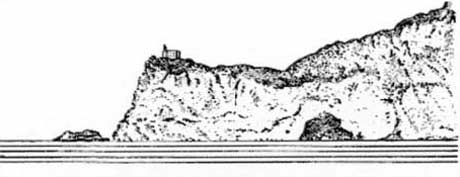
13.10 Punta Lividonia (42°26'N, 11°06'E), the NW extremity of Promontorio Argentario, is surmounted by a dis-used light structure. A light is shown from a structure, 12m high, standing close SW of the point. A prominent mast stands close SE of the point.
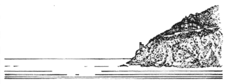 |
|
Punta Lividonia from SW |
Punta Calagrande, located 1.5 miles SW of Punta Lividonia, is surmounted by a disused signal station consisting of a building surrounded by a group of light-colored huts.
Punta Calamoresca, 0.7 mile S of Punta Calagrande, is surmounted by an old ruined tower. Scoglio Argentarola, lying 0.3 mile W of this point, is a dark above-water rock which is steep-to except at its N end. A spit, with a depth of 8m at its extremity, extends about 100m N from its N end.
Punta di Torre Ciana, steep and rocky, is the S extremity of Promontorio Argentario. A tower, with a short wall behind it, stands close within this point.
Punta Avoltore, located 1.5 miles E of Punta di Torre Ciana, consists of steep, rugged cliffs which rise sheer from the sea. These cliffs, 227m high, are surmounted by a massive and conspicuous tower.
Colle della Rocca, a hill, stands 1.5 miles N of Punta Avoltore, on the S side of Porto Ercole.
Porto Ercole (42°23'N, 11°13'E), a small craft harbor, lies on the SE side of Promontorio Argentario at the head of a small inlet. It is protected by a breakwater. From the E, the hills on both sides of the inlet appear rounded and of about the same height. Both of these hills project out conspicuously from the higher land of which they are spurs, and are surmounted by old forts. Another small but conspicuous light-colored fort stands 0.5 mile SW of the S entrance point of the harbor. Anchorage can be taken off the entrance to the harbor, in a depth of 14m, sand, NNW of the S entrance point of the inlet.
Promontorio Argentario to Civitavecchia
13.11 Punta Ansedonia (42°24'N, 11°17'E), located 3.5 miles E of Porto Ercole, is the S end of a moderately high, steep, and rocky promontory which separates two beaches. Torre Ansedonia, a ruined, barely visible tower standing on the summit of the promontory is visible from seaward. A house, with a red roof, is situated near this tower and to the W and lower down stands a prominent white house. Another tower, partly in ruins, stands on the SE extremity of the point.
Isola Formica di Burano, lying 1.7 miles SE of Punta Ansedonia, is low and black. It should not be closely approached. Between Punta Ansedonia and Civitavecchia, 30 miles SE, the coast is low, sandy, and can be approached within 1 mile, except near Punta Morelle, about midway along this stretch. The village of Capalbio, standing 6.7 miles NE of Punta Ansedonia, appears as a white patch from seaward and is conspicuous. This village is dominated by a square tower.
Montalto di Castro (42°21'N, 11°36'E), a village, is situated 2 miles inland. This village can be identified by its conspicuous church belfry and small castle which has two red towers. Torre di Montalto stands on the beach, SW of the village. It is a brick structure situated at the SE end of a long building.
Porto Clementino, situated 9 miles SE of Torre di Montalto, consists of a group of buildings standing on the beach. A conspicuous white building, painted red in its upper part, stands close S of this town and is surmounted by a tower. Another conspicuous white building is situated close NW of the town.
Tarquinia, situated 3.2 miles NE of Porto Clementino, is a large town which stands on a plateau. It has numerous towers and a conspicuous church is situated at the E end. A conspicuous red building, without windows, stands on the hillside, about midway between Tarquinia and Porto Clementino.
Torre Valdaliga, a short tower, stands on the coast, 1.8 miles NW of Civitavecchia. A power station, with three conspicuous chimneys, is situated close E of this tower.
Two structures, from which lights are shown, are situated 0.2 mile WNW and 0.3 mile W of the power station. Two piers, which carry pipes for the extraction of sea water, extend up to 0.2 mile S of the power plant and are marked by lights at their heads.
Caution. – Coastal reclamation is being carried out between a position lying 0.7 mile SE of the power station and the entrance to Civitavecchia.
Anchoring and fishing prohibited areas, which may best be seen on the chart, extends SW from the vicinity of a point lying 4 miles SE of Porto Clementino and Torre Valdaliga.
A submarine pipeline, which may best be seen on the chart, lies about 2 miles offshore along the S part of this stretch of coast.
A prohibited area has been established in the vicinity of position 42°20.0'N, 11°27.4'E No fishing, anchoring, diving, or trawling is permitted within a 500m radius of this marine reserve.
Civitavecchia (42°06'N, 11°47'E)
World Port Index No. 39810
13.12 Civitavecchia, the port for Roma, stands on a plain and is easily seen and identified from seaward. The port consists of outer and inner harbors with several basins.
Civitavecchia Home Page http:/www.port-of-rome.com
Winds – Weather. – The prevailing winds are from the SE and bring rain, especially during the winter. In the summer, the land and sea breezes usually alternate, except for variations due to atmospheric disturbances. Strong SW breezes may raise a slight sea in the outer harbor.
Tides – Currents. – Currents in the vicinity of the port follow the direction of the wind. Generally, they set NW with little strength.
Depths – Limitations. – The harbor is protected by an outer breakwater which extends 1 mile NW from the W side of Forte di Michelangelo. A shoal, marked by a lighted beacon, lies about 500m ESE of the head of this breakwater and narrows the entrance channel to a width of about 120m.
The five main harbor basins have 1,851m of total berthing space, with depths of 5.5 to 11.9m alongside. Darsena Petroli, a tanker basin, has 702m of total berthing space, with depths of 10.2 to 10.5m alongside. In addition, there is 868m of total berthing space, with depths of 7.3 to 8.7m alongside, on the inner side of the breakwater.
There are facilities for ferry, cruise, bulk, and tanker vessels. Vessels up to 49,500 dwt, 250m in length, 35m beam, and 10.5m draft can be accommodated.
Aspect. – Good landmarks in the vicinity of the harbor include a cemetery, enclosed by a stone wall, situated 0.2 mile NE of the harbor entrance; a number of silos standing in the SE part of the harbor; and Forte di Michelangelo standing close SE of the harbor.
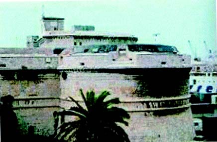 |
|
Fort di Michelangelo |
A chimney, 250m high and painted with red and white stripes, and a group of three smaller chimneys, also painted with red and white stripes, stand in the NW part of the town. Civitavecchia Light is shown from a prominent structure, 33m high, standing 1.5 miles E of the harbor entrance. A radio-beacon is situated at the light. A racon is situated at the light structure standing on the head of the outer breakwater.
An oil platform, from which a light and a racon is shown, has been established NW of Civitavecchia, 1.5 miles W of Torre Valdaligia (42° 07.4'N, 11°45.6'E). A submarine oil pipeline is laid from the platform to the shore, 1 mile NE.
Pilotage. – Pilotage is compulsory for vessels over 500 grt. Pilots can be contacted on VHF channel 14 and generally board about 1 mile from the harbor entrance.
Regulations. – A Traffic Separation Scheme has been established in the approaches to Civitavecchia. The scheme consists of a precautionary area, a 200m wide separation zone, an inbound lane SE of the separation zone, an outbound lane NW of the separation zone, and an Inshore Traffic Zone. All vessels transiting in the TSS near the port entrance must maintain a listening watch on VHF channels 14 and 16.
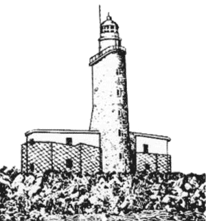 |
|
Civitavecchia Light |
Anchorage. – Vessels can anchor, in a depth of 16m, about 500m NW of the head of the outer breakwater. Two anchorage areas have been established. Anchorage Area A is for use by all vessels except those carrying dangerous cargo. Anchorage Area B is for use by vessels carrying dangerous cargo.
Caution. – Care should be exercised when entering the harbor at night as the navigation lights are not easily distinguished from the lights of the town.
An anchoring, fishing, and stopping prohibited area, the limits of which are shown on the chart, lies in the vicinity of the approaches to the port.
The above oil platform is surrounded by a restricted area, with a radius of 0.2 mile, to which entry is prohibited.
An extensive area of works in progress extends NW from the head of the outer breakwater and is best seen on the chart.
13.13 Capo Linaro (42°02'N, 11°50'E) is low and barren. It is surmounted by two high antennas which are very conspicuous from seaward.
Santa Marinella, a small town and summer resort, extends along the coast to the E of the cape. Palazzo Riviera, a conspicuous group of high buildings, is situated near the E end of this town. Anchorage may be obtained, by vessels with local knowledge, in a depth of 12m, weed, about 0.2 mile offshore, 0.5 mile ESE of Palazzo Riviera.
Torre Marangone, a large square structure, stands on the beach, 2 miles NNW of the cape. An extensive yacht and pleasure craft harbor, protected by two moles, lies close NNW of this tower.
The coast between Capo Linaro and the mouth of Fiume Tevere, 25 miles SSE, is low and slopes gently to the sea. The N part of this stretch of coast is barren, while the S part is thickly covered with pine trees. Numerous small streams flow through valleys and discharge into the sea along this stretch. Shoals and rocky patches front the shore and extend up to 2 miles seaward in places.
Caution. – Three obstructions, which may best be seen on the chart, have been placed, with depths of 18 to 22m, on the seabed between 2.5 miles NW and 1 mile W of Capo Linaro. These obstructions are used as a deterrent to trawling.
13.14 Santa Severa (42°01'N, 11°58'E) is situated on the coast, 5.5 miles ESE of Capo Linaro. This village can be identified by the houses which are enclosed within the walls of a large castle. At a short distance NNE of the castle, a conspicuous hill, with a bare and white peak, stands out from the surrounding hills and is visible at a great distance. A conspicuous red villa is situated 1.3 miles SE of Santa Severa. It is surrounded by trees and stands close N of a section of low trees. A factory, with a tall chimney, is situated close E of this villa.
Anchorage may be obtained, with local knowledge, in a depth of 11m, about 0.2 mile SW of the castle, having regard to the coastal bank and detached shoal patches in this vicinity. Several rocks lie close offshore abreast the castle and give it protection from the sea.
Monte Santo, 430m high, stands 4.7 miles NE of Santa Severa. It has a conspicuous rocky projection on the NW side and the ruins of a fort stand on the summit. A large, low, and light-colored building, which is visible from seaward, stands on the saddle between Monte Santo and Monte Sassone, 1.3 miles W. Torre Flavia, split in two and dark, stands 5.5 miles SE of Santa Severna.
Cerveteri, a village, is situated 3.2 miles NE of Torre Flavia and is clearly visible from seaward. Two villages, separated by a wooded area, stand on the coast to the SSW of Cerveteri and are prominent. A conspicuous church, partly hidden by some houses, stands at the NW end of Ladispoli, the NW village. Two conspicuous buildings, one being a well-preserved castle and the other a modern house, stand at the E end of Palo, the SE village.
The coast between Palo and Fiumicino, 11 miles SSE, is backed by low, undulating hills which gradually decrease in elevation to the S. Torre di Palidoro, a square and light-colored structure, stands 2 miles SE of Palo and can be easily identified by a low farmhouse which is situated close SE of it.
Torre del Maccarese stands 3.5 miles SSE of Torre di Palidoro and is square and shorter than the former tower. It is situated at the N edge of a dense wood which backs the coast and extends 2 miles SSE. A dangerous wreck, marked by a buoy, lies offshore 3.7 miles WSW of the tower.
When navigating at night along the coast between Capo Linaro and Capo d’Anzio, 50 miles SE, the glare of the lights of Roma (Rome) can be seen.
World Port Index No. 39820
13.15 Fiumicino stands on the N bank of Canaledi Fiumicino, just within its shallow entrance. Fiumara Grande, the S branch of Fiume Tevere (Fiume Tiber), is located 2 miles S.
Isola Sacra, which separates the two entrances, is low and flat with no distinctive features. The offshore oil terminal lies SW of the town.
Tides – Currents. – Great caution is necessary when conducting a coastal transit at night in this vicinity, especially during fresh NE winds, because of the nature of the coast, the off-lying shoals, and the various and irregular currents. In general, the current from Fiumara Grande sets perceptibly NNW because of the prevailing S winds. Its rate is variable and can sometimes reach as much as 6 to 7 knots. This is also true off the mouth of Canale di Fiumicino. When S winds are blowing freshly, the dividing line between the yellowish current and the blue sea water is distinctly visible. If a vessel is approaching from the SW, blue water will be reached after the vessel has passed beyond the river mouth. The current close inshore sometimes sets towards the land.
Depths – Limitations. – The offshore oil terminal consists of two mooring platforms connected to the shore by submarine pipelines.
These platforms, situated 0.5 mile apart, lie 2.7 miles SW of the entrance to Canale di Fiumicino. Platform R1 can accommodate vessels up to 200,000 dwt, with drafts up to 15.2m. Platform R2 can accommodate tankers up to 150,000 dwt, with drafts up to 13.7m. Each terminal is marked by a light.
Aspect. – The town of Fiumicino is situated on the N bank of a canal which forms the seaward mouth of Fiume Tevere. The large buildings and control tower of the airport stand close N of the town and are very conspicuous. A large yellow hotel and the pilot lookout station tower, 13m high, stand at the W end of the town and are prominent. A light is shown from a structure, 17m high, standing in the vicinity of the canal entrance.
Lido di Ostia, conspicuous and clearly visible from seaward, extends SE along the coast from the S entrance of Fiumara Grande. Within this resort is a prominent church, water tank, and the tower of a college.
Pilotage. – Pilotage is compulsory for berthing at the mooring platforms and for all vessels transiting the canal and river. Pilots can be contacted on VHF channel 12 or 16 and board in the pilotage zone, located about 1 mile N of the platforms. Vessels should send their ETA 72 hours and 24 hours in advance through Roma Radio.
Regulations. – Traffic zones have been established in the waters between Fosso Cupino and Tor San Lorenzo. There are three zones, as follows:
- Local Traffic Zone.
- Inshore Traffic Zone (ITZ).
- Offshore Traffic Zone.
Vessels of 50 grt and over are prohibited from navigating in the ITZ, with the following exceptions:
| Vessel Exception | Entry/Exit Point |
|---|---|
| Tankers carrying hydrocarbons, noxious substances, or dangerous chemical products in a liquid or gaseous state | Check Point Zone |
| Vessels bound for North Anchorage | Echo 1 Area |
| Vessels bound for South Anchorage | Echo 0 Area |
| Vessels leaving the ITZ | Uniform 0 Area |
The Entry/Exit Points are located, as follows:
| Entry/Exit Points | Description |
|---|---|
| Check Point Zone | A point about 11 miles SW of the breakwaters (41°40.8'N, 11°59.2'E). |
| Echo 1 Area | Area with a radius of 0.3 mile centered on a point about 8 miles WSW of the breakwaters. |
| Echo 0 Area | Area with a radius of 0.3 mile centered on a point about 6 miles SW of the breakwaters. |
| Uniform 0 Area | Area with a radius of 0.3 mile centered on a point about 6 miles WSW of the breakwaters |
Vessels bound to or from the canal must pass 3.5 miles N of Echo 1 Area or 4.5 miles S of Echo 0 and head on a direct course without passing through the anchorage areas.
Anchorage. – The anchorages are designated for use, as follows:
- Anchorage Alpha – Vessels of 30,000 dwt and over. This anchorage contains anchor berths F1, F2, and F3.
- Anchorage Beta – Vessels less than 30,000 dwt. This anchorage contains anchor berths F4, F5, and F6.
- Anchorage Delta – Vessels with a maximum draft of 3m. This anchorage contains anchor berths F7, F8, and F9.
Caution. – An anchoring prohibited area, which can best be seen on the chart, lies in the vicinity of the offshore terminal.
A spoil ground, with a radius of 0.5 mile, lies centered 2.5 miles WNW of the entrance to Canale di Fiumicino.
Navigation is restricted for merchant vessels exceeding 50 tons in the Fiumicino Coastal Traffic Zone, which lies close seaward of the 100m depth curve and for those vessels approaching or departing the oil terminal or port facilities. Fishing vessels of less than 150 tons and pleasure craft are exempted from these restrictions, but must remain clear of the oil terminal restricted area and the anchorages.
Tankers transporting liquid or gaseous hydrocarbons or dangerous chemical products must enter the inshore traffic zone through the Check Point Zone (41°40.8'N, 11°59.2'E) where vessels must obtain permission to enter from the Operations Center of the harbormaster.
Vessels requesting an anchor berth in the North Anchorage must enter the ITZ through Echo 1 Area, centered on position 41°46.2'N, 12°02.5'E Vessels requesting anchorage in the South Anchorage must report from Echo 0 Area, centered in position 41°41.8'N, 12°07.9'E All vessels leaving the ITZ must do so via Uniform 0 Area, centered on position 41°43.5'N, 12°05.8'E Each of the calling-in areas has a radius of 0.3 mile.
Vessels arriving or departing the port area must transit 3.5 miles N of Echo 1 Area, avoiding the anchorage zones.
A dangerous wreck, the position of which is approximate, lies in 41°48.3'N, 12°10.0'E, 3 miles NW of the entrance to Canale di Fiumicino.
13.16 Capo d’Anzio (41°27'N, 12°37'E) is located 25 miles SE of Fiumara Grande. The coast between consists of a light-colored sandy beach. Dense pine woods back the first 11 miles of this stretch of shore. The next 8 miles is covered by a continuous succession of buildings behind which is cultivated land with scattered groups of trees. The remaining 7 miles is formed by an almost uninterrupted line of buildings backed by a dense pine forest.
Monte Cavo (41°45'N, 12°42'E), the W peak of Monti Al-bani, stands 14 miles inland and is conspicuous. It can be identified by a large building on the summit.
Other landmarks along this part of the coast include Castel Proziano, a white tower, which rises above a group of houses 5 miles ENE of Lido di Ostia; and a large red square tower in the village of Pomezia, which is situated 3 miles inland, 14 miles NW of Capo d’Anzio.
A large industrial complex, with a high tank, is situated close inland, 4.5 miles NNW of Capo d’Anzio.
Capo d’Anzio is formed by a steep headland of porous rock. It has numerous grottoes and terminates in an arch which is clearly visible from the S. A light is shown from a structure, 21m high, standing 0.2 mile SE of the cape.
Caution. – Anchoring prohibited areas, which may best be seen on the chart, extend up to 6 miles seaward along the coast between Fiumara Grande and Capo d’Anzio.
Numerous outfalls, most marked by lighted buoys, are found along this section of the coast and are best seen on the chart.
13.17 Anzio (41°27'N, 12°38'E) (World Port Index No. 39830), a resort, is fronted by a harbor which extends along the coast E from Capo d’Anzio. The harbor is protected from the S and SW by Molo Innocenziano and from the W by Molo Neroniano.
Tides – Currents. – Along this part of the coast, the current usually sets NW parallel to the shore. Although weak under normal conditions, its strength may be increased by SE winds. During SE winds, water may be driven into the harbor.
Depths – Limitations. – There are four berths situated on the inner side of Molo Innocenziano with depths of 4.5m alongside. The harbor is mostly used by coasters, fishing vessels, and pleasure craft.
Aspect. – Prominent landmarks include a cupola standing among the trees of a cemetery, 0.5 mile NNE of Capo d’Anzio; a large cathedral standing 0.2 mile S of the cemetery; and a dark red tower standing 0.5 mile E of the cape.
Nettuno, situated 1 mile ENE of Anzio, is conspicuous from seaward because of its closely grouped buildings, large castle with rugged towers, and church with a gray belfry and high facade. This village is fronted by an extensive yacht marina.
Villa Borghese, a gray building with a flat roof, stands among a group of trees about midway between Anzio and Nettuno and is also conspicuous.
Pilotage. – Pilotage is compulsory for vessels of over 200 tons. Pilots can be contacted on VHF channel 12, 13, or 14 and board 0.5 mile SE of Molo Frangiflutti Light. Due to the continual variations in depths at the harbor entrance, local knowledge is required. Pilot service is restricted in bad weather. Entering or exiting port in adverse weather is prohibited.
Regulations. – Entering the port at night is not advisable. Vessels must contact Coast Guard Operations on VHF channel 12 or 16 prior to anchoring. Upon anchoring, vessels must also send the following information:
- National and international call signs.
- Flag, number, and port of registration.
- Length and grt.
- Type and quantity of cargo. If the vessel is empty, state the nature of the last cargo carried.
- Time of anchoring and estimated length of stay.
- Position of anchoring.
- Number of personnel on board.
- Purpose of anchoring.
- Any damage or deficiencies which could develop into an emergency situation.
Anchorage. – During good weather, temporary anchorage
can be taken, in a depth of 9m, sand, about 0.5 mile SE of the head of Molo Innocenziano. The anchorages are designated F1 through F5.Caution. – Approaching the harbor from the W or SW, care is necessary to avoid the dangers which extend SE of Capo d’Anzio.
It is reported that unexploded ordnance lies in a depth of 6.4m approximately 1 mile E of the head of Molo Innocenziano.
13.18 Capo Circeo (41°14'N, 13°04'E) is located 23 miles SE of Capo d’Anzio. The coast between is low, sandy, and uniform. A chain of several narrow lakes lies close inside the SE part of this stretch of coast.
Torre Astura, standing 7 miles ESE of Capo d’Anzio, is a conspicuous dark-colored structure which is visible from a great distance. It stands on a rock which is connected to the shore by a stone bridge with several arches.
Torre di Foce Verde, a square structure, stands on the coast, 2 miles E of Torre Astura. A small water intake pier is situated S of the tower. An extensive industrial complex, with a conspicuous tall building, is situated 0.8 mile N of the tower. The town of Latina, situated 4 miles farther NE, can be identified by a tall light-colored belfry with a tower standing near it.
Sabaudia, situated 5 miles NNW of Capo Circeo, can be identified by its slender church belfry with a tower standing near it. Both of these structures rise from among several light-colored buildings and stand out against the dark forest behind the town.
Torre Paola, standing 3 miles S of Sabaudia and at the foot of Monte Circeo, is a short and gray structure which does not show up well against the rocky slopes behind it.
Capo Circeo is the SW extremity of a promontory which is connected to the mainland by a low and flat plain. This promontory, when seen from the NW, appears as a high, pointed island. From the SE, it appears as a long undulating ridge. A disused signal station stands near the middle of the promontory. A light is shown from a structure, 18m high, standing 1 mile E of the cape.
Torre del Fico stands on the E extremity of the promontory, 2 miles E of the cape. It is round and conspicuous. Torre Vittoria and Torre Olevola stand 1 mile NNE and 2 miles NNE, respectively, of the cape. They are both square with windows and several buildings are situated in their vicinities.
13.19 Isole Pontine (Isole di Ponza) (40 °50'N, 12°58'E), consisting of a group of five islands, lies in the approach to Golfo di Gaeta. This group is divided into two distinct sections, 22 miles apart. Palmarola, Ponza, and Zannone form the NW and more important section and lie 15 to 20 miles SSW of Capo Circeo; Ventotene and Santo Stefano, forming the SE section of the group, lie about 30 miles SE of the cape.
The currents around Isole Pontine are usually weak and are greatly influenced by the winds. After heavy gales, they often run strongly in the passages which separate the islands.
Isola di Palmarola (40 °56'N, 12°51'E), the W island of the group, has high, irregular coasts.
Cala del Porto, on the W coast of the island, affords the only anchorage. La Forcina, dominating the head of this inlet, is a distinctive, light-colored, and rocky mass. From the W, it shows three distinct peaks, but from the E, it shows only one sharp summit. A promontory, 70m high, forms the S side of this inlet. It is surmounted by a small chapel and is connected to the main island by a low isthmus. Anchorage can be taken in the inlet, during offshore winds, in depths of 8m to 9m, sand.
Isola di Ponza (40 °54'N, 12°57'E), the largest island of the group, is high with a rugged and irregular outline. Isola di Gavi, lying close off the NE extremity of Isola di Ponza, is light-colored except for the red rock at its N end.
The E coast of Isola di Ponza is bare and rugged, with light-colored limestone showing at various places. Scoglio Evangelista lies 1 mile SW of Isola di Gavi and is high and conspicuous. A light is shown from the S extremity of Isola di Ponza at Punta della Guardia.
13.20 Ponza (40 °54'N, 12°58'E) is situated on the S side of Cala di Ponza, an inlet, and is fronted by a small harbor protected by moles. The harbor has depths of 2.6 to 6m and is accessible to vessels up to 60m in length and 5m draft. Larger vessels can anchor off the harbor entrance, in depths of 10 to 22m, mud. The cupola of the church and a castle, which are situated in the town, are conspicuous.
Faraglioni, lying close off the W coast of the island, is a conspicuous group of rocks. The largest and highest of which has a white patch and is especially noticeable from the S and SW.
Scoglio della Botte (40 °51'N, 13°06'E), lying 7 miles SE of Isola di Ponza, is a bare rock with steep sides, 18m high.
Isola Zannone (40 °58'N, 13°03'E) lies 3.2 miles NE of Isola di Ponza and several shoals lie on the bank which separates them. Lights are shown from the N and SW extremities of this island.
Isola Ventotene (40 °48'N, 13°26'E) rises to a summit, 139m high, close within its S extremity. A large and conspicuous yellow castle stands at the S end of a village on the NE coast of this island. A small harbor, marked by a light, fronts the village and is used by ferries.
Isola Santo Stefano (40 °47'N, 13°27'E) lies close E of Isola Ventotene and is surmounted by a conspicuous yellow building. Both of these islands are formed by the remains of an ancient volcanic crater.
Caution. – Landslides may occur along the coasts of Isola di Ponza and Isola Ventotene.
Prohibited areas marking nature reserves, best seen on the chart, have been established surrounding these islands.
13.21 Golfo di Gaeta, fronted by Isole Pontine, lies between Capo Circeo and Punta Torre Fumo, 53 miles SE. The coast is generally low and flat, except near Terracina, Gaeta, and Mondragone.
Terracina (41°17'N, 13°15'E), situated on the NE side of a shallow canal, is a resort and consists of an old city and a new city. The old city stands on the slope of a rocky hill and is dominated by two conspicuous towers and a belfry which are situated close NW of it. The new city stands on a plain at the foot of the hill and has several prominent buildings. The ruins of an ancient temple, with numerous arches, stands on the hill above the city. It is conspicuous from the E and S. A small craft harbor lies in the vicinity of the canal entrance and is protected by breakwaters. Entrance to the port is limited to vessels with a draft of 2.7m or less. The port monitors VHF channel 16. Anchorage can be taken, in depths of 5 to 15m, sand, good holding ground, E of the canal entrance clear of the prohibited area.
World Port Index No. 39860
13.22 The port of Gaeta lies at the W side of Golfo di Gaeta. The city stands on the W side of the promontory which forms the SW entrance point of Rada di Gaeta. It is divided into two parts, Gaeta-Sant’ Erasmo and Gaeta-Porto Salvo. Formia, with its two small harbors, is situated on the NW side of the roadstead.
Winds – Weather. – From September to April, winds from the E prevail; from May to August, winds from the W prevail. Generally, the velocity of these winds is minimal during the morning, increasing in the afternoon, and decreasing at sunset. Gusts from the N, which may blow suddenly in winter, are, although rare, violent and dangerous for vessels in the harbor. Strong winds from SE to SSW create a strong surf along the coast, especially at Gaeta-Porto Salvo.
Depths – Limitations. – The approach to the roadstead is deep and clear of dangers.
Porto San Antonio, in the S part of the harbor, has a depth of 6m and is reserved for naval vessels. Vessels up to 180m in length and 8m draft can be accommodated.
Bancina Caboto, a dry cargo pier, is 106m long. Vessels up to 130m in length and 6.4m draft have been accommodated alongside.
Banchina Genepesca, a ro-ro pier, is 70m long and has berths on either side with depths of 4.2 to 5m alongside.
Salvo d’Acquisto, a dry cargo pier, is 240m long. Vessels up to 7m draft can be accommodated alongside.
AGIP Oil Jetty is 200m long and has a depth of 15m alongside. Tankers up to 90,000 dwt and 14.6m draft can be accommodated.
It is reported (2001) that the offshore oil terminal berth is not in use.
Aspect. – Rada di Gaeta, a bay, lies between Promontorio di Monte Orlando and Promontorio di Scauri, 4.7 miles NE. The port lies at the SW end of this bay. Between Gaeta and Sperlonga, 8 miles NW, the coast is rugged and cliffy with several conspicuous features and objects. The promontory at Sperlonga decreases in height towards its extremity, on which stands Torre Truglia, a prominent structure. Torre Sant’ Agostino, situated 3.7 miles SE of Torre Trugli, is a structure partly in ruins which stands on a sandy beach. Torre Viola, standing 2 miles farther SE, consists of two structures, one cylindrical and the other one square and lower.
The promontory of Monte Orlando, at the SW entrance of the roadstead, is high, rocky, and surmounted by the Torre Orlando, which is conspicuous. A light is shown from a tower, 14m high, standing close SSE of Torre Orlando.
A conspicuous castle is situated 0.4 mile E of the light. Punta della Trinita, the SW extremity of the promontory, is formed by a high, brown, and rugged cliff with three vertical clefts. A chapel is situated in one of these clefts. A light is shown from a structure, 6m high, standing on Punta Stendardo, the NE extremity of the promontory. A signal station is situated close SE of the light.
That part of the city called Gaeta-Sant’ Erasmo is situated partly on a spur, which projects E from Promontorio di Monte Orlando, and partly on the N side of the promontory itself. Within this part of the city, the red tower SW of Porto San Antonio and the former convent SW of Punta Mulino can be identified. That part of the city called Gaeta-Porto Salvo is ancient and extends 1 mile N from the N side of the isthmus which connects Promontorio di Monte Orlando with the mainland. Monte Conca, 189m high, rises in slopes close N of this part of the city.
Formia, in the NW part of the roadstead, is an industrial town and can be identified by Castello Baldoni, which stands isolated on a green hill behind the it. A high chimney stands close NE of the town. The town is fronted by two small craft harbors which are protected by breakwaters.
A lighted range, which may best be seen on the chart, indicates the approach to the oil jetty.
Pilotage. – Pilotage is compulsory for vessels over 500 tons. Pilots can be contacted on VHF channel 12 or 16 and generally board within 2 miles ENE of Punta Stendardo. Vessels should send an ETA 72 hours, 48 hours, and 24 hours in advance. They should then contact the pilot 1 hour before arrival.
Anchorage. – Anchorage berths, best seen on the chart, have been established from NNW through ESE of Punta dello Stendardo. The berths are designated A through E, F, F1, F2; G1 through G4, and R.
Anchorage can be taken NE of the harbor and clear of the prohibited areas. Anchorage can also be taken off Formia, in depths of 12 to 14m, mud, good holding ground, but this roadstead should only be used in good weather during offshore winds.
Caution. – Shellfish bed areas lie along the shores in parts of Rada di Gaeta and may best be seen on the chart.
Anchorage and fishing prohibited areas lie in the approaches to the port and may best be seen on the chart.
A submarine pipeline extends up to 1.6 miles ESE and SE from the N part of the port and may best be seen on the chart.
Landslides may occur along the coast of Golfo de Gaeta. Prohibited areas, which may extend from 50 to 250m from the coast, may be established as necessary.
A prohibited area, radius 0.5 mile, surrounds the dangerous wreck SW of Terracina.
A marine nature reserve, marked by lighted buoys, has been established along the S coast of the Promontorio Monte Orlando.
13.23 Mondragone (41°07'N, 13°53'E), situated on the E side of the gulf, stands among trees at the foot of Monte Petrino, which is surmounted by a conspicuous castle. To the SE of this town, conspicuous objects include a square church tower and a water tank, showing above the trees, in the village of Castelvolturno on the SE bank of Fiume Volturno; Torre Patria, a square structure, close S of which the hills begin to approach the coast; and a dark building, with a red roof and tower, situated close inland behind several low sand dunes, 2 miles N of Torre Patria.
Anchorage is obtainable, with good holding ground, off the coast to the W of Mondragone. This roadstead is sheltered from NE winds, but is dangerous during SW winds.
To the NW of Mondragone, the village of Castelforte, which is dominated by a white tower, is conspicuous from seaward. The village of Minturno, situated 4 miles SW of Castelforte, contains two large prominent factories and a belfry. A square tower, standing close N of this village, appears to be part of the village when seen from the S.
Golfo di Gaeta to Golfo di Napoli
13.24 Isola Flegree (40 °43'N, 13°55'E), a group of three islands, lies within 10 miles of Punta Torre Fumo, the S entrance point of Golfo di Gaeta. It consists of Isola d’Ischia, Isola di Vivara, and Isola Procida.
Isola di Vivara (40 °45'N, 14°00'E), 109m high, is covered with bushes and surmounted by a tower. This small island lies at the SW end of Isola Procida and is connected to it by a bridge.
Isola Procida (40 °45'N, 14°01'E) is the NE island of the group. This island is covered mostly with vineyards. Its summit, 91m high, stands in the NE part. A prominent beacon stands on the S extremity of the island. A light is shown from a structure, 3m high, standing on Punta Pioppeto, the N extremity of the island. Several small boat harbors are situated around the island.
13.25 Isola d’Ischia (40 °43'N, 13°55'E), the outermost and largest island of the group, lies on the NW side of the entrance of Golfo di Napoli. It is separated from Isola di Procida and the mainland to the NE by Canale d’Ischia and Canale di Procida. The island, which is nearly all covered with vegetation, rises in its W part to Monte Epomeo, its summit.
From the NW and SE, the two sharp peaks of Monte Epomeo, which stand close together, appear as one.
Punta Imperatore, the SW extremity of the island, is a rocky promontory which forms an imposing mass, 227m high. A disused signal station is situated on the summit of this promontory. A light is shown from a structure, 13m high, standing on the W slope of the point.
The town of Forio stands about midway along the W coast of the island, close inland of Punta del Soccorso. A large and prominent tower rises from among the buildings in this town. The church situated on Punta del Soccorso is also conspicuous. A small harbor fronts the town and is subject to silting. It is only used by small craft and yachts.
On the N coast of the island, the village of Lacco Ameno can be identified by a prominent tower and a white house at its W end. A pier, with a depth of 6m at its head, fronts this village, but dangers lie within its head.
Casamicciola Terme, situated 0.7 mile E of Lacco Ameno, is another prominent village fronted by a small harbor. It is reported that hydrofoil ferries berth here.
13.26 Porto d’Ischia (40 °45'N, 13°57'E), a small harbor, lies on the NE side of the island. It is lined with quays and sheltered from all winds, but entry is limited to vessels up to 70m in length and 4m draft. It is reported that hydrofoil ferries berth here. This harbor can be contacted on VHF channels 13, 15, and 16.
Porto d’Ischia Home Page http://www.guardiacostiere.it/ischia
Castello d’Ischia, situated 1.4 miles SE of Porto d’Ischia, is prominent and stands on a round rock, 91m high. This rock is connected to the E coast of the island by a causeway with an arched bridge under it which forms a boat passage. A church and the ruins of a cathedral stand close to this castle.
Landmarks include a prominent yellow building standing close S of the harbor and a church and another building situated along the S shore of the harbor.
Caution. – An anchoring prohibited area extends NE between Isola d’Ischia and the mainland and may best be seen on the chart.
Vessels are warned not to anchor, fish, or engage in any form of seabed activity along the W side of Isola d’Ischia. This is due to the danger from obstructions and explosive ordnance on the bottom.
13.27 Canale d’Ischia (40 °44'N, 13°59'E), about 1.2 miles wide at its narrowest part, lies between Isola d’Ischia and Isola di Vivara. This passage is considered safer than Canale di Procida. Formiche di Vivara, a rocky shoal with a depth of 4m, lies 1 mile NE of Castello d’Ischia. This shoal is marked on its W side by a lighted beacon. Vessels should pass about midway between Formiche di Vivara and Castello d’Ischia. On the W side of the passage, the town of Ischia, which stands along the NE end of the island, is conspicuous.
The currents off the coast of Isola d’Ischia are usually weak and are influenced by the wind. However, in this passage they sometimes attain an appreciable velocity, and in good weather they become tidal and change direction every 6 hours.
Canale di Procida (40 °46'N, 14°03'E), lying between Isola di Procida and the mainland to the NNE, is 1.5 miles wide. However, because of several shoals, the fairway, which has a depth of 9m, is reduced to a width of only about 0.2 mile. The town of Procida, standing on the NE end of the island, is conspicuous from seaward. This town is fronted by a small craft harbor which is protected by breakwaters.
13.28 Golfo di Napoli (40 °40'N, 14°12'E), which is approached from the SW via the channel of Bocca Grande, is flanked on its NW side by the islands of Isole Flegree and on its SE side by Isola di Capri. The shores of this gulf contain three spacious bights; Golfo di Pozzuoli and Rada di Napoli lie on the N side while Rada di Castellammare di Stabia lies on the E side.
Vesuvio (40 °49'N, 14°26'E), which dominates the entire gulf, is easily identified from seaward because of its isolated position in a region of low land. The N coast of the gulf is less mountainous than the S side and consists of green hills with extinct craters here and there.
Monte Sant’Angelo a Tre Pizza (40 °39'N, 14°30'E) is the summit and the most conspicuous peak of the ridge which stands on the SE side of the gulf.
13.29 Golfo di Pozzuoli (40 °47'N, 14°07'E), lying on the NW side of Golfo di Napoli, is entered between Capo Miseno and Punta della Gaiola, 4.5 miles ENE.
Capo Miseno (40 °47'N, 14°05'E) is the S extremity of a promontory which consists of a large yellow rocky mass connected to the mainland by a low sandy isthmus. The seaward face of this cape is bare, steep, and rugged. A light is shown from a structure, 12m high, standing on the cape.
 |
|
Capo Miseno Light bearing 290° |
Approaching Capo Miseno, the white belfry, with a prominent cupola, at Bacoli and a large castle, standing 1.2 miles N and 2 miles N, respectively, of the cape, can easily be distinguished. Also conspicuous and readily identifiable throughout Golfo di Napoli is the convent of Camaldoli, which stands 4 miles N of Punta della Gaiola. This convent must not be confused with the convent situated at the foot of Vesuvio.
Secca della Gaiola, a shoal bank, extends up to 0.4 mile SSE of Punta della Gaiola. Several above-water rocks lie on this shoal which is marked by an articulated lighted beacon.
13.30 Miseno (40 °47'N, 14°05'E) (World Port Index No. 39920), a small harbor, lies on the N side of the Capo Miseno promontory. At the head of this harbor, a narrow canal leads into Lago Miseno. A conspicuous gray building stands on the S side of the canal. Depths of 7 to 11m lie in the outer part of the harbor, but only small craft can use the inner part which has depths of 2.3 to 5m. A range consisting of unlighted beacons leads into the port.
Baia (40 °49'N, 14°04'E), the site of ancient Roman ruins, stands at the head of a bight in the NW part of the gulf. The temple of Venus, the most conspicuous of these ruins, is formed by an octagonal structure with windows. A large yellow building stands close S of it. A small prominent church stands in the middle of the town. The small harbor, which is used by small craft, fronts the town and has a depth of 3m. Access to the port is limited to vessels with a draft of 4m or less. Anchorage can be taken, in a depth of 29m, mud, good holding ground, off this harbor.
Caution. – Following the earthquake activity in 1986, charted depths in Golfo di Pozzuoli are unreliable and vessels should exercise great caution.
Shellfish beds may lie along the shores of Golfo di Pozzuoli. A dangerous wreck with masts exposed and a stranded wreck lie close SE of the Temple of Venus ruins.
A prohibited area, best seen on the chart, lies NNE of the ruins in the Porto de Baia estuary.
A marine farm, marked by lighted and unlighted buoys, is centered 0.8 mile NE of the ruins and is best seen on the chart.
A marine farm, marked by a single lighted buoy, is located in the central part of the Golfo di Napoli NE of Miseno and S of Pozzuoli; it is best seen on the chart.
An underwater park has been established in the vicinity of Baia.
World Port Index No. 39940
13.31 Pozzuoli, a small port, lies on the NE shore of the gulf of the same name. The harbor is protected from the S by Molo Caligoliano, which extends 0.2 mile W from the city.
Winds – Weather. – Winds from the S are generally preceded and accompanied by substantial rises in the water level which sometimes inundates the quays.
Depths – Limitations. – The main facilities include Molo Caligoliano, 294m long, with depths of 4 to 5.5m alongside; Emporio Quay, with 282m of total berthing space and depths of 6.2 to 8.2m alongside; Molo Pirelli, with 445m of berthing space and a depth at its head of 7m and Banchina Villa, which has a depth of 4.5m alongside and is used by ferries. Vessels up to 6.5m draft can be handled. There are also extensive facilities for fishing vessels at the port.
Aspect. – The city stands on a small promontory. On the N side of the harbor, Monte Nuovo, covered with vegetation, stands near the coast. Farther NE, the massive and rocky Monte Barbaro is conspicuous. Within the vicinity of the city, numerous Roman ruins are prominent from seaward. On the N side of the city, the Temple of Serapide, with three columns, stands near the shore and is conspicuous. A quarry situated E of the city is also conspicuous. There are several prominent churches within the city.
Pilotage. – Pilotage is compulsory for vessels over 500 tons. The port can be contacted on VHF channel 9 or 16. Vessels must not exceed a speed of 4 knots inside the harbor.
Anchorage. – Anchorage can be taken outside the harbor, with good holding ground, mud bottom, but avoiding a sewer outfall which extends 0.7 mile SW from the S side of the town. Vessels are to anchor S of a line between the lights at Baia Fortino Tenaglia and on Molo Caligoliano. In S winds, anchorage on or to the N of this line is dangerous.
Caution. – Strong winds from the W or WSW can cause a strong undertow that makes it unsafe to remain moored at the piers.
World Port Index No. 39950
13.32 Bagnoli, a small port, lies on the E side of Golfo di Pozzuoli. The harbor area fronts an industrial center and is situated close SE of the city, which is noted for its hot mineral springs.
Depths – Limitations. – There are depths of over 18.5m in the approach to the piers.
Pontile Italsider Nord, used for unloading bulk cargo, is 647m long with depths of 11 to 12.6m alongside. Vessels berth on both sides of the outer 200m of this pier.
Pontile Italsider Sud, used for loading bulk cargo, is 384m long. A berth, 160m long, with a depth of 10.5m alongside is situated at head of the pier.
Pontile Montecantini, 245m long, has a depth of 5.4m alongside the berth at its head.
There are extensive facilities for the handling of bulk ores and minerals. Vessels up to 80,000 dwt and 12.5m draft can be accommodated.
Aspect. – The harbor is protected from the S by Isola di Nisida, an islet, which is conspicuous and is connected to the shore at the E end by Molo Cappellini. Two large cranes are situated in the harbor and several prominent chimneys stand close E of it.
Pilotage. – Pilotage is compulsory for vessels over 500 tons. Pilots can be contacted on VHF channel 9 or 12 and board about 1 mile W of Isola di Nisida.
Anchorage. – Vessels can anchor off the harbor as convenient good holding ground, sand. The depths decrease gradually towards the shore with no dangers.
Caution. – The shores of Isola di Nisida should be given a wide berth due to landslides. Porto Paone on the SW side of the island is for police and military craft only. Other vessels are prohibited from approaching, stopping, or landing in the port.
Gaiola Underwater Park has been established in the vicinity of Secca della Gaiola E of Isola di Nisida. A marine reserve, surrounded by an entry prohibited area, has been established in the area surrounding the Isola di Nisida.
World Port Index No. 39960
13.33 Napoli, at the head of Rada di Napoli, stands at the edge of a plain that extends to the foot of Vesuvio. The large port, which fronts the city, consists of an extensive harbor with several large basins which lie behind a system of breakwaters. Additional information may be found at the website below.
Napoli Home Page http://www.porto.napoli.it
Tides – Currents. – The tidal rise is negligible, being only 0.3m at springs. The water level in the harbor is mainly influenced by the wind. With S winds, it increases by up to 0.3m and with strong N winds, it decreases by an equal amount.
A constant SW set of 1 knot has been reported (1997) outside the breakwater.
Depths – Limitations. – The port is protected on its W side by a breakwater which extends about 1 mile ESE from the shore. The remainder of the port is protected from the S by a detached breakwater which extends about 0.3 mile NE and then 1.1 miles SE. The main entrance to the port is via Bocca di Ponente, which leads between the E end of the W breakwater and the W end of the detached breakwater. It has depths of 29 to 34m. The secondary entrance, at the E end of the port, has a dredged depth of 14.8m.
The harbor contains a naval dockyard and arsenal. There are extensive facilities for repairs with several floating docks and graving yards, the largest being 349m long and 45m wide.
There is about 7 miles of total quayage. This includes 80 berths, with depths of 7.3 to 11m alongside for container, passenger, ro-ro, bulk, and general cargo vessels. Generally, vessels are only limited by their drafts.
The oil terminal is situated at the E end of the harbor and comprises three piers. There are 11 berths, with depths of 7.6 to 14.3m alongside. Tankers up to 90,000 dwt and 14.1m draft can be accommodated.
Aspect. – Approaching from the W, the following landmarks can be identified:
- The convent of Camaldoli, previously mentioned in paragraph 13.29.
- The dark and massive Castel Sant’ Elmo standing on the summit of Collinadi San Martino, 2.3 miles ESE of the convent.
- Castel dell’ Ovo, which separates Rada di Mergellina and Rada di Santa Lucia.
- The white cupolas of the observatory which stands 2 miles N of Castel dell’ Ovo.
Approaching from the SE, Vesuvio dominates the NE shore of the gulf; an observatory, situated three-quarters of the way up its slope, and the lower station of the funicular railway, a little higher up and 1 mile ESE, can be easily identified.
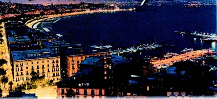 |
|
Napoli |
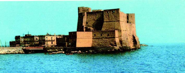 |
|
Castel dell’ Ovo |
On the coast 1 mile SE of Torre del Greco, Torre Bassano, dark and square, can be identified and a convent, standing 1 mile ENE of it, is conspicuous. Between Torre del Greco and Napoli, the red belfry of Santa Maria Pugliano and the prism-shaped belfry of San Giovanni a Teduccio, standing 1.7 miles NNW and 3.7 miles NW, respectively, of Torre del Greco, can be easily identified.
Conspicuous landmarks within the city of Napoli include the large buildings of Palazzo Reale and the iron and glass cupola situated 0.5 mile N of Castel dell’ Ovo; the skyscraper standing 0.2 mile NNE of Palazzo Reale; and the belfry of a church situated close N of Calata Villa del Popolo.
A light is shown from a prominent structure, 25m high, standing on the head of Molo San Vincenzo, the W breakwater. A racon is situated at the light.
Pilotage. – Pilotage is compulsory for vessels of over 500 grt. Pilots can be contacted on VHF channel 12 or 16. Pilots board for the W channel (Canale di Ponente) about 1.5 miles S of the main harbor entrance. Pilots board for the E channel (Canale di Levante) about 1 mile S of the red light at the head of the Diga Duca d’Aosta. All vessels arriving or departing must proceed at a speed not exceeding 6 knots.
Regulations. – A Traffic Separation Scheme (TSS) has been established in Rada di Napoli for use in the approaches to Canale di Ponente. The scheme has a 700m separation zone with inbound and outbound lanes on either side. The initial approach is on course 350 ° for 1.5 miles. A turn to course 307° is then made to enter port. The inbound lane is E of the separation zone and the outbound lane is W of the separation area.
A recommended route has been established for the approach to Canale di Levante. It is a two-way route 1 mile in length. The route is oriented N-S with its origin at the entrance light beacons.
All vessels entering or leaving the harbor must report to the Operations Center at the harbormaster’s office on VHF channel 14 and provide the following information:
- Vessel name and type.
- Destination or last port of call.
- Description of cargo.
Anchorage. – Anchorage is available in Rada di Napoli, as follows:
- Anchor Berth A1 through Anchor Berth A4 are centered S of the Molo S Vicenzo in Rada di Santa Lucia. They are intended for use by vessels carrying non-dangerous cargo.
- Anchor Berth B1 through Anchor Berth B4 are located immediately S of the Alpha anchor berths mentioned above and are for the use of vessels, except tankers, carrying dangerous cargo. Anchor Berth B3 and Anchor Berth B4 are not used when a nuclear-powered vessel is moored in Anchor Berth X4.
- Anchor Berth C1 through Anchor Berth C4 are located SE of the entrance to Canale di Levante and are for the use of tankers.
Rada di Santa Lucia, lying S of the W breakwater, is also the usual anchorage for naval vessels which generally anchor, in depths of 18 to 20m, sand, good holding ground. However, this roadstead is exposed to S winds.
Anchor Berth X3 and Anchor Berth X4, for nuclear-powered vessels, are located S of the boundary for the Bravo berths.
Anchor Berth D1 and Anchor Berth D2, located SW of the entrance to Canale di Levante, are for use when the Alpha and Bravo berths are not available.
Anchorage E in Rada di Mergellina is for use by small craft.
While at anchor vessels must maintain a listening watch on VHF channel 14 or 16.
Caution. – Caution is necessary because numerous fishing boats are likely to be encountered in the approaches to the port.
Several unlighted and uncharted mooring buoys are situated within the confines of the harbor.
Harbor traffic is heavy, with many ferries crossing at relatively high speeds.
Torre Annunziata (40 °45'N, 14°27'E)
World Port Index No. 39990
13.34 Torre Annunziata, situated at the E end of Golfo di Napoli, stands on the NE corner of Rada di Castellammare di Stabia. The small port, which fronts the town, is protected by two moles.
Winds – Weather. – Winds from the SE are reported to cause the most swell in the harbor. During heavy SE gales, the sea often washes over the outer mole. A remarkable agitation of the water in the harbor is reported to occur an hour or two before SE winds set in. During fresh NW winds, berthing alongside is reported to be dangerous.
Tides – Currents. – The currents at night, mainly caused by the discharge of Fiume Sarno, set generally NW along the coast. Between this river and Torre Annunziata, the current normally does not exceed a velocity of 1 to 1.5 knots, but with fresh E winds, it is increased considerably and felt farther offshore.
During the day, the current, because of winds from seaward, sets E, overcoming the current from Fiume Sarno and deflecting it towards Castellammare di Stabia. The velocity of this current usually does not exceed 1 knot, but with fresh W or WSW winds, it may be considerably increased.
Depths – Limitations. – There are depths up to 10.8m in the harbor. The main commercial facilities include Molo di Levante, 247m long, with depths of 8.3 to 9m alongside; and Caleta Crocelle, 300m long, with depths of 6 to 7m alongside a usable length of 198m. The harbor is mostly used by bulk vessels and fishing boats. Vessels up to 143m in length and 8.9m draft have been handled.
Aspect. – The ruins of Pompeii, destroyed by the eruption of Vesuvio in 79 A.D., are situated 1.5 miles E of the harbor. Torre Scassata, partly in ruins, is situated 1.4 miles W of the harbor and is conspicuous from seaward. Also conspicuous from the approaches is the church, with a belfry and surmounted by a cross, standing 1 mile NNW of Torre Scassata.
The town of Torre Annunziata is dominated by the tall cupola of the church of the Carmine, which stands near the head of the harbor. A prominent tower, used for bulk cargo, stands on the SE side of the harbor.
Pilotage. – Pilotage is compulsory for vessels over 500 tons. The port can be contacted on VHF channel 15 or 16. Vessels over 80m in length may only enter during daylight hours. The pilot boards 0.5 mile S of the breakwater.
Anchorage. – Three anchorage areas, which are designated A, B, and C, are located SW and W of the port.
1. Anchorage Area A, the S of the anchorages, has two designated berths, FA1 and FA2. They are located using Molo di Ponente Light, as follows:
- FA1 – bearing 196° at 0.9 mile.
- FA2 – bearing 218° at 1.1 miles.
2. Anchorage Area B, the NW of the anchorages, has three designated berths, FB1, FB2, and FB3. They are located using Molo di Ponente Light, as follows:
- FB1 – bearing 245° at 1 mile
- FB2 – earing 264° at 1.1 miles
- FB3 – bearing 269° at 0.8 mile
3. Anchorage Area C, the NE anchorage, is used for vessels carrying dangerous cargo. This anchorage has three designated berths, FC1, FC2, and FC3. They are located using Molo di Ponente Light, as follows:
- FC1 – bearing 201° at 0.4 mile
- FC2 – bearing 229° at 0.7 mile
- FC3 – bearing 256° at 0.5 mile
Caution. – A restricted area, marked by a lighted buoy, consisting of a shellfish haven, lies close W of the W mole and may best be seen on the chart.
Vessels should give the head of the W mole a wide berth.
A restricted area containing a seaplane operating area within its boundaries has been established between Torre Annunziata and Castellammare di Stabia. Anchoring and fishing are prohibited within the area.
Castellammare di Stabia (40 °42'N, 14°29'E)
World Port Index No. 40000
13.35 Castellammare di Stabia is situated in the SE corner of Rada di Castellammare di Stabia. The small port extends along the shore W of the town and is protected by a breakwater.
Winds – Weather. – Strong W and SW winds cause a heavy sea and swell in the harbor. With SE winds, strong squalls sweep down from the mountains and sometimes endanger vessels which are berthed alongside the inner side of the breakwater.
Tides – Currents. – Winds between the NE and ESE are reported to cause a weak current which sets W off the entrance to the harbor.
Depths – Limitations. – There are depths of 7 to 16m in the entrance of the harbor. The main facilities include Banchina Fontana, with 320m of berthing space; Molo Sottoflutto, with 150m of berthing space; Banchina Marinella, with 220m of berthing space; and Molo Silosi with 165m of berthing space. These quays have depths of 4 to 8.5m alongside. The harbor is mostly used by bulk vessels and fishing boats. Vessels between 130m and 150m in length, with drafts up to 8.2m, can be accommodated.
Aspect. – Several mountains stand to the S of the harbor and are conspicuous from seaward.
Scoglio di Revigliano, surmounted by a conspicuous ruined castle with a large tower, lies close offshore, 2 miles NNW of the harbor.
An industrial center, with several factories and chimneys, extends N along the coast from the town. A light is shown from a structure, 16m high, standing close S of the harbor.
A church, with a prominent bell tower, is situated 0.5 mile W of the light. Several silos stand at the head of the harbor and can be seen from seaward. Two prominent radio masts are reported to stand 2.3 miles SE of the light.
Pilotage. – Pilotage is compulsory for vessels over 500 tons. The port can be contacted on VHF channel 9 or 16. Vessels arriving must obtain an anchor berth from the Harbormaster on VHF channel 16. Vessels arriving or departing must proceed at a speed not exceeding 6 knots. The pilot boards 1 mile NW of the breakwater.
Regulations. – Vessels must arrive and depart via established traffic lanes between Waiting Area A and Waiting Area B. An inshore traffic zone has been established between the S boundary of Waiting Area A and the coast.
Anchorage. – Two anchorage areas designated A and B have been established to the W and NW of the harbor.Anchorage Area A lies W of Molo Foraneo Light and contains three designated berths, FA1, FA2, and FA3. They are located using Molo Foraneo Light, as follows:
- FA1, bearing 280 ° at 1 mile, is for vessels of 150180m overall length.
- FA2, bearing 268° at 0.5 mile, is for vessels of 100150m overall length.
- FA3, bearing 261° at 0.9 mile, is for vessels of 150180m overall length.
Anchorage Area B lies NW of Molo Foraneo. It contains one designated berth, FB1. This berth is located bearing 335° distant 0.6 mile from Molo Foraneo Light and is for vessels of 180 to 220m overall length.
Vessels arriving with dangerous cargo are prohibited from using these anchorages. Such vessels are required to wait at least 2.5 miles from the head of Molo Foraneo to receive instructions from the Port Authorities.
Castellammare di Stabia to Bocca Piccola
13.36 Punta Campanella (40 °34'N, 14°20'E) is located 10 miles SW of Castellammare di Stabia. The coast between forms the SE side of Golfo di Napoli and is dominated by a mountain range. The shore is indented by several small bays and fringed by beaches here and there.
Good landmarks include Monte Vico Alvano (40 °37'N, 14°26'E), with a sharp peak surmounted by a cross; Monte Sant’ Angelo, surmounted by a building conspicuous from the W, standing 1.5 miles NNW of Monte Vico Alvano; and the convent of Santo Francesco, which is situated near the coast, 1.5 miles NE of Monte Sant’ Angelo. This convent is topped by a lighted cross and has a black dome and a red belfry.
Vico Equense (40 °40'N, 14°26'E) stands on the edge of a tableland. Several conspicuous belfries are situated in this town, behind which stands a castle with a wall supported by arches. A prominent red church, with a tall square belfry, stands at the E end of the town. Scoglio Santa Margherita, a group of rocks, fronts the town. Large vessels can anchor, in depths of 11 to 14m, sand, moderate holding ground, about 0.2 mile NNE of Scoglio Santa Margherita.
Sorrento (40 °38'N, 14°23'E), a tourist resort, stands in the S part of a bight which lies between Punta Gradelle and Capo di Sorrento, 2.7 miles SW. The town, with numerous hotels, is situated on a high terrace in the midst of luxurious vegetation and is fronted by a small craft harbor which is protected by a mole. It can easily be identified by the bright metal dome and belfry of the church which stands close WSW of the harbor. A conspicuous light-colored hotel also stands close W of the harbor. A prominent red church, with a cupola and a belfry, stands on Punta Gradelle.
With strong SW winds and onshore winds, a current sets NE and follows the line of the coast in this vicinity. Off Sorrento, the currents are mostly weak and set W. During the winter, large vessels can anchor, in a depth of 40m, good holding ground, about 0.2 mile N of the head of the mole at Sorrento. At this time of year, winds from the SE and SW are accompanied by intermittent rain and generally back to the NE. When this occurs and because of the violence of the NE winds, vessels should leave this anchorage.
Caution. – Anchoring and fishing prohibited areas extend up to 0.5 mile seaward from the shore in the vicinity of Sorrento and may best be seen on the chart.
13.37 Capo di Sorrento (40 °38'N, 14°21'E) is located 1.2 miles WNW of the town of Sorrento. The coast between descends gradually in regular slopes, near the bottom of which are several coves. The cape is rocky and its extremity is surmounted by the ruins of a temple which consists of a few walls and arches. A ruined tower stands close SW of the cape.
Capo di Massa, located 0.8 mile SW of Capo di Sorrento, is steep and rocky. This cape is surmounted by a large and dark tower, with a prominent white building situated half way up the slope behind it.
Scoglio Vervece lies 0.8 mile offshore, about 0.9 mile SW of Capo di Massa. It is a moderately high, prominent rock and is marked by a lighted beacon. A submarine pipeline extends NW from the coast in the vicinity of this rock and may best be seen on the chart.
Caution. – An anchoring and fishing prohibited area extends along the coast from N of Capo di Sorrento to the SW and S as best seen on the chart.
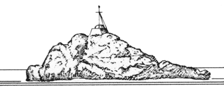 |
|
Scoglio Vervece Light |
13.38 Capo Corbo (40 °36'N, 14°20'E), located 1.2 miles SSW of Capo di Massa, can be identified by the fairly-prominent square tower standing on it. The town of Massalubrense is situated 0.5 mile ENE of the cape. A large yellow building, with a red roof and a yellow belfry, stand in this town. A prominent church, with a white facade and yellow belfry, stands at the head of the cove on the NE side of Capo Corbo. A prominent village stands 0.4 mile SE of Capo Corbo and can be identified by a tower surmounted by a smaller square tower.
Punta San Lorenzo, located 0.8 mile SSW of Capo Corbo, is formed by a high, rocky, and narrow ridge which is surmounted by a partly demolished and dark-colored tower. A prominent white pillar stands close N of the tower.
Punta di Calla Baccoli, located 0.5 mile SSW of Punta San Lorenzo, can be identified by a vertical white wall caused by excavation work. Torre Fossa, standing 0.7 mile SSE of the point, is square with heavy cornices.
Bocca Piccola (40 °34'N, 14°18'E), deep and clear of dangers, lies between Punta Campanella, the S entrance point of Golfe di Napoli and Isola di Capri.
13.39 Isola di Capri (40 °33'N, 14°14'E), separated from the mainland by Bocca Piccola, lies at the S end of Golfo di Napoli and the N end of Golfo di Salerno.
Monte Solaro, the summit of the island, stands in the SW part. It is 589m high and surmounted by the ruins of a fort. Monte Cappelletto, standing NE of it, is surmounted by a large cross.
Punta del Monaco (40 °33'N, 14°16'E) is the E extremity of the island. Capo Tiberio is located 0.3 mile NNW of Punta del Monaco and is fronted by a small rock. A light is shown from a structure, 5m high, standing on this rock.
Marina Grande (40 °33'N, 14°14'E) is situated on the N side of the island. It is the port for Capri and is fronted by a small harbor which is protected by breakwaters. The town of Capri stands 0.3 mile SE of the harbor. Anchorage can be taken in the roadstead off this harbor, keeping in mind that there are depths of over 29m at a distance of only 320m offshore. The harbor is mostly used by small craft and yachts. There are no authorized pilots, but men with local knowledge are available by request. The harbor can be contacted by VHF. It is reported that vessels should not enter or leave at a speed greater than 5 knots. Vessels leaving the harbor usually take precedence over other vessels.
The harbor is exposed to NE winds. During NE and SW winds, it is subject to a choppy sea.
When approaching the harbor, Marina Grande appears separated from Capri by a green valley of woods and vineyards which is crossed by a prominent funicular railway. Forte San Michele stands on the summit of a hill, 0.3 mile SE of the harbor. However, this fort does not show up well as its low and dark walls are the same color as the hill. Villa Torricelli is prominent and stands 0.1 mile W of the root of the NW breakwater. It consists of a white building with a turret, which resembles a belfry, and can be identified by a hotel, with conspicuous white columns and a large terrace, which stands on the slope just below it.
13.40 Punta Carena (40 °32'N, 14°12'E), the SW extremity of the island, is low and salient. It is dominated by Torre Guardia, a conspicuous tower, which stands 0.4 mile NE of the point. A light is shown from a conspicuous structure, 28m high, standing close E of the seaward extremity of the point. A radiobeacon is situated at the light.
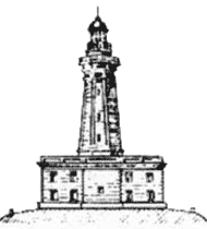 |
|
Punta Carena Light |
Punta dell’ Arcera (Punta di Vetereto), located 1.5 miles N of Punta Carena, is the NW extremity of Isola di Capri. The W coast of the island is rugged, bare, precipitous, and dotted with farms.
Marina Picolla is situated on the S side of the island, 1.7 miles ENE of Punta Carena. It is a beach resort and is backed by numerous white villas standing on the green slopes. To the E, the coast rises steeply to the ruins of a castle. La Certosa, situated 0.3 mile farther to the E, is a large and conspicuous building. Vessels with local knowledge can anchor, in depths of 7 to 10m, weed, off Marina Piccola.
Punta di Tragara (40 °33'N, 14°15'E), the SE extremity of the island, is steep and terminates in a high and conical bluff.
Isola Faraglioni, two high and conical islets, lie close together S of the point. The S islet resembles Punta di Tragara and the N islet, when seen from the E, shows a large natural arch.
The E coast of Capri, between Punta di Tragara and Punta del Monaco, is high, irregular, bare, and of a wild aspect. Monte Tiberio, which stands close SW of Punta del Monaco, is 340m high and is surmounted by a conspicuous church.
Caution. – A submarine cable area extends NE between the island and the mainland and may best be seen on the chart.
An entry prohibited area lies within the submarine cable area 1.7 miles NE of the light at Capo Tiberio.
13.41 Punta Campanella (40 °34'N, 14°20'E) is the SW extremity of a promontory which descends gradually from the summit of Monte Santo Costanzo. This mountain is 498m high and is surmounted by a white chapel which is an excellent landmark from seaward. A high brown rock, small in diameter, lies close off the point. A light is shown from a prominent structure, 18m high, standing on the point.
Golfo di Salerno, entered S of Punta Campanella, has steep and rocky shores on its N and E shores, which are backed by mountains more than 1,000m high. The head of the gulf lies between Salerno and Agropoli and is low and sandy. The gulf is generally clear of off-lying dangers, except along its NW shore where Scoglio Vivaro and Li Galli lie within 2 miles of the coast.
Li Galli (40 °38'N, 14°26'E), a group of three rocky islets, lies 5 miles E of Punta Campanella. Gallo Lungo, the E and largest of the group, is surmounted by a tower with a prominent villa standing close SE of it. A light is shown from a structure, 12m high, standing on the N end of this islet. Casteluccia and La Rotonda lie 0.1 mile W and 0.2 mile SW, respectively, of Gallo Lungo.
Scoglio Vivaro lies 1.5 miles W of Li Galli. This rock is high and rounded.
Punta di Montalto, located 1 mile E of Punta Campanella, is steep, rocky, and terminates in twin peaks. Torre di Montalto, situated close N of this point, is square and partly in ruins. Scoglio Penna, lying close SW of the point, is a small, high, and dark rock.
Scoglio Isca (40 °35'N, 14°23'E) is rounded at the top and is covered with sparse vegetation. Although high and massive, this rock is difficult to distinguish, even at a short distance from the coast.
The village of Santa Agata, situated 1.2 miles N of Scoglio Isca, stands in the middle of dense vegetation, on the crest of the coastal range, and is visible from seaward.
Punta Santa Elia, located 1.5 miles ENE of Scoglio Isca, is surmounted by a conspicuous white two-story house. The coast extending to the E of the point is rocky, steep, and eroded by the sea into the form of numerous caves.
Lo Scaricatore, the coastal area lying in the vicinity of Capo Scannato, 1.5 miles ENE of Punta Santa Elia, is less steep. The road to Solento, which is cut into the rocky slopes of Monte Vico Alvano, passes 0.2 mile N of Capo Scannato and is very prominent from seaward.
Caution. – Passage within 0.3 mile of the coast between Punta Campanella and Positano, 8 miles ENE, is reported to be prohibited between June and September.
Nature reserves have been established along the coast between Punta Campanella and Positano, as well as surrounding Li Galli. Anchoring and fishing are prohibited in the reserve areas which are best seen on the chart.
13.42 Positano (40 °38'N, 14°29'E) stands at the mouth of a wide valley which opens out like an amphitheater between the slopes of Monte Commune and Monte San Angelo a Tre Pizzi. This town can easily be readily recognized, since it is the only one between Punta Campanella and Capo Sottile, where the buildings extend all the way down to the sea. Anchorage can be taken by small vessels about 0.2 mile seaward of the town, over a sandy bottom and sheltered from N winds. However, vessels should leave this anchorage at the first sign of S winds, especially in winter.
Capo Sottile (40 °36'N, 14°32'E), located 2.5 miles ESE of Positano, is high, steep, and overlooked by a slender tower, partially in ruins, which has a small ruined fort at its foot.
Capo di Conca, located 2 miles farther E, is rocky and surmounted by a prominent yellow quadrangular tower. A large yellow building, with a central tower, surmounts a mountain, which stands NW of the cape, and is an excellent landmark from seaward. When seen from the E or W, it appears detached from the slope of the mountain behind it. The village of Conca dei Marini stands 0.3 mile N of the cape. It can be easily recognized by the conspicuous church, with its tall yellow belfry surmounted by a small cupola.
13.43 Amalfi (40 °38'N, 14°36'E), a small harbor, is protected from the SW by a breakwater and from the E by a jetty. Both the breakwater and jetty are quayed on their inner sides. Small vessels up to 150m in length and 4m draft can be accommodated. The harbor can be contacted on VHF channel 14 or 16.
Winds in the vicinity of the harbor, during autumn and winter, are mostly from the S and SE. They are generally violent and blow for a few days, sometimes veering to the SW. In summer, gentle land and sea breezes prevail. When Punta Licosa, located at the SE end of Golfo di Salerno, is clearly visible, N winds are likely. When Capo d’Orso is hidden by clouds or mist, E winds may be expected.
It is reported to be dangerous to enter Amalfi during strong winds from the NE to SE, or to remain there with a SE wind because of the strong backwash it causes.
Landmarks in this vicinity include Torre dello Ziro, an isolated tower, standing on a mountain ridge to the E of Amalfi; Torre di Pogerola, a tower partly in ruins, standing on a hill to the W of the town; the emerald green cupola of the prominent cathedral situated in the town; and Hotel Cappuccini, situated in a cleft of an overhanging cliff on the coastal road to the W of the town.
13.44 Atrani (40 °38'N, 14°36'E), a village, is separated from Amalfi by a steep, high, and rocky ridge which is dominated by Torre dello Ziro. This ridge terminates at the coast in Capo di Atrani, a high plateau, which is surmounted by a tower. A prominent church, with a maroon and white belfry and three small cupolas of green glazed tile, stands to the E of the town; this church faces away from the sea. Anchorage is obtainable off this village, in a depth of 15m, about 350m offshore.
The town of Minori, situated 1.5 miles NE of Atrani, stands at the mouth of a valley which is dominated by Monte Mandrino, 484m high. A dark church, with a red roof, stands on the summit of this mountain and is clearly visible from all directions. It is situated in an isolated and dominant position among green forests.
Torre Mezzacapo, a massive square building, stands on a rocky point, 0.3 mile ESE of Minori. Hotel Miramare, a yellow building with a red roof and three cylindrical spiral turrets, stands close N of this tower. A sandy beach extends between the tower and Punta Salicerchio, 0.8 mile ESE.
The town of Maiori is situated close behind the foregoing beach. It stands in the form of an amphitheater at the mouth of a valley and is overlooked by Monte dell’ Avvocata, 1,002m high. A dark-colored convent, with a red roof and a square belfry, stands on the W side of this mountain, a little below its summit. It is visible from any direction and is especially prominent from the S. A prominent church, with a dome, belfry, and clock stands in the town and can be seen from seaward. Anchorage can be taken, in depths of 14 to 20m, good holding ground, not less than 0.2 mile offshore. However, it is reported to be dangerous to remain at this anchorage during S winds.
Torre Badia, light in color, stands on a high cliff, 1 mile ESE of Punta Salicerchio. Two conspicuous buildings are situated on the slopes of a hill above this tower.
Caution. – Several submarine pipelines extend up to 1 mile from the coast between Positano and Porto di Salerno. The outer ends of these pipelines are marked by buoys and anchoring is prohibited in their vicinities.
Due to alluvial deposits in the vicinity of Minori and Maiori, the beaches extend notably seaward and there may be less water than charted. Care must be taken when anchoring in these roadsteads.
Currents in the bight between Capo di Atrani and Capo d’Orso generally set W and are reported to increase in velocity when strong S winds are forecast.
13.45 Capo d’Orso (40 °38'N, 14°41'E), a short and squat promontory, is the seaward termination of the S slopes of Monte Piano, 390m high, which stands 0.5 mile N of it. A light is shown from a structure, 5m high, standing 0.4 mile W of the cape.
Torre d’Erchie stands close NE of the E extremity of the cape. It is prominent and is situated on a small rocky projection.
Cetara, a town, stands at the entrance of a deep ravine, 0.7 mile NNE of Torre d’Erchie. It can easily be identified by a square tower, surmounted by a two-story building, standing at the E end.
Punta Fuente, located 2 miles NNE of Capo d’Orso, is barren and rocky. Punta d’Albori, located 0.5 mile farther NNE, can easily be identified by a tower, with a square base, standing on a high rocky slope close WNW of it. This tower is surmounted by a one-story battlemented house with three large arches and a sloping roof.
Scogli due Fratelli, a group of above-water rocks, lie close off the coast, about 0.5 mile ENE of Punta d’Albori. The houses of the village of Marina di Vietri are situated along the beach between the latter point and the group of rocks.
Torre Crestarella stands on a short and rocky promontory, 0.2 mile NE of Scogli due Fratelli. It is surmounted by a structure having three arches and a red roof.
Anchorage can be taken, in a depth of 11m, sand, ESE of the tower standing on Punta d’Albori. Small vessels can take temporary anchorage, in depths of 5 to 6m, off Marina di Vietri, sheltered from NW and NE winds.
Porto di Salerno (40 °40'N, 14°45'E)
World Port Index No. 40040
13.46 Salerno stands in the extreme N part of Golfo di Salerno and is built partly near the sea and partly on the slopes of the heights behind it. The port fronts the city and is protected by breakwaters.
Winds – Weather. – Winds from the N, which blow down from the mountains in violent squalls, can put a strain on the moorings of vessels. Winds from the S and SW cause a surf, impose a heavy strain on moorings, and can make entry difficult.
Tides – Currents. – Tides are almost negligible. With the approach of strong S or SW winds, the water level in the harbor is usually raised and the quays may become inundated. As weather conditions change, the water level drops rapidly and causes strong currents which make entry difficult.
Depths – Limitations. – The entrance is 260m wide and has a depth of 12m. The harbor consists of three main basins which have 1,460m of total quayage. There are twenty four berths, up to 380m in length, with depths of 6.5 to 11m alongside. There are facilities for general cargo, ro-ro, and container vessels. In addition, fishing vessels and pleasure craft use this harbor. Generally, vessels up to 220m in length and 10.8m draft can be accommodated.
Aspect. – The ruins of a prominent castle stand on the crest of a hill overlooking the town, 1.5 miles NE of Torre Crestarella. Monte San Liberatore, 462m high, stands NW of the harbor. When viewed from the SE, its peak has a profile which resembles the beak of a bird and can be recognized from a considerable distance. The white building of a disused convent, with a small belfry and cupola, can be seen on the E side of this mountain, near its summit. A conspicuous cross, 18m high, stands near the summit and is illuminated from 1900 to 2300 during the summer and from 1700 to 2100 during the winter. The cupola of St. Giovanni Battista is conspicuous from seaward.
The tall chimney of a cement works, which is situated close E of Fiume Irno, stands E of the city and is prominent. From seaward, and especially from the S, the conspicuous viaducts and the supporting walls of the panoramic road leading into the city can be seen at a great distance.
A light is shown from a structure, 5m high, standing on the elbow of the E breakwater. A light, with a racon, is shown from a structure, 13 m high, standing at the end of the E breakwater.
 |
|
St. Giovanni Battista |
Pilotage. – Pilotage is compulsory for vessels over 500 grt; national and foreign naval vessels are reported to be exempt. Local knowledge is advisable. Pilots can be contacted on VHF channel 14 or 16 and generally board close outside the harbor entrance.
Anchorage. – Vessels waiting to enter the harbor should find anchorage as convenient off Punta di Fuente.
Four anchorage areas, designated A, B, C, and D, have been established S of the outer breakwater. These areas must be used unless other arrangements have been made with the port authorities.
Caution. – The entrance requires a sharp turn after passing the head of Molo di Ponente, the W breakwater.
13.47 Torre Angellara (40 °39'N, 14°49'E), situated 4 miles SE of Salerno, is a massive square building surmounted by a small house. It is easily recognized by a large red palace which stands immediately to the N of it. Monte Giovi, 299m high, stands 1 mile ENE of the tower and is characterized by a huge cliff at its summit.
The coast between this tower and Agropoli, 18 miles SSE, is mostly backed by a wide coastal plain. An unmarked semi-submerged rubble breakwater, 100m long, has been established 0.2 mile SE of Torre Angellara.
Torre Tusciano, standing 6 miles SE of Torre Angellara, is white and surmounted by a small house. It is sometimes not visible from seaward due to the presence of tall eucalyptus trees. A group of modern buildings are situated close N of this tower and a white factory building, with two silos shaped like towers, stands close S of it. This latter building is low and long and stands out against the green background of the trees which cover the flat area behind it.
Fiume Sele is located 6 miles SSE of Torre Tusciano. The river mouth is not easily distinguished, but it has tall trees lining the banks for some distance inland and can be identified from seaward by this characteristic.
Paestum (40 °25'N, 15°00'E), an ancient Greek city in ruins, is situated 5 miles SE of the mouth of Fiume Sele and nearly 1 mile inland from the coast. It has several temples still standing which are visible from 6 to 7 miles offshore.
A cylindrical tower is situated near the coast, SW of these ruins. This tower can be identified by the small houses which surround it, and by the vegetation which covers a large part of it and the houses.
Monte Sporano, 1,082m high, stands 4.5 miles E of Paestum. This mountain along with Monte Sottano, standing 1.5 miles SW, dominate this section of the coast.
Torre San Marco, prominent and slender, stands at the foot of a hill near the coast, 2.7 miles S of Paestum.
Caution. – It is reported that the depths off this part of the coast are irregular and are decreasing.
A wreck, with a depth of 15m, lies about 2.7 miles NW of the cylindrical tower.
13.48 Agropoli (40 °21'N, 14°59'E), a prominent town, is situated on the SW side of a short, steep, and rocky promontory of which Punta del Fortino is the W extremity. The NW side of this promontory has numerous prominent grottoes. A light is shown from a structure, 10m high, standing on Punta del Fortino.
Anchorage can be taken NNW of the town, in a depth of 13m, sand, good holding ground, about 0.7 mile NNW of the light. However, this anchorage is exposed to winds from the SW through W to NW. In winter, strong NW winds, which sometimes last for three days, raise a heavy sea in this roadstead.
A dangerous wreck lies offshore, about 0.5 mile W of the town.
Between Punta del Fortino and Punta Paglian, 3 miles SW, the coast is high, steep, and fringed with rocks. Then to the town of Santa Maria di Castellabate, located 2 miles farther S, the coast is low, sandy, and uniform. The coast extending to the S of this town comprises a sandy beach and rises gradually inland to cultivated hills, the slopes of which are dotted with houses.
Santa Maria di Castellabate consists of a long row of houses which stand along the rocky shore. From seaward, a large white building is very visible. It seems to stand above a prominent viaduct with eight large arches on each of two levels.
The town of Castellabate stands 0.5 mile SSE of Santa Maria di Castellabate and can be recognized from various directions by a castle and other houses which are situated on the summit of a hill.
The coast between Castellabate and Punta Torricella, 1.5 miles SW, is hilly and scattered with houses which form the village of San Marco di Castellabate.
A small harbor, protected by a mole, lies 1 mile SW of the castle at Castellabate. Anchorage can be taken, in a depth of 20m, sand, about 0.5 mile offshore from Santa Maria di Castellabate. However, this anchorage becomes untenable with winds from the SW and NW quadrants. Anchorage can also be taken, in a depth of 10m, good holding ground, about 250m offshore from San Marco di Castellabate.
Golfo di Salerno to Golfo di Policastro
13.49 Punta Licosa (40 °15'N, 14°54'E), a low salient point, is the S entrance point of Golfo di Salerno. From seaward, the best landmark in this vicinity is the village church of Sant’ Antonio, which stands on the summit of a hill, 176m high, 0.5 mile E of the point. Torricella, a conspicuous hill, 326m high, stands 1.5 miles ESE of Punta Licosa and appears as two peaks, except from the S. It is surmounted by a ruined tower.
Isolotto di Licosa, lying 0.3 mile W of the point, is low and yellowish like the mainland and not easily distinguished from the NW. This islet lies on a rocky area, with depths of less than 5m, which extends up to about 0.5 mile W of Punta Licosa. Depths of less than 10m lie up to 1 mile W of the point. A light is shown from a structure, 9m high, standing on this islet.
Secche di Licosa, which consists of patches of rock and sand with a least depth of 6m, lies centered about 1.2 miles W of Isolotto di Licosa.
Between Punta Licosa and Punta dell’ Ogliastro, 2 miles SE, the coast is rugged and fringed by rocks both awash and above-water. Punta dell’ Ogliastro, low and flat, is fringed by reefs and shoals which extend up to about 0.1 mile from it. Torre dell’ Ogliastro, square and in ruins, stands near the seaward extremity of the point.
13.50 Agnone (40 °13'N, 15°00'E), a village, is conspicuous from seaward. Anchorage can be taken in a suitable depth, with a good holding ground of mud and sand, in front of this village. Shelter is afforded from N and NE winds, but this roadstead becomes untenable with onshore winds.
This part of the coast is dominated by Monte Madonna della Stella, 1,130m high, which stands 3.5 miles ENE of Agnone. The light-colored summit of this mountain is surmounted by a dark-colored church. Numerous villages, all visible from seaward, are situated on the lower slopes of Monte Madonna della Stella.
The village of Acciaroli, situated 3 miles SSE of Agnone, consists of old houses which line the rocky coast. A large tower, on a square base, stands on a rocky ridge in front of this village. In addition, the white belfry and pyramidal spire of the church show up well from seaward. A small fishing harbor fronts this village.
Torre di Caleo, standing 1 mile SE of the village, is partly in ruins, but is visible in clear weather.
La Punta, a promontory, is located 1.2 miles ESE of Torre di Caleo and is fringed by rocks, awash. It is surmounted by a tower which has been almost completely demolished.
The coast in the vicinity of Acciaroli and La Punta should be given a berth of at least 1 mile. Seas break on the numerous dangers in this area.
13.51 Marina di Casal Velino (40 °11'N, 15°07'E), a prominent village, can be identified by a square tower, in ruins, which stands on a steep ridge, near the beach. The village of Castelnuovo Cilento, situated 3.5 miles NE, can be easily distinguished from seaward as it stands on a hill which has gentle slopes and is covered with olive trees; a tower dominates the village.
The coast extending to the SE of Marina di Casal Velino is low and sandy. It is dominated by high hills that rise on either side of the wide and rich valley of the Fiume Alento. The village of Castellamare di Bruca, standing 0.5 mile E of the mouth of Fiume Alento, is situated on a rocky shrub-covered hill and is separated from the sea by a wide beach. A tower on a round base stands in the village and is conspicuous from seaward.
The village of Ascea, situated 2 miles SE of the mouth of the Fiume Alento, stands on the slopes of the hills behind the beach. It is prominent and is situated in the midst of olive groves. A church, with a red roof and cupola, stands close NW of the village and is conspicuous.
Torre del Telegrafo, square and in ruins, stands 1 mile S of Ascea on a coastal spur which descends steeply to a low and rocky point. An isolated and above-water rock lies close W of the extremity of this spur.
13.52 Marina di Pisciotta (40 °06'N, 15°14'E), situated 2.5 miles SE of Torre del Telegrafo, stands on a gravel beach. This village can be easily recognized by a square tower, with battlements, standing on a plateau at its SE end. The village of Pisciotta, situated 0.5 mile inland of the tower, stands on a conical hill covered with olive groves. The railway station at Pisciotta, a three-story red building, is situated above the village and is conspicuous. A prominent railroad bridge, with several arches, stands in this vicinity.
Anchorage is obtainable, with local knowledge, off Marina di Pisciotta. The best berth, in depths of 15 to 20m, weed and rock, lies about 700m offshore, but the use of an anchor buoy is advised. Landing from boats is possible under the lee of a ridge of rocks, awash, which extend from abreast Marina di Pisciotta.
Torre Ficaiola, square and reddish, stands 0.8 mile SE of Marina di Pisciotta. This tower is reported to be hard to distinguish from the land behind it.
Capo Palinuro (40 °02'N, 15°16'E), a flat-topped promontory, is 203m high and projects W from the lower wooded hills of the adjoining coast. It sides are steep and rocky. A light is shown from a structure, 24m high, standing close to a low and massive tower on top of the cape near Punta del Telegrafo, its SW extremity. A disused signal station is situated on a hill, 0.3 mile E of the light.
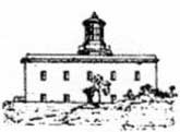 |
|
Capo Polinuro Light |
Porto Palinuro, a small bight with sandy shores, is formed on the N side of the cape. It lies between the village of Palinuro and Punta del Fortino, 0.5 mile WSW. An ancient fort stands on the latter point, and several houses are situated along the beach at the head of the bight.
Punta della Quaglia, the NW extremity of Capo Palinuro, is surmounted by Torre Formicola, an ancient tower.
Anchorage can be taken in Porto Palinuro, in a depth of 18m, good holding ground, ENE of Torre Formicola. Good shelter from SE winds is afforded in Porto Palinuro. During SW winds, although sheltered from the wind itself, vessels are sometimes affected by the heavy seas that sweep back from the coast to the anchorage. The last phase of bad weather is particularly dangerous, when the wind veers violently W and NW before becoming calm.
The S side of Capo Palinuro is reddish and rocky. Torre Calafetente stands near the edge of the coast, 0.7 mile E of the light.
Scoglio della Marina, lying 320m E of the SE extremity of the cape, is a tall rock. It is grayish in color with steep cliffy sides.
Caution. – Several dangerous wrecks lie in the vicinity of Capo Palinuro and may best be seen on the chart.
13.53 Ancoraggio della Molpa (40 °01'N, 15°19'E), a wide bight, is entered E of Scoglio della Marina. A rounded and yellowish cliff, 138m high, separates the mouths of two rivers at the head of the bight. This cliff appears to overhang a beach at its foot and is surmounted by the inconspicuous ruins of Castello di Molpa.
Monte Sant’Antonio, 510m high, stands 2.7 miles E of the E entrance point of the bight and dominates the area. A white chapel stands on the S slope of this hill, near the summit. Anchorage can be taken, in depths of 9 to 10m, in the W part of the bight.
Torre Finosa, whitish and square, stands near the edge of the cliffs, 0.9 mile SSW of the summit of Monte Sant’Antonio. Isolotto di Camerota, a large rock, lies about 150m offshore, 1 mile SE of the tower. It is low and covered with vegetation. A tower, with a square base and a large cornice, stands on the coast, close N of this islet.
13.54 Marina di Camerota (40 °00'N, 15°5'E) is situated 0.5 mile E of Isolotto di Camerota. This village stands on the E side of a rocky promontory which separates two bights. It is dominated by a prominent belfry with a terraced roof. Torre del Poggio, 10m high and light-colored, stands close inland at the E end of the village.
The village of Camerota is situated on a hill, 2 miles N of Marina di Camerota. Torre di Punta Zincalo stands on the E entrance point of the bight in which Marina di Camerota is situated. This tower is square, squat, and dark. Anchorage is obtainable off Marina di Camerota. A good berth, in a depth of 13m, sand, is W of Torre di Punta Zincalo.
The wreckage of an aircraft is reported to lie in a depth of 10m, about 200m off Marina di Camerota.
Golfo di Policastro
13.55 Golfo di Policastro (40 °03'N, 15°35'E) is entered between Punta Iscoletti, located 7 miles ESE of Capo Palinuro, and Isola Sant’Ianni, 14 miles E. This gulf is high and rocky on its W and E sides, while its head is low and sandy. The waters of the gulf are deep and the shores are generally free of dangers.
The gulf is surrounded by mountains which rise at a relatively short distance from the coast. Monte Bulgheria, 1,225m high, stands 5 miles N of Punta Iscoletti; Monte Coccovello, 1,511m high, stands 5 miles N of Isola Sant’Ianni; and Monte San Biagio, 623m high, stands 1.3 miles NNE of Isola Sant’Ianni. This latter mountain is conspicuous and is easily recognized by the belfry of Maratea standing on its N slope and by a statue of Christ surmounting its summit. This statue is reported to be illuminated at night between June 1 and September 30.
During S winds, vessels in the gulf are sometimes exposed to heavy seas which get more violent closer to the coast. However, these S winds generally do not last long. Winds from the W and NW are generally stronger and last much longer. If the slopes of Monte Bulgheria are covered with cloud, usually S winds are indicated. When Monte Coccovello can be seen amid streaks of cloud, locally known as Secce, it is very probable that strong S winds can be expected.
Punta Iscoletti, arid and light-colored, is high with steep rocky sides and is surmounted by a tower. Torre Mozza, standing 1.3 miles NE of the point, is light-colored, square, and partly demolished. Torre Spinosa, square with a large cornice, stands on the lower slope of a coastal hill, 2.5 miles NE of Torre Mozza. This tower is prominent from seaward and a high radio antenna rises from its base.
13.56 Scario (40 °03'N, 15°29'E), a small town, is situated on the NE shore of the gulf. This town has a prominent church, with a cylindrical belfry and a square tower, which stands near the beach at its NE end. A light is shown from a structure, 12m high, standing near the S end of the town. A small craft harbor fronts the town.
Anchorage off Scario is the best in the gulf for large vessels and is sheltered from winds from the WSW through N to NE. The best berth, in a depth of 13m, good holding ground, lies about 500 to 600m offshore, ENE of the light.
Torre dell’Oliva, standing 0.7 mile NNE of the light at Scario, is a large square structure situated low down and close to the sea. A masonry bridge, which is prominent from the SSE, stands 1 mile NE of the tower. It spans the Fiume Bussento, 0.2 mile upstream from the river mouth.
The town of Policastro del Golfo stands on the slopes of a conical hill, 87m high, 0.8 mile NE of the mouth of Fiume Bussento. An ancient square tower, with a large ruin situated close E of it, stands on the summit of this hill. The land slopes down from this hill to the valley of Fiume Bussento and is covered with olive trees. A small craft harbor fronts the shore at Policastro del Golfo.
Villamare (Marina di Vibonati), a village situated 3 miles E of Policastro del Golfo, can be identified by a prominent church with a dark and square belfry. A small hill, surmounted by a tower on a square base, stands at the E end of this village and is surrounded by a group of houses.
13.57 Sapri (40 °04'N, 15°38'E), a small town, stands at the back of a shingle beach at the head of a cove, 1.5 miles E of Villamare. Punta del Fortino, the W entrance point of the cove, is low, rocky, and marked by a light. Capo Bianco, the E entrance point of the cove, is surmounted by a tower in ruins. A prominent church belfry is situated in the E part of the town and a conspicuous hospital building stands in the center of the town and resembles a Swiss chalet.
Anchorage can be taken, with local knowledge, in a depth of 11m, in the outer part of the cove. Small vessels can anchor, in a depth of 5m, about 0.5 mile off the head of the cove.
A breakwater extends from the E side of the cove and protects a pier which is situated at the head. This pier is used by fishing boats and small craft. The cove is completely open to the SW and sometimes winds from that quadrant render the anchorage untenable.
The coast extending SE of Capo Bianco is high, rocky, and irregular. Scoglio Scialandro, an above-water and blackish rock, lies 0.2 mile S of the cape. This rock can be easily distinguished from the SE, but from other directions, it is hardly visible because it has the same color as the coast behind it.
Torre delle Grive, standing 1.5 miles SE of Capo Bianco, is situated on Punta delle Grive, a rocky spur, which rises perpendicularly from the sea. This tower is the same color as the surrounding rock and is not easily distinguished from seaward. A dangerous wreck, with a depth of 8m, is reported to lie about 300m S of the tower.
The village of Acquafredda, consisting of a group of houses set among olive groves, is situated 1 mile ESE of Punta delle Grive. A viaduct, with high arches, can be seen to the N of the village and several other prominent arches stand in an elevated position, 1 mile SSE of the village.
13.58 Torre Santa Venere (40 °00'N, 15°42'E) stands on a small promontory fronted by rocks which extend up to 0.2 mile offshore. This tower can only be distinguished from a short distance to seaward. Maratea, standing on the N slopes of Monte San Biagio, is situated 1 mile E of Torre Santa Venere. This town is very visible from the W, and even at a great distance, can be identified by a belfry and a spire which dominate the houses. Maratea is not visible to vessels approaching from the SW quadrant.
The summit of Monte San Biagio is very sharp and is surmounted by a large statue of Christ, which differentiates it from the surrounding peaks. The statue is erected on a gray column which stands on the W slope in the center of a circular terrace with a balcony.
Porto di Maratea, a small cove, is entered 0.5 mile SE of Torre Santa Venere. Torre del Porto stands on its SE entrance point. This cove is protected by a mole and a short breakwater and has a small harbor which is used by small craft and fishing boats.
Isola Sant’Ianni (Isola Sant’Janni) lies about 0.2 mile offshore, 1 mile S of Porto di Maratea. This islet is 8m high and is surmounted by a black cross. Its lower part is jagged and covered with vegetation. A depth of 12m lies in the narrow fairway between the islet and the mainland, but this passage should not be attempted without local knowledge. Secca della Giumenta, with a least depth of 1.3m, lies about 0.2 mile offshore, 0.4 mile SE of Isola Sant’Ianni.
Golfo di Policastro to Capo Bonifati
13.59 Torre di Caino (39°57'N, 15°44'E), square and in ruins, stands on the summit of a rocky promontory, 1.7 miles SE of Isola Sant’Ianni. It appears conical from the NW and SE.
Fiumara di Castrocucco flows into the sea, 1.5 miles SE of Torre di Caino. This river is spanned by a bridge, with five arches, which stands 0.5 mile above its mouth. The banks of the river are bordered by tall trees and many greenhouses can be seen situated in their vicinity. The village of Praia a Mare, situated 2 miles farther SE, extends along a wide beach at the base of Serra Vingiolo. The summit of this hill is 524m high and stands 0.5 mile E of the village. A long building, with a prominent chimney, stands out along the beach due to its light color. The chimney of a woolen mill nearby is also conspicuous.
Isola di Dino (39°52'N, 15°46'E), 65m high, has bare and precipitous sides. This islet lies 1.5 miles SE of Praia a Mare and its top is flat and cultivated. The islet is joined to the mainland by a ridge of above-water rocks. A partly destroyed tower stands on the W extremity of the islet. Torre di Fiuzzo stands abreast Isola di Dino. It is squat, battlemented, and is situated close inland, on the mainland. Anchorage can be taken either N or S of Isola di Dino, but both berths are exposed to W winds. The best berth, with a bottom of sand and weed, good holding ground, is about 250m N of the E extremity of the islet. This anchorage is frequently used in winter during strong S winds.
Porto San Nicola, entered 1.5 miles SSE of Isola di Dino, is a small and sandy bight which is overlooked by a hill, 110m high, on which is situated the prominent village of San Nicola Arcella.
Caution. – Strong winds from between the ENE and N sometimes cause whirlpools off Isola di Dino, rendering the anchorage untenable.
A submarine cable extends between Isola di Dino and the mainland; the landing places of this cable are marked by lighted beacons.
13.60 Capo Scalea (39°50'N, 15°46'E) is the W extremity of a promontory, 81m high. This promontory has steep and rocky sides and a level and cultivated top. Torre Dino stands on the summit of this promontory, near its W end.
Scalea is situated on the slopes of a small hill standing 1.5 miles SE of the cape. This hill is surmounted by medieval ruins and by a church with a red belfry. The houses of the town are arranged in terraces, rising one above the other. Several bare mountains overlook the town and it is fronted by a low and wide beach.
Secca della Giumenta, awash at LW, lies about 0.2 mile offshore, W of Scalea. This shoal reef consists of two rocky ridges which lie parallel to each other and perpendicular to the coast.
Scoglio la Torre is a prominent rock, lying at the S end of the beach, which is connected to the shore by a sandy tongue. It is surmounted by a tower and several houses. Anchorage by small vessels, with local knowledge, can be taken a short distance off the tower. In December and January, winds from the ENE are sometimes so violent as to make this anchorage untenable.
Caution. – Two wrecks, partially covered with sand, lie approximately 50m from the coast, adjacent to Scalea. They are reported to lie in a depth of 5m and both contain unexploded ordnance.
13.61 Monte Montea (39°40'N, 15°57'E), 1,783m high, is an excellent landmark. Cozzo Sangineto, 1,092m high, stands 2.5 miles S of Monte Montea. This mountain has a sharp peak and is also conspicuous.
The coast extending to the S of Scalea is characterized by a wide valley which is rich in trees. The village of Cirella Vecchia, situated 6 miles S of Scalea, consists of a conspicuous group of houses, in ruins. It stands on the crest of a small and bare hill, close inland. The village of Cipolina stands 2 miles NNE of Cirella Vecchia and is conspicuous.
Isola di Cirella (39°42'N, 15°48'E) lies 1 mile SSW of Cirella Vecchia and presents a rounded outline when seen from the N or S. A tower, with a square foundation, stands on the summit of this islet. A depth of 11m lies in the fairway between the islet and the mainland, but the depths rapidly decrease towards the shores.
The village of Diamante, situated 1.5 miles SSE of Isola di Cirella, consists of several houses which are mostly white and stand on a small plateau, 25m high. Torre di Diamante, standing on a square foundation, is situated in the W part of the village and very prominent. The village of Marina, situated 3.5 miles SSE of Diamante, consists of a few prominent houses. Castello del Principe, in ruins, stands close to the coast, 5.8 miles SSE of Diamante.
Capo Tirone (39°38'N, 15°51'E), a rocky mass, is located 3.7 miles SE of Diamante and is surmounted by a tower. This cape is fringed by rocks and shoals which extend up to about 0.2 mile offshore. An underwater ridge of rocks lies about 100m offshore and parallels the beach which fronts the village of Marina.
Belvedere Marittimo, a conspicuous little town, stands 0.7 mile ESE of Capo Tirone. It is situated on a rounded hill, 150m high, which rises from a plateau with rocky sides that slope steeply to the sea.
Numerous rivers enter the sea along this stretch of coast, the most important being Torrente Sangineto, which discharges 2.5 miles SSE of Capo Tirone. This river is spanned by a prominent bridge, 0.5 mile above its mouth.
Capo Bonifati to Golfo di Sant’Eufemia
13.62 Capo Bonifati (39°33'N, 15°52'E), a short coastal projection, can be identified by a prominent green hill, 254m high, which rises close within the cape and is surmounted by Torre del Capo. A light is shown from a structure, 7m high, standing close to the cape. However, this light structure is not easily seen from seaward except when within about 2 miles.
A large and square tower, situated in a walled enclosure, stands on a rocky spur which extends from the cape. Another building, situated in the enclosure, obscures this tower from view when approaching from the SE.
From Capo Bonifati to Golfo di Sant’Eufemia, 39 miles SSE, the coast is quite regular, generally steep-to, and clear of dangers.
Capo Testa, located 2 miles SE of Capo Bonifati, is a dark-colored rocky spur which interrupts a long stretch of light-colored beach. Cresta la Serra, 620m high, stands 1.7 miles E of the cape and is surmounted by the Sanctuary of Santa Maria. This mountain is barren and reddish, and the Sanctuary is prominent from seaward because of its light color.
The town of Cetraro, standing 1.2 miles SW of Capo Testa, is situated on a hill, 76m high, and is bordered to the N by Torrente San Giacomo. The mouth of this latter river is spanned by a prominent bridge.
Aquapessa, situated 1.5 miles SE of Cetraro, stands on a hill, 80m high. Intavolata, another small village, is situated 1.2 miles farther SSE. This latter village consists of a group of prominent houses which is situated on a coastal hill. A conspicuous white patch, on which can be seen a stone bluff supporting a winding road, is situated about midway between these two villages.
Guardia Piemontese (39°28'N, 16°00'E), a town, is built on the crest of a hill, 514m high, which is fairly prominent from seaward. A dark tower and a large tank stand in the N part of town. A belfry stands in the S part and dominates the whole town. Torre di Fuscaldo, standing 3 miles farther S, is white with a large cornice. The small town of Fuscaldo, situated on a hill covered with olive trees, stands 0.7 mile E of this tower. It can be identified by the compact appearance of the houses and their dark and red roofs.
13.63 Paola (39°22'N, 16°02'E), a town, stands 3.5 miles SSE of Torre di Fuscaldo and 0.5 mile inland. It stands in the form of an amphitheater on a spur, 94m high, of the coastal range. A conspicuous arched viaduct is situated close S of the town. Another viaduct connects the town with Marina di Paola, situated close W. Torre di Paola, a large building, stands on a small hill, close N of Marina di Paola.
From Paola to Amantea, 13.5 miles S, the coast consists of a narrow beach closely backed by hills on which are situated numerous small towns and villages.
San Lucido, situated 3.2 miles S of Paola, is a picturesque village which is built on a plateau. This plateau is 60m high and drops steeply to the sea. A prominent high wall and a ruined castle surmount a rocky mass which is located in front of the village. A viaduct, with many arches, stands at the S end of the high wall and is very prominent from seaward.
Fiumefreddo Bruzio, situated 4.3 miles S of San Lucido, is built about halfway up a slope on a spur of the coastal range. The remains of a castle are situated close S of this town. Two bridges stand close N of the spur on which the town is built. A prominent group of white buildings stand on the beach at the S of the town.
The distinctive peak of Monte Cocuzzo, 1,541m high, stands 3.2 miles ESE of Fiumefreddo Bruzio and can be easily identified from seaward. Longobardi, a prominent town, stands halfway up the slopes of a mountain which stands close W of Monte Cocuzzo.
Belmonte, a village, is situated 2.8 miles S of Longobardi. It can be identified by a white tower, 30m high, which stands 0.5 mile WSW of the village and is surmounted by a large cross. This tower stands on a battlemented terrace and is an excellent landmark.
13.64 Scoglio Isca (39°09'N, 16°04'E), consisting of two above-water rocks, lies 0.2 mile offshore, 3.7 miles SSW of Longobardi. The larger rock is 12m high.
Amantea (39°08'N, 16°05'E) is situated 1 mile SE of Scogli Isca. This prominent town stands partly on the coastal plain and partly on the slope of a hill that is dominated by an old tower. The remains of a conspicuous castle and the ruins of an old church are situated close S of the hill. The tower, the ruins of the castle, and the church can not be distinguished easily as they blend in with the background.
Torre di Guardia, standing 2.5 miles SSE of Amantea, is a white building which is situated on a steep hill. This hill terminates in a blackish cliff which is fringed with rocks. Several small houses stand near the base of this tower.
Scoglio Formicola, 0.6m high, lies about 0.2 mile offshore, close SW of the tower.
Fiume Oliva enters the sea, 1.2 miles S of Torre di Guardia. This river has a whitish gravel bed and two prominent bridges close above the mouth.
Fiume Savuto is located 4 miles SSE of Torre di Guardia. The mouth of this river can be recognized by its whitish color and by a bridge, with three spans, which crosses it. The S shore of the river mouth is covered with a dense clump of trees.
Torre del Casale stands 1.5 miles SE of the mouth of the Fiume Savuto. This tower is dark, cylindrical, and its top is in ruins. Torre Lupo (Torre dei Lupi), a dark and truncated building with a window facing the sea, stands on a rocky spur, 2 miles SSE of Torre del Casale.
Capo Suvero (38°57'N, 16°10'E) rises steeply from the beach and can be easily recognized. A light is shown from a prominent structure, 25m high, standing on the cape.
Torre Spineto, standing 0.5 mile E of the light, is partly in ruins. Monte Mancuso, standing 4.5 miles NE of the cape, is surmounted by a conspicuous radar antenna. The towns of Gizzeria and Falerna are situated 3 miles NE and 3 miles NNE, respectively, of the cape. They are situated on the slopes of the mountains and dominate the cape.
A detached rocky area, with a least depth of 4.5m, lies about 0.5 mile S of the cape.
Golfo di Sant’Eufemia
13.65 Golfo di Sant’Eufemia (38°50'N, 16°00'E) indents the coast between Capo Suvero and Capo Vaticano, 25 miles SW. The shores of the gulf are formed by a sandy beach. This beach is wide on the E side and is backed by a coastal plain, but it gradually narrows as the hills approach the coast close N of Pizzo. The beach then becomes a narrow strip and extends to Briatco. From Briatco to Capo Vaticano, the shore of the gulf is high, rocky, and interspersed with several narrow beaches. Numerous villas stand both close to the water and on the hills inland along this stretch. During favorable weather, vessels can anchor off the shores of the gulf, but are exposed to all W winds.
Sant’Eufemia Marina, situated 3 miles ESE of Capo Suvero, consists of a few houses among which the railroad station is conspicuous. Bastione di Malta is a large, square, and battlemented tower. It stands close E of the above railroad station and is partly hidden by tall trees. Torre di Mezzapraia, a dark structure, stands 6.5 miles S of Bastione di Malta. It is situated near a low fort, in ruins, and a red two-story building with a terrace above it. Anchorage can be taken off Sant ’Eufemia Marina, over a bottom of sand, good holding ground.
Caution. – The section of beach between Capo Suvero and Sant’Eufemia Marina is subject to shoaling due to progressive silting.
13.66 Pizzo (38°44'N, 16°10'E), a beautiful town, is built on a large rock mass, 106m high, which has perpendicular NE and W sides. It interrupts a long stretch of sandy beach. The cathedral of San Francesca, with a conspicuous dome surmounted by a structure on a square base, stands close N of the town. A large tower, the remains of a castle, is situated in this vicinity and is also very prominent. Anchorage, during good weather or with moderate winds from NNE to SSE, can be taken, in depths of 10 to 20m, hard sand, poor holding ground, W of this town. However, it is dangerous to remain at this anchorage with W winds.
Vibo Valentia Marina (38°43'N, 16°08'E)
World Port Index No. 40060
13.67 Vibo Valentia Marina, a small port, lies in the S part of Golfo di Sant’Eufemia, near the town of Bivona, and is enclosed by two breakwaters.
Winds – Weather. – Winds from the E prevail in winter and spring. In the autumn and also in winter, winds from the SSW and WNW are usually experienced. Winds from the W raise a sea in the harbor, and winds from the E, although violent, do not. Winds from the E usually cause a haze and those from the SSW and WNW are generally accompanied by fog.
Tides – Currents. – The currents follow the coast and are influenced by those in Stretto di Messina. Off the entrance of the harbor, they occasionally attain rates of 1 knot. Vessels approaching the harbor entrance will sometimes experience a W set, even with the wind and sea from between the W and WSW.
Depths – Limitations. – Vibo Valentia Marina is accessible to vessels up to 200m in length and 8.5m in draft. The harbor is subject to silting which makes dredging periodically necessary.
Aspect. – The town of Vibo Valentia, situated 3 miles S of the harbor, stands on the slope of a hill. This town is easily recognized by its massive, dark castle. The buildings of a cement factory are situated 0.5 mile SW of the harbor. These buildings, which are dominated by a high chimney, stand out against the background of green hills and form the best landmark in approach.
Villa Gagliardi is situated on the beach in front of a group of trees, 0.5 mile W of the above-mentioned tall chimney. It is a two-story yellow building, with a red roof, which is sur0mounted by a prominent yellow turret.
A conspicuous group of large cylindrical tanks is situated near the root of the outer breakwater and extend along its outer side. Numerous silver-colored tanks are situated near the head of this breakwater.
Pilotage. – Pilotage is compulsory for all vessels of 500 grt or more. The port can be contacted on VHF channel 14 and a local pilot will generally board close outside the harbor en-trance. A speed limit of 5 knots is in force within the harbor. Vessels entering the harbor have precedence over other vessels.
Anchorage. – Vessels waiting for a berth may anchor in locations designated by the harbor master. Tankers and cargo vessels have separate designated anchor berths.
13.68 Torre di Rocchetta (38°44'N, 16°00'E), standing 4 miles W of Vibo Valentia Marina, is a large structure, in ruins, situated on a square base and fronted by above-water rocks. Several old houses and two conspicuous buildings stand in the vicinity of this tower.
Scoglio Safo, an above-water rock, lies about 250m offshore, 0.8 mile E of Torre di Rocchetta. A spit, with depths of less than 2m, extends offshore up to 0.3 mile NE of this rock.
Briatco (38°43'N, 16°01'E) stands on a small plateau, 30m high with vertical sides, on the W bank of the Fiumara Murria. The houses of this village are overlooked by a prominent church with two belfries surmounted by small domes. The bluish two-story building of the railroad station stands 0.5 mile W of the village and is conspicuous. The ruins of an ancient village are situated close W of Briatco.
In good weather, anchorage can be obtained, in a depth of 8m, about 0.2 mile offshore, abreast Briatco. Local knowledge is required.
Torre Galera, a ruined tower, stands 1 mile W of Briatco and is situated on a flat and rocky spur which drops steeply to the sea. A conspicuous convent, visible only from the NE, stands on the beach next to the vertical wall of this spur. Scoglio Arena, an above-water rock, lies 0.4 mile offshore, abreast Torre Galera.
Capo Cozzo, located 1.5 miles WSW of Torre Galera, has a rounded top and precipitous rocky sides. From this cape, a wide and sandy beach trends WSW for 4 miles to Tropea. Parghelia, a village, is situated 1.2 miles E of Tropea and stands along a ridge, 87m high, which slopes steeply to the sea. This village is dominated by a church, with a gray belfry, which stands at the E end.
Tropea stands on a rocky plateau, 60m high, which rises steeply from a wide beach. This town is partly surrounded by ancient walls. Two rocky masses rise from the beach in front of the town. Isola, the W rocky mass, is surmounted by a sanctuary and San Leonardo, the E rocky mass, is cultivated at its top and appears isolated.
A shoal bank, 1 mile long, lies close off Tropea. It extends roughly parallel to the coast and has depths of 2 to 3m.
From Tropea to Capo Vaticano, 5 miles SW, the coast is rocky and fringed with a narrow beach of very white sand. Several old towers stand along this beach and cultivated hills, dotted with small villages, rise behind them.
Scoglio Vadera is a small, low, and blackish rock. It lies about 0.3 mile offshore, 1.2 miles N of Capo Vaticano.
13.69 Capo Vaticano (38°37'N, 15°50'E), one of the most distinctive promontories along this coast, is rocky, steep, and rugged. Its slopes are furrowed by water courses which are spanned by bridges. A light is shown from a prominent structure, 8m high, standing on the cape.
A disused signal station stands close NE of the light on the flattish top of the promontory. Scoglio Mantineo lies about 320m W of Capo Vaticano.
Golfo di Gioia
13.70 Golfo di Gioia (38°30'N, 15°50'E) indents the coast between Capo Vaticano and Capo Paci, 22 miles SSW. The depths within this gulf are considerable up to within a short distance of its shores. This gulf lacks shelter and is fully exposed to winds from the W. Its N and S shores are mountainous while its head is formed by a low and sandy beach that is crossed by numerous rivers. Several towns and villages stand along the shores of the gulf and on the neighboring heights.
Monte Petto di Torre, 467m high, stands 3 miles SE of Capo Vaticano. It slopes gradually seaward and can be recognized by a conspicuous white building which stands on one of the terraces in the vicinity of a road. This building has wide balconies facing the sea and two prominent turrets.
Nicotera (38°33'N, 15°56'E), a town, is prominent from seaward. It can be recognized by a massive palace building, with arches, and a church with a prominent spire.
San Ferdinando, standing 4 miles S of Nicotera, can be identified by the square belfry of its principal church ; the latter faces seaward and overlooks the low houses of the town. Another church, standing on the beach at the S end of the town, is very prominent from seaward.
Rosarno stands at the W end of an isolated hill, 2.7 miles E of San Ferdinando. This town is also visible from a great distance offshore. A slender belfry and a reddish school building, surmounted by a tower, rise among the other buildings.
A wreck lies sunk in two sections, about 1.1 miles SSW of San Ferdinando. One section lies, with a depth of 4m, about 20m offshore and the other section lies, with a depth of 16m, about 200m offshore.
13.71 Gioia Tauro (38°26'N, 15°54'E) extends to the coast and is visible from a considerable distance to seaward. However, to vessels within 2 miles of the coast, it is mostly hidden by trees. A church, with a yellow belfry and a red roof, stands out among the buildings of this large town and is conspicuous. The chimneys of several factories, which serve to identify this locality, stand along the beach abreast of the town.
Gioia Tauro Industrial Port (38°27'N, 15°54'E) (World Port Index No. 40115), is protected by two breakwaters which form an entrance, 250m wide. Within the breakwaters, a channel, about 1.2 miles long, leads to a quayed basin with a ro-ro terminal. Vessels may not overtake or meet in the channel within 0.5 mile of the light on Molo Sud. Depths decrease from 20m at the entrance to 12.5m in the harbor basin.
Gioia Tauro Home Page http://www.portodigioiatauro.it
Depths – Limitations. – The quay is 350m long and 43m wide. A maximum draft of 13.4m can be accommodated.
Pilotage. – Pilotage is compulsory for all vessels over 500 grt. Vessels intending to enter the harbor should contact the harbormaster at least 24 hours in advance. The harbormaster should be contacted on VHF channel 16 at least 1 hour before arrival. Pilot boards 1 mile from the breakwater.
Anchorage. – Vessels waiting to enter port must anchor N of a line between position 38°35.1'N, 15°42.9'E and the light on Molo Nord, at least 1.5 miles from the coast and clear of the restricted area. Vessels intending to remain at anchor near the entrance must report their position to the port authorities.
Caution. – A restricted area has been established along the coast N of Porto Gioia Tauro. Anchoring, fishing or any other seabed activity is prohibited due to the presence of unexploded ordnance and obstructions.
13.72 Fiume Petrace (38°25'N, 15°53'E) is located 1 mile SW of Gioia Tauro. This river mouth can be identified by two thickly wooded strips which line its banks, and by an iron bridge, with masonry arches at each end, which is visible from seaward. Discolored water, caused by deposits brought down by the river, can be seen off the mouth and at a considerable distance from the shore.
Monte Tezzo, 189m high, stands 1.5 miles S of the mouth of the river and can be recognized by its prominent summit.
Caution. – A submarine methane gas double pipeline, which may best be seen on the chart, extends SW from close S of the Fiume Petrace river mouth to the Sicilian coast.
Torre di Pietri Nere (38°23'N, 15°52'E), tall and light-colored, stands 1 mile WSW of Monte Tezzo. It is situated on a rocky spur and is prominent when seen from the NW or SW. From the W, it blends with the background and cannot be recognized from more than 2 or 3 miles offshore. A small fishing harbor lies close SW of this tower and is protected by a mole which extends WSW and then S.
13.73 Capo Triari (38°22'N, 15°51'E) is a steep cliff that marks the shore where the beach ends and the rocky coast begins. A rocky reef extends up to 0.2 mile offshore from the cape and terminates in Scoglio Agliastro, an above-water rock, which is only visible from a short distance. The coast to the S of the cape is steep and covered with vineyards and olive groves.
Capo Barbi, located 1.2 miles S of Capo Triari, is backed by cliffs that become more precipitous and rocky to the S of the cape, until they overhang the N end of the village of Marina di Palmi, 0.2 mile S of the cape.
Palmi, a town, stands 0.5 mile E of Capo Barbi. The red roofs of the buildings in the higher part of the town form a patch of bright color against the dark green of the vegetation in the background. A slender white steeple, which is very visible from a great distance, stands in the center of the town, adjacent to a large rose-colored church. The village of Marina di Palmi stands at the head of a small cove, close WSW of the town.
Monte Sant’Elia, 579m high, stands S of Palmi and when seen from the NNW, appears as a squat mass with a rounded ridge covered by sparse vegetation. A tank, surmounted by a radio antenna, stands on the summit of this hill.
Temporary anchorage can be obtained, in a depth of 20m, on a sandy patch in the N part of the cove fronting Marina di Palmi. The bottom around this sandy patch is rocky and unfit for anchoring. Local knowledge is required.
Torre Rosci (38°18'N, 15°49'E), tall and dark with a ruined top, is prominent when seen from the SW, but it cannot be easily distinguished from the NW as it blends with the background.
Bagnara Calabra, situated 0.7 mile farther SW, is built partly on the slopes of the foothills which descend moderately to the beach and partly on the beach. A high and conspicuous viaduct stands S of this town. The port monitors VHF channels 11 and 16.
Caution. – Submarine cables, which extend across the Stretto di Messina, are landed on the coast, 0.5 mile SW of Bagnara Calabra. They may best be seen on the chart and anchoring and fishing are prohibited in their vicinity.
13.74 Scilla (38°15'N, 15°43'E) is built on the sides and the slopes of a rocky spur, 72m high, which has vertical slopes and is surmounted by a prominent castle. A small mole extends NE from the E side of the rocky spur and affords shelter to fishing boats and small craft. Marina della Chianalea, with a prominent group of houses, is situated on the E side of the rocky spur and is fronted with rocks.
Between the rocky spur and Capo Paci, 0.5 mile WSW, a bight opens and Marina Grande di Scilla is situated at its head. Anchorage can be taken off this small town, in a depth of 9m, sand, good holding ground, about 300m from the shore. This locality is exposed to the strong currents of Stretto di Messina and is dangerous during strong onshore winds. Anchorage can also be taken, in depths of 27 to 29m, about 0.2 mile from the shore and E of the castle at Scilla.
The bottom off Marina della Chianalea is scattered with large boulders and covered with a heavy growth of weed. Anchorage is not recommended here.
Capo Paci (38°15'N, 15°42'E), located 0.7 mile WSW of Scilla, is the E entrance point of the N end of Stretto di Messina.
Stretto di Messina – East Side
13.75 Pilotage. – Pilotage is compulsory for vessels of 15,000 dwt and over, and for vessels of 6,000 dwt and over which are carrying pollutants.
Vessels in these categories should communicate at least 12 hours in advance, via Messina Radio and Reggio Calabria Radio, giving the following information:
- Name.
- Flag.
- Call sign.
- GRT.
- Type and quantity of pollutant carried.
- The ETA at Capo Peloro for vessels proceeding S and the ETA at Punta San Raineri for vessels proceeding N. Such vessels must confirm their ETA by VHF at least 1 hour in advance.
Other vessels must report at least 2 hours in advance and give the same information on VHF channel 16.
Entry into the straits is determined by priority of arrival at a position 0.5 mile from the entrance. Vessels must inform interested traffic of their intentions on VHF channel 16.
Pilots for vessels on passage through the strait usually embark about 3 miles N of Capo Peloro for the southbound passage or 2.5 miles SE of Punta San Raineri for the north -bound passage. Pilots for vessels entering Porto di Messina embark 1.5 miles N of Punta San Raineri.
The Messina pilots will, if required, take vessels which are proceeding N as far as the vicinity of Bagnara Calabra. They will also take vessels which are proceeding S as far as a line joining Punta di Pellaro and Capo Scaletta. Pilots are available day or night and generally in any weather.
Regulations. – Navigation of the strait is prohibited for merchant ships of 50,000 dwt and above carrying pollutants. Transiting vessels must keep to starboard of a TSS separation line which joins the following points:
a. 38°16.5'N, 15°43.5'E
b. 38°14.0'N, 15°36.6'E
c. 38°10.8'N, 15°36.0'E
Transiting vessels shall have their engines ready for immediate maneuver and must keep a continuous watch on VHF channel 16.
A voluntary reporting system is established in the Stretto di Messina. Call Messina Traffic Control on VHF channel 13 or 16. Vessels should make an initial report to Messina Traffic Control on VHF channel 16 when 5 miles from the N or S entrance. The initial report requires the following information:
- Name and call sign.
- Flag.
- Last port of call and destination.
- Gross tons.
- Type cargo and quantity.
- IMO cargo
Caution. – Strong currents, ed.dies, and whirlpools are found throughout Stretto di Messina and off the neighboring coasts. Violent squalls also occur in and near this strait.
Numerous submarine cables lie in the strait and are marked at their landing positions by the alignment of two beacons which are surmounted by yellow and black spheres with a white letter T.
Several anchoring and fishing prohibited areas lie in the strait and may best be seen on the chart.
13.76 Punta Pezzo (38°14'N, 15°38'E) is wide, level, low, and sandy. It projects W from the foot of an elevation on which stand the villages of Pezzo and Piale. A light is shown from a prominent tower, 23m high, standing amongst trees close E of the point.
A church, with a belfry and a spire surmounted by a cross, stands near the shore, close NE of the light.
Punta Pezzo is located 3.5 miles WSW of Capo Paci. The E shore of Stretto di Messina, between the cape and the point, consists of a steep narrow beach which is intersected by the mouths of various rivers and backed by hills and cultivated plateaus.
Torre Cavallo stands about halfway up a rocky ridge that rises 1 mile WSW of Capo Paci. This tower is circular and partly in ruins, but is clearly visible.
A conspicuous framework tower, 200m high, stands 300m SE of Torre Cavallo. This tower, along with a similar one on Sicilia, formerly supported the overhead cable which spanned the strait and has now been removed. The small town of Marina di Porticello is located near a river mouth, 0.5 mile WSW of the tower.
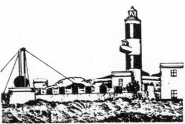 |
|
Punta Pezzo Light |
Anchorage, sheltered from winds between the ENE through S to WSW, can be taken, in a depth of 30m, about 300m off the river mouth at Porticello. This anchorage is excellent for large vessels. Smaller vessels can anchor, in a depth of 20m, sand and weed, closer inshore over good holding ground, but this anchorage is untenable with N winds.
Caution. – The currents are of considerable intensity near Punta Pezzo and whirlpools are frequently formed. The phenomenon known as Taglio exists in this vicinity and consists of a strong surface agitation of the water accompanied by a characteristic rustling noise that is caused by the meeting of opposing currents.
13.77 Villa San Giovanni (38°13'N, 15°38'E) (World Port Index No. 40070), a small town, stands 0.7 mile S of Punta Pezzo. The harbor, which fronts the town, is formed by a quayed outer mole. This mole extends NNW and has ferry slips situated at its base. The E side of the harbor is quayed. Due to the constricted area and the necessity of keeping the outer mole and the approaches to the ferry slips clear, the harbor is restricted to vessels of limited size and draft. The harbor is generally accessible to vessels up to 100m in length and 4.6m draft. A depth of 6.7m is maintained in the ferry basin, lying E of the mole, by dredging. The ferry berths on the mole have an average depth of 5.2m alongside. The harbor can be contacted on VHF channel 15 or 16.
Winds from the WNW prevail at Villa San Giovanni. Those between the W and NW are stormy and troublesome, especially between February and March, and frequently create a heavy sea that sweeps into the harbor. During NW winds, entering or remaining in this harbor is reported to be dangerous. Winds from the SE usually bring a haze. Winds from the NE are frequent in autumn.
Winds from the SE are forecast by the clouding over of the heights in the vicinity of Scilla. Winds from the SW or NW are preceded, respectively, by the clouding over of the mountains of Messina and Etna.
Prominent features in the vicinity of the harbor include a factory, with a tall chimney, standing close N of the town and a cathedral, with three large arches flanked by two towers, standing in the center of the town.
Caution. – The depths in the harbor are subject to shoaling.
The current, which sets S in the strait, sometimes sets against the mole and into the harbor, making vessel movements difficult. This occurs particularly during the spring when the current is strongest.
It is advisable not to anchor outside the harbor, because of the strong currents and the rocky bottom that does not hold well.
13.78 Acciarello (38°13'N, 15°39'E), a small village situated close S of Villa San Giovanni, stands along the coast and appears as a continuation of the town.
Catona, a small town, is situated 2 miles S of Villa San Giovanni and dominated by a prominent church with a yellow belfry and pyramidal spire. The conspicuous church of San Francesco, with a red roof and a belfry surmounted by five spires, stands close S of the town.
Gallico, a small town, is situated 1 mile S of Catona and consists of a long line of houses extending along the beach. Behind the town, a church, with a red roof and a low belfry, is prominent. Anchorage in front of this town is tenable only during moderate winds and is not recommended.
Reggio di Calabria (38°07'N, 15°39'E)
World Port Index No. 40080
13.79 Reggio di Calabria is a large city and an important commercial and fishing port. The harbor fronts the city and is enclosed on its W side by Molodi Ponente, which is completely quayed and has a high sea wall along the outer side, and a breakwater which extends NNE from its N end.
Winds – Weather. – In autumn and winter, winds from the SE and SW quadrants are prevalent. In spring and summer, winds from the NE and NW quadrants are the most frequent. The strongest winds are usually those from the NW, W, and SW. During March and April, very violent gusty winds from between the WSW and WNW sometimes make navigation difficult along the coast in this vicinity, but they do not last long.
Tides – Currents. – Tides are almost negligible, being 0.3m at springs. When augmented by onshore winds, the tidal rise does not exceed 0.6m.
The Carrobio, a sudden periodic rise and fall in the water level occurs occasionally along this part of the coast. It has a range of about 1m. These changes in the level are ascribed to fluctuations in atmospheric pressure. This phenomenon is usually preceded by a calm, a black and blue sky, and a low barometric pressure.
The currents in the strait off the port sometimes have rates up to 5 knots, particularly during the equinoctial periods. These currents, in combination with SW winds, can cause difficulties for vessels attempting to enter the harbor.
Depths – Limitations. – The main quays include Banchina Margottini, 120m long, with a depth of 10m alongside; Ban-china Levante, 280m long, with a depth of 11.5m alongside; Banchina Levante Nuova, 410m long, with a depth of 12m alongside; Banchina Ponente Tratto No. 1, 30m long, with a depth of 7.5m alongside; and Banchina Ponente Tratto No. 2, 400m long, with a depth of 12m alongside.
There are facilities for fishing, ro-ro, bulk, ferry, and container vessels. In addition, there is a basin for yachts and a hydrofoil terminal. Vessels up to 50,000 dwt, 180m in length, and 10m draft have been accommodated.
Aspect. – Monte Pentimele, a precipitous hill, stands N of the port and is surmounted by an old fort. Casa Cantoniera, a red two-story customhouse with a turret, is situated at the foot of this hill and is conspicuous. The prominent church of Santa Caterina, with a belfry and a spire, stands in the N part of the city. A conspicuous monument, consisting of two tall columns surmounted by connecting architecture, is situated on the beach, 1 mile SSW of the harbor entrance.
Pilotage. – Pilotage is compulsory for vessels over 500 grt. Pilots can be contacted on VHF channel 12 or 16 and generally board about 0.5 mile NW of the harbor entrance. Vessels should send advance notice of their arrival 48 hours, 24 hours, and 12 hours prior to entry.
Regulations. – The following are extracts from the harbor regulations:
- Vessels must proceed with care and are forbidden to exceed a speed of 5 knots or to pass through the harbor entrance at the same time as another vessel.
- Small craft, within 1 mile of the harbor entrance, must give way to vessels entering or leaving. Vessels impeded by small craft should sound at least 4 blasts.
- Vessels are forbidden to stop or anchor within 0.5 mile of the harbor entrance.
- Vessels leaving have precedence over vessels arriving, but vessels should not begin to leave if another vessel is already entering.
- Naval vessels have precedence over merchant vessels.
- Ferries have precedence over naval and merchant vessels, but ferries which reverse direction must do so outside the harbor.
- Fishing, including fishing for sport, is prohibited within 1 mile of the harbor entrance.
Anchorage. – Rada di Pentimele, lying 0.5 mile N of the harbor, is one of the safest anchorage roadsteads in Stretto di Messina. The bottom forms a good holding ground, the current is less violent here, and the SW winds are moderate within this bight. Anchorage can be taken, in depths of 46 to 49m, about 400m offshore.
Caution. – Vessels should use caution when entering or leaving as the currents close outside the entrance may affect the maneuvering of vessels. In general, the current setting S in the strait forms a current which sets W off the entrance.
13.80 Punta Calamizzi (38°06'N, 15°38'E) is located 1.5 miles S of Reggio di Calabria and a prominent radio mast stands 1.2 miles ENE of it.
The coast from Punta Calamizzi to Capo dell’Armi is composed of short terraces of varying elevations which rise in gentle slopes to a range of coastal hills. These hills recede gradually from the coast, then approach it again at Capo dell ’Armi.
Fiumara di Sant’Agata, lying 1.6 miles S of Punta Calamizzi, has a broad whitish bed and can be recognized by a long bridge which spans the river mouth.
Punta di Pellaro (38°01'N, 15°38'E), located 4.8 miles S of Punta Calamizzi, is wide, sandy, and forms the S entrance point of the Stretto di Messino on the E side. A radio mast stands on the point. A sandy shoal, with a depth of 3m, fronts the seaward extremity of the point. A bright-red church, with a prominent belfry, stands close S of the point. The large and conspicuous building of a beverage plant, with a low tank on cement columns situated close NW of it, is reported to stand in the vicinity of the point.
Between Punta di Pellaro and Capo dell’Armi, 4.5 miles SSE, the vegetation gradually diminishes until it disappears in the immediate vicinity of the cape. Short and steep streams wind down from the mountains along this stretch of the coast and are clearly visible due to the alluvial deposits which they bring down.
The village of Motta San Giovanni, situated 3 miles ESE of Punta di Pellaro, overlooks this stretch of coast. A conspicuous church, with a belfry and a spire, stands in the lower part of this village and is visible from the NW and SW; from other directions, the church is hidden by the surrounding hills.
Punta di Pellaro to Capo Spartivento
13.81 Capo dell’Armi (37°57'N, 15°41'E) is located 4.5 miles SSE of Punta di Pellaro. This cape is high, rounded, bare, and rises perpendicularly from the sea in whitish and rocky cliffs. A light is shown from a prominent tower, 12m high, standing on the cape.
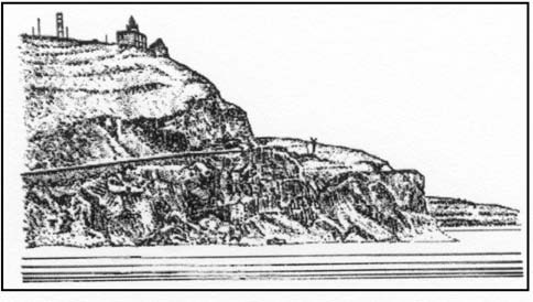 |
|
Capo dell’armi Light bearing 104° |
The village of Saline, situated at the mouth of Fiumara di Molara, stands 1.5 miles ESE of Capo dell’Armi and is dominated by a conspicuous reddish church. A conspicuous chimney, 176m high, stands in the vicinity of an oil refinery which is situated close to the coast, 1 mile SE of the village.
Porto Saline di Montebello Joniche (37°56'N, 15°43'E), a small harbor, lies 1 mile S of Saline and is protected by breakwaters. There is a turning basin, dredged to a depth of 12m, a dock basin, dredged to a depth of 8m, and a marina within this harbor.
A water intake terminal, marked by a light, lies close E of this harbor.
Pentedattilo, a prominent rocky cliff, stands 2 miles inland, 4 miles E of Capo dell’Armi. It is shaped like a monstrous hand and lies between two rivers, the Fiumara di Sant’Elia to the N and the Fiumara Anna to the S. This cliff rises 150m from the slope of a hill. The village of Pentedattilo is situated at the foot of this strange formation, but is not visible from most directions. A prominent peak stands close E of the cliff.
Melito di Porto Salvo, a small town, stands 5.5 miles ESE of Capo dell’Armi. It is situated among citrus groves on the slopes of a hill on the W bank of Fiumara di Melito. The mouth of this river is spanned by a bridge with two arches. A small church, with a prominent yellow cupola, stands near the beach, SW of this town.
The wreck of a vessel, with the main mast showing, lies in depths of 25 to 28m, about 400m W of the mouth of Fiumara di Melito.
Fiumara di Amendolea enters the sea through a wide valley, 5 miles E of Melito di Porto Salvo. This river has a very wide bed and is spanned near its mouth by a long bridge, supported by seven piers. Monte Papagallo, 95m high, stands on the E bank of the river mouth. This hill is conspicuous, when seen from the W, because of its whitish color and a large clump of trees on its summit.
13.82 Bova Marina (37°55'N, 15°55'E), a village, is situated 2 miles E of the mouth of the Fiumara di Amendolea. It consists of a prominent group of houses intersected by the Fiumera Sideroni, which flows through a verdant valley.
The village of Bova, situated 4 miles N of Bova Marina, stands on the summit of a mountain, 827m high. This village is dominated by Monte Porticella di Bova, standing 0.7 mile N, which can be identified by its flattish top and a prominent notch on its W side. The seaward side of this mountain is furrowed by deep valleys.
Large vessels can anchor off Bova Marina, in a depth of 29m, about 0.4 mile from the shore; small vessels can anchor, in depths of 6 to 7m, about 0.2 mile from shore. With N winds, this anchorage is considered to be one of the safest along this part of the coast.
Punta San Giovanni, located 0.5 mile ESE of Bova Marina, is formed by a steep cliff and is fringed by rocks. A tower, half in ruins and poorly visible, stands on the point. A light-colored tower and a conspicuous statue of the Madonna stand near the tower. The village of Palizzi Marin is situated 2.5 miles E of the point.
13.83 Torre Mozza (37°55'N, 16°00'E), almost completely in ruins, stands on a cliff at the E side of a small valley, 0.5 mile E of Palizzi Marina. The ruins are only visible from the E or W.
A rocky shoal bank, with a least depth of 0.5m, fronts the coast abreast Torre Mozza and extends up to about 0.3 mile offshore. A dangerous wreck, covered by a depth of less than 18m, lies about 0.8 mile offshore, 2 miles WSW of Torre Mozza.
Capo Spartivento (37°55'N, 16°04'E) is located 3 miles E of Torre Mozza. The coastal slopes between the tower and this cape become less steep and descend towards the sea in spurs, which because of their whitish color, resemble huge sand dunes. The summits of several of these spurs are covered with sparse vegetation.
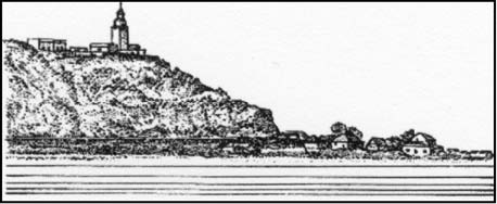 |
|
Capo Spartivento bearing 045° |
Capo Spartivento is rugged, rocky, and fringed by a narrow sandy beach on which stand some houses. This cape can be easily identified from some distance by its whitish appearance. A light is shown from a prominent structure, 15m high, standing on the cape. A disused signal station is situated close NW of the light.
Due to rocky patches, the cape should not be approached within 0.5 mile.
Caution. – A circular prohibited area with a radius of 2,000m is centered on position 37°53.8'N, 16°00.7'E
Fiumara Spropoli enters the sea on the W side of Punta di Spropoli, 1 mile W of the cape. Several houses stand in the vicinity of the river mouth.
Anchorage, sheltered from N winds, can be taken off the coast between Torre Mozza and Punta di Spropoli. There are berths, in a depth of 10m, about 500m from the shore, or in depths of 15 to 20m, about 0.5 mile offshore. The beach frontng this stretch of coast is slowly extending seaward.